

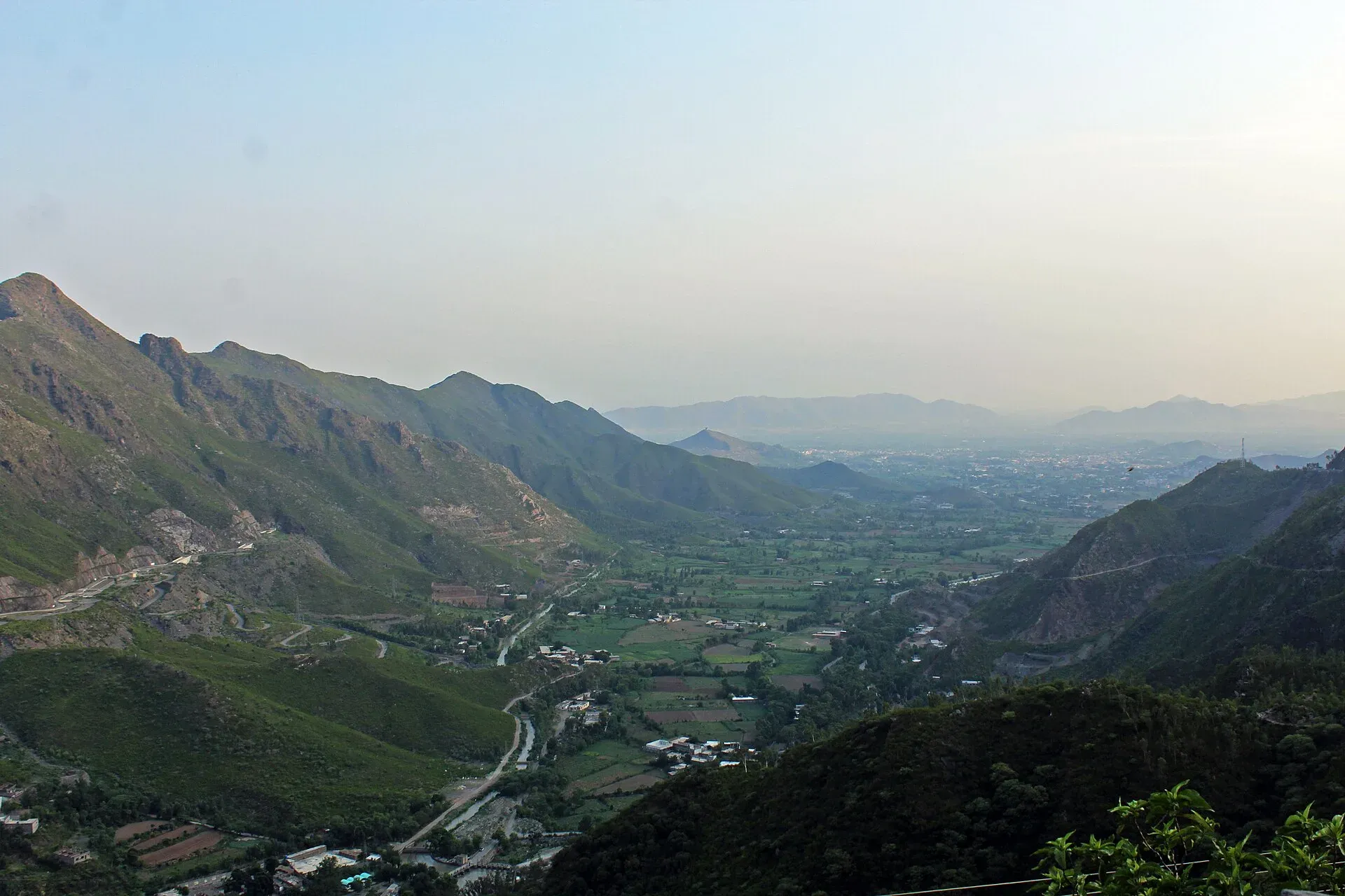
Photo: Malakand District, with thanks · CC BY-SA 4.0 · via Wikimedia Commons · temporary stand-in photo

Malakand Pass
The road gateway from the plains to Swat and Dir, climbing from Dargai to Batkhela. Known for the 1895 and 1897 frontier fighting and the Swat Canal. For foreign visitors: the UK FCDO advises against all but essential travel to Malakand.
Overview
Malakand Pass is the gateway from the Mardan and Charsadda plains into Swat, Dir and, further on, Chitral. It carries the main road from Peshawar towards Chitral through Malakand District, Khyber Pakhtunkhwa. In Pashto and Urdu it is called Darra Malakand.
Wikipedia gives no summit height. One tunnel-industry source gives 470 m at Dargai and 663 m at Batkhela, the two ends of a planned tunnel, and a travel blog gives 1,362 m for the summit. The sources do not agree, so no height is given here.
Plan your visit
- Nearest town
- Dargai and Batkhela
- Getting there
From the plains near Mardan, the road reaches Dargai, then climbs through the pass to Batkhela and Swat. The pass is about 150 km from Islamabad by Wikipedia's figure. More
- Malakand Pass
- Related places nearby: Batkhela, Saidu Sharif, Dir, Chakdara Fort
The road, in order
The road begins at Dargai, which Wikipedia places about 150 km north-west of Islamabad, at the foot of the pass on the plains side. It climbs to the top, where Malakand Fort guards the crest. It then drops through the bazaar town of Batkhela, where a Hindu Shahi fort stands on a hill above the bazaar. Beyond Batkhela it runs on to the headworks of the Swat Canal, near the Swat river, and continues towards Swat, Dir and, further on, Chakdara Fort. Wikipedia calls it a wide, well-built road that is sometimes heavily trafficked.
The Swat Canal
The British built the Swat Canal in the colonial era to carry water from the Swat river through the pass to the plains around Mardan. It descends from the top of the pass through the valley, and it is one of the reasons the plains below are farmed.
History
The pass became prominent in 1895, during the Chitral Expedition, when Pashtun tribes strongly resisted Sir Robert Low's advance to relieve Chitral.
In 1897 came the Siege of Malakand, from 26 July to 2 August. About 10,000 tribesmen, drawn from Yusufzai, Mohmand, Utmankhel, Swati and Bunerwal groups and led by the religious leader Saidullah, attacked the British camp at Malakand South, which held a garrison of about 10,600 men. Churchill described the camp as "a great cup" overlooked by hills. The garrison held for about six days. At the same time the small fort at Chakdara, with about 200 men, was attacked and then relieved on 2 August. These fights opened the Malakand Expedition.
A young Winston Churchill, then a second lieutenant and war correspondent, accompanied the relief force. His 1898 book The Story of the Malakand Field Force grew out of his reports for the Daily Telegraph.
What to see and do
The pass is mostly a drive. Malakand Fort and the Hindu Shahi fort above Batkhela are the two landmarks named in sources, and no source describes visitor access to either, so confirm locally before stopping.
When to visit
The road stays open most of the year, but heavy snow and landslides have disrupted Malakand and nearby areas in winter (Dawn). Check weather before you set out.
Where to stay and eat
Batkhela and Dargai have small hotels and roadside restaurants. Most visitors stay in Swat or Peshawar.
Good to know
- Tunnel plans. A Malakand Tunnel between Dargai and Batkhela has been planned for years, with Korean funding. A Business Recorder report put the revised PC-I at Rs 23.565 billion, with a 42-month build. There is no known current report of construction, so treat it as a plan.
- Travel advice. For foreign visitors: the UK FCDO (updated 27 October 2026, checked 17 November 2026) advises against all but essential travel to Malakand, and against all travel to Swat, Buner and Upper and Lower Dir. It also notes Governor's Rule and emergency measures in KP since 11 October 2026.
- Fees. No fees are involved.
Highlights
- Gateway from the plains to Swat and Dir
- 1895 and 1897 frontier fighting
- Malakand Fort at the top
- Swat Canal runs through the pass
Getting there
From the plains near Mardan, the road reaches Dargai, then climbs through the pass to Batkhela and Swat. The pass is about 150 km from Islamabad by Wikipedia's figure.
Tips
- Read the live FCDO advice for Malakand and Swat first
- Drive in daylight
- Check road reports in winter
- Read Churchill's account for the history, not as a travel guide
Photos we still need: Malakand Fort, the Swat Canal headworks, or the Hindu Shahi fort above Batkhela. Send us yours
Sources and last checked
Last checked Confidence medium6 sources3 still to check
- Last checked
- Method
- Desk research from published sources
- Confidence
- medium
- Checked by
- trek.pk research team
Researched from published sources; not yet checked on the ground by our team. Spot something out of date? Report a mistake.
Sources
- Malakand Pass (Wikipedia) · Wikipedia · checked
- Malakand tunnel project (Tunnels and Tunnelling) · Tunnels and Tunnelling · checked
- NHA recommends 2nd revised PC-1 of Malakand Tunnel project · Business Recorder · checked
- Heavy snowfall, landslides disrupt life in Malakand, Hazara · Dawn · checked
- Pakistan travel advice: warnings and insurance (updated 27 October 2026) · UK FCDO · checked
- Siege of Malakand · Wikipedia · checked
Still to be checked on the ground (3)
- Summit height (Wikipedia, edited 13 Sep 2026, still gives none)
- Whether the Malakand Tunnel is under construction (Wikipedia mentions the tunnel without status; no current report found)
- Current road conditions (Wikipedia calls the road wide and well built; no dated report)
Nearby and related

Batkhela
Headquarters of Malakand District on the N-45 road to Swat, known for a long bazaar and its canals. A busy trading town, mainly a stop on the way north.

Saidu Sharif
The administrative town of Swat, joined to the bazaar city of Mingora, with the ancient Butkara stupa, the Swat Museum of Gandhara art, a Sufi shrine and the road into the Swat valley.

Swat Valley
A long green river valley in northern Khyber Pakhtunkhwa, with Gandhara Buddhist sites, orchards, hill towns and the road up to Kalam. Check the current security advice before you plan a trip.

Dir
The old capital of the princely state of Dir, on the Dir River at the foot of the Lowari Pass, with a palace on the hill above. A stop on the road between Peshawar and Chitral.
Chakdara Fort
A British fort of 1896 on the site of an older Mughal fort at Chakdara, Lower Dir, famous for its defence in the siege of 26 July to 2 August 1897. It is used by the Chitral Scouts. In an area the UK FCDO advises against visiting.

Swat and Kalam
A 4-5 day road trip from Islamabad up the Swat valley by the M-16 and N-95 to Mingora, Madyan, Bahrain and Kalam, with Mahodand Lake and Ushu forest in summer.

Gandhara Buddhist Trail
A themed journey through the Buddhist stupas and monasteries of Gandhara: Taxila, Bhamala and Mankiala are open day trips from Islamabad; the great Khyber Pakhtunkhwa sites are currently advised against.