

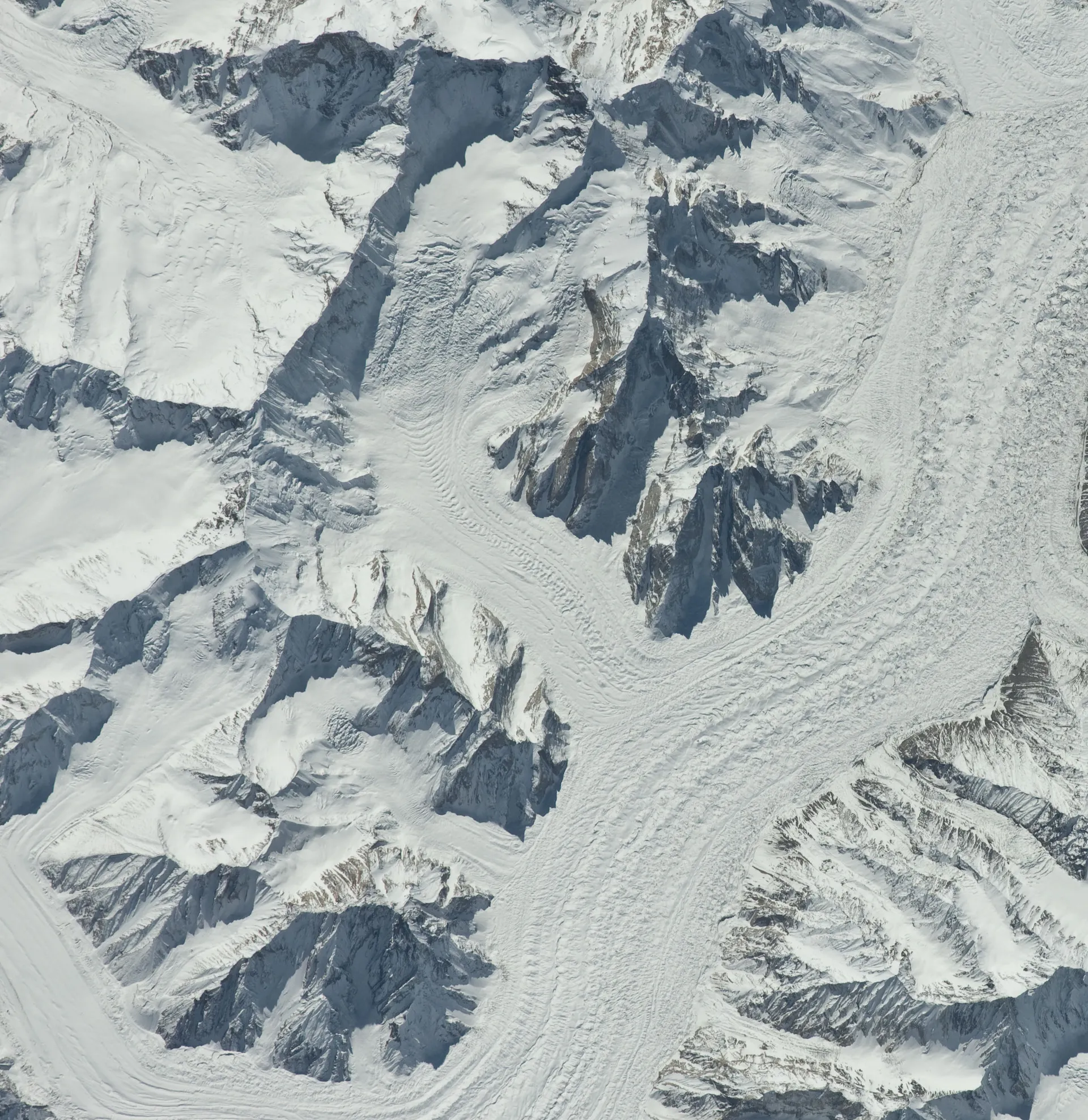
Photo: Earth Science and Remote Sensing Unit, Lyndon B. Johnson Space Center, with thanks · Public domain (CC0) · via Wikimedia Commons · temporary stand-in photo

Biarchedi Glacier
A Karakoram glacier north-east of Biarchedi Peak that flows north into the Baltoro Glacier. Few details are known.
Overview
The Biarchedi Glacier is in the Karakoram of Baltistan, Gilgit-Baltistan. It lies north-east of Biarchedi Peak and flows north into the Baltoro Glacier. Its length and area are not published in the sources found.
Plan your visit
- Nearest town
- Skardu
- Getting there
No route is described. The nearby Baltoro trek starts from Askole. More
Best months
Jul – Aug
- Biarchedi Glacier
- Related places nearby: Baltoro Glacier, Godwin-Austen Glacier (K2 Base Camp), Central Karakoram National Park
Where it sits
Biarchedi Peak (6,781 m) rises on the south side of the Baltoro Glacier. Wikipedia lists Masherbrum to its south-west and Mitre Peak (6,010 m) to the east. The Polish climber Jerzy Kukuczka made the first ascent of the peak, solo, in July 1984.
The Baltoro itself runs about 62 km, with its upper third clean ice and the lower two-thirds under rock debris. An International Space Station photograph shows the Biarchedi Glacier together with the Baltoro, Gondogoro Ri, the Nuating Glacier and Mitre Peak. See the Baltoro Glacier page for the area.
What to see and do
No route to the glacier itself is described in the sources found, and no trekking route is published for it. Visitors on the Baltoro trek travel along the main glacier; the Baltoro trek starts at Askole.
Getting there
No access directions are published. The Baltoro trek begins at Askole, reached by jeep road through Shigar from Skardu.
When to visit
The usual trekking season on the Baltoro is June to September.
Where to stay and eat
No facilities. Camping only, on the Baltoro trek.
Good to know
- Travel advice. For foreign visitors: the UK FCDO page for Pakistan (updated 27 October 2026, checked 17 November 2026) does not advise against Gilgit-Baltistan as a whole. It does advise against all travel on the Karakoram Highway between Mansehra and Chilas, and against travel within 10 miles of the Line of Control. Check the live page for your route.
- Fees and permits. Baltoro-area routes need a permit through a licensed operator and park fees. Current fees will be added soon.
Highlights
- Flows north into the Baltoro Glacier
- North-east of Biarchedi Peak
Tips
- See the Baltoro Glacier page for the trek.
Photos we still need: the Biarchedi Glacier seen from the Baltoro trail. Send us yours
Sources and last checked
Last checked Confidence low4 sources5 still to check
- Last checked
- Method
- Desk research from published sources
- Confidence
- low
- Checked by
- trek.pk research team
Researched from published sources; not yet checked on the ground by our team. Spot something out of date? Report a mistake.
Sources
- Biarchedi Glacier · Wikipedia · checked
- Godwin-Austen Glacier · Wikipedia · checked
- Foreign travel advice: Pakistan · UK FCDO · checked
- Biarchedi Peak · Wikipedia · checked
Still to be checked on the ground (5)
- Length and area (none found)
- Coordinates are Wikipedia's
- Whether any route reaches it
- Current permit and CKNP fees
- Whether Biarchedi Peak is 6,781 m on other sources
Nearby and related

Baltoro Glacier and K2 Base Camp

Baltoro Glacier
About 62 km long, the Baltoro is the glacier you walk up to reach K2 Base Camp and Concordia. A restricted-zone trek of about two weeks from Askole, inside Central Karakoram National Park.
Godwin-Austen Glacier (K2 Base Camp)
The glacier below K2. It meets the Baltoro Glacier at Concordia, and the trek to K2 Base Camp follows its medial moraine.

Central Karakoram National Park
Pakistan's largest protected area, covering about 10,500 square kilometres of the highest mountains on earth: K2, Gasherbrum I and II, Broad Peak and the Baltoro, Biafo and Hispar glaciers.