

Photo: Shikari7, with thanks · CC BY-SA 3.0 · via Wikimedia Commons · temporary stand-in photo

Baltoro Glacier and K2 Base Camp
- Duration
- 14–21 days
- Distance
- 143.6 km
- Grade
- Strenuous
- Max altitude
- 5,135 m
- Season
- Jun – Sep
The classic Karakoram trek: about 72 km up the Baltoro Glacier to Concordia and K2 Base Camp, past the Trango Towers and four of the world's 8,000 m peaks. A 15-day expedition-style trek that needs a permit.
Overview
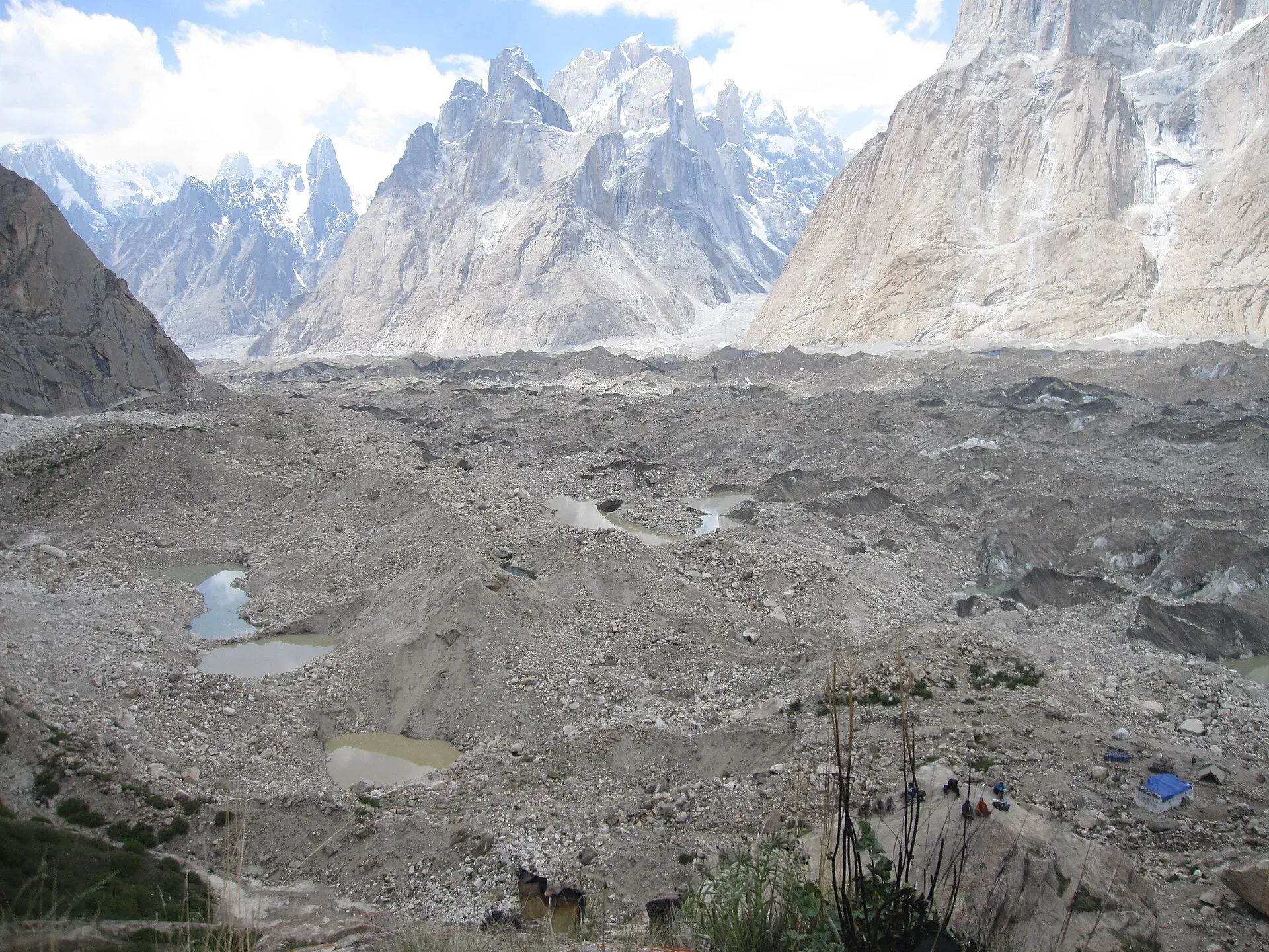
The Baltoro Glacier is the classic Karakoram trek and Pakistan's most visited trekking route. You walk about 72 km up a glacier that is roughly 63 km long. On the way you pass the granite towers of the Trango group, Paiju Peak and Masherbrum. At Concordia, about 4,600–4,650 m up, the Godwin-Austen, Upper Baltoro and Vigne glaciers meet. From there K2 (8,611 m) stands to the north, with Broad Peak, the Gasherbrums and Mitre Peak all in view. A side trip takes you on to K2 Base Camp at about 5,135 m.
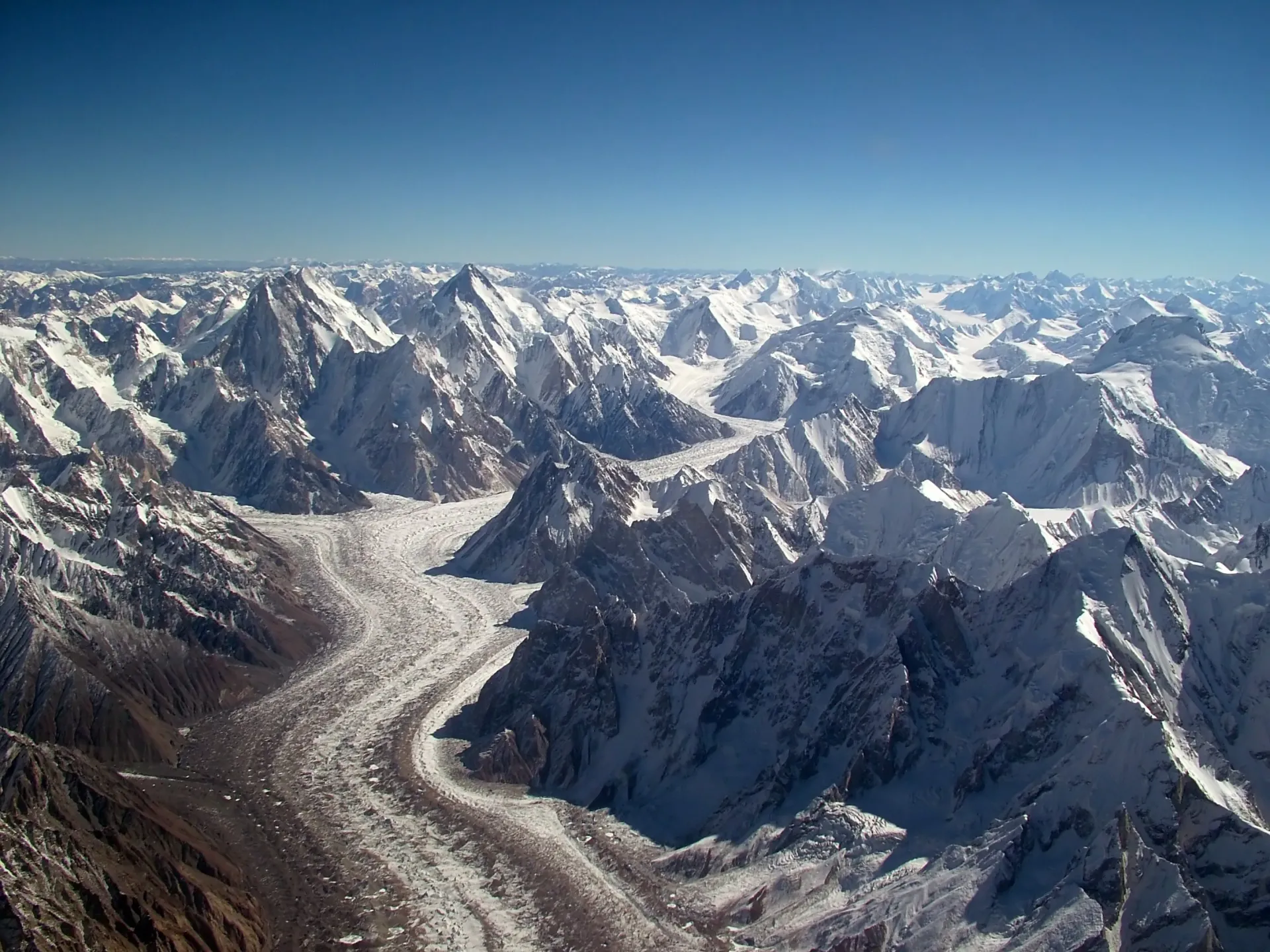
Photo: Guilhem Vellut, with thanks · CC BY-SA 2.0 · via Wikimedia Commons · temporary stand-in photo

Only two camps, Goro II and Concordia, sit on the ice itself, and the route needs no ropes or technical skill. Even so, it is a long, high expedition-style trek with porters, a cook and a guide. It is not an easy walk.
Who it suits
This is a strenuous trek of about two weeks at altitude. You should be fit, comfortable walking 5–8 hours a day on rough rubble, and happy sleeping above 4,000 m for many nights. Experience of altitude helps a great deal. Rescue is slow: once you are past Paiju, a road is at least four days away on foot, and army helicopters are the only fast evacuation. Take insurance that covers helicopter rescue.
When to go
The glacier is usually open from mid-June. Most expeditions go up in June and come back in August, so these are busy months. River crossings on the approach are easier before July, when the meltwater rises. The CKNP summary describes mid-July to August as the busiest window and first snow at Concordia as typical from mid-September. High-altitude trekking in the park is reported closed from October to April.
The route
From the roadhead you follow the Braldu and Biaho valleys for four stages before the ice. Korophon, Jula, Skam Tsok and Paiju are camps in tamarisk and willow. Most parties take a rest day at Paiju, the last place with wood. From Paiju you cross the terminal moraine and step onto the Baltoro.

Photo: Shikari7, with thanks · CC BY-SA 3.0 · via Wikimedia Commons · temporary stand-in photo

Next come Khoburtse, then Urdukas (4,050 m). The meadows above Urdukas give one of the best views on the trek: Nameless Tower, the Trango Towers and Cathedral Towers. After Urdukas you walk on the glacier itself. Masherbrum's north face comes into view, and you camp at Goro II (4,380 m). The last stage follows the black medial moraine to Concordia (4,650 m by the old guidebook). Most parties stay two or three nights.
From Concordia you can walk to Broad Peak Base Camp (about 5,000 m) and K2 Base Camp (5,135 m), a long day or an overnight move. The Gilkey memorial, with plaques for climbers who died on K2, sits at the foot of the mountain. A second side trip goes to Gasherbrum I Base Camp (about 5,150 m).
You return the same way in about five days. If you want to keep going over the Gondogoro La to Hushe, see the Gondogoro La trek.
Terrain underfoot
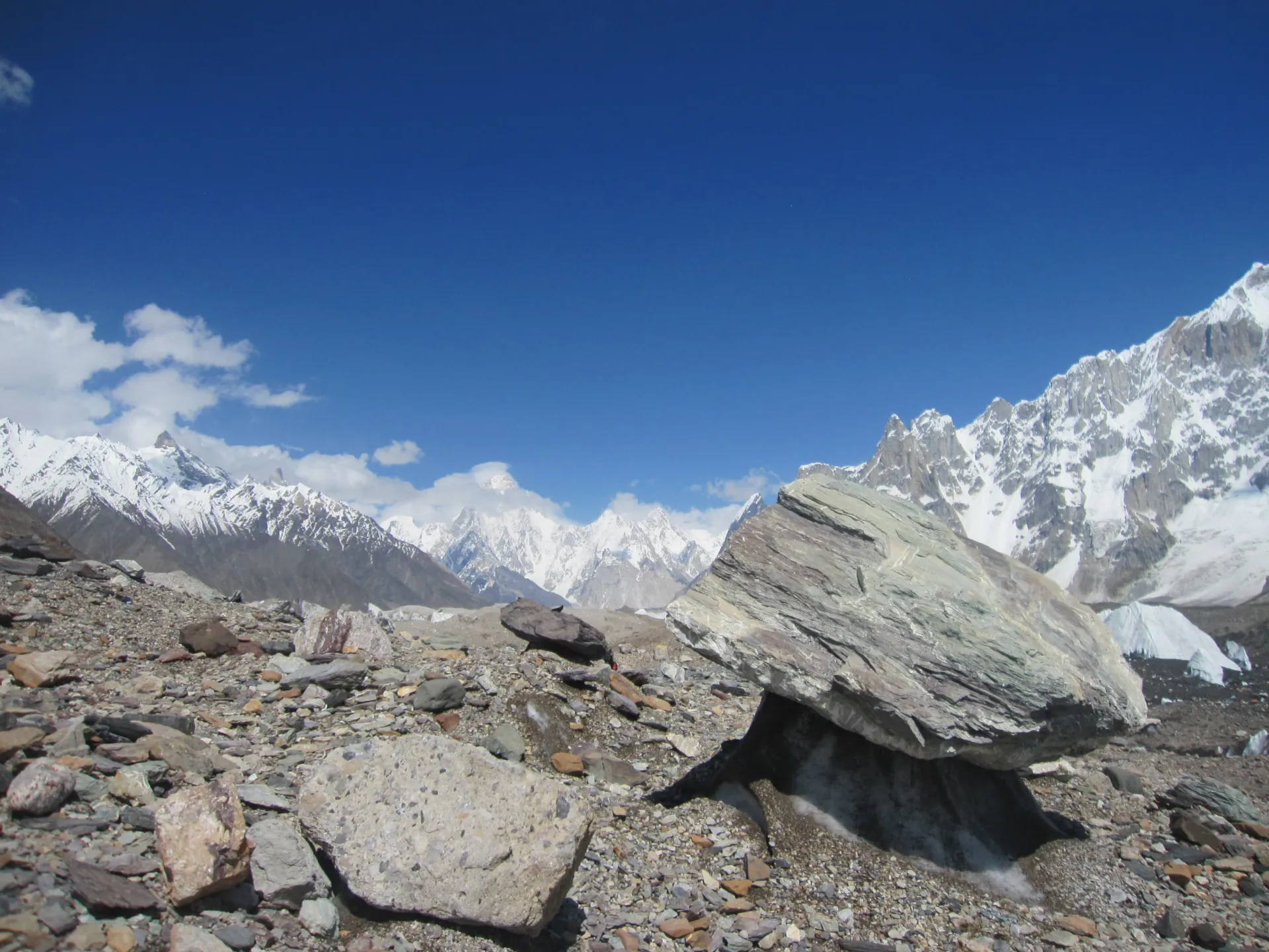
Photo: Shikari7, with thanks · CC BY-SA 3.0 · via Wikimedia Commons · temporary stand-in photo

The walk changes surface five times. For the first four stages you follow the Braldu and Biaho valleys on dusty river flats, terraces and footbridges, with side streams to cross, and silty glacier water in the afternoon. At Paiju you climb the terminal moraine, a long ridge of loose rock at the glacier's end. Most of the Baltoro is then rubble-covered ice: boulders and gravel over ice, with hidden pools and melt holes, marked by cairns. Above Goro II the route follows the black medial moraine (the ridge of rock in the middle where two glaciers meet) to Concordia. The side trip towards K2 crosses white ice, where bare ice and fresh snow can hide crevasses. Wikipedia gives the glacier as 63 km long with an area of about 1,500 square kilometres, fed by the Godwin-Austen, Abruzzi, Gasherbrum, Vigne and Yermandendu glaciers.
Culture and people
Balti porters from the Braldu valley villages, mainly Askole and nearby, carry most loads. Many families depend on this income. Porters traditionally bring their own food for the first four stages to Paiju. After that you supply food and fuel. It is customary for the group to buy a goat or sheep at Paiju for the porters to butcher. Make sure each porter has proper clothing, boots and sun protection for the ice. Load limits, set by local porter associations, are around 25 kg.
Practical information
Road. A jeep road runs from Skardu up the Shigar and Braldu valleys to Askole (the guidebook's Thungol is the old roadhead just before). It takes about 6–7 hours and is often blocked by landslides and river erosion. A local report in September 2025 said the "K2 road" had been closed for nearly four months, so leave spare days at both ends. In winter it can close completely.
Rules inside the park. The CKNP page says the Baltoro lies in the park's Core Zone, where a trekking permit and a per-person park fee apply and applications are handled at the Skardu office and the Askole and Hushe checkpoints. It says solo trekking is not permitted in the Core Zone: you need at least one registered porter, and a group of three or more needs a registered guide. The maximum porter load is 25 kg. Bottled water is not sold past Askole, so filter or boil melt water.
Rescue. CKNP says Pakistan Army Aviation is the only realistic high-altitude rescue, that it will fly to 5,500 m on the Baltoro for a confirmed casualty, and that no lift happens without advance payment confirmation. It puts the cost at about USD 6,000 to 10,000 per flight hour. Check that your insurance names helicopter rescue at altitude in Pakistan.
Environment. The glacier campsites are heavily used. Rubbish and human waste are a real problem, and the army posts along the route have their own rubbish pits. Carry out all waste, use the toilets that exist and keep clear of water sources.
Maps. The old guide recommended the Swiss Foundation for Alpine Research 1:250,000 Karakoram sheets 1 and 2, and the Italian 1:100,000 Baltoro Glacier map. Some camp names are not marked on them.
Further reading. In the Throne Room of the Mountain Gods by Galen Rowell and K2: Triumph and Tragedy by Jim Curran are the books the old guide recommended.
Highlights
- Concordia, where three glaciers meet below K2 (8,611 m), Broad Peak and the Gasherbrums
- Trango Towers, Cathedral Towers and Paiju Peak along the lower glacier
- Optional side trip to K2 Base Camp (about 5,135 m) and the Gilkey memorial
- Non-technical glacier walking, with only Goro II and Concordia camped on ice
Day by day
| Day | Camp | Altitude |
|---|---|---|
| 1 | Korophon | 3,000 m |
| 2 | Skam Tsok | 3,300 m |
| 3 | Paiju | 3,450 m |
| 4 | Rest day at Paiju | not given |
| 5 | Khoburtse | 3,930 m |
| 6 | Urdukas | 4,050 m |
| 7 | Goro II | 4,380 m |
| 8 | Concordia | 4,650 m |
| 9 | Concordia: K2 and Broad Peak Base Camps | not given |
| 10 | Spare or rest day at Concordia | not given |
| 11 | Goro II | 4,380 m |
| 12 | Urdukas | 4,050 m |
| 13 | Paiju | 3,450 m |
| 14 | Korophon | 3,000 m |
| 15 | Thungol | not given |
| Day | Route | Hours | Distance | Ascent / descent | Camp and altitude |
|---|---|---|---|---|---|
| Day 1 | Thungol to Korophon | 4–5 h | 12.6 km | +150 m | Korophon, 3,000 m |
Day 1 notesFollow the road and trail to the junction beyond Kesar Shaguran, then continue east below the rock buttress. Cross the snout of the Biafo Glacier on an easy, obvious trail. Korophon is a wide dusty plain with a few willows. The glacier water turns silty in the afternoon. If you start from Askole, this day is a little shorter. | |||||
| Day 2 | Korophon to Skam Tsok | 4½–5½ h | 13.4 km | +300 m | Skam Tsok, 3,300 m |
Day 2 notesCross the Dumordo River on the footbridge near Jula (villagers charge a small toll), then follow the Biaho River through tamarisk and ephedra. Chobrok, with clear water, is a good lunch stop. Bardumal is a poor, abandoned camp. Skam Tsok is 30–45 minutes further, at the first clear side stream. Low-water and high-water trails both exist between Jula and Skam Tsok; the low-water one is quicker. | |||||
| Day 3 | Skam Tsok to Paiju | 3–3½ h | 8.6 km | +150 m | Paiju, 3,450 m |
Day 3 notesThe trail alternates between the river bed and terraces. The outwash stream of the Paiju Glacier is easy to ford in low water; in high water you may need a rope. You get first views of Paiju Peak and the Cathedral Towers. Paiju is often crowded, noisy and dirty. Camp on the quieter platforms higher up the stream. It is the last place with wood. | |||||
| Day 4 | Rest day at Paiju | not given | not given | not given | not given |
Day 4 notesNearly all parties rest here to acclimatise. Some parties reach Paiju in two days by camping at Jula, but the camps are better on a three-day schedule. A small shop sells basic supplies such as flour, sugar and kerosene, at higher prices than Skardu. | |||||
| Day 5 | Paiju to Khoburtse | 4½–5½ h | 10.8 km | +480 m | Khoburtse, 3,930 m |
Day 5 notesWalk about an hour to the glacier snout, climb the terminal moraine and cross the Baltoro to its south-east margin in about 2½ hours. Liligo is a cramped camp in a boulder field. Khoburtse, past the Liligo Glacier, has clear water and a few level tent sites. Avoid the tent sites close to the toilets, which are exposed to rockfall. Views of Uli Biaho, Great Trango Tower and Cathedral Towers are very good. | |||||
| Day 6 | Khoburtse to Urdukas | 2–3 h | 5.1 km | +120 m | Urdukas, 4,050 m |
Day 6 notesA short day along the lateral moraine, stepping onto the glacier to skirt two side glaciers. Urdukas sits on a grassy, boulder-strewn slope above a moraine lake. Use the higher, eastern stream for cleaner water. Walk up the meadows above camp for one of the best panoramas of the Trango Towers and Nameless Tower. Fit, acclimatised parties can sometimes combine Paiju–Urdukas in one day. | |||||
| Day 7 | Urdukas to Goro II | 6–7 h | 12.1 km | +330 m | Goro II, 4,380 m |
Day 7 notesHead north, pass several porters' graves and move out to the middle of the glacier. The trail is marked by occasional cairns and crosses small streams. Masherbrum's north face comes into view. After lunch near Shakspoon you reach Goro II, next to an army camp in mid-glacier. Wind is common and the tent platforms are made of ice and rock. | |||||
| Day 8 | Goro II to Concordia | 5–6 h | 9.2 km | +270 m | Concordia, 4,650 m |
Day 8 notesFollow the black medial moraine up the centre of the glacier. Broad Peak appears as you approach Concordia. The army camp is at the junction. About ten minutes beyond is a large level area with porters' shelters and your first full view of K2. Concordia is exposed, windy and the coldest camp on the route. | |||||
| Day 9 | Concordia: K2 and Broad Peak Base Camps | 6–8 h | 20 km | +485 m / −485 m | not given |
Day 9 notesA side trip to Broad Peak Base Camp (about 5,000 m) and K2 Base Camp (about 5,135 m) can be done as one long day or by moving camp. The route follows the Godwin-Austen Glacier's medial moraine, then white ice, with a snow bridge near the start. Check altitude symptoms before you go higher than Concordia. | |||||
| Day 10 | Spare or rest day at Concordia | not given | not given | not given | not given |
Day 10 notesMost parties spend two or three nights here to enjoy the views, rest, or visit Gasherbrum I Base Camp (about 5,150 m, a two-stage round trip). Use it as a weather buffer. | |||||
| Day 11 | Concordia to Goro II | 4–5 h | 9.2 km | not given | Goro II, 4,380 m |
Day 11 notesReturn down the medial moraine. Going down is faster, but the surface is just as rough. Stay hydrated and wear sun protection, because the ice is very bright. | |||||
| Day 12 | Goro II to Urdukas | 5–6 h | 12.1 km | not given | Urdukas, 4,050 m |
Day 12 notesRetrace your steps along the glacier to Urdukas. It is a good place for a last look at the Trango Towers in the afternoon. | |||||
| Day 13 | Urdukas to Paiju | 6–7 h | 15.9 km | not given | Paiju, 3,450 m |
Day 13 notesA long day down to the glacier snout and across the terminal moraine. Many parties here buy or butcher a goat for the porters, which is traditional. | |||||
| Day 14 | Paiju to Korophon | 7–9 h | 22 km | not given | Korophon, 3,000 m |
Day 14 notesFollow the Biaho valley down, crossing the Paiju outwash and the Dumordo footbridge. In high water, use the high trails where indicated by your guide. | |||||
| Day 15 | Korophon to Thungol | 4–5 h | 12.6 km | not given | not given |
Day 15 notesThe final stage over the Biafo moraine, with a short walk to Askole and the jeeps. | |||||
Getting there
Fly or drive to Skardu (flights from Islamabad when the weather allows; otherwise a long drive on the Karakoram Highway and the Skardu road). From Skardu a jeep takes about 6–7 hours up the Shigar and Braldu valleys to Askole. Older guidebooks start at Thungol, the old roadhead a short way before Askole. Hire jeeps and porters through your operator. The road is often blocked by landslides, so check its state before you leave Skardu.
Permits and rules
- Permit needed
- Yes, Restricted zone
- Fee
- Current fees will be added soon
- Last checked
- 16 November 2026
Zone: restricted. You need a trekking permit arranged through a licensed Pakistani tour operator, a licensed guide, and (inside Central Karakoram National Park, CKNP) the park fees. You cannot walk this route alone. The checkpoint is at the roadhead; keep your permit papers with you.
Fees. A trekking permit fee, Central Karakoram National Park fees and a waste-management fee apply. Current fees will be added soon. Until then, ask your licensed operator for the current written fee list.
How trekking permits, NOCs and registration work: Visa and permits.
Season
Best: Jun – Sep
Water and camps
Water on the lower route comes from side streams and is silty in the afternoon, so settle or filter it. Clear streams run at Chobrok, Skam Tsok, Paiju and Urdukas. On the glacier, melt streams and moraine ponds supply water at Goro II and Concordia; treat all of it. Wood is available only up to Paiju. Camps from Paiju onwards are crowded with porters' shelters and toilets, so keep your tents away from rockfall slopes. The old guide notes that the camp sites at Liligo and Khoburtse are alternatives to one another. A shop at Paiju sells basic supplies.
Gear and safety
Altitude. You sleep above 4,000 m from Urdukas and reach about 4,650 m at Concordia. Climb slowly, drink plenty of fluid and descend if headache, vomiting or breathlessness persists. K2 Base Camp is about 5,135 m.
Glacier hazards. Rubble-covered ice hides holes and pools, and rockfall is common near the lateral moraines. Fast-moving side streams are risky in the afternoon. The route is non-technical, but poor weather and fresh snow can hide crevasses on the white ice towards K2.
Rescue. A telegraph line links the army posts, and helicopters are the only fast evacuation. Helicopter rescue is very expensive and is usually guaranteed in advance through your operator and insurer. Check your insurance wording.
Gear. Warm layers rated to about -10 C, sun hat, glacier glasses, gaiters and trekking poles. Crampons are not normally needed.
Variations
- Gondogoro La (see the Gondogoro La trek) crosses from Concordia to Hushe over a fixed-rope pass, avoiding the walk back.
- Gasherbrum I Base Camp is a two-stage side trip from Concordia.
- Hispar La (see the Hispar La trek) starts from the same area and uses the Biafo and Hispar glaciers.
- Panmah Glacier and other restricted-zone routes start from the same roadhead; see Other treks in Baltistan.
Tips
- Book through a licensed operator early; permits and fees changed in 2024–25, so ask for the current written fee list.
- Take a rest day at Paiju and another at Concordia to acclimatise.
- Leave 2–3 spare days for road closures between Skardu and Askole.
- Carry your rubbish out and make sure your porters have proper boots, clothing and sun protection.
- Buy travel insurance that covers helicopter evacuation.
Photos we still need: K2 Base Camp and the Gilkey memorial; the Trango Towers; Paiju camp; Askole and the Braldu valley road. Send us yours
Health and emergency
Mobile signal is patchy on most treks, so tell someone your plan before you go. Emergency numbers
Sources and last checked
Last checked Confidence medium9 sources6 still to check
- Last checked
- Method
- Desk research from published sources
- Confidence
- medium
- Checked by
- trek.pk research team
Researched from published sources; not yet checked on the ground by our team. Spot something out of date? Report a mistake.
Sources
- Baltoro Glacier (old trek.pk page, text from Lonely Planet Trekking in the Karakoram and Hindukush, c. 2002; used for facts only) · trek.pk / Lonely Planet · checked
- Baltoro Glacier · Wikipedia · checked
- Visiting CKNP: permits, season, logistics (unofficial-looking summary; figures approximate) · cknp.org · checked
- Trekkers and Climbers Stranded Amid Pakistan Permit Dispute (March 2025) · ExplorersWeb · checked
- K2 Base Camp Trek - 2025 price increases · Jagged Globe · checked
- Braldo Shigar notables raise alarm over K2 road mismanagement (Sept 2025) · ARY News · checked
- Fees and Paperwork for a Karakorum Trek (May 2020) · ExplorersWeb · checked
- GB tourism stakeholders trade blame as permit fees remain undecided · Dawn (29 Apr 2025) · checked
- Tour operators blame permit fee rise for fall in foreign visitors · Dawn (1 Feb 2026) · checked
Still to be checked on the ground (6)
- Current permit, CKNP and waste-management fees. The CKNP site gives about PKR 2,000 per foreign trekker (undated, set by GB Tourism each year); a 2025 court stay suspended the new fee list and Dawn (Feb 2026) says fees are blamed for the fall in visitors. No dated official fee list found
- State of the Skardu–Askole road this season (CKNP confirms Askole as the roadhead, 6–7 hours by jeep, often blocked)
- Concordia height: 4,600 m (Wikipedia, glaciology paper) to 4,650 m (Lonely Planet, CKNP) and 4,687 m (one operator); the page gives the range
- Per-day distances and times come from the c. 2002 guide and may have changed with trail rerouting
- Camp names and facilities (Liligo/Khoburtse, Goro I/II) as they are now
- Exact opening and closing dates in the year you go (CKNP gives only typical dates: upper Baltoro opens mid-June to mid-July, first snow at Concordia 10–25 September, closed October to April)
Nearby and related

Gondogoro La
Gondogoro Valley

Hispar La (Biafo–Hispar traverse)

Masherbrum Base Camp
Gondogoro La
A fixed-rope trekking pass of about 5,585 to 5,620 m between Concordia on the Baltoro Glacier and the Hushe valley. Famous for its view of K2; technical and restricted-zone.
Mitre Peak (Concordia)
Mitre Peak (about 6,010 m) rises at Concordia where the Baltoro Glacier branches meet. It is seen on the Baltoro trek and passed on the way to the Gondogoro La. Do not confuse it with New Zealand's Mitre Peak.
Gasherbrum III
Gasherbrum III (7,952 m) is a summit of the Gasherbrum massif on the Pakistan-China border, between Gasherbrum II and IV. It was first climbed in 1975 by a Polish expedition.
Skyang Kangri
Skyang Kangri (7,545 m) stands on the Pakistan-China border about 7 km north-east of K2. It was first climbed in 1976 by a Japanese expedition.
Praqpa Ri (Praqpa Kangri)
Praqpa Ri, also Praqpa Kangri, is a Baltoro Muztagh peak of 7,134 m with three summits. The main and north summits are unclimbed; the south summit was first climbed in 2017.
Marble Peak
Marble Peak (6,256 m) rises about 1,750 m above the Baltoro Glacier next to Concordia. It is seen with K2 and Broad Peak from Concordia.
Crystal Peak
Crystal Peak (6,252 m) is a Baltoro Muztagh summit about 12 km from K2. Wikipedia gives its first ascent as 1892 by Martin Conway's party. It is seen from Concordia with Marble Peak.