

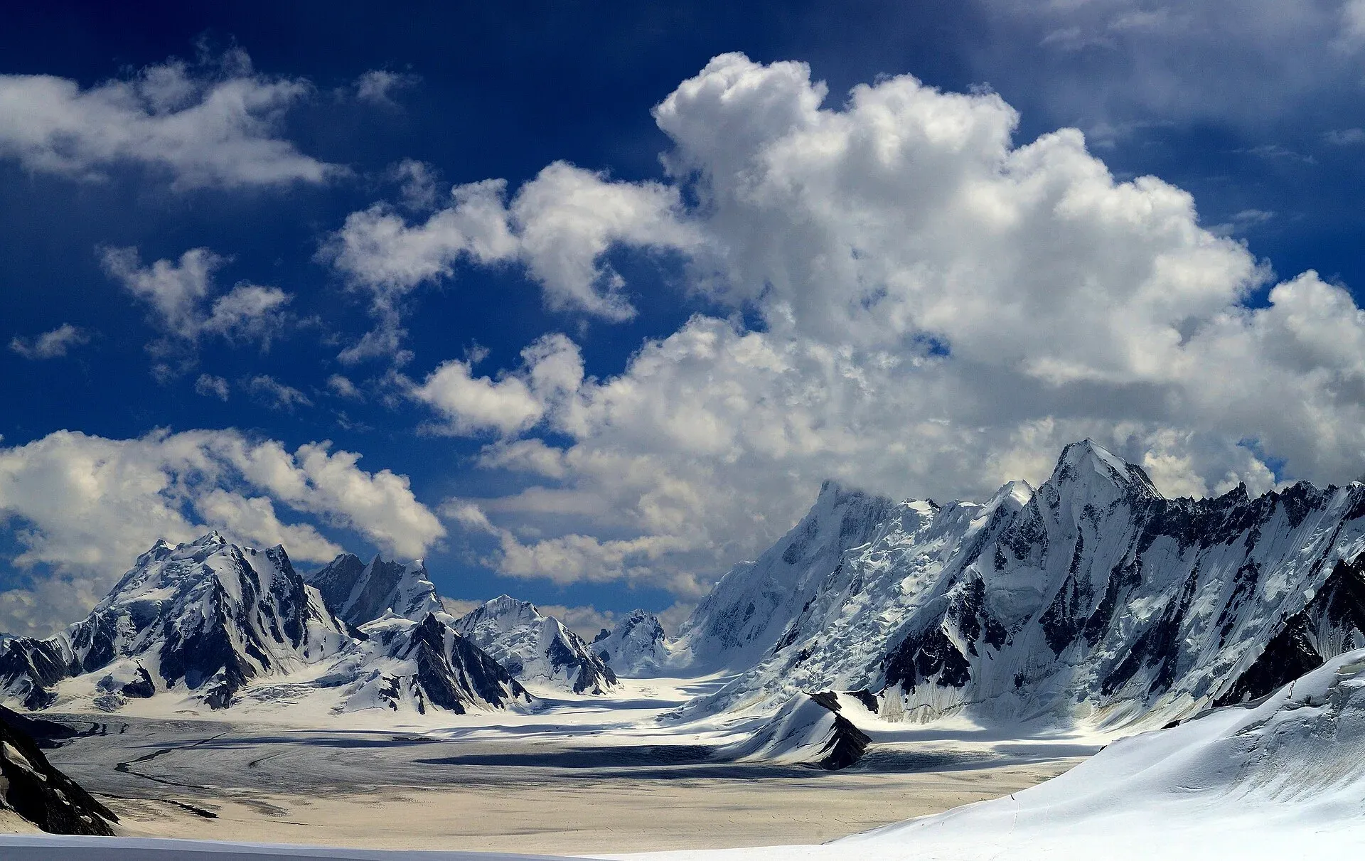
Photo: Vasiq Eqbal, with thanks · CC BY-SA 4.0 · via Wikimedia Commons · temporary stand-in photo

Central Karakoram National Park
Pakistan's largest protected area, covering about 10,500 square kilometres of the highest mountains on earth: K2, Gasherbrum I and II, Broad Peak and the Baltoro, Biafo and Hispar glaciers.
Overview
Central Karakoram National Park (CKNP) was created in 1993 and is the largest protected area in Pakistan, at about 10,557 square kilometres (Wikipedia; its lead rounds this to 10,000, and the core and buffer zones of about 7,600 and 3,000 sq km add up to about 10,600). It is often called the highest national park in the world. It ranges from about 2,000 m up to the summit of K2 at 8,611 m. Gasherbrum I (8,068 m), Broad Peak (8,051 m) and Gasherbrum II (8,035 m) are also inside, with about sixty other peaks above 7,000 m.
The park covers the Baltoro, Panmah, Biafo and Hispar glaciers and their tributaries. Pakistan placed it on UNESCO's World Heritage Tentative List in 2016. It is divided into a core zone of peaks, glaciers and high ground (about 7,600 square kilometres) and a buffer zone of lower land around settlements (about 3,000 square kilometres). A management plan was adopted in 2015.
Plan your visit
- Nearest town
- Skardu
- Getting there
Fly or drive to Skardu: the flight from Islamabad takes about an hour in good weather but is often cancelled, while the road by the Karakoram Highway takes about two long days. More
Best months
Jun – Sep
- Central Karakoram National Park
- Related place nearby: Panmah Glacier
What to see and do
CKNP is a trekking and mountaineering destination, not a place for casual wandering. The main routes inside it are:
- Baltoro Glacier and K2 Base Camp / Concordia. The classic expedition and trekking route from Askole.
- Gondogoro La and Gondogoro valley. A high pass above Concordia that links to Hushe.
- Masherbrum Base Camp from Hushe.
- Biafo and Hispar glaciers and Hispar La. A long glacier traverse between Baltistan and Nagar.
- Chogo Lungma glacier, with Arandu and Bisil as access villages.
Wildlife includes snow leopard (Vulnerable), Himalayan ibex, markhor, Himalayan brown bear and Tibetan wolf; most people see ibex or marmots at most. Birds include lammergeier and snowcock.
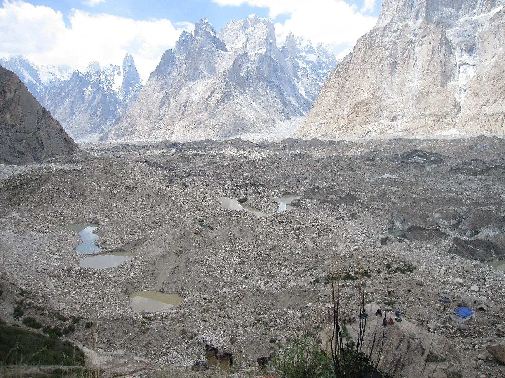
Photo: Shikari7, with thanks · CC BY-SA 3.0 · via Wikimedia Commons · temporary stand-in photo

Landscape, zones and wildlife
The park runs from valley floors at about 2,000 m to the summit of K2. Boundaries were unclear for about two decades because no management plan existed; a plan covering ten sectors, including wildlife, tourism and water, was set up in February 2015 after a year-long consultation. A Landsat-based study of 2001 to 2010 found ice cover largely unchanged, a pattern linked to the "Karakoram anomaly".
Spruce, Himalayan white pine and juniper grow in the lower valleys, with sea buckthorn and wild rose shrubs. Villages at the valley bottoms grow wheat, maize, potatoes, pomegranate and apricot. Wikipedia lists Marco Polo sheep, markhor, ibex, urial, snow leopard, brown and Asian black bear, Turkestan lynx and Tibetan wolf among the mammals, and Himalayan monal and several birds of prey among the birds. The park is an Important Bird Area. Sightings on a trek are a matter of luck and most people see far fewer species than the list suggests.
Most expeditions arrive in July and August, some in May and June, and September suits climbing at lower altitude. The Trango Towers stand close to the trekking route to K2 Base Camp.
When to visit
The trekking season is from about June to the end of September. July and August are the most settled but the glaciers are also at their hottest and most crevassed. Deep snow closes the high passes outside this window. Spring and autumn are cold and are not suited to trekking, except for experienced groups.
Where to stay and eat
Skardu has hotels and guest houses of all kinds. Beyond Askole and Hushe there are no services; trekkers camp, and all food and fuel must be carried or arranged with a tour operator. Porters and guides come from local villages.
Good to know
- A park fee applies for the Central Karakoram National Park, and treks in the area usually need permits through a registered Pakistani tour operator. A fee may apply. Current fees will be added soon; check with the park office or the provincial wildlife department before you go.
- Many routes inside CKNP lie in restricted zones. Check current rules with the Gilgit-Baltistan tourism department and your operator before you plan.
- Glacier travel, river crossings, altitude and rockfall are real hazards. Rescue is slow and expensive; carry insurance that covers helicopter evacuation.
- Follow the standard park rules: take your litter out with you, do not light fires outside marked sites, do not pick plants or disturb animals, and do not hunt. Hunting and trapping inside a national park are offences. Ask the park office before flying a drone; many parks need written permission and drones are banned near borders and sensitive sites.
- Pack out all rubbish, including toilet paper, from camps. Concordia and the Baltoro have been badly affected by waste from expedition traffic.
Highlights
- Home to K2, Gasherbrum I and II and Broad Peak
- Baltoro, Biafo, Panmah and Hispar glaciers
- Classic treks to K2 Base Camp and Gondogoro La
- UNESCO World Heritage Tentative List since 2016
Getting there
Fly or drive to Skardu: the flight from Islamabad takes about an hour in good weather but is often cancelled, while the road by the Karakoram Highway takes about two long days. From Skardu, jeeps take about 7 to 8 hours to Askole, the last village on the Baltoro route; Hushe is reached by jeep in about 6 to 7 hours through Khaplu.
Tips
- Trek with a registered operator and carry evacuation insurance
- Go between late June and September
- Leave no waste on glaciers or at camps
- Allow acclimatisation days
Wildlife
Facilities
- None inside the core zone; services only at Skardu, Askole and Hushe
- Trekking campsites
- Local guides and porters via operators
Photos we still need: wildlife in the park (markhor, ibex or marmot) taken in Pakistan; Askole or a trailhead village; a camp in the buffer zone. Send us yours
Sources and last checked
Last checked Confidence medium2 sources4 still to check
- Last checked
- Method
- Desk research from published sources
- Confidence
- medium
- Checked by
- trek.pk research team
Researched from published sources; not yet checked on the ground by our team. Spot something out of date? Report a mistake.
Sources
- Central Karakoram National Park (Wikipedia) · Wikipedia · checked
- Pakistan Tourism Guide 2021 · TDAP Pakistan · checked
Still to be checked on the ground (4)
- Park fee and permit rules this season (no official source reachable)
- Which trekking areas are restricted zones (no official list found)
- Dates for flights and jeep roads
- Wikipedia gives the park area as both about 10,000 and 10,557 sq km
Nearby and related

Baltoro Glacier and K2 Base Camp

Gondogoro La
Gondogoro Valley

Masherbrum Base Camp

Hispar La (Biafo–Hispar traverse)

Chogo Lungma Glacier

Other treks in Baltistan
Panmah Glacier
A long glacier in the Panmah Muztagh, inside the Central Karakoram National Park, with the Latok spires at its head. It is in a restricted zone.