

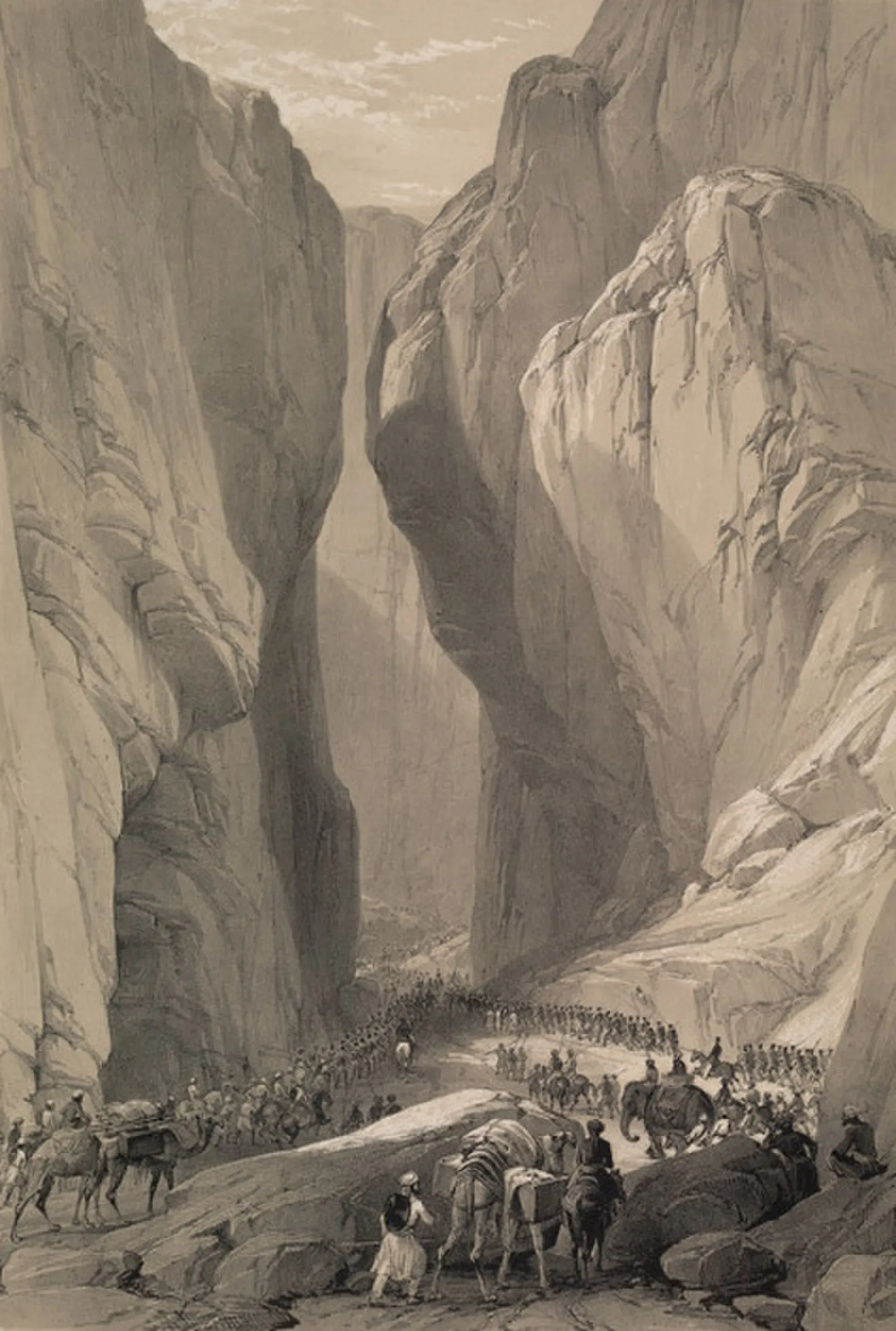
Photo: Louis Haghe, after James Atkinson, with thanks · Public domain (CC0) · via Wikimedia Commons · temporary stand-in photo

Bolan Pass
An 89 km gorge route from Sibi to Quetta, with a highway and a railway. A key route since early times, but the FCDO advises against all travel in Balochistan.
Overview
The Bolan Pass is a long gorge of the Bolan river in the Toba Kakar range, joining Sibi and the Kachhi plain to Quetta. Wikipedia gives its length as 89 km, from Rindli (Dhadar) in the south to Darwaza near Kolpur in the north, and a height of about 1,793 m (1,793.4 m in Wikipedia's headline figure). The pass lies about 120 km south of the Afghan border. The N-65 highway and the Rohri-Chaman railway line both use it. Its southern end near Dhadar marks the western edge of the Indus valley. Mehrgarh, one of the oldest farming sites in South Asia, lies on the plain near the southern mouth.
This is a road and rail pass, not a trekking pass. It is a through route for travellers; there are no guided facilities. Treat this page as background, because the FCDO advises against all travel to Balochistan.
Plan your visit
- Nearest town
- Mach (north) or Rindli/Dhadar (south)
- Getting there
The N-65 runs from Sibi through the pass to Quetta. The railway runs the same corridor. We do not recommend travel in Balochistan at present; if you must, get local advice and travel in daylight. More
What to see and do
The pass is about the journey. Narrow limestone walls and cliffs close in on the road and rail line. Wikipedia mentions the Khundilani gorge, where conglomerate cliffs rise to about 240 m, and Siri Bolan, where the rocks leave room for only about three riders abreast.
Railway
The railway from Sibi first followed the Bolan stream, but floods forced the line to move to the Mashkaf valley, which meets the Bolan at Machh. A second route, by Harnai, carried ordinary traffic at first, and the Bolan route was upgraded in 1895 to take all traffic. Floods in 1942 wiped out a large part of the line. Wikipedia says the Sibi to Khost branch is out of service as of 2024. See Bolan Pass Railway and ML-3 Rohri-Quetta-Chaman line.
History
Ahmad Shah Durrani used the pass and the Khyber in 1748. In February 1839 Sir John Keane led some 12,000 men through it into Kandahar in the First Anglo-Afghan War. A British officer's account of 1841 describes a road along the stream bed, robbers called Kakurs, and a sudden flood that swept away about 37 men. After the Quetta agency was set up in 1877, the British secured the pass with Baloch militias, mostly Marris. In 1883 Sir Robert Sandeman agreed British control of it with the Khan of Kalat, for an annual payment.
When to visit
Wikipedia says summers are extremely hot, and winters bring cold, icy winds through the narrow outlet. No season is recommended here. Flash floods from mountain rain have swept away people and property, so avoid the gorge in heavy rain.
Good to know
- Ask the district administration or local police about current conditions before you go. Travel advice. For foreign visitors: the UK FCDO (updated 27 October 2026, checked 16 November 2026) advises against all travel to Balochistan, which includes Quetta and the pass. In 2025 the Jaffar Express train was hijacked in the Bolan Pass (Wikipedia).
- Hazards. Flash floods, heat, and security risks on the road.
- Trains. Check Pakistan Railways for current services; we have not confirmed what runs today.
- Fees. No fees are involved.
Highlights
- 89 km river gorge from Sibi to Quetta
- Used by armies and caravans for centuries
- Carries the N-65 highway and the Rohri-Chaman railway
- Near the prehistoric site of Mehrgarh
Getting there
The N-65 runs from Sibi through the pass to Quetta. The railway runs the same corridor. We do not recommend travel in Balochistan at present; if you must, get local advice and travel in daylight.
Tips
- Check the FCDO page before any travel in Balochistan
- Avoid the gorge in rain: flash floods are a known danger
- Look at Pakistan Railways for train status
- Read the Mehrgarh page for the prehistoric side of the story
Photos we still need: the Khundilani gorge and Siri Bolan. Send us yours
Sources and last checked
Last checked Confidence medium3 sources3 still to check
- Last checked
- Method
- Desk research from published sources
- Confidence
- medium
- Checked by
- trek.pk research team
Researched from published sources; not yet checked on the ground by our team. Spot something out of date? Report a mistake.
Sources
- Bolan Pass (Wikipedia) · Wikipedia · checked
- Pakistan Tourism Guide 2021 · TDAP Pakistan · checked
- Pakistan travel advice: warnings and insurance (updated 27 October 2026) · UK FCDO · checked
Still to be checked on the ground (3)
- Current rail services in the pass (Wikipedia notes the Sibi-Khost branch is out of service as of 2024; main-line status not confirmed)
- Current flood and road conditions
- Exact location of the railway photo within the pass (Commons says only 'Bolan')
Nearby and related

Quetta
Balochistan's high-valley capital, the Fruit Garden of Pakistan: bazaars, sajji, orchard valleys and the base for Hanna Lake and Ziarat.

Sibi
A hot town at the mouth of the Bolan Pass in eastern Balochistan, famous for the Sibi Mela, a cultural and livestock fair held since 1885.

Mehrgarh
One of the oldest farming villages in South Asia, on the Kachhi Plain near the Bolan Pass in Balochistan. People lived here from about 7000 BCE, and the site is on Pakistan's UNESCO tentative list (2004).

Balochistan
Pakistan's largest and least populated province: Quetta's high valleys, Ziarat's juniper forest, the Makran coast, Hingol and Gwadar. Security and permission rules need checking first.

Quetta, Ziarat and Hanna Lake
A three-day road trip from Quetta to Hanna Lake and the juniper forests and Quaid-e-Azam Residency at Ziarat, 124 km from Quetta. For foreign visitors: the UK FCDO advises against all travel to Balochistan; check current advice before planning.