

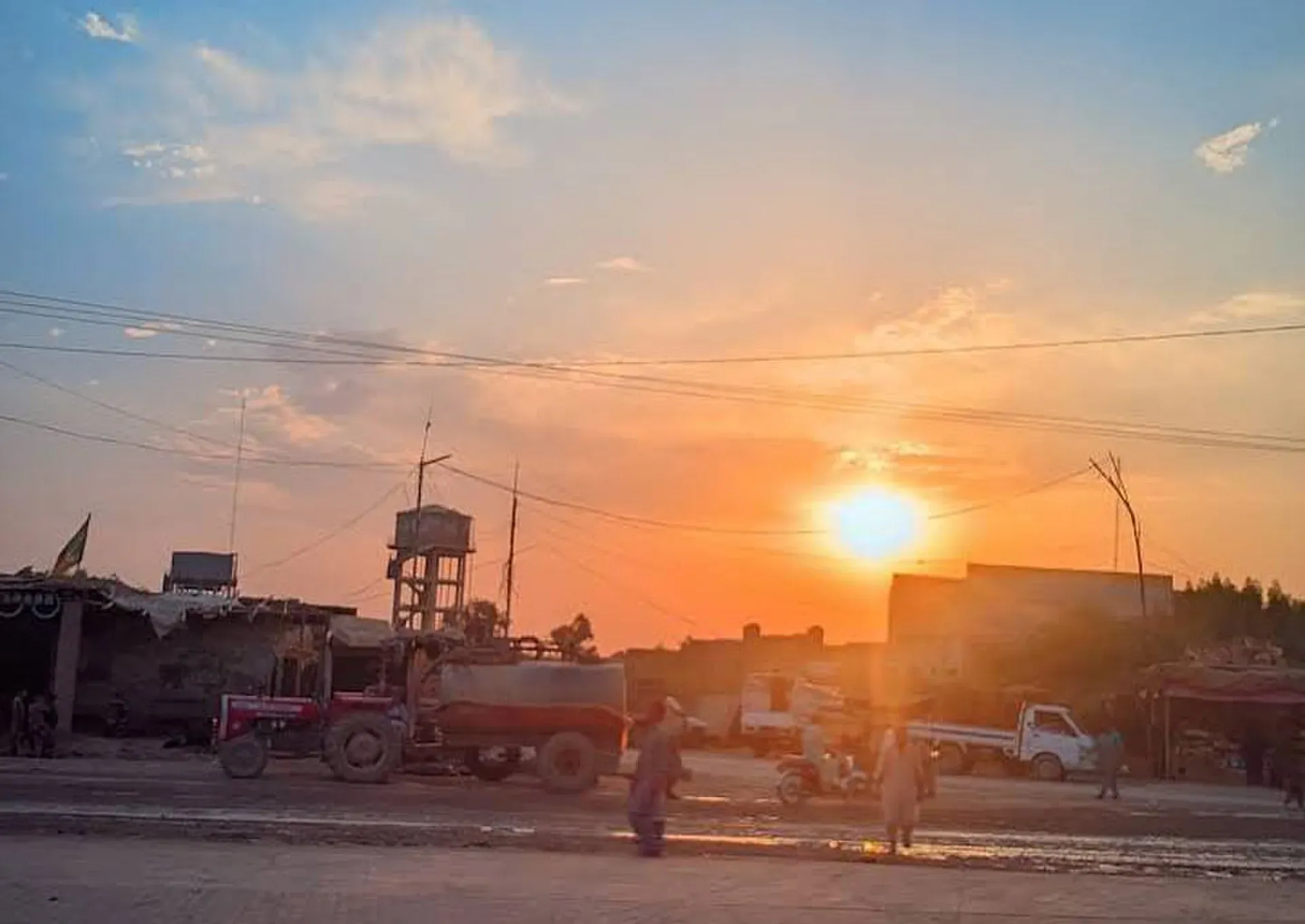
Photo: Farazhusaynakhter, with thanks · Public domain (CC0) · via Wikimedia Commons · temporary stand-in photo

Dera Allah Yar
Rice-milling and farming city, headquarters of Jaffarabad District in eastern Balochistan, on the N-65 and the Rohri to Chaman railway near the Sindh border. For foreign visitors: the UK FCDO advises against all travel to Balochistan.
Overview
Dera Allah Yar, formerly called Jhatpat, is the headquarters of Jaffarabad District in eastern Balochistan, close to the Sindh border. It is named after Allah Yar Khan Khosa, a local political leader. The city stands on flat alluvial plain at about 56 m above sea level, one of the lowest-lying places in the province. The 2023 census counted 98,761 people in the city (a municipal corporation), with Balochi spoken by about 59 per cent, Sindhi by about 26 per cent and Saraiki by about 9 per cent. Brahui speakers make up a little over 3 per cent.
Jaffarabad District was created in 1987 and is named after Mir Jafar Khan Jamali. It has two tehsils (sub-districts), Jaffarabad and Jhatpat, and a population of about 302,498 in 2023.
Plan your visit
- Nearest town
- Dera Murad Jamali
- Getting there
Road: Sukkur about 95 km (about 1 hour 10 minutes); Dera Murad Jamali about 23 km (about 20 minutes); Quetta about 300 km. Rail: Rohri to Chaman line. No airport. More
Best months
Nov – Mar
- Dera Allah Yar
- Related place nearby: Dera Murad Jamali
What to see and do
There are no recognised visitor sights. It is a working agricultural city, and the bazaars and the railway station are its main points of interest. Local shops sell farm machinery, construction equipment, seeds and fertiliser, as the town serves the farmland around it.
The local economy
The economy rests on farming, rice milling and livestock. Wheat, rice, maize, bajra (pearl millet) and barley are grown on the canal-irrigated plain, and several large rice mills operate in the city. Cattle farming is also significant.
Why you might pass through
The city lies on the N-65, which links Sukkur and Jacobabad with Quetta via Dera Murad Jamali, Sibi and the Bolan Pass, and on the Rohri to Chaman railway. A bypass road connects Dera Allah Yar and Jacobabad, mainly for heavy traffic. Bus services run to Karachi, Quetta, Jacobabad, Sukkur and Larkana, and vans, auto-rickshaws and taxis link the city with nearby towns such as Sohbatpur and Usta Muhammad.
Getting there
OSRM estimates Sukkur at about 95 km and 1 hour 10 minutes, and Dera Murad Jamali at about 23 km and 20 minutes (optimistic estimates, checked 16 November 2026). Quetta is around 300 km by road according to Wikipedia. Rail services on the line are sometimes suspended, so check Pakistan Railways. There is no airport; the nearest are at Sukkur and Quetta.
Services
Expect the basic services of a district headquarters: a government district hospital and private clinics, pharmacies, fuel stations on the main roads and a central bazaar. ATMs are most likely in the main bazaar or along the highway. No verified list of individual businesses is available, so confirm what you need in a larger city before you arrive.
Nearby
Dera Murad Jamali is the neighbouring district headquarters, and Sukkur is the nearest larger city with sights. Jacobabad lies just across the provincial border in Sindh.
Safety
For foreign visitors: the UK FCDO advises against all travel to Balochistan (page updated 27 October 2026; checked 16 November 2026). This page therefore does not recommend visiting as a traveller. If you live here or have essential business, follow guidance from the provincial authorities and your embassy, and do not rely on this page for planning. The FCDO also notes a general risk of terrorism across Pakistan.
Highlights
- Headquarters of Jaffarabad District
- Rice mills and canal farmland
- On the N-65 and the Rohri to Chaman railway
- Close to the Sindh border
Stay, eat and essentials in Dera Allah Yar
Places to eat
- Quetta Dua Hotel & RestaurantMap of Quetta Dua Hotel & Restaurant in Google Maps
- Al Madina Bakers and SweetCall Al Madina Bakers and SweetMap of Al Madina Bakers and Sweet in Google Maps
- New Quetta A-1 City Hotel And Baar B QCall New Quetta A-1 City Hotel And Baar B QMap of New Quetta A-1 City Hotel And Baar B Q in Google Maps
Essential services fuel stations, ATMs, pharmacies and hospitals and clinics
Fuel
- Magsi CNG Station 3Map of Magsi CNG Station 3 in Google Maps
- Pakistan State OilMap of Pakistan State Oil in Google Maps
- Jamali pumpMap of Jamali pump in Google Maps
- Aftab Petroleum Service.Map of Aftab Petroleum Service. in Google Maps
- Maulana Filling StationMap of Maulana Filling Station in Google Maps
- Madina CNG Station JhatpatCall Madina CNG Station JhatpatMap of Madina CNG Station Jhatpat in Google Maps
ATMs
- National Bank of PakistanCall National Bank of PakistanMap of National Bank of Pakistan in Google Maps
- Askari BankCall Askari BankMap of Askari Bank in Google Maps
Pharmacies
- Liaqat medical store Dera Allah Yar jaffarabad balochistanCall Liaqat medical store Dera Allah Yar jaffarabad balochistanMap of Liaqat medical store Dera Allah Yar jaffarabad balochistan in Google Maps
- Hafiz Medical StoreCall Hafiz Medical StoreMap of Hafiz Medical Store in Google Maps
Hospitals and clinics
- DHQ HospitalMap of DHQ Hospital in Google Maps
All listings in Dera Allah Yar
Listings come from Google Maps data and are unverified: phone numbers, opening months and prices may have changed. Report a problem · Own one of these? Claim it
Tips
- Do not plan leisure travel here: the FCDO advises against all travel to Balochistan.
- Base in Sukkur only if your travel is essential and you have checked advice.
- Expect extreme summer heat.
- Check Pakistan Railways for current services.
Photos we still need: rice mills or farmland around Dera Allah Yar (section: The local economy). Send us yours
Sources and last checked
Last checked Confidence medium6 sources1 still to check
- Last checked
- Method
- Desk research from published sources
- Confidence
- medium
- Checked by
- trek.pk research team
Researched from published sources; not yet checked on the ground by our team. Spot something out of date? Report a mistake.
Sources
- Dera Allah Yar · Wikipedia · checked
- Jaffarabad District: 2023 census · CityPopulation.de · checked
- OSRM public routing demo (driving, optimistic) · Project OSRM · checked
- Pakistan travel advice · UK Foreign, Commonwealth & Development Office (FCDO) · checked
- Jaffarabad: Dera Allah Yar (Jhatpat) municipal corporation, 2023 census · CityPopulation.de · checked
- Jaffarabad District · Wikipedia · checked
Still to be checked on the ground (1)
- Current rail services
Nearby and related

Dera Murad Jamali
The canal-irrigated farming city and administrative centre of Nasirabad District in eastern Balochistan, on the Rohri to Chaman railway near the Sindh border.

Sukkur
Sindh's third-largest city on the Indus, with the 1932 Sukkur Barrage, the 1889 Lansdowne Bridge, Masum Shah's Minaret and the river islands of Rohri.

Balochistan
Pakistan's largest and least populated province: Quetta's high valleys, Ziarat's juniper forest, the Makran coast, Hingol and Gwadar. Security and permission rules need checking first.