

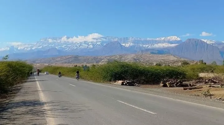
Photo: Asad ASAd, with thanks · Public domain (CC0) · via Wikimedia Commons · temporary stand-in photo

Koh-e-Sulaiman National Park
A mountain national park in the Sulaiman range in Dera Ismail Khan, Khyber Pakhtunkhwa, listed in 2021 at about 300 square kilometres. Very little visitor information exists, and the FCDO advises against all travel to the district.
Overview
Wikipedia's list of national parks gives Koh-e-Sulaiman National Park as a Khyber Pakhtunkhwa park in Dera Ismail Khan District, established in 2021 and covering about 30,000 hectares (300 square kilometres). It is in the Sulaiman Mountains. This is the Khyber Pakhtunkhwa park, not the Fort Munro area on the Punjab side. See Fort Munro for that area. No official notification, boundary map or management plan was found, so the extent of the park on the ground is unconfirmed.
Plan your visit
- Nearest town
- Dera Ismail Khan
- Getting there
Dera Ismail Khan is the nearest city. We have no confirmed access route, entry point or public transport details for the park. More
Best months
Oct – Mar
- Koh-e-Sulaiman National Park
- Related places nearby: Dera Ismail Khan, Sheikh Badin National Park, Sherani Chilgoza Forests, Takht-i-Sulaiman
The Sulaiman range
The Sulaiman Mountains are a north-south extension of the southern Hindu Kush, forming the eastern edge of the Iranian plateau. Wikipedia says the eastern edge runs about 450 km, from the Gomal Pass in Khyber Pakhtunkhwa to near Jacobabad in Sindh, and covers parts of Waziristan, Kurram, northern Balochistan and south-western Punjab as well as eastern Afghanistan. The range formed as a fold and thrust belt when the Indian and Eurasian plates collided, beginning about 30 million years ago.
Takht-e-Sulaiman, the twin-peaked high point of the main range at 3,487 m, is near Darazinda in Dera Ismail Khan District. Ibn Battuta recorded the peak as Koh-i Sulaiman. It is linked in tradition with the Prophet Solomon, and a local legend places the grave of Qais Abdur Rashid, a legendary ancestor of the Pashtuns, on the summit. See the Takht-e-Sulaiman page. Wikipedia says climbs are mostly made in summer, because snow makes them difficult from late November to March.
The district below
Dera Ismail Khan District has fertile alluvial plains on the east side of the Indus and clay ground cut by rain ravines farther out, according to Wikipedia. The Sheikh Badin Hills, with Sheikh Badin National Park, separate the district from Lakki Marwat. A thin strip of South Waziristan lies between the district and the Sulaiman Mountains of Balochistan. Saraiki and Pashto are the two main languages, and Wikipedia describes sobat, a chicken dish with onions, garlic, tomatoes and spices, as a traditional dish of the district capital.
What to see and do
No visitor trails, viewpoints or wildlife lists are confirmed for the park. The area is mountain country with steep ground and few roads. The best-documented feature is the Takht-e-Sulaiman massif.
When to visit
Not confirmed. The plains near Dera Ismail Khan are very hot in summer, so the cooler months are more practical in general. Higher ground is snowbound from late November to March.
Where to stay and eat
No facilities are known. Dera Ismail Khan is the nearest city.
Good to know
- No fees or visitor arrangements are published that we could confirm. Current fees will be added soon.
- This is a remote area and not set up for tourism. Follow the standard park rules: take your litter out with you, do not light fires outside marked sites, do not pick plants or disturb animals, and do not hunt. Ask the park office before flying a drone.
Travel advice
For foreign visitors: the UK FCDO advises against all travel to Dera Ismail Khan (checked 17 November 2026, page updated 27 October 2026). It also advises against travel within 10 miles of the Afghan border. Do not plan a visit without checking the live advice.
Highlights
- Part of the Sulaiman Mountains
- Listed as a national park in 2021
- Near Takht-e-Sulaiman, the range's highest peak
Getting there
Dera Ismail Khan is the nearest city. We have no confirmed access route, entry point or public transport details for the park.
Tips
- Check the live FCDO advice, which advises against all travel to Dera Ismail Khan
- Ask the Khyber Pakhtunkhwa Wildlife Department before any visit
- Do not expect services
Photos we still need: landscape inside the park (the available CC0 photo shows Takht-e-Sulaiman from Darazinda). Send us yours
Sources and last checked
Last checked Confidence low5 sources6 still to check
- Last checked
- Method
- Desk research from published sources
- Confidence
- low
- Checked by
- trek.pk research team
Researched from published sources; not yet checked on the ground by our team. Spot something out of date? Report a mistake.
Sources
- List of national parks of Pakistan · Wikipedia · checked
- Sulaiman Mountains (Koh-e-Sulaiman) · Wikipedia · checked
- Pakistan travel advice (updated 27 October 2026) · UK FCDO · checked
- Sulaiman Mountains · Wikipedia · checked
- Dera Ismail Khan District · Wikipedia · checked
Still to be checked on the ground (6)
- Official name, notification and boundary
- Wildlife and facilities
- Coordinates are from Wikipedia's list and not checked
- Access and permissions
- Fees
- Wildlife (markhor, urial or other) not confirmed by any source opened
Nearby and related

Dera Ismail Khan
A historic Indus river city in southern Khyber Pakhtunkhwa where Saraiki and Pashtun cultures meet, near the 5,000-year-old Rehman Dheri mound. Check security advice before any visit.

Fort Munro
Southern Punjab's only hill station, about 1,800 to 2,200 m in the Sulaiman Mountains above Dera Ghazi Khan, founded in 1866 as a summer base. UK advice is against all but essential travel to Dera Ghazi Khan.

Sheikh Badin National Park
A hill-top national park in the Sheikh Badin hills, between Lakki Marwat and Dera Ismail Khan in southern KP. About 15,540 hectares, set up in 2003, with a colonial hill station and a Sufi shrine. For foreign visitors: the UK FCDO advises against travel here.
Sherani Chilgoza Forests
High forests of chilgoza (pine-nut) pine on the Sulaiman range in Sherani district, Balochistan, around the Takht-i-Sulaiman ridge. Not set up for tourism; the UK FCDO advises against all travel to Balochistan.
Takht-i-Sulaiman
Takht-i-Sulaiman (3,487 m) is the highest peak of the Sulaiman Mountains in Dera Ismail Khan district. FCDO advises against all travel to Dera Ismail Khan and Balochistan. Information only; this site gives no route.