

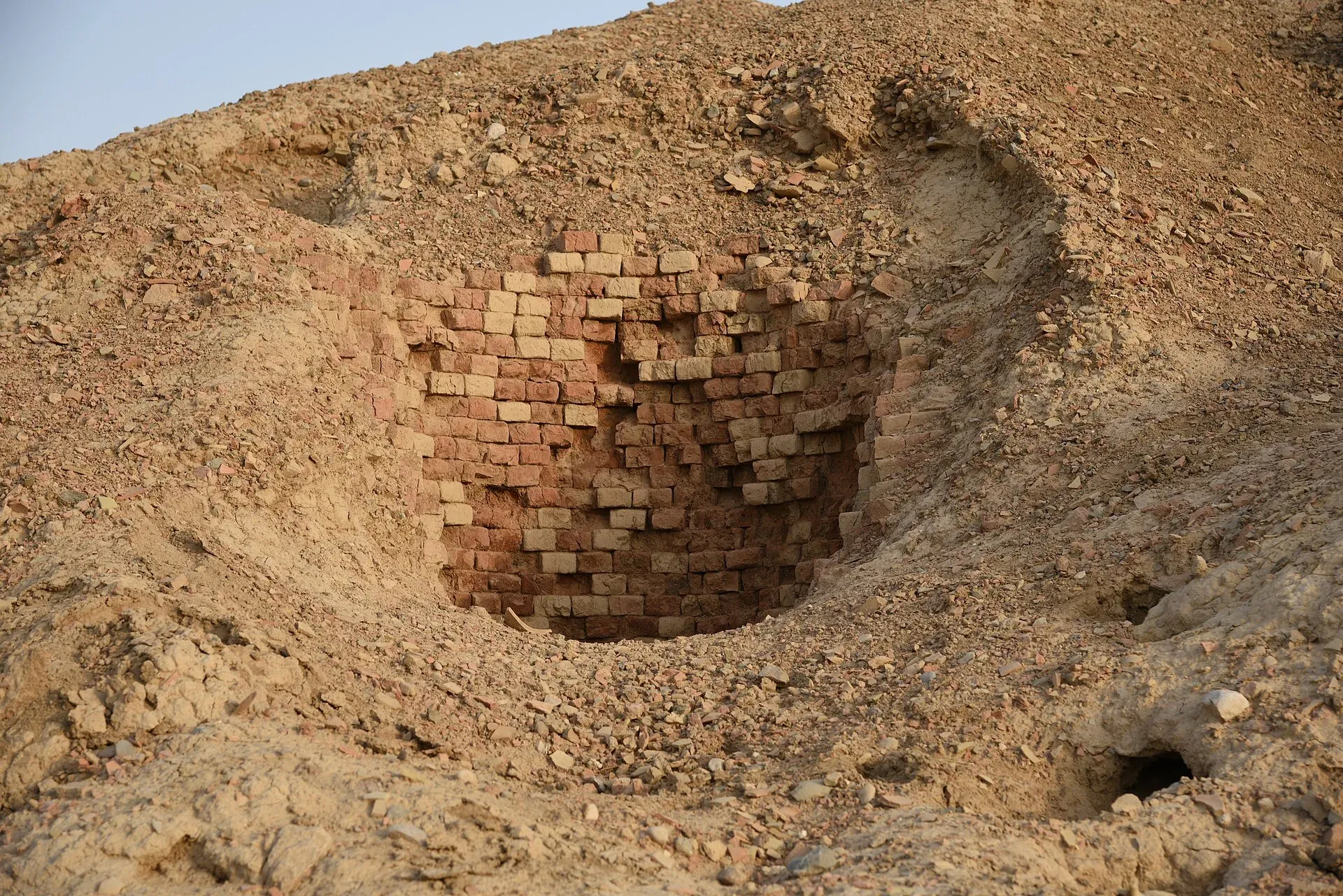
Photo: mhtoori, with thanks · CC BY-SA 4.0 · via Wikimedia Commons · temporary stand-in photo

Dhadar
Small headquarters town of Kachhi District on the Kachhi plain, close to Mehrgarh and the mouth of the Bolan Pass.
Overview
Dhadar (also spelled Dadhar) is the headquarters of Kachhi District, which was known as Bolan District until 2008, and of the tehsil of the same name. It lies on the flat Kachhi plain at about 132 m, far lower and hotter than Quetta. The 2023 census counted 17,276 people. The town has grown from 4,099 people in 1961 to 12,818 in 1998 and 15,240 in 2017, about 2.1 per cent a year since 2017.
Plan your visit
- Getting there
Road: Sibi about 28 km (about 25 minutes); Quetta about 136 km (about 1 hour 45 minutes) (OSRM, checked 16 November 2026, optimistic). Rail and air: none in the town; check Pakistan Railways for the Bolan line. More
Best months
Nov – Mar
History
The Kachhi plain is one of the oldest farming landscapes in South Asia. In 1740 it passed to the Khanate of Kalat, and it was notified as a district in 1965.
Mehrgarh, the nearby site
The Neolithic settlement of Mehrgarh lies close to the town, on the Kachhi plain near the Bolan Pass. A French team led by Jean-François and Catherine Jarrige found it in 1974 and excavated until 1986 and again in 1997 to 2000. The site covers about 2 km² across six mounds.
Its earliest phase (about 5250 to 4650 BCE in the current dating; earlier estimates went back to 7000 BCE) is aceramic, meaning without pottery. People grew wheat and barley, kept sheep, goats and cattle and built unbaked mud-brick houses. Later phases add the earliest pottery in Pakistan, copper tools and kilns, and many female terracotta figurines. Beads of lapis lazuli found here came from as far as Badakhshan, which shows long-distance trade. Mehrgarh was largely replaced by the fortified town of Nausharo, about five miles away, around 2500 BCE.
Check access with the Department of Archaeology before going, because the site is not set up for casual visits.
What to see and do
Dhadar itself is a working administrative and market town with little for visitors. The reason to know it is Mehrgarh.
When to visit
If you must travel, winter is the only comfortable season. Summers on the Kachhi plain are very hot.
Where to stay and eat
Services are those of a district headquarters: expect a government hospital, pharmacies, fuel stations, banks or ATMs and basic guesthouses or hotels in the main bazaar. There is no verified list of facilities or businesses, so confirm before you rely on any of them, and carry cash and fuel.
Good to know
Sibi is about 28 km away by road and Quetta about 136 km (about 1 hour 45 minutes), according to OSRM routing from the nearest cities (checked 16 November 2026). The route to Quetta passes through the Bolan area. Mehrgarh is about 21 km from Dhadar by road, roughly 45 minutes (OSRM estimate; the site coordinate is only to the nearest minute).
Ask the district administration or local police about current conditions before you go. Safety: For foreign visitors: the UK FCDO advises against all travel to Balochistan, including Quetta and Ziarat (page updated 27 October 2026; checked 16 November 2026). Visiting as a tourist is not recommended. If you live here or have essential business, follow current guidance from the provincial authorities and your embassy, and expect checkpoints. The FCDO also notes an ongoing risk of terrorism across Pakistan.
Highlights
- Headquarters of Kachhi District
- Close to the Neolithic site of Mehrgarh
- On the Kachhi plain near the Bolan Pass
Getting there
Road: Sibi about 28 km (about 25 minutes); Quetta about 136 km (about 1 hour 45 minutes) (OSRM, checked 16 November 2026, optimistic). Rail and air: none in the town; check Pakistan Railways for the Bolan line.
Hotels, food, fuel and services in Dhadar
Essential services fuel stations and hospitals and clinics
Fuel
- Mir Manzoor Rind PetroliumMap of Mir Manzoor Rind Petrolium in Google Maps
- Petrol Pump پٹرول پمپMap of Petrol Pump پٹرول پمپ in Google Maps
- Shaheen PumpMap of Shaheen Pump in Google Maps
- Al-Yousf Shahwani PumpMap of Al-Yousf Shahwani Pump in Google Maps
- Al Saudia Petrolim serviceMap of Al Saudia Petrolim service in Google Maps
- Al-Zaheer PetroliumMap of Al-Zaheer Petrolium in Google Maps
Hospitals and clinics
- D.H.Q Hospital DhadarCall D.H.Q Hospital DhadarMap of D.H.Q Hospital Dhadar in Google Maps
Listings come from Google Maps data and are unverified: phone numbers, opening months and prices may have changed. Report a problem · Own one of these? Claim it
Tips
- Visit only in winter if at all.
- Carry water, cash and fuel.
- Check the security situation before any journey.
Photos we still need: Dhadar town or the main bazaar. Send us yours
Sources and last checked
Last checked Confidence medium7 sources3 still to check
- Last checked
- Method
- Desk research from published sources
- Confidence
- medium
- Checked by
- trek.pk research team
Researched from published sources; not yet checked on the ground by our team. Spot something out of date? Report a mistake.
Sources
- Dhadar · Wikipedia · checked
- Kachhi District · Wikipedia · checked
- OSRM driving routes (road distances and times) · Project OSRM / OpenStreetMap · checked
- Pakistan travel advice (updated 27 October 2026) · UK Foreign, Commonwealth & Development Office · checked
- Sevi Division (Wikipedia) · Wikipedia · checked
- Foreign travel advice Pakistan: warnings and insurance · UK FCDO · checked
- Mehrgarh (periods, finds, excavation) · Wikipedia · checked
Still to be checked on the ground (3)
- Hospital, fuel and lodging (no verified list)
- Which division Kachhi belongs to: Wikipedia lists it under Sevi (Sibi) Division, renamed Sui Division in July 2026 per a ProPakistani report not opened; unconfirmed
- Road security on the Bolan route (FCDO still advises against all travel to Balochistan; no route-specific official notice)
Nearby and related

Balochistan
Pakistan's largest and least populated province: Quetta's high valleys, Ziarat's juniper forest, the Makran coast, Hingol and Gwadar. Security and permission rules need checking first.

Mehrgarh
One of the oldest farming villages in South Asia, on the Kachhi Plain near the Bolan Pass in Balochistan. People lived here from about 7000 BCE, and the site is on Pakistan's UNESCO tentative list (2004).

Sibi
A hot town at the mouth of the Bolan Pass in eastern Balochistan, famous for the Sibi Mela, a cultural and livestock fair held since 1885.

Quetta
Balochistan's high-valley capital, the Fruit Garden of Pakistan: bazaars, sajji, orchard valleys and the base for Hanna Lake and Ziarat.