

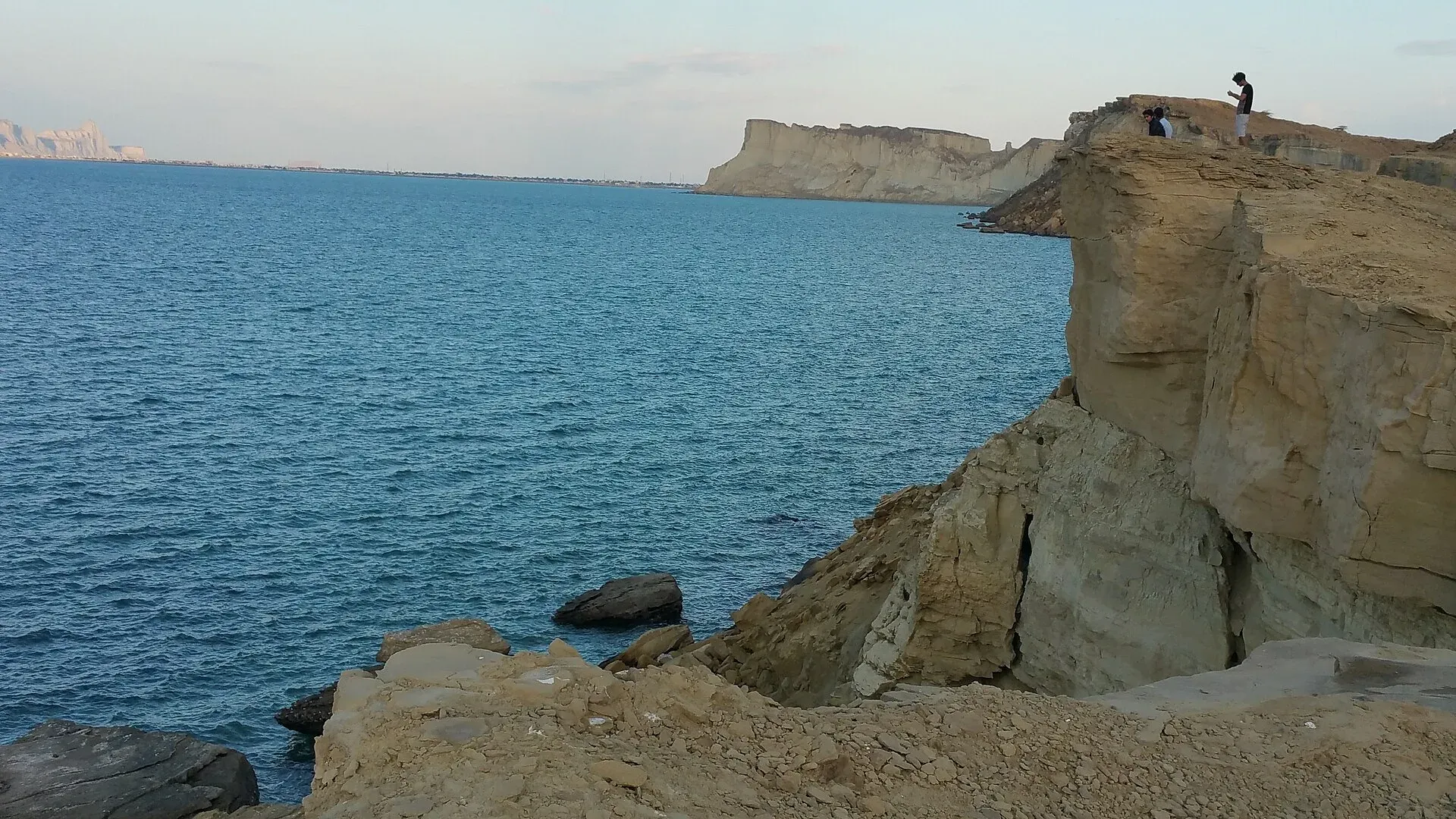
Photo: Madihasalam, with thanks · CC BY-SA 4.0 · via Wikimedia Commons · temporary stand-in photo

Gwadar Beaches
Beaches on either side of Gwadar's narrow peninsula: the shallow western bay (Padi Zirr), Marine Drive, Sunset Park and Kapasi Beach below Koh-e-Batil. Erosion and waves are a worry. Balochistan is under UK FCDO 'all travel' advice.
Read this first: current advice
Ask the district administration or local police about current conditions before you go. For foreign visitors: the UK FCDO (updated 27 October 2026, checked 17 November 2026) advises against all travel to Balochistan Province. The whole Balochistan coast is covered by that advice, so it applies to this beach. The page describes the coast for information and does not recommend the trip. On the N-10, the Gwadar district administration barred public transport at night in a notification of 28 March 2025, with set daytime departure windows for services to and from Gwadar. Dawn reported it on 30 March 2025 as 'till further orders', and there is no known notice lifting it.
Plan your visit
- Nearest town
- Gwadar
- Getting there
Gwadar is 627 km and 7 hours 25 minutes by road from Karachi on the N-10 (OSRM, checked 16 November 2026). Night public transport on the N-10 has been banned by Gwadar district (Dawn, 30 March 2025). More
Best months
Oct – Mar
Overview
Gwadar sits on a hammerhead-shaped peninsula. A narrow, sandy isthmus, about 12 km long and 240 m wide, joins the rocky Koh-e-Batil headland to the mainland and separates two semicircular bays: Padi Zirr on the west and Demi Zirr on the east, where the deepwater port was built (Wikipedia). The beaches described here lie along these bays and the headland. By road Gwadar is 627 km and 7 hours 25 minutes from Karachi (OSRM, 16 November 2026). Paradise Point, often mentioned with Gwadar, is a Karachi beach: see the Cape Monze page.
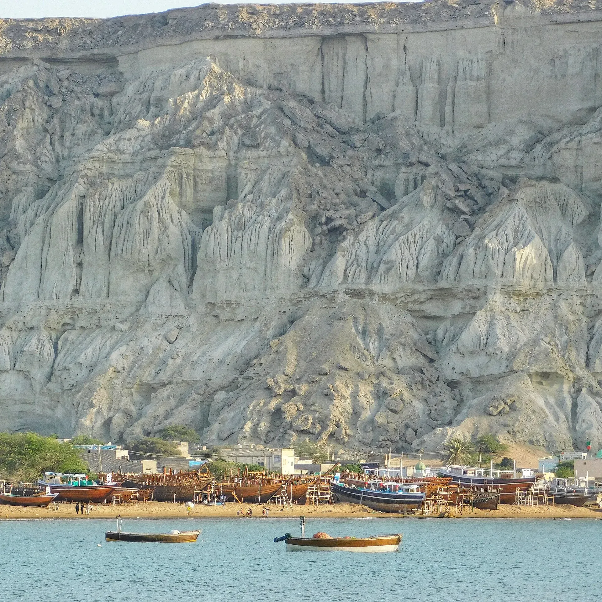
Photo: Sajjad Mahesri, with thanks · CC BY-SA 4.0 · via Wikimedia Commons · temporary stand-in photo

What to see and do
The Gwadar Development Authority lists these places to visit:
- Marine Drive: a long road along the shore, used for sunset drives.
- Padizer Park: near the authority's office on Marine Drive.
- Hammerhead and Sunset Park: a viewpoint (the authority places Sunset Park at Hammerheads in the Sanghar Housing Scheme) with the sea to the south and the town to the north, popular at sunset.
- Kapasi Beach, Koh-e-Batil: on the back side of the hill, reached by stairs, known for sunsets.
Padi Zirr is generally shallow, with an average depth of 3.7 m (Wikipedia). WWF-Pakistan counts the Gwadar headland among turtle nesting sites (Dawn, 15 June 2022).
Around the headland and the bays
Gwadar's coast is a working fishing coast as well as a leisure one. Ancient Greek writers called the people of the Makran coast the Ichthyophagoi, the "fish-eaters". The Sultanate of Muscat held Gwadar from 1783 to 1958, and Omani-era buildings and a fort remain in the old city. The Gwadar Development Authority also lists these places on or near the bays:
- Sad-e Kandag, Koh-e-Batil: Gwadar's best-known tourist spot, with more than 500 steps climbing to views over the town.
- Hammerhead: a rock formation made by a mud volcano, with the sea to the south and the town to the north.
- Fish harbours: a mini fish harbour at Surbanden on the eastern side and another at Pishukan, a fishing village at the eastern end of Gwadar Bay.
- Ganz fisherman village: at the western corner near the Iranian border, with rock formations nearby.
- Marine Drive landmarks: the "I Love Gwadar" sign in front of the Gwadar Tourist Motel, and Padizer Park near the authority's office.
One day on the shore (suggested outline)
This outline uses only the places above. In the morning, walk the western bay by the fishing basin and Padizer Park. In the afternoon, take Marine Drive towards the headland, then climb the steps at Koh-e-Batil before sunset, keeping to marked paths and away from cliff edges.
Swimming safety
Gwadar's sea has become more dangerous. A Gwadar Development Authority deputy environment director, Abdul Rahim, told the Associated Press that waves have become more violent because of rising sea temperatures and eroded beaches, and that cliffs at Sunset Park have been gashed (Arab News, 6 February 2025). The same report says rocks have fallen from the cliffs onto the shore. There is no known lifeguard information or ban notices. Treat swimming as risky. Currents on the Balochistan coast are strong and there are few or no lifeguards. Do not swim alone, keep children out of the water and stay in your depth.
When to visit
October to March. Gwadar is outside the monsoon belt but gets light showers from June to August, and the sea is rough in summer. Mean daily highs are 24 to 25 degrees C from December to February and 34 degrees C in May and June (Wikipedia).
Where to stay and eat
Gwadar has hotels and restaurants, but this page does not name them. Check the Gwadar town page and the Balochistan tourism authorities for current options.
Good to know
Parts of the port area are restricted. Obey checkpoints, ask before photographing people and carry out your rubbish. Keep lights and noise off turtle beaches at night.
Highlights
- Beaches on both sides of a hammerhead peninsula
- Marine Drive and Sunset Park viewpoints
- Kapasi Beach below Koh-e-Batil
- Erosion and rough waves are a concern
Getting there
Gwadar is 627 km and 7 hours 25 minutes by road from Karachi on the N-10 (OSRM, checked 16 November 2026). Night public transport on the N-10 has been banned by Gwadar district (Dawn, 30 March 2025). For the airport and other transport, see the Gwadar town page.
Tips
- Go at sunset, but keep to marked paths and watch the cliff edges.
- Carry water and cash; avoid swimming in rough sea.
- Respect restricted port zones and checkpoints.
- Read the live UK FCDO page first.
Photos we still need: Kapasi Beach and the steps of Koh-e-Batil; Marine Drive at sunset; the Hammerhead rock formation. Send us yours
Sources and last checked
Last checked Confidence medium8 sources3 still to check
- Last checked
- Method
- Desk research from published sources
- Confidence
- medium
- Checked by
- trek.pk research team
Researched from published sources; not yet checked on the ground by our team. Spot something out of date? Report a mistake.
Sources
- Gwadar · Wikipedia · checked
- Places to Visit in Gwadar · Gwadar Development Authority · checked
- The sea was once a blessing for the Pakistani city of Gwadar. But it's become a curse (6 February 2025) · Arab News (AP) · checked
- Sea turtles along Pakistan's coast face host of threats (15 June 2022, quotes WWF-Pakistan) · Dawn (Anadolu Agency) · checked
- OSRM driving route service: distances and times measured 16 November 2026 (without stops) · OSRM / OpenStreetMap contributors · checked
- Night travel banned on key highways in Balochistan (30 March 2025) · Dawn · checked
- Pakistan travel advice: warnings and insurance (updated 27 October 2026) · UK Foreign, Commonwealth and Development Office · checked
- Gwadar (Wikivoyage) · Wikivoyage · checked
Still to be checked on the ground (3)
- Whether each listed beach is open and safe today (on the ground)
- Swimming conditions and any bans (no ban or lifeguard notice found in the GDA page, Arab News or Dawn)
- The photo 'Blue Lagoon at Gwadar' location (Commons is blocked; Wikipedia's Gwadar article has the caption only, no description)
Nearby and related

Gwadar
Arabian Sea port town and Gwadar District headquarters, a fishing settlement that Pakistan bought from Oman in 1958 and now a CPEC port.

Balochistan
Pakistan's largest and least populated province: Quetta's high valleys, Ziarat's juniper forest, the Makran coast, Hingol and Gwadar. Security and permission rules need checking first.

Pasni
Fishing town on the Makran coast, about 508 km from Karachi, with open beaches and the boat crossing point for Astola Island. Services are limited. Balochistan is under UK FCDO 'all travel' advice.

Jiwani
Small port town at the western end of Pakistan's coast, 34 km from the Iranian border, with Daran Beach, a main green turtle nesting site, nearby. Balochistan is under UK FCDO 'all travel' advice.

Karachi, Makran Coastal Highway and Gwadar
A reference page for the 632 km Makran Coastal Highway (N-10) from Karachi to Gwadar. For foreign visitors: the UK FCDO advises against all travel to Balochistan, and night travel is restricted on the road. Not recommended without current local advice.