

Photo: Shayhaq Baloch, with thanks · CC BY-SA 4.0 · via Wikimedia Commons · temporary stand-in photo

Gwadar Hammerhead and Port View
A hammer-shaped rock on Gwadar's peninsula with views of the Arabian Sea and the town, popular at sunset. Port areas are secured. For foreign visitors: the UK FCDO advises against travel to Balochistan.
Overview
Gwadar sits on a hammerhead-shaped peninsula. The Gwadar Development Authority (GDA) describes the Hammerhead as a rock named for its hammer-like shape, formed, like other rocks in Gwadar, from a mud volcano. From the top you see the Arabian Sea to the south and the town to the north. The GDA lists a Sunset Park at the Hammerhead, in the Sanghar Housing Scheme, known for sunset viewing.
Plan your visit
- Nearest town
- Gwadar
- Getting there
The Hammerhead is on Gwadar's peninsula, a short drive from the town centre; the exact access point is not published, so ask your hotel. The Makran Coastal Highway links Gwadar with Karachi; More
Best months
Oct – Mar
The peninsula
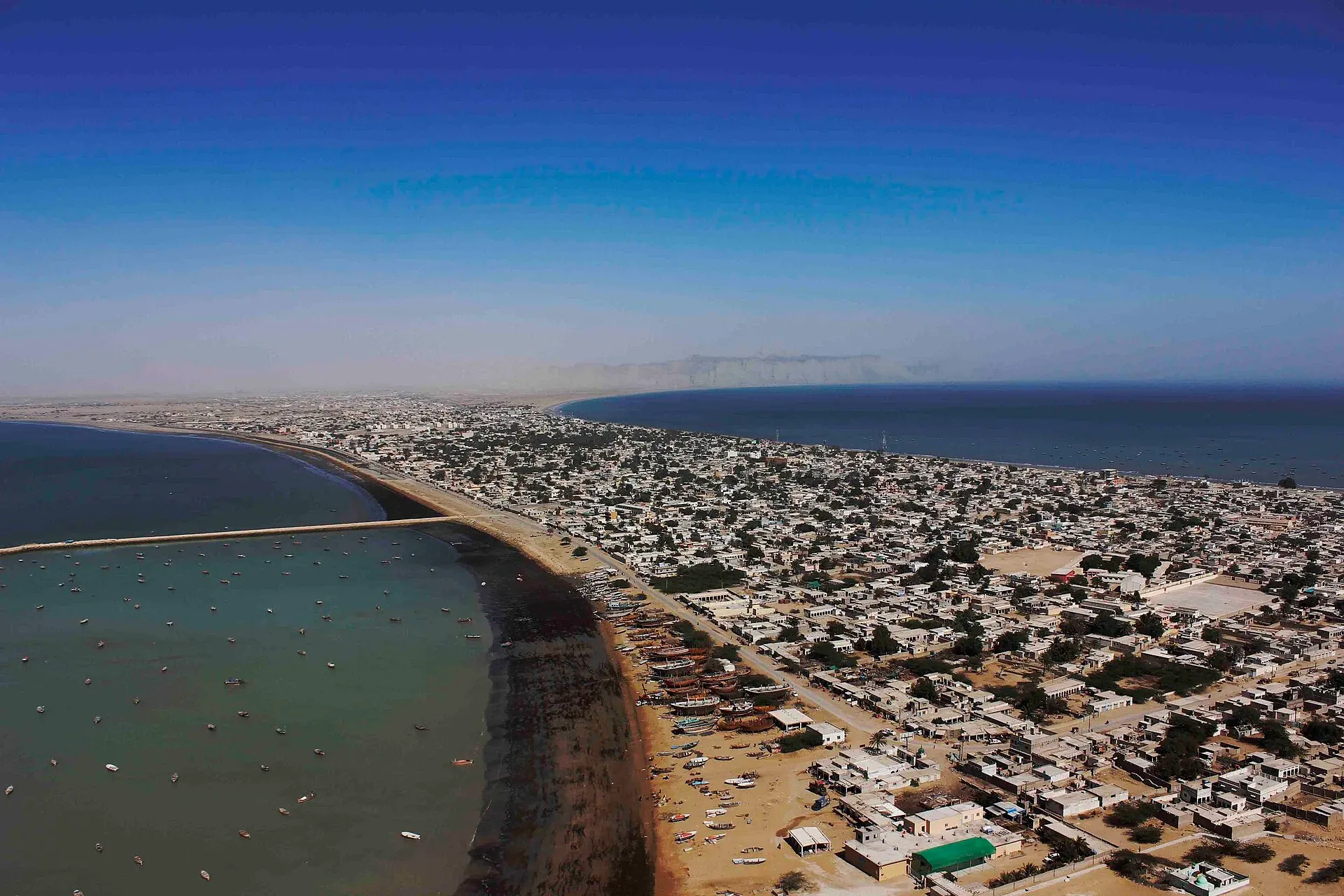
Wikipedia describes a narrow sandy isthmus about 12 km long that joins the mainland coast to a rocky headland, Koh-e-Batil, rising to about 150 m. The two sides of the isthmus form semicircular bays. The western bay, Padi Zirr, is shallow, with an average depth of 3.7 m. The eastern bay, Demi Zirr, is a deepwater harbour, and Gwadar Port was built there. Wikipedia says its first phase was built from 2007 at a cost of $248 million, and that China Overseas Port Holdings took over the port in 2013.
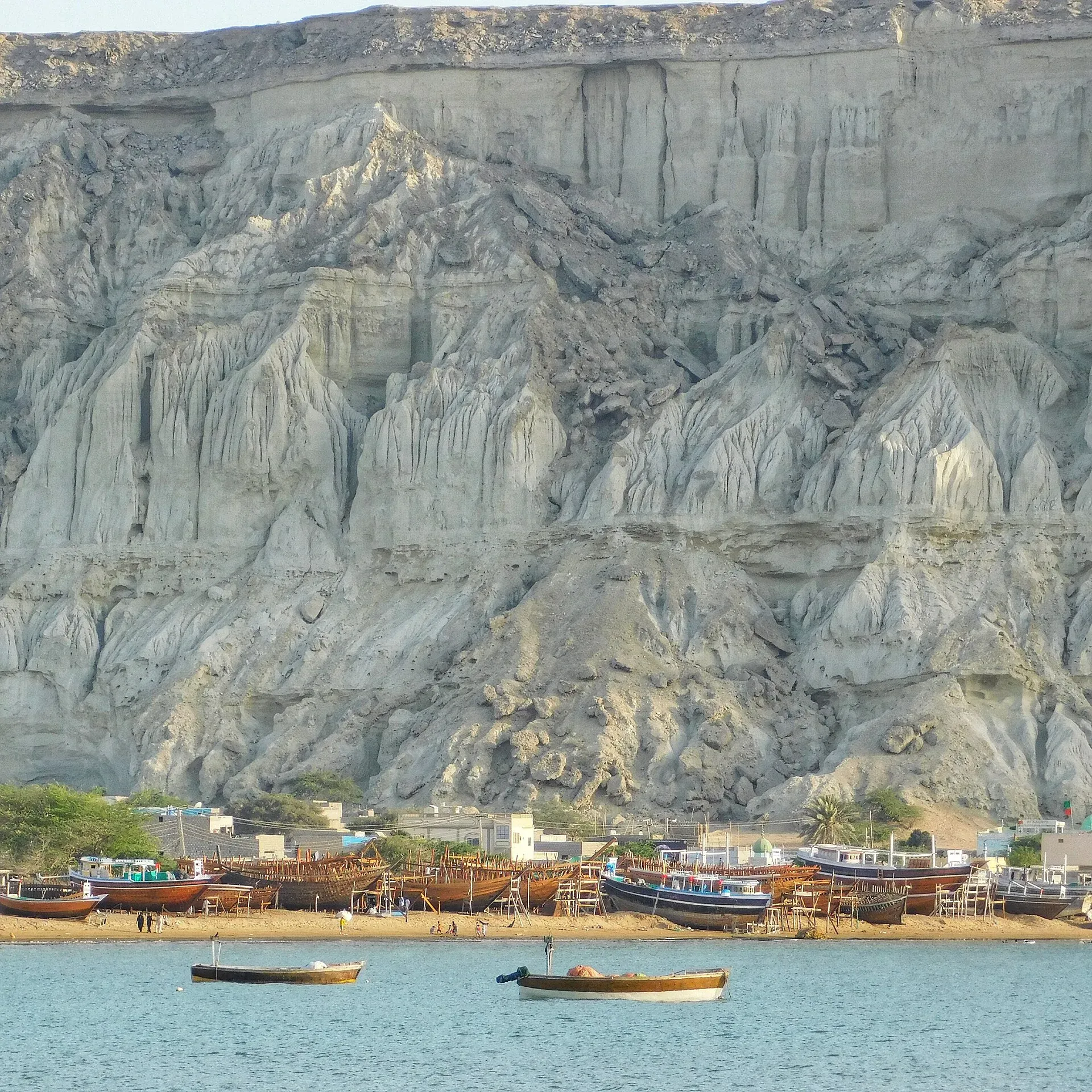
Photo: Sajjad Mahesri, with thanks · CC BY-SA 4.0 · via Wikimedia Commons · temporary stand-in photo

What to see and do
Come for the sunset and the sea view. From the high ground you look across to Padi Zirr on the west, where fishing boats are moored and built, and east to the port. The port is a working facility with security, so you see it from a distance. Do not photograph restricted areas, and follow instructions from guards.
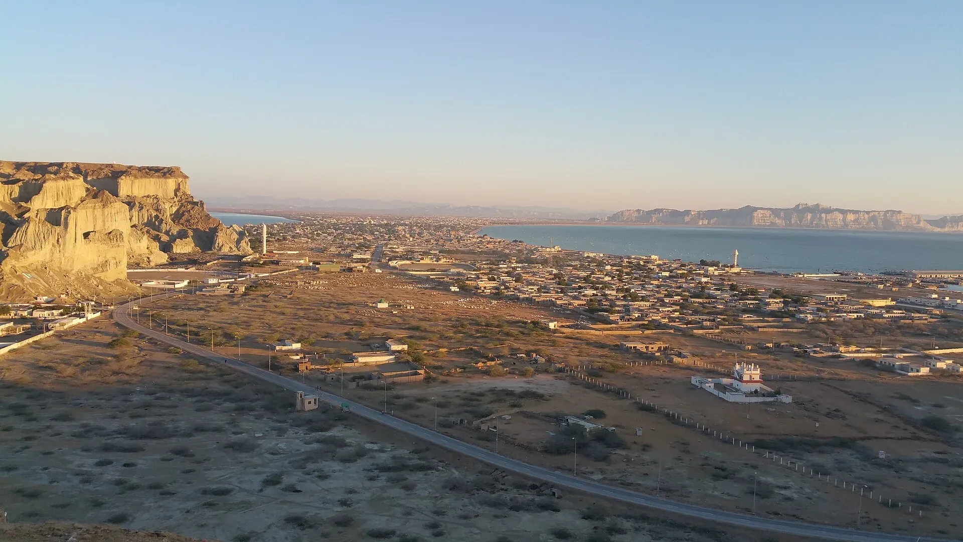
Photo: Madihasalam, with thanks · CC BY-SA 4.0 · via Wikimedia Commons · temporary stand-in photo

For a bigger view, the GDA also lists Sad-e Kandag (Koh-e-Batil), the headland at the top of more than 500 steps, with Kapasi Beach on its far side and steps down to the sand and a sunset view. See the Koh-e-Batil page for that, and Gwadar Marine Drive and Gwadar beaches for the waterfront. The GDA also lists Padizer Park on Marine Drive near its office complex.
Gwadar past and present
Oman held Gwadar until 1958, when it passed to Pakistan, and the Gwadar Fort and some Omani-era buildings remain in the town. The population is mostly Baloch, and fishing has long been the main livelihood. A fish harbour with a small port was built by the Belgian firm BESIX under a contract awarded in 1988 and finished in December 1992, according to the GDA.
When to visit
Winter is pleasant; Wikipedia gives mean temperatures of about 18 to 19 degrees C in January and 31 to 32 degrees C in June, with only about 100 mm of rain a year. Go in the last hour before sunset between October and March, and watch the wind.
Where to stay and eat
Gwadar has hotels and seafood places. No businesses are named here. Ask the GDA or your hotel about access to the Hammerhead area.
Good to know
- Safety. For foreign visitors: the UK FCDO page for Pakistan (updated 27 October 2026, checked 16 November 2026) advises against all travel to Balochistan. Read it and local news first.
- Opening hours and fees are not published; contact the GDA before you go (the GDA site gives (086) 9201010 and 4211775).
- Edges can be unfenced; keep children close.
Highlights
- Hammer-shaped rock formed from a mud volcano
- Sea to the south, town to the north
- Sunset viewing
- Port and Padi Zirr bay visible nearby
Getting there
The Hammerhead is on Gwadar's peninsula, a short drive from the town centre; the exact access point is not published, so ask your hotel. The Makran Coastal Highway links Gwadar with Karachi; Gwadar is about 367 km and 4 hours 20 minutes by road from the Princess of Hope formation on the coastal highway, and flooding in February 2024 cut the Gwadar to Karachi highway (Wikipedia). New Gwadar International Airport, about 26 km north-east of the city, began commercial flights in January 2025, and the East Bay Expressway, opened in June 2022, links the port with the coastal highway. Ask your hotel for the best road in.
Tips
- Go an hour before sunset in winter.
- Do not photograph restricted port areas.
- Check access with the GDA first.
- Take water and sun protection.
Photos we still need: the Hammerhead rock and its viewpoint; the Hammerhead rock and its viewpoint. Send us yours
Sources and last checked
Last checked Confidence medium4 sources6 still to check
- Last checked
- Method
- Desk research from published sources
- Confidence
- medium
- Checked by
- trek.pk research team
Researched from published sources; not yet checked on the ground by our team. Spot something out of date? Report a mistake.
Sources
- Places to Visit in Gwadar · Gwadar Development Authority · checked
- Gwadar · Wikipedia · checked
- Foreign travel advice: Pakistan · UK FCDO · checked
- OSRM routing · OSRM / OpenStreetMap · checked
Still to be checked on the ground (6)
- Exact viewpoint location and access (no opened source gives it)
- Whether Sunset Park is open and its hours (not in Wikipedia or gwadarpro.pk home page)
- Restricted zones around the port (no published map found)
- Security situation (FCDO advises against all travel to Balochistan; Wikipedia notes security concerns held back the port)
- Wikipedia and the GDA do not say whether the Hammerhead can be climbed or how far it is from the town centre
- Wikipedia and the GDA do not say whether the Hammerhead can be climbed or how far it is from the town centre
Nearby and related

Gwadar
Arabian Sea port town and Gwadar District headquarters, a fishing settlement that Pakistan bought from Oman in 1958 and now a CPEC port.

Gwadar Beaches
Beaches on either side of Gwadar's narrow peninsula: the shallow western bay (Padi Zirr), Marine Drive, Sunset Park and Kapasi Beach below Koh-e-Batil. Erosion and waves are a worry. Balochistan is under UK FCDO 'all travel' advice.

Koh-e-Batil (Gwadar)
The rocky hammerhead headland of Gwadar, about 150 m high, with a stairway of 500 or more steps to a lookout over the port and the Arabian Sea. For foreign visitors: the UK FCDO advises against travel to Balochistan.

Gwadar Marine Drive
Gwadar's seafront road, used for evening drives and walks, with Padizer Park and the I Love Gwadar sign beside it. For foreign visitors: the UK FCDO advises against travel to Balochistan.