

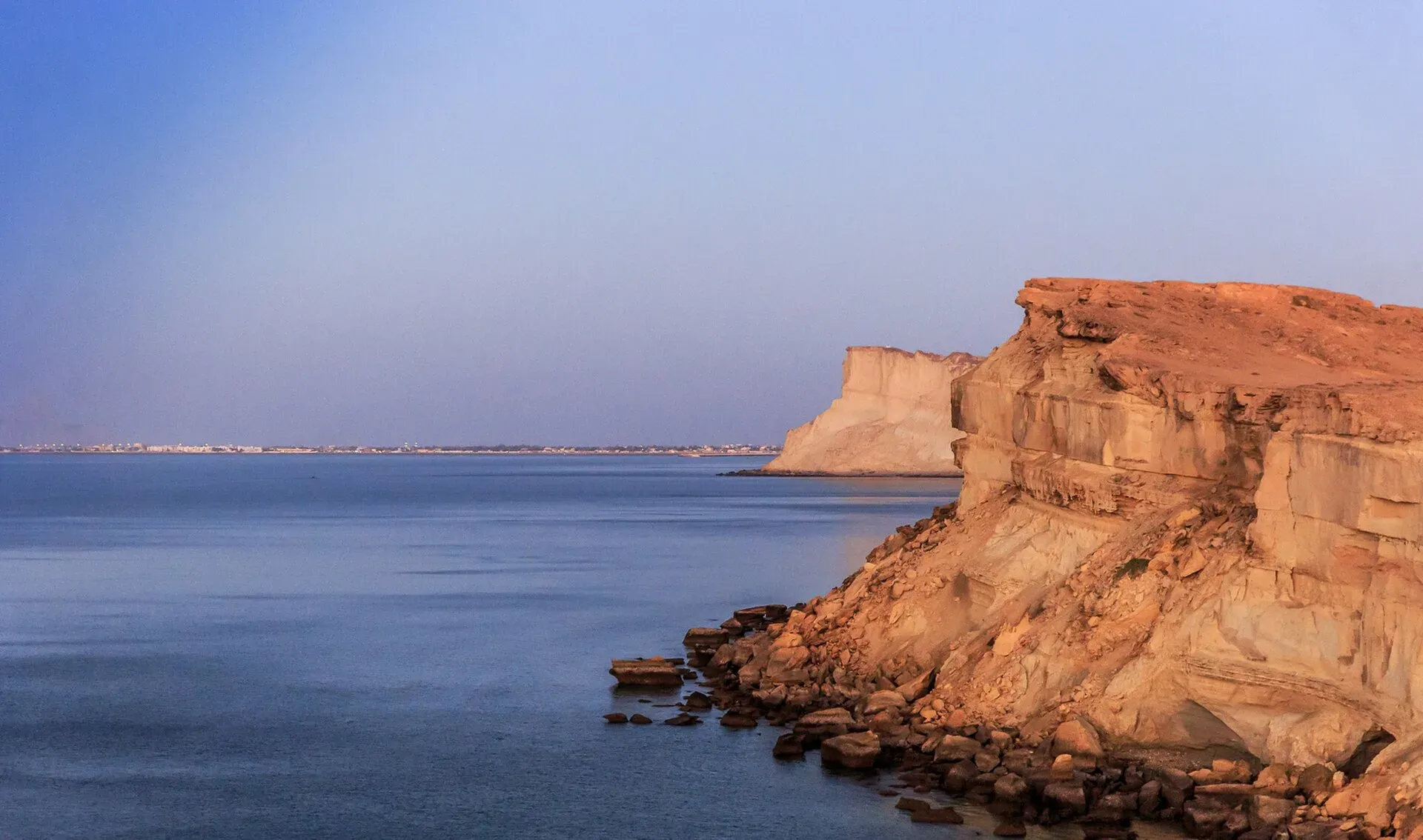
Photo: Ghulam Murtaza, with thanks · CC BY-SA 4.0 · via Wikimedia Commons · temporary stand-in photo

Koh-e-Batil (Gwadar)
The rocky hammerhead headland of Gwadar, about 150 m high, with a stairway of 500 or more steps to a lookout over the port and the Arabian Sea. For foreign visitors: the UK FCDO advises against travel to Balochistan.
Read this first: current advice
For foreign visitors: the UK FCDO Pakistan page (updated 27 October 2026, checked 16 November 2026) advises against all travel to Balochistan, including the coast. This page describes the place for information and does not recommend a visit.
Plan your visit
- Nearest town
- Gwadar
- Getting there
Gwadar is about 629 km and 7.5 hours from Karachi by road (OSRM, 16 Nov 2026). The hill is inside Gwadar town. The GDA places Kapasi Beach on the back of the hill, reached by stairs. More
Best months
Nov – Mar
Overview
Koh-e-Batil, the hammerhead-shaped headland of Gwadar, is a rocky promontory reaching about 150 m. It runs about 11 km east to west and is about 1.5 km wide, and joins the mainland by a sandy isthmus 240 m wide, on which the town stands. Geographers call the whole a tombolo, a headland tied to the coast by a sand bar. It separates the shallow western bay, Padi Zirr (average depth 3.7 m, at most 9.1 m), from the deepwater eastern harbour, Demi Zirr, where the port was built from 2007. See Gwadar for the town.
The town below
Gwadar has been settled since the Bronze Age. From 1783 to 1958 it was held by the Sultan of Muscat and Oman, who built the fort, and Oman handed it to Pakistan in 1958. From 1863 to 1879 it was the base of a British Assistant Political Agent. Arab influence is strong, and some Oman-era buildings remain. About 96% of residents speak Balochi at home. Fishing was the traditional economy, and fishing boats are a common sight in the east bay.
What to see and do
- The stairway. A staircase climbs to the top. The Gwadar Development Authority says there are more than 500 steps; a travel blog says about 700. Expect a steep climb in the heat.
- The view. From the top you can see the town, the port, the two bays and the coast. Sunset is the favoured time. See also Gwadar hammerhead and port view.
- Kapasi Beach. On the back of the hill, reached by stairs, and known for sunsets. See Gwadar beaches.
- Photos. Late afternoon, with a wide lens for the hammerhead outline. Cliff edges are eroded.
When to visit
November to March is cooler. Gwadar has a hot desert climate with only about 100 mm of rain a year. Sea breezes keep it cooler than inland: June averages 31 to 32 °C and January 18 to 19 °C. Gwadar is hot from April to September, and the sea is rough in summer.
Getting there
Gwadar is about 629 km and about 7.5 hours by road from Karachi (OSRM estimate, 16 Nov 2026). A night restriction on public transport on the N-10 was announced in March 2025; see Gwadar beaches. The hill is within Gwadar town; one source mentions a rougher vehicle route beside the steps.
Where to stay and eat
Gwadar has hotels and restaurants; see Gwadar. No verified business names are given here.
Good to know
- No opening hours for the climb are published by the GDA. Confirm locally.
- Take water and a hat; there is little shade on the steps.
- Keep back from eroded cliff edges. The Associated Press quoted a GDA official in February 2025 saying cliffs at Sunset Park have been gashed.
- Parts of the port are restricted. Obey checkpoints and ask before photographing.
- Fees are not confirmed.
Highlights
- Hammerhead headland about 150 m high
- 500+ steps to a lookout over port and sea
- Sunset views and Kapasi Beach below
- Not recommended now: FCDO all-travel warning
Tips
- Climb late in the afternoon in cooler months
- Carry water and wear sturdy shoes
- Stay back from eroded edges
- Check road and security advice before travel
Photos we still need: the stairway and the view from the top of Koh-e-Batil; the hammerhead outline seen from the east bay. Send us yours
Sources and last checked
Last checked Confidence medium5 sources4 still to check
- Last checked
- Method
- Desk research from published sources
- Confidence
- medium
- Checked by
- trek.pk research team
Researched from published sources; not yet checked on the ground by our team. Spot something out of date? Report a mistake.
Sources
- Gwadar (Wikipedia) · Wikipedia · checked
- Places to visit in Gwadar · Gwadar Development Authority · checked
- Koh-e-Batil: Witnessing the Marvels of Gwadar · Pakistan Traveler · checked
- UK FCDO Pakistan travel advice · UK Foreign, Commonwealth & Development Office · checked
- OSRM public routing service (road distances and times, 16 Nov 2026) · OpenStreetMap / Project OSRM · checked
Still to be checked on the ground (4)
- Number of steps: GDA says more than 500, an undated blog says about 700; no count from an authority
- Access hours and any restrictions (neither source gives any; GDA lists (086) 9201010 and info@gda.gov.pk)
- Where the stairway starts (not stated by either source)
- Photo of the exact lookout
Nearby and related

Gwadar
Arabian Sea port town and Gwadar District headquarters, a fishing settlement that Pakistan bought from Oman in 1958 and now a CPEC port.

Gwadar Beaches
Beaches on either side of Gwadar's narrow peninsula: the shallow western bay (Padi Zirr), Marine Drive, Sunset Park and Kapasi Beach below Koh-e-Batil. Erosion and waves are a worry. Balochistan is under UK FCDO 'all travel' advice.

Balochistan
Pakistan's largest and least populated province: Quetta's high valleys, Ziarat's juniper forest, the Makran coast, Hingol and Gwadar. Security and permission rules need checking first.