

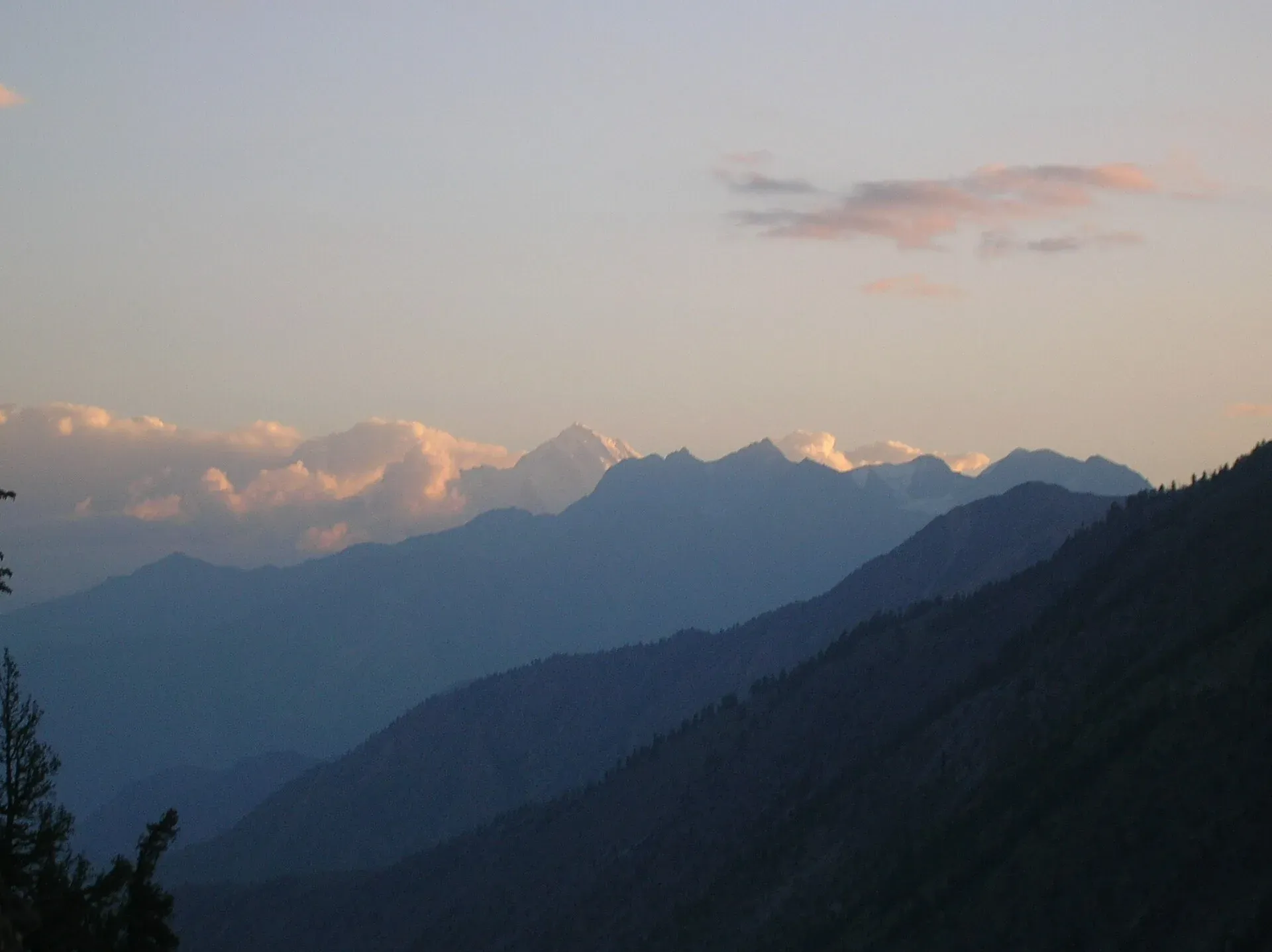
Photo: Shackadventures, with thanks · CC BY-SA 3.0 · via Wikimedia Commons · temporary stand-in photo

Haramosh
Haramosh (7,409 m) rises above the Indus about 65 km east of Gilgit. First climbed in 1958, it is remembered for a tragic 1957 Oxford expedition. Easy treks from Sassi lead to Haramosh Base Camp.
Overview
Haramosh is a 7,409 m mountain in the Rakaposhi-Haramosh Mountains of the Karakoram, about 65 km east of Gilgit. It rises steeply above the north bank of the Indus, just upstream from where the Gilgit River joins it. It ranks 67th among the world's highest mountains, and Wikipedia cites a ranking that places it 17th in the world for local relief and steepness. The massif has two main summits, Haramosh and Haramosh Kutwal Laila. It is also known as Peak 58.
Plan your visit
- Nearest town
- Sassi
- Getting there
Haramosh villages are reached from Sassi on the Gilgit-Skardu road, about 65 km east of Gilgit as the crow flies (the mountain; road distance not checked). More
Best months
Jun – Sep
- Haramosh
- Related places nearby: Bagrot Valley, Gilgit, Malubiting, Kutwal Meadows (Haramosh)
History
A Swiss team explored the area in 1947, and a German team investigated a north-eastern route in 1955. In 1957 an Oxford University expedition of four, Tony Streather, John Emery, Bernard Jillot and Rae Culbert, met disaster. Jillot and Culbert died, and Emery lost all his fingers and toes to frostbite. Ralph Barker told the story in The Last Blue Mountain.
Three Austrians, Heinrich Roiss, Stefan Pauer and Franz Mandl, made the first ascent on 4 August 1958 by the Haramosh La (a glacier pass) and the East Ridge, roughly the route of the 1957 tragedy. The Himalayan Index lists only three more ascents, in 1978 (Japanese, West Ridge), 1979 and 1988 (Polish, South-West Face).
The Haramosh Valley
The valley runs north from the Gilgit-Skardu road at Sassi. A jeep road leads from Sassi to Dassu, the road end, and the walk starts there. The route then goes up through Iskere (about 2,500 m) and Gure, along the north edge of the Mani Glacier. Villages here are farming and herding settlements. Near the head of the valley the walk runs beside the glacier, with meadow, pine and birch around Kutwal.
Treks
- Kutwal Lake (3,260 m). Meadows, pines and birch at the head of the valley, with views of Mani (6,685 m), Haramosh and Malubiting. An easy trek, usually mid-June to September. See Kutwal Meadows.
- Haramosh Base Camp. Crosses the Chonga ridge (3,300 m) and drops to Ishkapal (2,740 m), then climbs to Bariyabu (3,600 m), beneath the south-west face.
- Rakhan Gali. A four-day, 46 km crossing of a 4,548 m pass between the Bagrot and Haramosh valleys, ending at Hanuchal on the Gilgit-Skardu road. See Rakhan Gali and Bagrot Valley.
- Haramosh La. The glacier pass from the Chogo Lungma side down to Kutwal Lake and Dassu needs rope, crampons, ice axe, helmet and an experienced guide.
The short routes are also described on Other treks in Gilgit.
When to visit
Valley treks are best in summer, from about June to September. Check conditions locally.
Where to stay and eat
Gilgit has hotels and guesthouses. Haramosh villages have basic stays, and on the treks you camp and carry food from Gilgit.
Good to know
Climbing context. Haramosh has few ascents, and the early expedition ended in tragedy. It is for experienced mountaineers; the trekking routes stay well below the summit.
Permits and royalty. See the trek pages for zone rules. Climbing needs an expedition permit and royalty, arranged through a licensed Pakistani operator. Dawn reported on 1 March 2025 that the GB Finance Act 2024 raised the mountaineering royalty and trekking fee by 300 percent and that the GB Chief Court suspended the increases until its next hearing. In May 2025 the Gilgit-Baltistan Tourism Department notified a reduced fee schedule after a cabinet decision (The News, 25 May 2025). No official schedule for 2026 was found, so current fees will be added soon; ask your operator for the written fee list.
Ask the district administration or local police about current conditions before you go. Getting there safely. For foreign visitors: the UK FCDO (updated 27 October 2026) advises against travel on the KKH between Mansehra and Chilas but does not advise against Gilgit-Baltistan as a whole. Ask your operator which route they use.
Highlights
- 7,409 m peak above the Indus
- First climbed 4 August 1958 by Austrians
- Easy Haramosh Valley treks from Sassi
- The 1957 Oxford expedition story
Getting there
Haramosh villages are reached from Sassi on the Gilgit-Skardu road, about 65 km east of Gilgit as the crow flies (the mountain; road distance not checked). A jeep road runs from Sassi to Dassu, where the walk to Kutwal and the upper valley starts. Ask a licensed operator in Gilgit about current access.
Tips
- Start the Haramosh treks at Sassi on the Gilgit-Skardu road.
- Combine Kutwal Lake with the Rakhan Gali crossing if you have time.
- Confirm road and jeep-track conditions with a local operator.
Photos we still need: the Haramosh Valley, Dassu or Kutwal Lake; Haramosh seen from the Gilgit-Skardu road or from Sassi. Send us yours
Sources and last checked
Last checked Confidence medium5 sources4 still to check
- Last checked
- Method
- Desk research from published sources
- Confidence
- medium
- Checked by
- trek.pk research team
Researched from published sources; not yet checked on the ground by our team. Spot something out of date? Report a mistake.
Sources
- Haramosh Peak (Wikipedia) · Wikipedia · checked
- List of mountains in Pakistan (heights and prominence) · Wikipedia · checked
- Mountaineering royalty and trekking fee increase challenged in GB Chief Court (1 March 2025) · Dawn · checked
- Pakistan travel advice (updated 27 October 2026) · UK Foreign, Commonwealth and Development Office · checked
- GB slashes mountaineering, trekking fees to promote tourism (25 May 2025) · The News · checked
Still to be checked on the ground (4)
- Zone and permit rules for the Haramosh treks (no official source reachable; gbtourism.gov.pk did not resolve)
- Current royalty and trekking fee amounts (the GB Tourism Department notified a reduced schedule in May 2025 per The News; no official 2026 schedule found)
- Road access to Sassi (no source opened covers it)
- Road distance and drive time from Gilgit to Sassi and on to Dassu (not sourced)
Nearby and related

Other treks in Gilgit

Rakhan Gali
Bagrot Valley
A high valley about 30 km from Gilgit, running up to Rakaposhi and Diran, with farming villages, Gargo meadow and the open trek to Diran Base Camp from Chirah.

Gilgit
Gateway to Gilgit-Baltistan on the Karakoram Highway: a busy mountain town with the Kargah Buddha and the base for Hunza, Naltar and Skardu.
Malubiting
Malubiting (7,458 m) is a peak in the Rakaposhi-Haramosh range, about 50 km east of Gilgit. It was first climbed in 1971 by an Austrian team.
Kutwal Meadows (Haramosh)
Meadows, pines and birch at the head of the Haramosh Valley, about 3,260 m, by Kutwal Lake and the north edge of the Mani Glacier.