

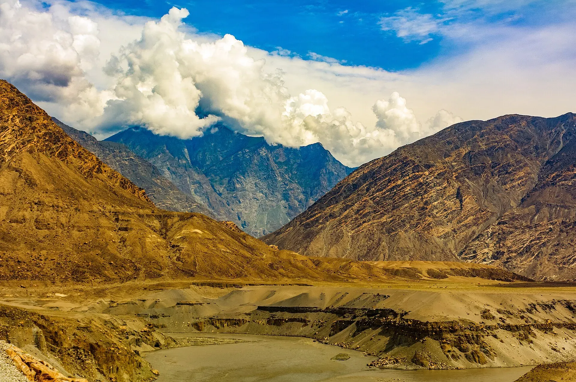
Photo: Ansab Mahmood, with thanks · CC BY-SA 4.0 · via Wikimedia Commons · temporary stand-in photo

Jaglot
A town on the Karakoram Highway south-east of Gilgit, at the junction where the road to Skardu and Astore leaves the KKH, near the meeting of the Gilgit and Indus rivers.
Overview
Jaglot (also Juglot) is a town in Gilgit District, Gilgit-Baltistan, about 45 km south-east of Gilgit on the Karakoram Highway (Wikipedia; OSRM gives about 50 km by road). Wikipedia puts it at 1,988 m. It sits where the Karakoram, Hindu Kush and Himalaya ranges are said to meet, and where the Gilgit and Indus rivers join. There is no known census figure for the town.
Plan your visit
- Nearest town
- Gilgit
- Getting there
Road: about 45 km south-east of Gilgit on the KKH (Wikipedia); OSRM measured about 50 km by road from the Gilgit centre. Vans and buses along the KKH stop here. More
Best months
Apr – Jun, Sep – Oct
- Jaglot
- Related places nearby: Jaglot Confluence (Three Giants), Gilgit, Astore, Gilgit River
Rivers and ranges
The Gilgit River is about 240 km long and rises at Shandur Lake. Its largest tributary is the Hunza River, which supplies more than half its mean annual volume. Near Jaglot and Bunji it joins the Indus. Measured at Alam Bridge at Jaglot, below the Hunza confluence, the Gilgit's mean flow is about 617 cubic metres a second, against about 293 at Gilgit above it. Wikipedia says the Sai Nala also joins the Indus here from the right. The "three great ranges" label is local shorthand; sources define the meeting point differently. See Jaglot confluence.
Roads
Jaglot is a junction town. Wikipedia says the roads to Gilgit and Skardu split here, with the Skardu road branching off about 6 km towards Gilgit. Bunji, about 50 km from Gilgit, lies in Astore District where the Astore river joins the Indus. See Astore. Vans and buses along the Karakoram Highway stop at Jaglot.
History
The town was strategically important on the route linking British India to China through Kashmir. A ferry crossed the Indus to Bunji in the 19th century, and the Partab Bridge was built upstream in 1893. Bunji was a Dogra fort town after 1846, on the old Srinagar to Gilgit road, and the British set up the Gilgit Agency in 1889. Today Jaglot is a major logistical base for the Pakistan Army and gained importance during the Siachen conflict.
The valley and its villages
Wikipedia describes a fertile valley with fifteen villages, naming Damot, Manote, Bargin, Chakarkot, Gasho Pahote and Sabil. It reports the territory's largest oil, wheat and flour depots here, with independent power generation supporting flour mills and marble plants. It also says a community called the Soniwals pans for gold in the Indus.
What to see and do
- River confluence: a viewpoint area is on the Karakoram Highway; see the confluence page.
- Road junction: a useful pause if you are choosing between Skardu and the highway to Chilas.
- Roadside tea stalls: useful for a break on a long drive.
When to visit
April to June and September to October are the most comfortable. Summer is hot at this height. Bunji, nearby, has a cool arid climate with about 190 mm of rain a year.
Where to stay and eat
There is little accommodation here, and most travellers stay in Gilgit. Roadside restaurants and tea stalls serve rice, meat, bread and tea.
Good to know
- Check road conditions before heading south on the Karakoram Highway or east towards Skardu.
- Fuel and ATM information is unconfirmed here. Fill up in Gilgit.
- Dress modestly and ask before photographing people.
- Do not drive the Karakoram Highway at night.
Travel advice
For foreign visitors: the UK FCDO does not advise against Gilgit-Baltistan generally (advice updated 27 October 2026, checked 16 November 2026), but it advises against all travel on the Karakoram Highway between Mansehra and Chilas. Read the live advice before you plan.
Highlights
- KKH junction for Skardu and Astore
- Near the Gilgit and Indus confluence
- Easy stop from Gilgit
Getting there
Road: about 45 km south-east of Gilgit on the KKH (Wikipedia); OSRM measured about 50 km by road from the Gilgit centre. Vans and buses along the KKH stop here.
Hotels, food, fuel and services in Jaglot
Places to stay
- United Hotel, Jaglot Gilgit.Call United Hotel, Jaglot Gilgit.Map of United Hotel, Jaglot Gilgit. in Google Maps
- Junction ResortMap of Junction Resort in Google Maps
- DreamLand Hotel Jaglote Sai GBCall DreamLand Hotel Jaglote Sai GBMap of DreamLand Hotel Jaglote Sai GB in Google Maps
- Royal Hotel Jaglot GilgitCall Royal Hotel Jaglot GilgitMap of Royal Hotel Jaglot Gilgit in Google Maps
- Jaglot MessMap of Jaglot Mess in Google Maps
Places to eat
- Resham Steak n GrillCall Resham Steak n GrillMap of Resham Steak n Grill in Google Maps
- Pizza ParlourCall Pizza ParlourMap of Pizza Parlour in Google Maps
Essential services fuel stations, pharmacies and hospitals and clinics
Fuel
- Total - New Himalaya Filling StationCall Total - New Himalaya Filling StationMap of Total - New Himalaya Filling Station in Google Maps
- Silkway Filling Station - Total Petrol StationCall Silkway Filling Station - Total Petrol StationMap of Silkway Filling Station - Total Petrol Station in Google Maps
- AdmoreMap of Admore in Google Maps
- Attock Petroleum JaglotCall Attock Petroleum JaglotMap of Attock Petroleum Jaglot in Google Maps
Pharmacies
- Zaman Medical StoreMap of Zaman Medical Store in Google Maps
- Adam Medical Store JugloteCall Adam Medical Store JugloteMap of Adam Medical Store Juglote in Google Maps
Hospitals and clinics
- Civil Hospital BunjiCall Civil Hospital BunjiMap of Civil Hospital Bunji in Google Maps
Listings come from Google Maps data and are unverified: phone numbers, opening months and prices may have changed. Report a problem · Own one of these? Claim it
Tips
- Fuel up in Gilgit.
- Check road conditions on the Skardu and KKH roads.
- Do not drive the KKH at night.
- Read the live FCDO advice.
Photos we still need: the Skardu road junction; Alam Bridge and the Gilgit River at Jaglot. Send us yours
Sources and last checked
Last checked Confidence medium6 sources4 still to check
- Last checked
- Method
- Desk research from published sources
- Confidence
- medium
- Checked by
- trek.pk research team
Researched from published sources; not yet checked on the ground by our team. Spot something out of date? Report a mistake.
Sources
- Juglot · Wikipedia · checked
- OpenStreetMap Nominatim (coordinates) · OpenStreetMap · checked
- OSRM driving routes (road distances and times) · Project OSRM / OpenStreetMap · checked
- Pakistan travel advice · UK FCDO (GOV.UK) · checked
- Gilgit River · Wikipedia · checked
- Bunji, Pakistan · Wikipedia · checked
Still to be checked on the ground (4)
- Population (no census figure found)
- Fuel and ATM
- Accommodation options
- Where the Astore road leaves the Karakoram Highway relative to Jaglot
Nearby and related

Jaglot Confluence (Three Giants)
A roadside stop at Jaglot on the Karakoram Highway, about 45 km from Gilgit, where the Gilgit River meets the Indus and three great ranges are said to meet.

Gilgit
Gateway to Gilgit-Baltistan on the Karakoram Highway: a busy mountain town with the Kargah Buddha and the base for Hunza, Naltar and Skardu.

Skardu
The main town of Baltistan, where the Indus meets the Shigar river. Skardu is the base for the Deosai Plains, the Kachura and Satpara lakes, Shigar, and the K2 and Baltoro treks.

Astore
Main town of Astore District in Gilgit-Baltistan, at about 2,546 m. It is the base for the Astore valley, Rupal valley, Rama Meadows and the road to Deosai.

Gilgit River
A glacier-fed river of about 240 km that rises at Shandur and runs through Ghizer to Gilgit, picks up the Hunza, and meets the Indus near Jaglot where the Karakoram, Hindu Kush and Himalaya join.