

Photo: Ahmed Zohair, with thanks · CC BY-SA 3.0 · via Wikimedia Commons · temporary stand-in photo

Gilgit River
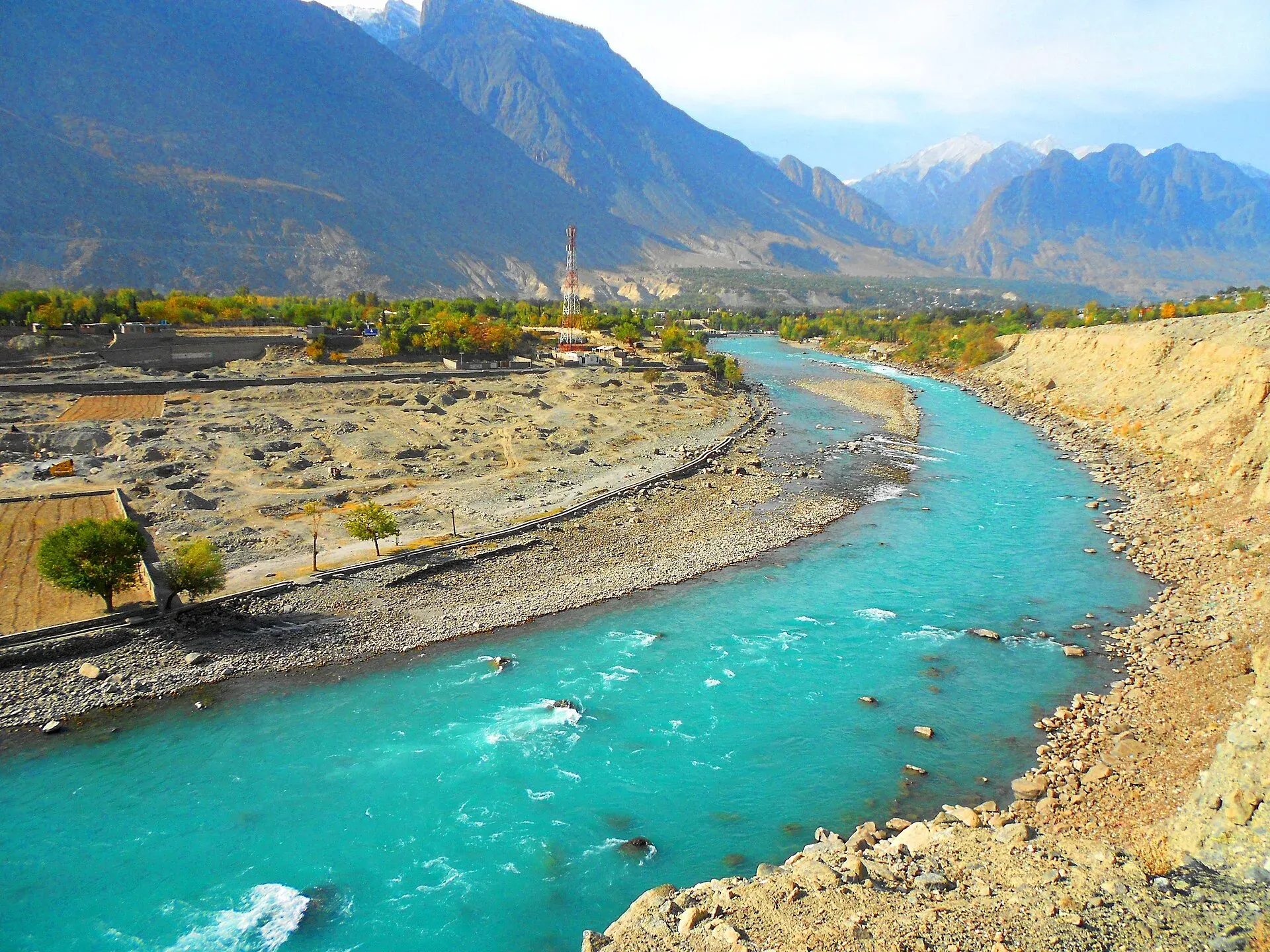
A glacier-fed river of about 240 km that rises at Shandur and runs through Ghizer to Gilgit, picks up the Hunza, and meets the Indus near Jaglot where the Karakoram, Hindu Kush and Himalaya join.
Overview
The Gilgit River drains a catchment of about 26,159 sq km in Gilgit-Baltistan. It is about 240 km long. Its upper reaches are also called the Ghizer or Gupis River. Reference works say it begins at Shandur Lake, on the high plateau between Chitral and Ghizer, and then flows east through Gupis and Gilgit before joining the Indus near Jaglot and Bunji.
Plan your visit
- Nearest town
- Gilgit
- Getting there
Gilgit has flights from Islamabad and road links on the Karakoram Highway and the Gilgit–Shandur road. Jaglot is about 45 km south-east of Gilgit on the KKH. Ghizer is reached by road west from Gilgit. More
Best months
Apr – Oct
- Gilgit River
- Related places nearby: Gilgit, Kargah Buddha
Course and tributaries
From Shandur the river runs down the long Ghizer Valley. Wikipedia's Ghizer District article names the Qurumbar, Phakora, Hayal, Singul, Yasin and Phander streams among its tributaries. The Yasin River joins from the north, and the Karambar (Ishkoman) river comes from Karambar Lake in the Ishkoman valley. Ghizer is the westernmost district of Gilgit-Baltistan and is known to the tourism department as the "Land of Lakes"; see Ghizer Valley.
At Gilgit the river is already wide. A few kilometres downstream of the town, the Hunza River joins from the north-east (Wikipedia's Hunza River page puts the mouth at about 35.92 N, 74.37 E). The Hunza is the Gilgit's largest tributary and supplies more than half of its mean annual volume.
Measured at Gilgit before the Hunza arrives, the mean annual flow for 1981 to 2010 was about 293 cubic metres a second, ranging from about 83 to 868. At Alam Bridge, after the Hunza has joined, the mean rises to about 617, with a recorded range of about 66 to 4,834. These figures show how strongly the flow swings between winter and summer.
Gilgit and the river
Gilgit sits at about 1,500 m in a broad valley near the meeting of the Gilgit and Hunza rivers. The climate is cold desert, with 120 to 240 mm of rain a year. Wikipedia gives a record high of 46.3 C and a record low of about -11 C.
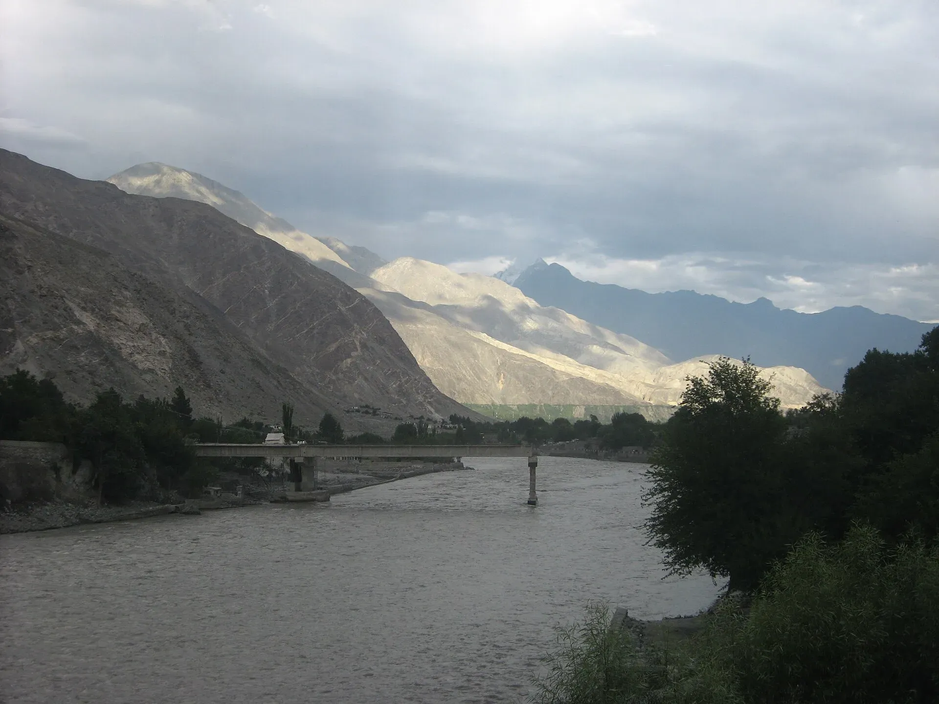
Photo: Flickr user 40987041@N07, with thanks · CC BY 2.0 · via Wikimedia Commons · temporary stand-in photo

Wikivoyage describes the Gilgit Bridge, a suspension bridge across the river at the end of the traditional bazaar. It is 182 m long and narrow enough for one jeep at a time. The page notes that its details date from 2015, so check the bridge before you rely on it. The main bridges are the best places to look at the river from.
The Indus confluence at Jaglot
The Gilgit meets the Indus at Jaglot, about 45 km south-east of Gilgit town and 1,988 m above sea level (35.685 N, 74.624 E). Wikipedia describes the town as lying at the junction of three major ranges: the Karakoram, the Hindu Kush and the Himalaya. The road to Skardu leaves the Karakoram Highway at this point. Wikivoyage says a minivan runs to Jaglot and a taxi covers the rest to the monument and walking paths at the meeting point. See Jaglot and the confluence.
What to see and do
- Gilgit town. Walk or drive along the riverbank at sunset. The main bridges are the best viewpoints.
- Ghizer Valley. Follow the upper river through Gupis and Phander. The Phander lake and the Yasin and Ishkoman side valleys are all worth time.
- Day trips from Gilgit. Wikivoyage lists Naltar (about two hours by jeep), the Kargah Buddha (about 10 km) and Sher Qilla (38 km, with trout fishing in a small lake).
- Jaglot. Stop at the junction for a look at the meeting of the two rivers.
- Fishing. The upper Ghizer has trout. Wikivoyage says permits come from the Fisheries Department. Closed seasons apply. Current fees will be added soon; ask the Gilgit-Baltistan Wildlife and Fisheries Department.
- Rafting. Wikivoyage lists boating and rafting on the Gilgit and Indus rivers, and tour operators offer short runs in summer. Sections, seasons and operator licensing are not confirmed from an official source, so ask Gilgit-Baltistan Tourism.
Culture
Gilgit was an important Silk Road city and a centre of Buddhism, and Wikipedia reports that the Chinese pilgrims Faxian and Xuanzang are said to have passed through. The Gilgit manuscripts record the Buddhist culture of the region. The Kargah Buddha, carved into a rock beside a side stream near the city and dated to about 700 CE, is a short drive from town. Later, the Trakhan dynasty ruled Gilgit for centuries, ending around 1810. Wikipedia credits Queen Dadi Jawari, a 17th-century ruler, with building irrigation canals.
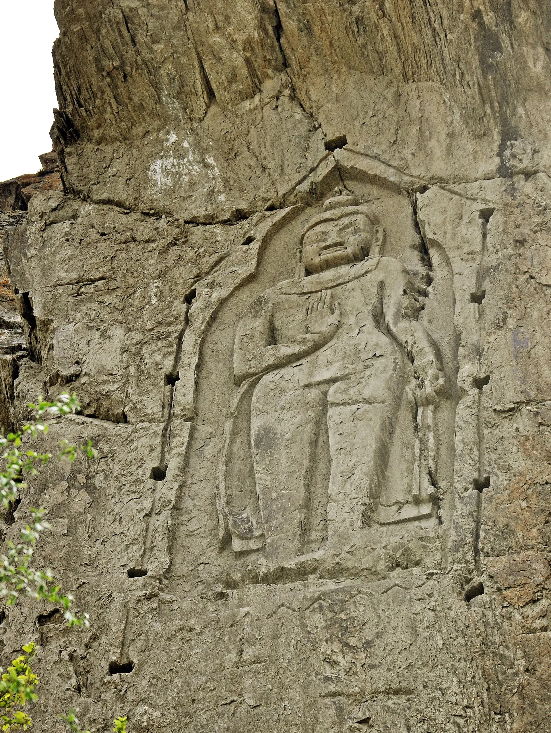
Photo: Furqanlw, with thanks · CC BY-SA 4.0 · via Wikimedia Commons · temporary stand-in photo

When to visit
April to October is the main season for travel along the river. Flows peak in July and August as glaciers melt. The Ghizer is often colder and quieter in autumn.
Good to know
- Glacier-fed rivers can rise suddenly in the afternoon. Never camp on gravel bars or cross by wading; see the river crossings guide.
- Landslides and floods can close riverside roads in the monsoon. Check road conditions in Gilgit.
- For foreign visitors: the UK FCDO page (updated 27 October 2026, checked 17 November 2026) does not advise against Gilgit-Baltistan generally. It advises against all travel on the Karakoram Highway between Mansehra and Chilas, which affects road approaches from the south.
Highlights
- About 240 km long, from Shandur to the Indus
- Joined by the Yasin, Ishkoman and Hunza rivers
- Meets the Indus near Jaglot where three ranges converge
- Easy riverside views in Gilgit and Ghizer
- Trout in the upper river
Getting there
Gilgit has flights from Islamabad and road links on the Karakoram Highway and the Gilgit–Shandur road. Jaglot is about 45 km south-east of Gilgit on the KKH. Ghizer is reached by road west from Gilgit. Check weather and road status before leaving.
Tips
- Visit Jaglot for the confluence, 45 km from Gilgit
- Stay off riverbank gravel in the afternoon when flows rise
- Ask for fishing rules before you cast
- Check road status after heavy rain
Photos we still need: the Gilgit–Indus confluence at Jaglot; the upper Ghizer River (Gupis or Phander). Send us yours
Sources and last checked
Last checked Confidence medium8 sources4 still to check
- Last checked
- Method
- Desk research from published sources
- Confidence
- medium
- Checked by
- trek.pk research team
Researched from published sources; not yet checked on the ground by our team. Spot something out of date? Report a mistake.
Sources
- Gilgit River (Wikipedia) · Wikipedia · checked
- Jaglot (Wikipedia) · Wikipedia · checked
- Hunza River (Wikipedia) · Wikipedia · checked
- Pakistan Tourism Guide 2021 · Trade Development Authority of Pakistan (TDAP) · checked
- Pakistan travel advice (updated 27 October 2026) · UK Foreign, Commonwealth & Development Office · checked
- Gilgit · Wikipedia · checked
- Gilgit · Wikivoyage · checked
- Ghizer District · Wikipedia · checked
Still to be checked on the ground (4)
- Trout fishing rules and licence fees (GB Wildlife and Fisheries Department)
- Rafting sections and operator licensing
- Whether the Hunza joins exactly at Gilgit town (Wikipedia's mouth coordinates and gauge data put it just east of town, above Alam Bridge; not checked on the ground)
- Gilgit Bridge details (Wikivoyage entry dates from 2015; its 'largest suspension bridge in Asia' claim is not repeated)
Nearby and related

Gilgit
Gateway to Gilgit-Baltistan on the Karakoram Highway: a busy mountain town with the Kargah Buddha and the base for Hunza, Naltar and Skardu.

Ghizer Valley
The long upper Gilgit River valley running west from Gilgit to Shandur, with Punial orchards, Gahkuch, Gupis, Khalti and Phander lakes, trout fishing and side valleys to Yasin and Ishkoman.

Phander Lake
A small, deep lake in Phander village, Gupis-Yasin district, in the far west of Gilgit-Baltistan. It is fed by the Ghizer River and sits on the road between Gilgit and Shandur.

Yasin Valley
A high Hindu Kush valley in northern Ghizer, reached by road from Gupis, with Burusho villages, the Thui and Darkot routes and Darkot village at its head.
Ishkoman Valley
A quiet glacier and trout valley north of Gahkuch in Ghizer, with Chatorkhand, Dain waterfall, Phakora and the road end at Imit, and treks towards Yasin, Naltar and Karambar Lake.

Shandur Pass
A high grassy pass of about 3,720 m between Ghizer in Gilgit-Baltistan and Upper Chitral. Home to the Shandur polo ground and a summer festival, reached by a rough road.

Kargah Buddha
A standing Buddha about 15 m tall, carved into a cliff in Kargah Nala west of Gilgit, probably from the 7th century.

Indus River
Pakistan's greatest river, rising in Tibet and running about 3,180 km to the Arabian Sea. It crosses Gilgit-Baltistan, meets the Gilgit near Jaglot and the Kabul at Attock, and feeds the plains from Tarbela to the delta.

Hunza River
The river that runs beside the Karakoram Highway through Gojal, Hunza and Nagar before joining the Gilgit River. It formed Attabad Lake in 2010, when a landslide blocked it.