

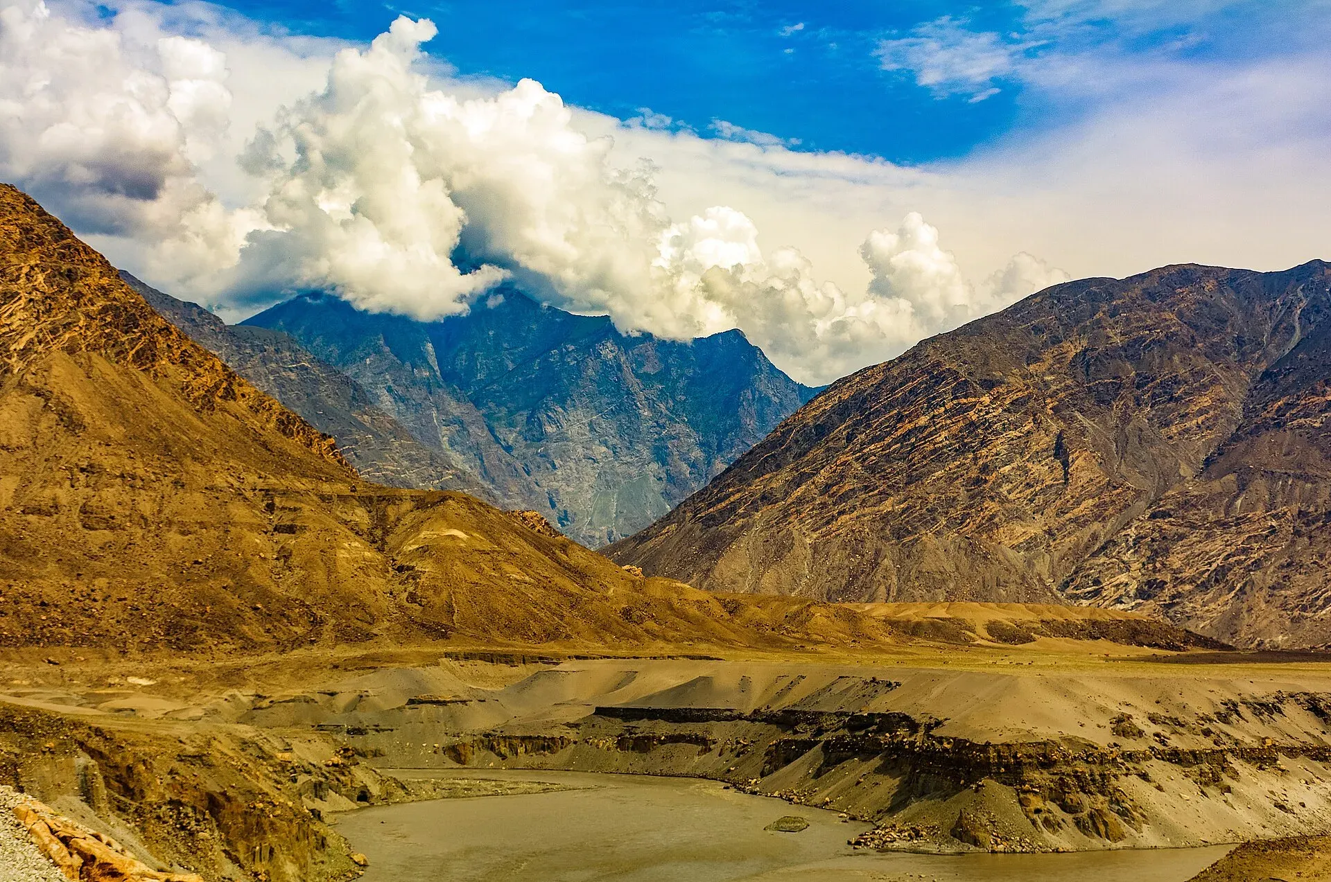
Photo: Ansab Mahmood, with thanks · CC BY-SA 4.0 · via Wikimedia Commons · temporary stand-in photo

Jaglot Confluence (Three Giants)
A roadside stop at Jaglot on the Karakoram Highway, about 45 km from Gilgit, where the Gilgit River meets the Indus and three great ranges are said to meet.
Overview
Jaglot (also spelt Juglot) lies on the Karakoram Highway (KKH), about 45 km south-east of Gilgit, at 1,988 m above sea level. The town stands where the Gilgit River joins the Indus. It is described as the junction of the Karakoram, the Himalaya and the Hindu Kush, which is why it is called the meeting of the three giants. The roads to Gilgit and to Skardu split here: the Skardu road leaves the KKH about 6 km towards Gilgit.
Plan your visit
- Nearest town
- Gilgit
- Getting there
On the KKH, about 45 km from Gilgit (Wikipedia); OSRM gives 49 km and 36 minutes, optimistic. Buses and vans between Gilgit and Chilas pass through. More
Best months
Apr – Jun, Sep – Oct
- Jaglot Confluence (Three Giants)
- Related places nearby: Gilgit, Gilgit River, Jaglot
The rivers
The Gilgit River is about 240 km long. It rises at Shandur Lake and runs through the Gupis-Yasin, Ghizer and Gilgit districts, and its upper reaches are also called the Gupis and Ghizer rivers. The Yasin and the Karambar (Ishkoman) rivers join it on the way. The Hunza River is its largest tributary and supplies over half of its mean annual flow, so much of the Karakoram arrives at Jaglot in one stream. The Indus comes from Baltistan and is the larger river.
Gauge records show how the flow changes. At Gilgit the mean discharge for 1981 to 2010 was 293 cubic metres a second, ranging from 83 to 868. At Alam Bridge near Jaglot, after the Hunza joins, the mean for 1981 to 2015 was 617, ranging from 66 to 4,834.
The town and its surroundings
The town sits at the mouth of the Sai Nala (a nala is a seasonal or mountain stream), which joins the Indus from the right. A few miles upstream, another torrent joins it, and the fertile ground has drawn about a dozen hamlets together into the village. The town includes villages such as Damot, Manote, Bargin and Chakarkot. Gold panning in the Indus is an old craft carried out by the Soniwals.
Across the Indus, on the left bank, lies Bunji. In the 19th century a ferry linked Jaglot, then called Sai, with Bunji. It was the only link between Gilgit and Kashmir until the Partab Bridge, a suspension bridge, was built upstream in 1893. The route connected British India with China through Kashmir.
What to see and do
Stop at the roadside viewpoint to look over the confluence. Mountain ranges have no painted line, and sources define the meeting point in different ways, so treat the "three giants" label as local shorthand. The stop shows how the great rivers join.
When to visit
Morning light is usually softer, and the roads are most reliable from spring to autumn. The stop takes 10 to 20 minutes and fits easily into the drive between Gilgit and Chilas or Skardu.
Where to stay and eat
There are tea stalls and small shops along the road. Gilgit, 36 minutes away by OSRM estimate (optimistic), has the nearest hotels.
Good to know
- Getting there: About 49 km from Gilgit by road (OSRM, 36 minutes, optimistic). Buses and vans on the KKH pass through.
- Altitude: Jaglot town is at 1,988 m. The exact viewpoint height is not confirmed.
- Safety: The road is busy with trucks. Park well off the carriageway and keep back from the river edge. Rockfall can close the road after rain.
- Travel advice: For foreign visitors: the UK FCDO does not advise against Gilgit-Baltistan generally. It advises against the KKH between Mansehra and Chilas (updated 27 October 2026), so check the live page if you plan a road trip from Islamabad.
Highlights
- Gilgit River meeting the Indus
- Where the Karakoram, Himalaya and Hindu Kush are said to meet
- A short roadside stop on the KKH
- About 45 km from Gilgit
Getting there
On the KKH, about 45 km from Gilgit (Wikipedia); OSRM gives 49 km and 36 minutes, optimistic. Buses and vans between Gilgit and Chilas pass through. The Skardu road branches off the KKH about 6 km from Jaglot towards Gilgit (Wikipedia).
Tips
- Stop for 10 to 20 minutes while driving between Gilgit and Chilas or Skardu.
- Ask a local guide where the Gilgit and Indus actually meet.
- Park off the road and stay back from the edge.
- Use a local guide if you want to understand the geology.
Facilities
- Roadside viewpoint
- Tea stalls and shops (unconfirmed)
Photos we still need: the Gilgit-Indus confluence from the road; Partab Bridge or Alam Bridge at Jaglot. Send us yours
Sources and last checked
Last checked Confidence medium4 sources2 still to check
- Last checked
- Method
- Desk research from published sources
- Confidence
- medium
- Checked by
- trek.pk research team
Researched from published sources; not yet checked on the ground by our team. Spot something out of date? Report a mistake.
Sources
- Juglot (Wikipedia) · Wikipedia · checked
- Gilgit River · Wikipedia · checked
- OSRM driving route service: distances and times measured 16 November 2026 (times are optimistic, without stops) · OpenStreetMap / OSRM · checked
- Pakistan travel advice: warnings and insurance (updated 27 October 2026) · UK Foreign, Commonwealth & Development Office · checked
Still to be checked on the ground (2)
- Exact viewpoint position (Wikipedia gives only the town coordinates, 35.685 N 74.624 E; no source places a viewpoint)
- Viewpoint facilities (none described in any source opened)
Nearby and related

Gilgit
Gateway to Gilgit-Baltistan on the Karakoram Highway: a busy mountain town with the Kargah Buddha and the base for Hunza, Naltar and Skardu.

Gilgit River
A glacier-fed river of about 240 km that rises at Shandur and runs through Ghizer to Gilgit, picks up the Hunza, and meets the Indus near Jaglot where the Karakoram, Hindu Kush and Himalaya join.

Indus River
Pakistan's greatest river, rising in Tibet and running about 3,180 km to the Arabian Sea. It crosses Gilgit-Baltistan, meets the Gilgit near Jaglot and the Kabul at Attock, and feeds the plains from Tarbela to the delta.

Hunza River
The river that runs beside the Karakoram Highway through Gojal, Hunza and Nagar before joining the Gilgit River. It formed Attabad Lake in 2010, when a landslide blocked it.

Jaglot
A town on the Karakoram Highway south-east of Gilgit, at the junction where the road to Skardu and Astore leaves the KKH, near the meeting of the Gilgit and Indus rivers.

Islamabad to Khunjerab and the China Border
An overland guide from Islamabad to Khunjerab Pass (4,693 m) on the KKH, with the border rules to check: who can visit the top, who can cross to China, and the seasons.

Skardu, Shigar and Deosai
A 7-day road trip from Islamabad to Skardu, the Shigar valley and the high Deosai Plains, with day-by-day distances, road conditions and the summer-only Deosai season.