

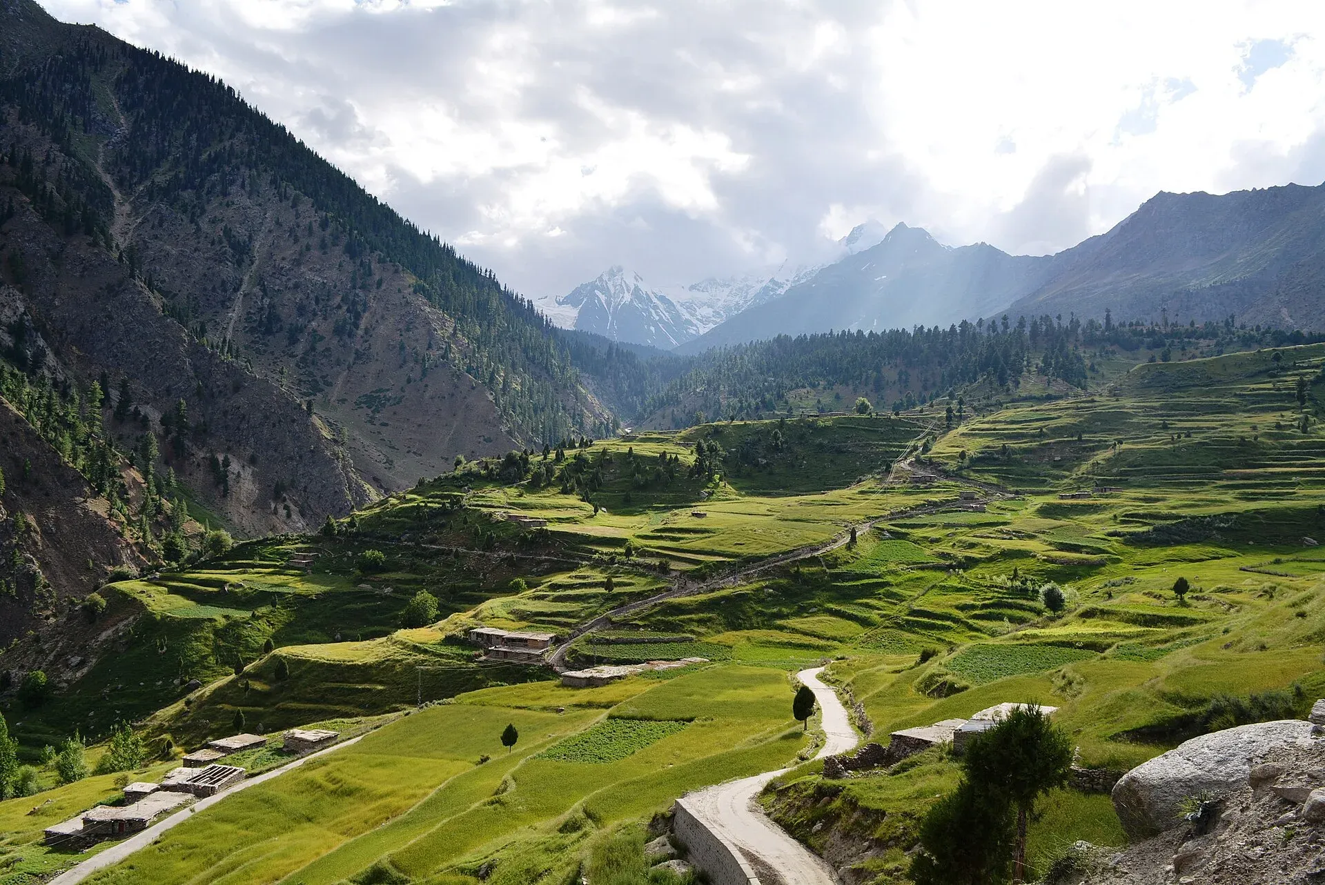
Photo: Obaid Hassan Qureshi, with thanks · CC BY-SA 4.0 · via Wikimedia Commons · temporary stand-in photo

Astore
Main town of Astore District in Gilgit-Baltistan, at about 2,546 m. It is the base for the Astore valley, Rupal valley, Rama Meadows and the road to Deosai.
Overview
Astore is the main town of Astore District in Gilgit-Baltistan, at about 2,546 m. The district includes Bunji, Eidgah, Rattu, Rupal and Minimarg. It largely coincides with the Astore Valley, covers 5,411 sq km and has about 250 sq km of glacier. Less than 6 percent of the district is forest, and about 43 percent is alpine and winter pasture. The climate is continental, with about 402 mm of rain a year.
The old Astore to Burzil road once linked Gilgit with Srinagar and was closed in 1978 as the Karakoram Highway developed.
Plan your visit
- Getting there
Road: from Gilgit by the Astore road via Jaglot, roughly 3 hours; OSRM gives about 157 km for one test route but this should be treated as indicative. Local vans and jeeps run daily from Gilgit. More
Best months
May – Oct
- Astore
- Related places nearby: Astore Valley (with Rama), Astore Wildlife Sanctuary, Rama Meadows, Rama Lake, Rupal Valley, Deosai National Park, Gilgit
History
Astore was ruled by a branch of the Maqpon dynasty of Skardu until 1842, when it was annexed for the Sikh Empire by Colonel Nathu Shah. It became part of the princely state of Jammu and Kashmir in 1846. Astore was first set up as a district in 1935, joined Pakistan after the 1947 Gilgit Rebellion, became a tehsil of Diamer District in 1972 and regained district status in 2004.
What to see and do
- Astore valley: a long valley with villages, meadows and river views. See the Astore Valley page.
- Rupal valley and Nanga Parbat: the road leads towards the Rupal face base. See Rupal Valley.
- Rama Meadows and Rama Lake: a popular half-day trip from town. See Rama Meadows and Rama Lake.
- Deosai National Park: reached by the road from the Astore side, in summer only. See Deosai National Park.
- Bazaar: everyday goods and dried fruit.
Roads in
There are two roads to the district's centre at Eidgah. The year-round road is from Gilgit via Jaglot, about 128 km. The other runs from Skardu across the Deosai plateau, about 143 km, but it cannot be used from November to June because of heavy snow. Gilgit has air links with Islamabad. Plan your journey from Gilgit (Gilgit).
When to visit
June to September for the higher meadows. Roads to Rama and Deosai can be closed by snow in winter and spring.
Where to stay and eat
Hotels and guesthouses are in and around the bazaar and on the road to Rama. Food is simple: rice, meat, bread and tea.
Good to know
- Astore is at altitude, so sleep slowly if you are coming up fast.
- Fuel, ATM and clinic details are not confirmed. Plan from Gilgit.
- Dress modestly and ask before photographing people.
- For foreign visitors: the UK FCDO does not advise against Gilgit-Baltistan generally (advice updated 27 October 2026, checked 16 November 2026). Read the live advice before you plan.
Highlights
- Base for the Astore and Rupal valleys
- Rama Meadows nearby
- Road towards Deosai
- Old Gilgit to Srinagar road
Getting there
Road: from Gilgit by the Astore road via Jaglot, roughly 3 hours; OSRM gives about 157 km for one test route but this should be treated as indicative. Local vans and jeeps run daily from Gilgit.
Hotels, food, fuel and services in Astore
Places to stay
- Astore Inn Hotel & RestaurantCall Astore Inn Hotel & RestaurantMap of Astore Inn Hotel & Restaurant in Google Maps
- PTDC Motel RamaCall PTDC Motel RamaMap of PTDC Motel Rama in Google Maps
- Rama lake view hotel and restaurantCall Rama lake view hotel and restaurantMap of Rama lake view hotel and restaurant in Google Maps
- City Inn Hotel & RestaurantCall City Inn Hotel & RestaurantMap of City Inn Hotel & Restaurant in Google Maps
- Mulberry Inn astore (bulen)Call Mulberry Inn astore (bulen)Map of Mulberry Inn astore (bulen) in Google Maps
- Rama Midway Guest House AstoreCall Rama Midway Guest House AstoreMap of Rama Midway Guest House Astore in Google Maps
Essential services fuel stations, pharmacies and hospitals and clinics
Fuel
- NEW KARAKURAM PET SERVICEMap of NEW KARAKURAM PET SERVICE in Google Maps
- Admore - Rama Filling StationMap of Admore - Rama Filling Station in Google Maps
Pharmacies
- Khyber PharmacyCall Khyber PharmacyMap of Khyber Pharmacy in Google Maps
Hospitals and clinics
- DHQ Hospital AstoreMap of DHQ Hospital Astore in Google Maps
Listings come from Google Maps data and are unverified: phone numbers, opening months and prices may have changed. Report a problem · Own one of these? Claim it
Tips
- Carry cash and fuel from Gilgit.
- Check Deosai road opening dates locally.
- Allow time for altitude.
- Dress modestly.
Sources and last checked
Last checked Confidence medium6 sources4 still to check
- Last checked
- Method
- Desk research from published sources
- Confidence
- medium
- Checked by
- trek.pk research team
Researched from published sources; not yet checked on the ground by our team. Spot something out of date? Report a mistake.
Sources
- Astore (city) · Wikipedia · checked
- OpenStreetMap Nominatim (coordinates) · OpenStreetMap · checked
- OSRM driving routes (road distances and times) · Project OSRM / OpenStreetMap · checked
- Pakistan travel advice · UK FCDO (GOV.UK) · checked
- Deosai National Park (Wikipedia) · Wikipedia · checked
- Astore District: geography, history, roads · Wikipedia · checked
Still to be checked on the ground (4)
- Wikipedia and OpenStreetMap coordinates differ by about 40 km (using OpenStreetMap)
- Altitude: only Wikipedia (2,546 m) found
- Fuel, ATM and clinic availability
- Rama and Deosai road opening dates (Wikipedia says only that Deosai is a summer-only place; no dates found)
Nearby and related

Astore Valley (with Rama)
A forested valley south-east of Gilgit on the eastern side of Nanga Parbat, with Rama Meadows and Rama Lake, the Rupal and Rattu valleys and the seasonal road over the Deosai plateau.

Astore Wildlife Sanctuary
A mountain wildlife sanctuary in Astore District, Gilgit-Baltistan, listed by Wikipedia as designated in 1975 and covering about 415 square kilometres. It protects habitat of the Astor markhor and snow leopard. Boundaries and access need local confirmation.
Rama Meadows
A forest-edged meadow in the Rama valley above Astore, about 25 km from the town by road, with pine and juniper woods and views towards Nanga Parbat country.
Rama Lake
A high lake in the Rama Valley near Astore, at about 3,300 m. Snow covers the valley for seven to eight months of the year, and it is also a route towards the eastern side of Nanga Parbat.

Rupal Valley
The valley below the south face of Nanga Parbat, reached from Astore by a rough road to Tarishing. The Rupal Face rises about 4,600 m; an easy trek leads to the German base camp and Shaigiri.

Deosai National Park
A vast high plateau at about 4,100 m above Skardu and Astore, covered in wildflowers in summer. Created in 1993 to protect the Himalayan brown bear. Open only in summer.

Gilgit
Gateway to Gilgit-Baltistan on the Karakoram Highway: a busy mountain town with the Kargah Buddha and the base for Hunza, Naltar and Skardu.