

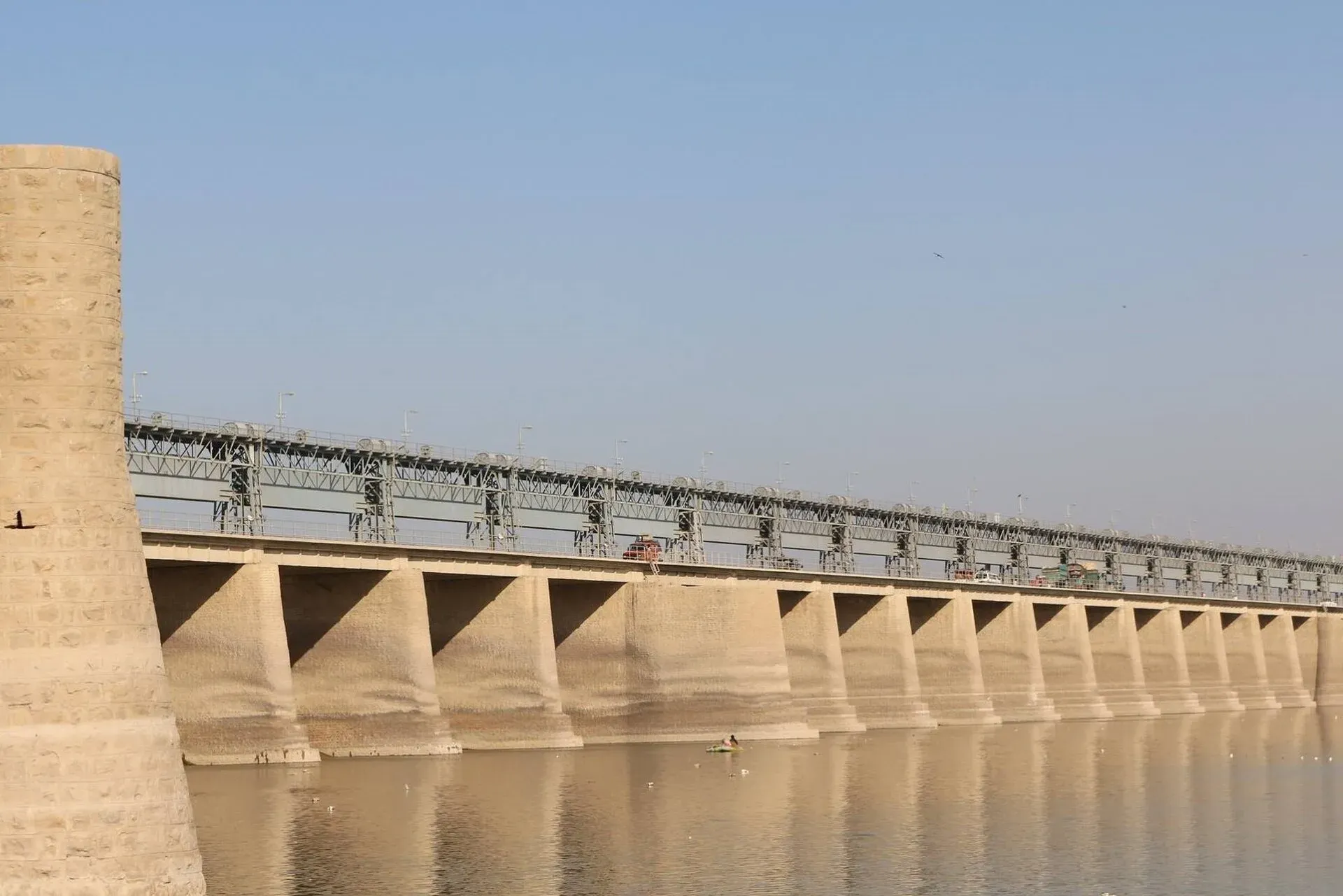
Photo: Jeetesh Maheshwari, with thanks · CC BY-SA 4.0 · via Wikimedia Commons · temporary stand-in photo

Jamshoro
District capital across the Indus from Hyderabad, known as Sindh's education city for its universities. Handy base for Ranikot Fort and Keenjhar Lake.
Overview
Jamshoro is the capital of Jamshoro District, on the right bank of the Indus about 13 km (OSRM) from Hyderabad. Wikipedia calls it the Education City because four major Sindh universities are located there, among them the University of Sindh and Mehran University of Engineering and Technology. At the 2023 census the city had 88,190 people (Wikipedia, citing the census).
Wikipedia says about 95 percent of residents are migrants from other parts of Sindh, who settled in the town from about 1948 onwards. The city is mostly Sindhi, with substantial Pathan and Baloch communities and smaller Brahui, Punjabi and Muhajir groups, and a small Hindu minority.
Plan your visit
- Getting there
From Hyderabad: about 13 km, around 15 minutes (OSRM, optimistic, checked 16 November 2026). To Ranikot Fort: about 107 km, roughly 1 hour 45 minutes (OSRM). To Keenjhar Lake: about 79 km, roughly 1 hour 20 minutes. More
Best months
Oct – Mar
- Jamshoro
- Related places nearby: Hyderabad, Ranikot Fort, Keenjhar Lake, Kirthar National Park, Institute of Sindhology Museum, Kotri Barrage (Ghulam Muhammad Barrage), Darawat Dam, Kotri
The education city
The city is mainly a campus town and a quick hop from Hyderabad. Wikipedia names the University of Sindh, Mehran University of Engineering and Technology and Liaquat University of Medical and Health Sciences among the universities, and Cadet College Petaro nearby.
Ranikot Fort
The reason to come to this district is Ranikot Fort near Sann, nicknamed the Great Wall of Sindh. Wikipedia gives its circumference as about 26 km and its length along the hills as about 31 km, so figures vary. It has been on UNESCO's tentative list since 1993 and has protected status under the Antiquities Act 1975.
The fort joins several bare hills of the Kirthar range with a stone and lime wall, broken by bastions. It has four gates (Sann, Amri, Shah-Pere and Mohan), and a smaller inner fort, Miri Fort, about 3 km from the Sann Gate, is reported to have been the Mir family's palace. The Sann Gate is well preserved and can be climbed for a view over the surrounding land. The original builders and purpose are unknown. Archaeologists point to the 17th century for its first construction, and Wikipedia says some of the present structure was rebuilt by the Talpur rulers in 1812 at a cost of 1.2 million rupees. Inscriptions found in 2018 have been read by one scholar as Gupta period (4th or 5th century), but this is not settled. See the Ranikot Fort page.
By road, Ranikot is about 107 km from Jamshoro (OSRM). Wikipedia says the fort is about 90 km north of Hyderabad on the Indus Highway (N-55), and a rough 21 km diversion road from near Sann leads to the Sann Gate. Sann is a railhead on the Kotri to Larkana line.
Other places nearby
Keenjhar Lake, near Thatta, is about 79 km away. The district also reaches into the Kirthar range (Kirthar National Park). The Kotri Barrage on the Indus, between Jamshoro and Kotri, is the nearest view of the river from the city.
When to visit
October to March is pleasant. Summers are very hot.
Where to stay and eat
Most visitors stay in Hyderabad, which has far more hotels and restaurants. Jamshoro has simple eateries around the universities. No names have been verified.
Good to know
As a district headquarters it should have a government hospital, pharmacies, banks with ATMs and fuel stations, but there are no verified details, so check on arrival and fill up and withdraw cash before heading into the countryside. Safety: the UK FCDO Pakistan page (updated 27 October 2026, checked 16 November 2026) advises against all but essential travel to Sindh north of and including Nawabshah. Jamshoro is well south of that line and is not named on the page. Check the live page before you go.
Highlights
- Sindh's Education City, with four major universities
- Next door to Hyderabad
- Base for Ranikot Fort, the Great Wall of Sindh
Getting there
From Hyderabad: about 13 km, around 15 minutes (OSRM, optimistic, checked 16 November 2026). To Ranikot Fort: about 107 km, roughly 1 hour 45 minutes (OSRM). To Keenjhar Lake: about 79 km, roughly 1 hour 20 minutes. Karachi is about 150 km away.
Hotels, food, fuel and services in Jamshoro
Places to stay
- Teachers Hostel (استادن جي رهائش)Map of Teachers Hostel (استادن جي رهائش) in Google Maps
- Rashidi HostelMap of Rashidi Hostel in Google Maps
- Boys Hostels University of Sindh JamshoroCall Boys Hostels University of Sindh JamshoroMap of Boys Hostels University of Sindh Jamshoro in Google Maps
- Luxurious Wasii Boys HostelCall Luxurious Wasii Boys HostelMap of Luxurious Wasii Boys Hostel in Google Maps
- Prime Luxurious Boys HostelCall Prime Luxurious Boys HostelMap of Prime Luxurious Boys Hostel in Google Maps
- Sindh Hostel Campus 2Call Sindh Hostel Campus 2Map of Sindh Hostel Campus 2 in Google Maps
Places to eat
- Black & Brown BakersCall Black & Brown BakersMap of Black & Brown Bakers in Google Maps
- Hik-2-AdhaiCall Hik-2-AdhaiMap of Hik-2-Adhai in Google Maps
- Kabab GharCall Kabab GharMap of Kabab Ghar in Google Maps
- Pie In The SkyCall Pie In The SkyMap of Pie In The Sky in Google Maps
- RAWR cafe & loungeCall RAWR cafe & loungeMap of RAWR cafe & lounge in Google Maps
- Cheezistaan 🍕 HyderabadCall Cheezistaan 🍕 HyderabadMap of Cheezistaan 🍕 Hyderabad in Google Maps
Essential services fuel stations, mechanics, ATMs, pharmacies and hospitals and clinics
Fuel
- ShellCall ShellMap of Shell in Google Maps
- Taj Filling Station Total Parco Petrol StationCall Taj Filling Station Total Parco Petrol StationMap of Taj Filling Station Total Parco Petrol Station in Google Maps
- Al Zaib Petroleum ServiceCall Al Zaib Petroleum ServiceMap of Al Zaib Petroleum Service in Google Maps
- Byco Al-Raheem Fuel StationMap of Byco Al-Raheem Fuel Station in Google Maps
- PSO Filling StationCall PSO Filling StationMap of PSO Filling Station in Google Maps
- Al-Habib petrol Be energy Petrol PumpMap of Al-Habib petrol Be energy Petrol Pump in Google Maps
Mechanics and tyre shops
- New Farhan AutosMap of New Farhan Autos in Google Maps
- Muslim AutosMap of Muslim Autos in Google Maps
- Hur Puntchar ShopMap of Hur Puntchar Shop in Google Maps
- Ustaad Papu AutosMap of Ustaad Papu Autos in Google Maps
ATMs
- Habib Bank Sindh University BranchCall Habib Bank Sindh University BranchMap of Habib Bank Sindh University Branch in Google Maps
- Bank Al-HabibCall Bank Al-HabibMap of Bank Al-Habib in Google Maps
- National Bank of Pakistan (NBP)Map of National Bank of Pakistan (NBP) in Google Maps
- Allied Bank Ltd. (ABL) - Gulistan-e-Sajjad Br.Call Allied Bank Ltd. (ABL) - Gulistan-e-Sajjad Br.Map of Allied Bank Ltd. (ABL) - Gulistan-e-Sajjad Br. in Google Maps
- Meezan Bank ATMMap of Meezan Bank ATM in Google Maps
Pharmacies
- Faculty Of Pharmacy, University Of Sindh JamshoroMap of Faculty Of Pharmacy, University Of Sindh Jamshoro in Google Maps
- DVAGO Pharmacy & Wellness ExpertsCall DVAGO Pharmacy & Wellness ExpertsMap of DVAGO Pharmacy & Wellness Experts in Google Maps
- Pakistan Corporation PharmacyCall Pakistan Corporation PharmacyMap of Pakistan Corporation Pharmacy in Google Maps
- Mashhad PharmacyCall Mashhad PharmacyMap of Mashhad Pharmacy in Google Maps
- Laghari Medical StoreCall Laghari Medical StoreMap of Laghari Medical Store in Google Maps
- Mahran Medical store Qasimabad Beside Asim clinic main road Qasimabad HyderabadCall Mahran Medical store Qasimabad Beside Asim clinic main road Qasimabad HyderabadMap of Mahran Medical store Qasimabad Beside Asim clinic main road Qasimabad Hyderabad in Google Maps
Hospitals and clinics
- SICVD HyderabadCall SICVD HyderabadMap of SICVD Hyderabad in Google Maps
- Yashfeen Fatima colour Doppler and TVS ultrasound clinicCall Yashfeen Fatima colour Doppler and TVS ultrasound clinicMap of Yashfeen Fatima colour Doppler and TVS ultrasound clinic in Google Maps
- Sanjana Sadhwani Speech therapist and special EducatorMap of Sanjana Sadhwani Speech therapist and special Educator in Google Maps
- Civil Hospital Lumhs JamshoroCall Civil Hospital Lumhs JamshoroMap of Civil Hospital Lumhs Jamshoro in Google Maps
- Pet family Hospital & BoardingCall Pet family Hospital & BoardingMap of Pet family Hospital & Boarding in Google Maps
- Afzal Medical CenterCall Afzal Medical CenterMap of Afzal Medical Center in Google Maps
Listings come from Google Maps data and are unverified: phone numbers, opening months and prices may have changed. Report a problem · Own one of these? Claim it
Tips
- Stay in Hyderabad and visit Jamshoro on the day.
- Start for Ranikot early; the fort is large and the road long.
- Check road conditions before heading into the hills.
Photos we still need: a university campus building or the Indus bank at Jamshoro. Send us yours
Sources and last checked
Last checked Confidence medium4 sources3 still to check
- Last checked
- Method
- Desk research from published sources
- Confidence
- medium
- Checked by
- trek.pk research team
Researched from published sources; not yet checked on the ground by our team. Spot something out of date? Report a mistake.
Sources
- Jamshoro · Wikipedia · checked
- OSRM driving routes (road distances and times, optimistic) · Project OSRM · checked
- Pakistan travel advice: warnings and insurance · UK FCDO (GOV.UK) · checked
- Ranikot Fort · Wikipedia · checked
Still to be checked on the ground (3)
- Hotels and services
- Ranikot route times (OSRM may be optimistic)
- Ranikot circumference: Wikipedia gives about 26 km in one place and a 31 km wall length in another
Nearby and related

Hyderabad
Sindh's second-largest city, founded in 1768 and famous for its glass bangles, Pacco Qillo fort and Talpur tombs, about 160 km from Karachi.

Ranikot Fort
A huge hill-top wall in the Kirthar hills of Sindh, often called the Great Wall of Sindh, with four gates and a smaller inner fort. On Pakistan's UNESCO tentative list since 1993.

Keenjhar Lake
Sindh's largest freshwater lake, about 36 km from Thatta and roughly 120 km from Karachi. A Ramsar site since 1976, with winter ducks, geese and flamingos and a shrine on an island.

Kirthar National Park
A rugged semi-desert park in the Kirthar Mountains north of Karachi, established in 1974. About 3,087 square kilometres, home to Sindh ibex, urial, chinkara and leopard.

Thatta
Sindh's medieval capital, home to the UNESCO-listed Makli Necropolis and the tiled Shah Jahan Mosque, about 100 km from Karachi and Hyderabad.
Institute of Sindhology Museum
The museum and gallery of the Institute of Sindhology at the University of Sindh in Jamshoro, holding archaeological material, crafts, coins, photographs and paintings about Sindh.
Kai Caves
Two groups of caves in the Kai valley south of Sehwan Sharif, Jamshoro District, Sindh, in the Kirthar range. The lower group is known locally as Satt Ghariyoon (Seven Caves). Access is by a narrow, difficult track.

Kotri Barrage (Ghulam Muhammad Barrage)
A barrage on the Indus between Jamshoro and Hyderabad, finished in 1955. It is the last major barrage before the river reaches the sea, and carries a road across the river.
Darawat Dam
An irrigation dam on the Nai Baran River in Jamshoro District, Sindh, opened in 2013-14. It is a rural water-storage site with no known visitor facilities.
Kotri
Industrial and fishing town on the Indus in Jamshoro District, beside Kotri Barrage. Few tourist sights; mainly useful as a gateway between Hyderabad and Jamshoro.
Lakki Shah Saddar Hot Springs
Sulphur springs and ponds in the Lakki hills near Sehwan, Sindh, long a pilgrimage and bathing site. Little current visitor information exists. For foreign visitors, FCDO advises against all but essential travel to much of northern Sindh.