

Photo: S zillayali, with thanks · CC BY-SA 3.0 · via Wikimedia Commons · temporary stand-in photo

Lahore Canal and Mall Road
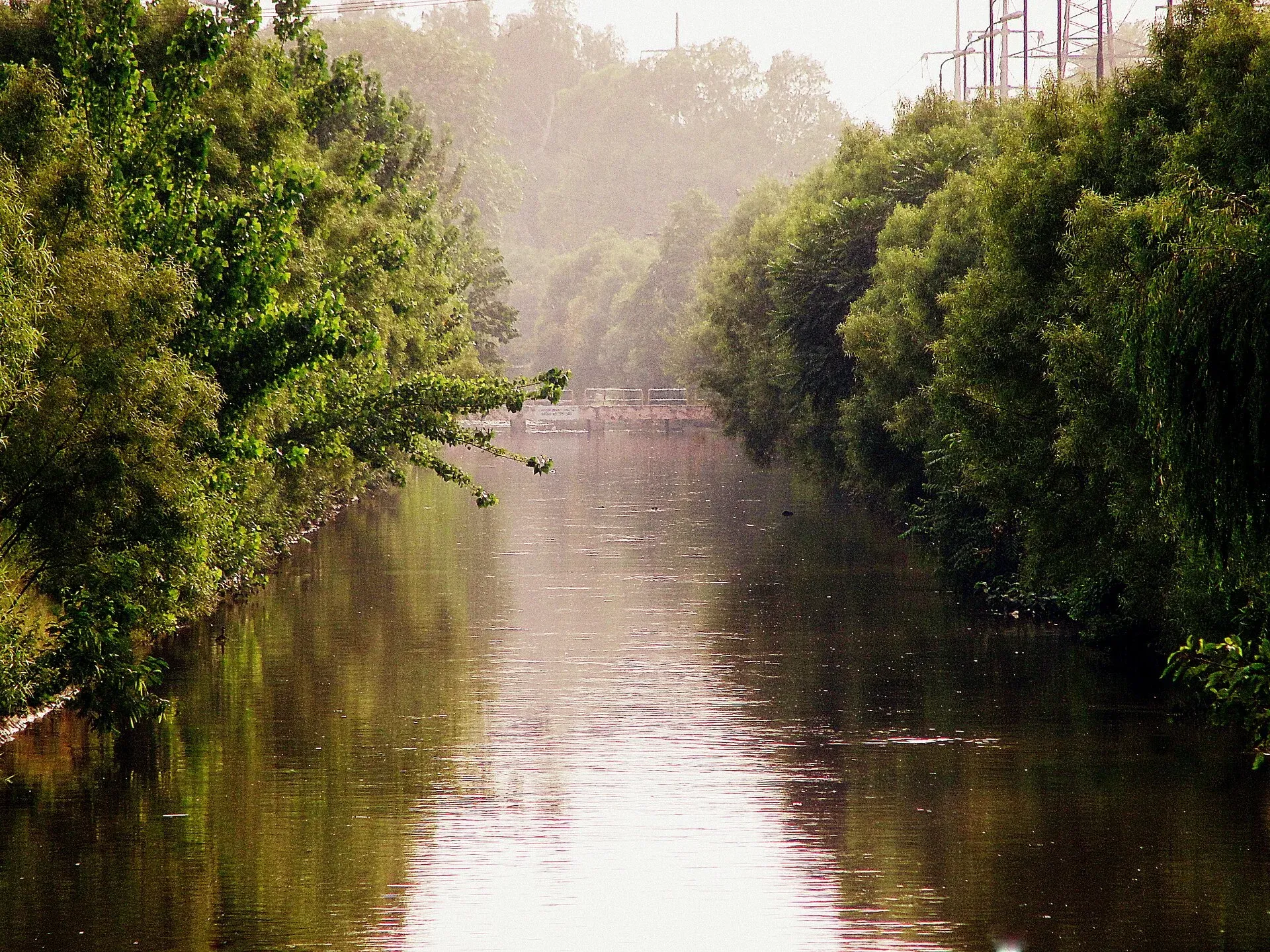
Two of Lahore's best-known roads: the colonial-era Mall Road, about 6.5 km of Victorian and Indo-Saracenic buildings, and the tree-lined Lahore Canal, a long public green belt with a road along each bank.
Overview
Mall Road (officially Shahrah-e-Quaid-e-Azam) and the Lahore Canal, known locally as the Nahr, cross the city. Together they show two sides of Lahore: the British-era civil lines and the green belt that Lahoris use for evening drives and walks.
Plan your visit
- Nearest town
- Lahore
- Getting there
Mall Road is about 3 km from the centre of Lahore, roughly 10-15 minutes by road in light traffic (OSRM routing). Metrobus crosses the canal on a flyover; More
Best months
Oct – Mar
- Lahore Canal and Mall Road
- Related places nearby: Lahore, Lahore Museum, Lahore Fort, Walled City of Lahore
Mall Road
The British built The Mall after the 1857 rebellion as the main road linking the Walled City in the west to the civil and military lines in the east. Wikipedia gives its length as about 6.5 km, from Multan Road near the Lahore Secretariat to Mian Mir Bridge on Aziz Bhatti Road. The British first set up a cantonment in Anarkali, then moved it about five miles east to Mian Mir. Some development at the Lower Mall end is older: the Civil Secretariat was once the residence of General Jean-Baptiste Ventura.
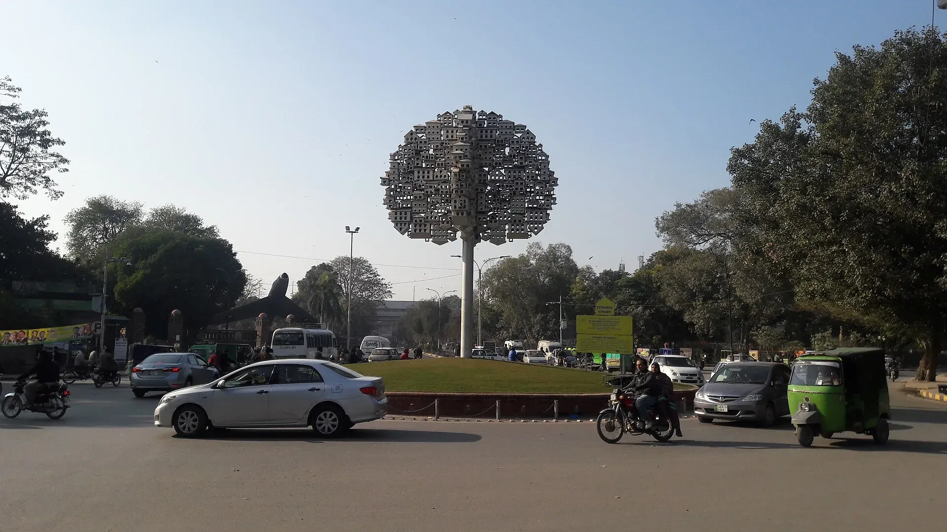
Photo: Tahir mq, with thanks · CC BY-SA 4.0 · via Wikimedia Commons · temporary stand-in photo

The style changes as the road runs east. The west end has Neoclassical and Neo-Gothic buildings. On the south side are the Town Hall, the Mayo School of Arts (now the National College of Arts), the Lahore Museum, the Punjab Public Library and Tollinton Market. On the north side are the District Courts, Government College and the University of the Punjab. Further east the style turns Indo-Saracenic (a British blend of Mughal and Gothic forms), with the General Post Office, the Lahore High Court, the Telegraph Office and the YMCA, plus missionary schools and churches. Charing Cross, named after the London junction, marks the heart of the road. Its Queen Victoria statue was moved to the Lahore Museum after independence.
Close by are the Alhamra Arts Council, Bagh-e-Jinnah (the former Lawrence Gardens), Governor House, Aitchison College and Lahore Zoo. For the older city, see the Walled City of Lahore and Lahore Fort.
The Lahore Canal
The canal runs about 60 km (Wikipedia's text; its headline figure says 82 km, and there is no known official figure). It branches off the Bambawali-Ravi-Bedian canal near Khaira village and ends at Raiwind Road. That older canal dates from the Mughal era, and the British later extended it west to Raiwind. The Punjab Irrigation Department manages it. Today it is an irrigation channel and the centre of a long linear park, with Canal Bank Road along both banks, and it is desilted each December and January. On national days and festivals the banks are lit up. The canal separates the older parts of Lahore on the west from the newer districts on the east.
A day on both roads
An honest outline from the sights above: take the morning on Mall Road, starting at the west end near the Lahore Museum, then walking east past the National College of Arts, the Punjab Public Library, Tollinton Market and Government College to Charing Cross, with Bagh-e-Jinnah a short way off. Each building has its own opening times, so check them first. Leave the evening for the canal, when the heat has eased and the banks are lit on festival nights.
When to visit
October to March is best. Summer afternoons are very hot; evenings are better for the canal.
Where to stay and eat
Hotels and restaurants are plentiful around Mall Road and the Gulberg side of the canal.
Good to know
- Traffic is heavy at rush hour and on weekends. Walking Mall Road is easier early in the morning.
- Do not swim in the canal. Wikipedia reports that tests found pollutants above national limits and warns that the water can spread diseases such as hepatitis, although people do swim in summer. Keep children back from the water, especially in the monsoon.
- Official building opening hours vary; check each place before you go.
Highlights
- Victorian and Indo-Saracenic buildings along The Mall
- Charing Cross, Lahore Museum and Bagh-e-Jinnah nearby
- About 60 km canal with a linear park
- Lit up on national days and festivals
Getting there
Mall Road is about 3 km from the centre of Lahore, roughly 10-15 minutes by road in light traffic (OSRM routing). Metrobus crosses the canal on a flyover; taxis and ride-hailing cars are the simplest way to reach either road.
Tips
- Visit Mall Road early on a weekday for quieter pavements.
- Evenings suit the canal best.
- Check each building's opening times separately.
- Do not swim in the canal.
Photos we still need: Canal Bank Road lit up on a festival night. Send us yours
Sources and last checked
Last checked Confidence medium3 sources3 still to check
- Last checked
- Method
- Desk research from published sources
- Confidence
- medium
- Checked by
- trek.pk research team
Researched from published sources; not yet checked on the ground by our team. Spot something out of date? Report a mistake.
Sources
- The Mall, Lahore (Wikipedia) · Wikipedia · checked
- Lahore canal (Wikipedia) · Wikipedia · checked
- OSRM road routing (driving distance and time from the city centre) · OpenStreetMap / OSRM · checked
Still to be checked on the ground (3)
- Exact canal crossing point used for the map pin (approximate)
- Canal length: Wikipedia gives 60 km in its text but 82 km in its summary box; official figure not found
- Whether the 1861 British upgrade of the canal (stated on the earlier page) can be confirmed from a second source; removed pending a source
Nearby and related

Lahore
Punjab's capital and Pakistan's cultural city: Mughal forts, mosques and gardens, a lively Walled City, and some of the best food in the country.

Lahore Museum
Pakistan's oldest and largest museum, in an 1894 Indo-Saracenic building on The Mall. Home of the Fasting Buddha from Gandhara and galleries from the Indus Valley to the Pakistan Movement.

Lahore Fort
The Mughal citadel at the north end of Lahore's Walled City, with palaces, a marble mosque and a long tiled Picture Wall. Inscribed by UNESCO in 1981 together with the Shalimar Gardens.

Walled City of Lahore
Lahore's old core: lanes, gates and Mughal and Sikh-era monuments around the Royal Road, including Wazir Khan Mosque, Delhi Gate and the Shahi Hammam. Its lanes are best explored on foot.