

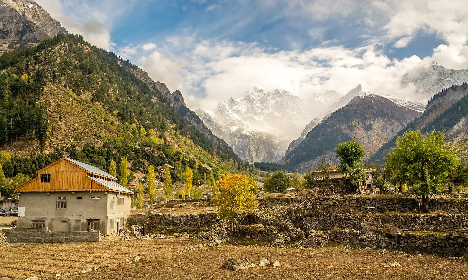
Photo: Muh.Ashar, with thanks · CC BY-SA 3.0 · via Wikimedia Commons · temporary stand-in photo

Matiltan Camping (Swat)
Camping at Matiltan in the Usho valley above Kalam, Swat, on the road to Mahodand Lake. For foreign visitors: the UK FCDO advises against all travel to Swat; little reliable detail is published on camps.
Overview
Matiltan is a village in the Usho valley above Kalam in upper Swat, about 11 km from Kalam by Wikipedia's figure. It is on the road to Mahodand Lake and has views of Falak Sar, described as the tallest peak in Swat. Camping is possible in the area, but little reliable detail is published about who runs camps or what they charge, so confidence in this page is low.
Plan your visit
- Nearest town
- Kalam
- Getting there
From Kalam, a non-metalled 4x4 road leads about 11 km up the Usho valley to Matiltan (Wikipedia). Jeeps can be hired in Kalam. More
Best months
Jun – Sep
- Matiltan Camping (Swat)
- Related places nearby: Kalam, Mahodand Lake, Swat Valley, Falak Sar
Check the travel advice first
The UK Foreign Office (updated 27 October 2026, checked 16 November 2026) advises against all travel to Swat, and notes emergency measures in Khyber Pakhtunkhwa. Read the live page and local news before planning. This page describes the place; it is not a recommendation to go.
The Usho valley
Usho (also spelt Ushu) is a village and valley in Swat Kohistan, in Behrain tehsil of Upper Swat. Its name comes from the Gawri word oš, meaning cold or ice. Matiltan and Usho are mainly inhabited by Gawri people. Wikipedia describes the valley as one of large glaciers, thick forest and high peaks, and as cloudy and rainy. The Ushu River, a left-bank tributary of the Swat River, rises at Mahodand Lake and runs down this valley to join the Utror stream at Kalam, where the two form the Swat River.
Matiltan also has an 84 MW hydropower plant on the river, so the village is more than a camping stop: expect works and power lines as well as meadow and forest.
Published distances differ. Wikipedia puts Matiltan about 11 km from Kalam and Usho village about 8 km from Kalam. Wikivoyage says Usho is about 3 km from Kalam. Treat all as approximate and ask locally.
Access
A non-metalled road leads from Kalam to Matiltan and on to Usho, and needs a four-wheel-drive vehicle (Wikipedia). Jeeps are hired in Kalam. Allow extra time after rain. Landslides and floods can close the road.
The road is seasonal beyond Usho. Wikipedia says the Ushu Glacier blocks the only path to Mahodand Lake in winter, and the way reopens in summer once the snow melts and the remaining snow is cleared.
Beyond Matiltan: Mahodand Lake
Mahodand is the usual destination for this road. Wikivoyage gives about 40 km from Kalam, reachable only by four-wheel drive, and describes it as a summer campsite among meadows, forest and snow-capped mountains, with fishing and boating. Wikipedia places it about 27 km from Usho village. The lake is fed by glacier melt and springs and is the source of the Ushu River. See the Mahodand Lake page and Matiltan Waterfall.
Who manages it, and the rules
- Local land. The meadows and forest belong to local communities. Ask permission before pitching and agree any charge.
- Forest. Do not cut trees or light fires in the forest. ARY News reported in September 2025 that the KP government planned an eco-tourism zone in the Usho Forest; its rules are not published in that report.
- Development authority. A 2020 ARY report said KP set rules, with fines, for the Kumrat and Kalam development authorities. It does not say which rules cover Matiltan camps.
- Treks. Operators run treks from Kalam via Matiltan, including nights at a camp called Jabba. These listings have not been verified independently.
- Waste. Carry all rubbish out. The river downstream supplies villages.
- Fees. Camp or vehicle charges may apply; current fees will be added soon.
Best months
June to September. Winter snow closes the upper valley.
Safety
- Do not camp beside the Swat River or its tributaries; floods have hit Swat before.
- Weather changes quickly at altitude.
- Hire a local guide and a 4x4 with a driver.
Nearby
Matiltan Waterfall, Mahodand Lake, Kalam and Falak Sar.
Highlights
- Usho valley village about 11 km above Kalam (Wikipedia)
- View of Falak Sar, the tallest peak in Swat
- Gawri-speaking community; 84 MW hydropower plant on the river
- Road continues to Mahodand Lake, closed by snow in winter
- For foreign visitors: the UK FCDO advises against all travel to Swat
Getting there
From Kalam, a non-metalled 4x4 road leads about 11 km up the Usho valley to Matiltan (Wikipedia). Jeeps can be hired in Kalam.
Tips
- Check FCDO and local conditions before planning.
- Do not camp near rivers.
- Ask villagers before pitching a tent.
Photos we still need: a camp or meadow at Matiltan or in the Usho valley; the Usho valley road towards Mahodand Lake. Send us yours
Sources and last checked
Last checked Confidence low6 sources5 still to check
- Last checked
- Method
- Desk research from published sources
- Confidence
- low
- Checked by
- trek.pk research team
Researched from published sources; not yet checked on the ground by our team. Spot something out of date? Report a mistake.
Sources
- Pakistan travel advice: warnings and insurance (updated 27 October 2026) · UK Foreign, Commonwealth & Development Office · checked
- Matiltan · Wikipedia · checked
- KP plans eco-tourism zone in Usho Forest, Kalam (September 2025) · ARY News · checked
- KP defines rules for preserving scenic beauty of tourist spots (2020) · ARY News · checked
- Usho · Wikipedia · checked
- Swat Valley (travel guide) · Wikivoyage · checked
Still to be checked on the ground (5)
- Which camps exist and who runs them
- Current rules and charges (the 2020 ARY article covers only fines for the Kumrat and Kalam development authorities, not Matiltan camping)
- Current road condition above Kalam (Wikipedia: non-metalled, 4x4 only; no recent report)
- Altitude of Matiltan (not given in Wikipedia or Wikivoyage)
- Distances from Kalam (Wikipedia 11 km to Matiltan, Wikivoyage 3 km to Usho, Wikipedia 8 km)
Nearby and related

Matiltan Waterfall
A roadside waterfall in the Matiltan area of the Usho valley above Kalam, Swat, on the way to Mahodand Lake. Few reliable sources exist. For foreign visitors: the UK FCDO advises against all travel to Swat.

Kalam
The last large town in the upper Swat Valley, at about 2,000 m where the Ushu and Gabral rivers meet. Kalam is the base for Ushu, Utror, Mahodand Lake and Kundol Lake.

Mahodand Lake
A cold trout lake at about 2,865 m in the Usho valley above Kalam, reached by a rough 4x4 track of around 40 km. Open in summer only.

Swat Valley
A long green river valley in northern Khyber Pakhtunkhwa, with Gandhara Buddhist sites, orchards, hill towns and the road up to Kalam. Check the current security advice before you plan a trip.

Falak Sar
Falak Sar (about 5,918 m) is the highest peak in the Swat Valley, above Matiltan. First climbed in 1957; sources disagree on its height and range. Check the FCDO advice on Swat first.