

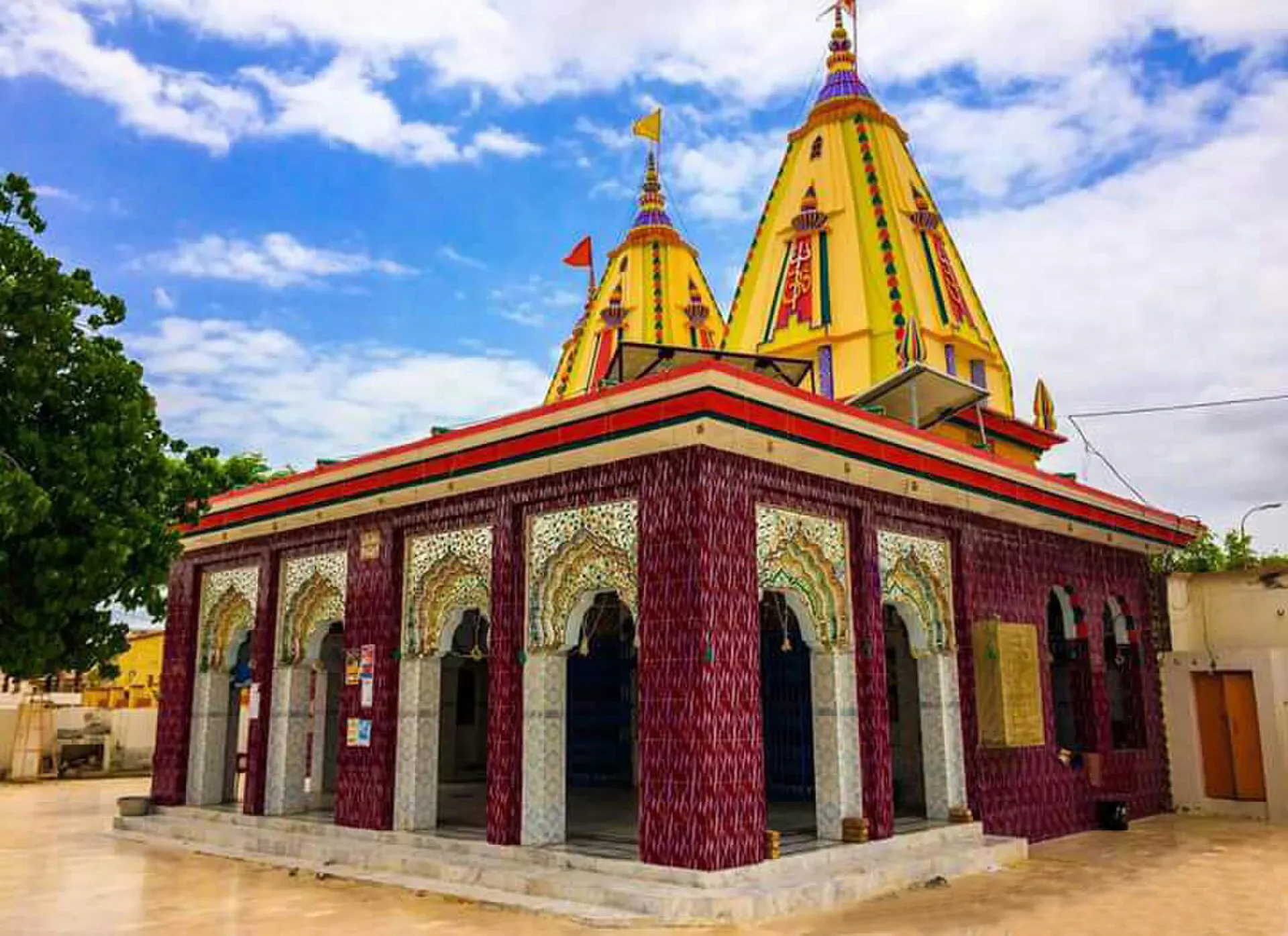
Photo: Mumbaipsytrance, with thanks · CC BY-SA 4.0 · via Wikimedia Commons · temporary stand-in photo

Mithi
The district headquarters of Tharparkar in Sindh, a Hindu-majority town in the Thar Desert and the practical base for Islamkot, Nagarparkar and the green desert after the monsoon.
Overview
Mithi is the headquarters of Tharparkar District in Sindh and has been since 1990, when the district was separated from Mirpur Khas (Wikipedia). The 2023 census counted 52,376 people in Mithi city and 239,091 in Mithi tehsil (Wikipedia, citing the census). The town is one of few in Pakistan with a Hindu majority: about 70 per cent of Mithi taluka in 2023 (69.9 per cent, or 167,048 people, per Wikipedia's Mithi Taluka page). Wikipedia's Mithi page also says about 70 per cent of the city, without a separate census figure for the city. Its height is given as 28 m or 42 m in different places on the same page.
The TDAP guide says more than 90 per cent of Tharparkar's people live in over 200 villages. Mithi is the main bazaar and service town for them.
Plan your visit
- Getting there
Road: About 343 km from Karachi (OSRM, optimistic 4 h 40 min), 181 km from Hyderabad and 89 km from Umerkot. Buses from Karachi and Hyderabad; a hired car is easier. More
Best months
Aug – Sep, Nov – Feb
- Mithi
- Related place nearby: Naukot Fort
People and language
Tharparkar is Sindh's largest district, at 19,637 sq km, and has the largest Hindu population in Pakistan. At the 2023 census Hindus were 45.6 per cent of the district and Muslims 54.3 per cent, with Mithi, Nagarparkar and Islamkot tehsils Hindu-majority (Wikipedia). Almost all residents record Sindhi as their language. Dhatki, a dialect close to Marwari across the border, is the most widely used local speech, and Parkari and Kachi Koli are spoken near the Gujarat border. Communities include Meghwar, Bheel, Kolhi, Rajput, Lohana and Rabari families.
What to see and do
- Temples and bazaar: the Shiv Parvati Temple is the best-documented temple in town. Gadi Bhit, also in Mithi, is listed among Tharparkar's sights. Mud-brick houses with painted walls are common.
- Local life: the TDAP guide describes Thar as a place to meet communities and learn about local culture and lifestyle. Ask permission before photographing people.
- After the monsoon: the desert turns green, usually from August (Express Tribune, 16 August 2026).
- Islamkot and Nagarparkar: the main day trips; see below.
Getting there
- Road: Mithi is about 343 km from Karachi (OSRM about 4 hours 40 minutes, optimistic), about 181 km from Hyderabad (about 2 hours 50 minutes) and about 89 km from Umerkot. The roads are paved with long straight stretches, cattle and sand drift.
- Public transport: buses from Karachi and Hyderabad. A hired car is easier for the desert tracks.
Crafts and the desert economy
The district's handicrafts include ralli (patchwork quilts), pottery, puppet-making, carpets, block printing and embroidery. Wikipedia reports about 6,000 handlooms in Chachro tehsil alone, and craft sales add to household income, especially for women. Ask before photographing people or workshops, and buy directly from makers where you can.
The rain decides everything here. Most falls from July to September, and some areas average only 100 mm a year. The district has been declared drought-affected many times since 1968. Thar coal lies beneath the district, which holds about 95 per cent of Pakistan's lignite reserves (Wikipedia), and power plants near Islamkot have changed the local economy.
A day from Mithi
Use Mithi as a base for one day trip. A drive to Islamkot takes about 40 minutes; Nagarparkar is about 132 km and two hours away by road (Thar route page), so combine it with the Jain temples rather than trying both in a day. Stay in town for evening bazaar time and an early start.
When to visit
November to February is cool and clear. August and September are green after the rain, but the Express Tribune reported on 16 August 2026 that crowds, accidents and drowning at Tharparkar sites caused five deaths and more than 105 injuries in 24 hours and that hotels were full. Summer before the rain is very hot; there are no confirmed temperature figures to quote.
Where to stay and eat
Accommodation is limited. Hotels and guesthouses are in the town centre and main road, with simple rooms. Food is simple and local. Carry water, fuel and cash.
Treks and day trips
- Islamkot: about 42 km from Mithi (about 40 minutes; Thar route page).
- Nagarparkar and the Karoonjhar hills: about 132 km (about 2 hours). The temples and Jain monuments are the main sights.
- See the Thar route page for the Karachi to Nagarparkar drive.
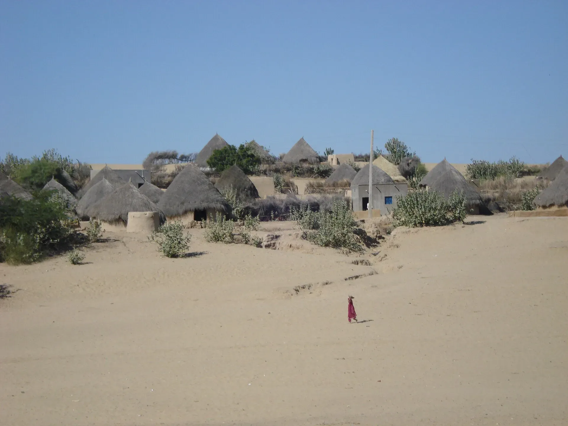
Photo: Baig Aamir, with thanks · CC BY-SA 4.0 · via Wikimedia Commons · temporary stand-in photo

Safety and good to know
Ask the district administration or local police about current conditions before you go. For foreign visitors: the UK FCDO advises against all but essential travel to Sindh north of and including Nawabshah (updated 27 October 2026, still current when checked on 17 November 2026). Mithi lies south of that line, but check the advice. Respect temples and shrines: dress modestly and ask before entering. Do not swim in dams or ponds that locals do not use. Fees are not confirmed here; current fees will be added soon.
Highlights
- Tharparkar district headquarters
- Hindu-majority town and temples
- Green desert after the monsoon
- Base for Islamkot and Nagarparkar
Hotels, food, fuel and services in Mithi
Places to stay
- Ashiana Guest House (آشیانہ گیسٹ ہاؤس)Call Ashiana Guest House (آشیانہ گیسٹ ہاؤس)Map of Ashiana Guest House (آشیانہ گیسٹ ہاؤس) in Google Maps
- Bin Qasim Guest House MithiCall Bin Qasim Guest House MithiMap of Bin Qasim Guest House Mithi in Google Maps
- Parkar Guest House Mithi TharparkarCall Parkar Guest House Mithi TharparkarMap of Parkar Guest House Mithi Tharparkar in Google Maps
- Star Guest HouseCall Star Guest HouseMap of Star Guest House in Google Maps
- The Royal Palace MithiCall The Royal Palace MithiMap of The Royal Palace Mithi in Google Maps
- Raja Star Guest House Mithi TharparkerCall Raja Star Guest House Mithi TharparkerMap of Raja Star Guest House Mithi Tharparker in Google Maps
Places to eat
- Thar CuisineCall Thar CuisineMap of Thar Cuisine in Google Maps
- Diamond Hotel Mithi, TharparkarCall Diamond Hotel Mithi, TharparkarMap of Diamond Hotel Mithi, Tharparkar in Google Maps
- Cafe Thar Restaurant - Mithi, TharparkarCall Cafe Thar Restaurant - Mithi, TharparkarMap of Cafe Thar Restaurant - Mithi, Tharparkar in Google Maps
- Royal Taj Foods MithiCall Royal Taj Foods MithiMap of Royal Taj Foods Mithi in Google Maps
- Dawn Hotel & RestaurantCall Dawn Hotel & RestaurantMap of Dawn Hotel & Restaurant in Google Maps
- Babu Baker'sCall Babu Baker'sMap of Babu Baker's in Google Maps
Essential services fuel stations, mechanics, ATMs, pharmacies and hospitals and clinics
Fuel
- Malani PSOCall Malani PSOMap of Malani PSO in Google Maps
- LUCKY PETROLEUM SERVICE - MITHI- Total Petrol StationCall LUCKY PETROLEUM SERVICE - MITHI- Total Petrol StationMap of LUCKY PETROLEUM SERVICE - MITHI- Total Petrol Station in Google Maps
- Hascol Petrol Station-MarviCall Hascol Petrol Station-MarviMap of Hascol Petrol Station-Marvi in Google Maps
- ShellCall ShellMap of Shell in Google Maps
- Mithi Feuling Pump (PSO)Map of Mithi Feuling Pump (PSO) in Google Maps
- PSOMap of PSO in Google Maps
Mechanics and tyre shops
ATMs
- National Bank of PakistanMap of National Bank of Pakistan in Google Maps
- Habib Bank Ltd MithiCall Habib Bank Ltd MithiMap of Habib Bank Ltd Mithi in Google Maps
- JS BankCall JS BankMap of JS Bank in Google Maps
Pharmacies
- Karoonjhar Medical Store MithiMap of Karoonjhar Medical Store Mithi in Google Maps
- Pursna MedicosMap of Pursna Medicos in Google Maps
- Moonstar Medical StoreMap of Moonstar Medical Store in Google Maps
Hospitals and clinics
- SICVD MithiCall SICVD MithiMap of SICVD Mithi in Google Maps
- Al-Khidmat HospitalMap of Al-Khidmat Hospital in Google Maps
- Civil Hospital MithiMap of Civil Hospital Mithi in Google Maps
- The Modern HospitalCall The Modern HospitalMap of The Modern Hospital in Google Maps
- DHQ HospitalMap of DHQ Hospital in Google Maps
- Kumar Charitable Medical CentreMap of Kumar Charitable Medical Centre in Google Maps
Listings come from Google Maps data and are unverified: phone numbers, opening months and prices may have changed. Report a problem · Own one of these? Claim it
Tips
- Visit in the cool months or just after rain.
- Carry water, fuel and cash.
- Book hotels ahead for August weekends.
- Ask permission before photographing people.
Photos we still need: the Mithi bazaar and Islamkot or Nagarparkar after rain (no suitable image checked). Send us yours
Sources and last checked
Last checked Confidence medium7 sources4 still to check
- Last checked
- Method
- Desk research from published sources
- Confidence
- medium
- Checked by
- trek.pk research team
Researched from published sources; not yet checked on the ground by our team. Spot something out of date? Report a mistake.
Sources
- Mithi · Wikipedia · checked
- Five dead, over 100 injured as tourists flock to Tharparkar (16 August 2026) · The Express Tribune · checked
- Pakistan travel advice (updated 27 October 2026) · UK Foreign, Commonwealth & Development Office · checked
- OSRM driving route service: distances and times measured 16 November 2026 (times are optimistic, without stops) · OSRM / OpenStreetMap · checked
- Pakistan Tourism Guide 2021 · TDAP Pakistan · checked
- Mithi Taluka · Wikipedia · checked
- Tharparkar District (Wikipedia) · Wikipedia · checked
Still to be checked on the ground (4)
- Town altitude (Wikipedia gives 42 m in the summary box and 28 m in the text on both pages; no other source)
- Hotel availability outside August (no source)
- Hindu share of the city (Wikipedia says about 70% for the city without a cited city-level figure; the census figure is for the taluka)
- What Gadi Bhit is and whether it can be visited (listed by Wikipedia without detail)
Nearby and related

Sindh
Pakistan's south-east: Karachi's beaches and markets, the Indus Valley city of Moenjodaro, Thatta's Makli tombs, Sufi shrines, the Thar desert and the Indus delta.

Mirpur Khas
Sindh's City of Mangoes, founded by the Talpurs in 1806, with the Chitorri tombs and Buddhist-era remains, about 70 km east of Hyderabad.

Hyderabad
Sindh's second-largest city, founded in 1768 and famous for its glass bangles, Pacco Qillo fort and Talpur tombs, about 160 km from Karachi.

Karachi
Pakistan's largest city and main port: colonial buildings, museums, beaches, busy bazaars and some of the country's best food.
Naukot Fort
A burnt-brick Talpur fort of 1814 at the edge of the Thar Desert in Tharparkar, with nine semicircular bastions. Added to Pakistan's UNESCO tentative list in 2026.

Thar Desert: Mithi and Nagarparkar
A three-day, about 475 km road trip from Karachi through Hyderabad to Mithi and the Karoonjhar hills at Nagarparkar, with Jain temples and monsoon greenery. Measured distances; August 2026 brought crowds and accidents.