

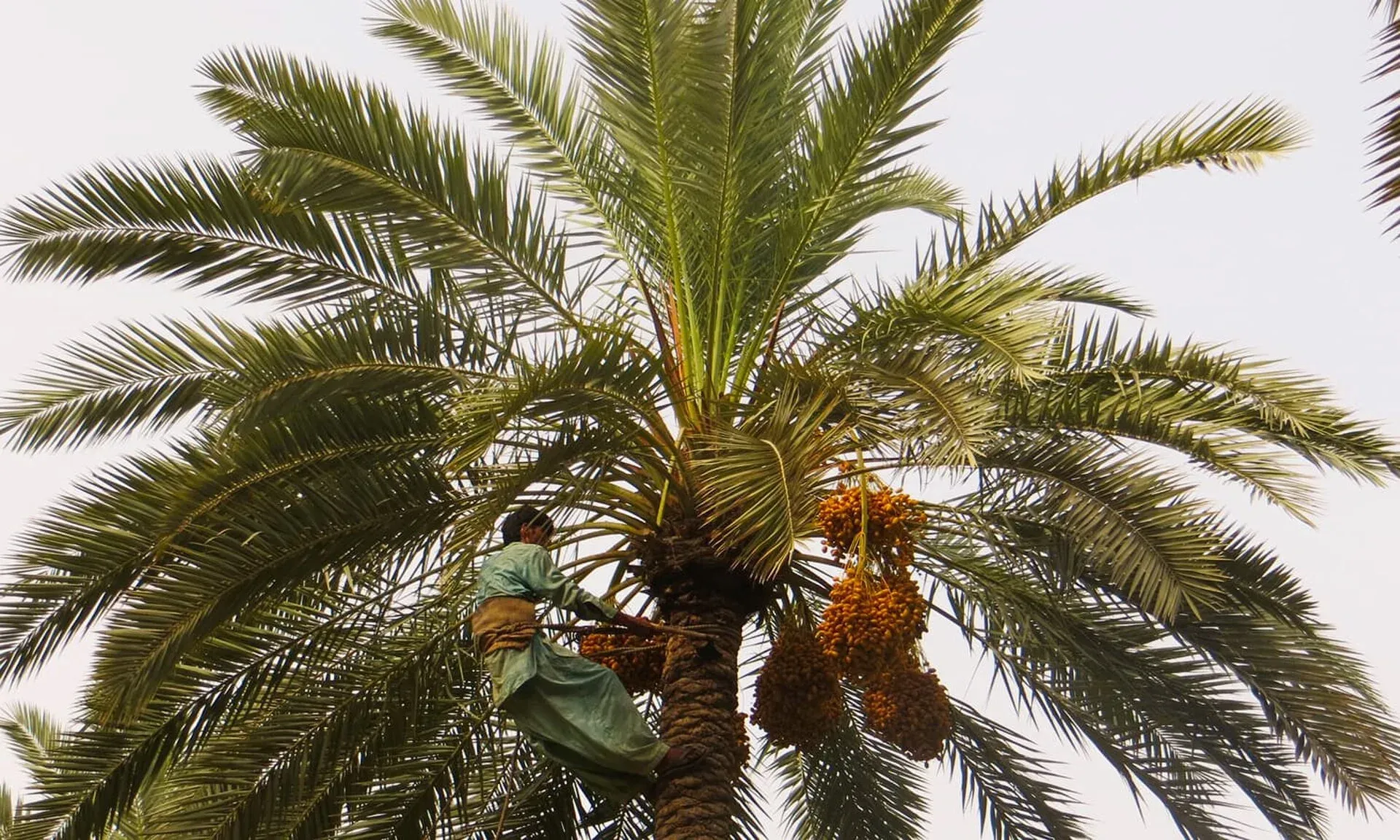
Photo: Panjgur District, with thanks · CC BY-SA 4.0 · via Wikimedia Commons · temporary stand-in photo

Panjgur
Date-growing river oasis in south-west Balochistan and headquarters of Panjgur District, known for Mazafati dates.
Overview
Panjgur is the headquarters town of Panjgur District, at about 980 m on the Rakshan River. It is not a single compact town but a string of about twelve villages along both banks, among them Chitkan, Tasp, Gramkan and Washbood, historically called the "twelve towns of Panjgur". The geographer al-Muqaddasi wrote in 985 CE of a place called Bannajbur as the capital of Makran, the earliest Arabic mention of the Baloch.
The 2023 census counted 157,693 people, but that figure includes Chitkan, Tasp and Washbood (CityPopulation.de), so it describes the whole oasis, not one town centre.
Plan your visit
- Getting there
Road: Turbat about 239 km (about 3 hours); Quetta about 514 km (about 6 hours 20 minutes) (OSRM, checked 16 November 2026). Air: Panjgur Airport exists; More
Best months
Nov – Mar
The district
Panjgur District covers 16,891 km² in western Balochistan and borders Iran. It lies in a highland basin ringed by dry mountains, with the Siahan range to the north. The Rakhshan River divides it into northern and southern zones, and most settlement follows the river. Balochi is the language of 99.6% of the population (Wikipedia). Panjgur became a separate district on 1 July 1977.
The Gichki tribe ruled Makran from about 1740 to 1955, and their ancestral seat is the Gichk valley. Wikipedia lists older sites in the district: Kuhna Kalat, built of large baked red bricks; the tomb of Allang Essai in Panjgur town; the tomb of Malik Asa and the ancient Band-e-Gillar dam; and shrines with decorated baked tiles.
Dates and farming
Agriculture employs about two thirds of the district's workforce, though only about 6% of the land is cultivated. Irrigation depends on karezes (underground channels that carry water from the hills) fed by the Rakhshan, and tubewells and dugwells are banned to protect them. The district is one of Pakistan's main producers of Mazafati dates, a soft table variety, with about 27,000 acres under cultivation. Wheat, jowar (sorghum), barley and rice are also grown, and livestock matter. The date groves and village lanes are the character of the place.
When to visit
Winter is mild and the best season. Summers are hot, though cooler than much of Makran.
Where to stay and eat
Services are those of a district headquarters. Confirm before you rely on any of them, and carry cash and fuel.
Good to know
Turbat is about 239 km (about 3 hours) and Quetta about 514 km (about 6 hours 20 minutes) by road (OSRM estimates, checked 16 November 2026, optimistic). The N-85 links the district to Quetta. Panjgur has an airport, but Wikipedia lists only an Abu Dhabi Aviation charter flight and no scheduled service, so no current passenger flights are confirmed.
Ask the district administration or local police about current conditions before you go. Safety: For foreign visitors, the UK FCDO advises against all travel to Balochistan Province (page updated 27 October 2026; checked 17 November 2026). It is not suitable for tourist travel. Wikipedia notes ongoing insurgency in the district, especially in the remote Gichk and Paroom tehsils. If you live here or have essential business, follow current guidance from the provincial authorities and your embassy, and expect checkpoints. The FCDO also notes an ongoing risk of terrorism across Pakistan.
Highlights
- Oasis of about twelve villages on the Rakshan River
- Mazafati date production
- Earliest Arabic mention of the Baloch, from 985 CE
Getting there
Road: Turbat about 239 km (about 3 hours); Quetta about 514 km (about 6 hours 20 minutes) (OSRM, checked 16 November 2026). Air: Panjgur Airport exists; Wikipedia lists only a charter flight and no scheduled service, so check with the airline. Rail: none.
Hotels, food, fuel and services in Panjgur
Essential services fuel stations and hospitals and clinics
Fuel
- Petrol Pump Near Children Park ChitkanMap of Petrol Pump Near Children Park Chitkan in Google Maps
- Rodini Petrol PumpMap of Rodini Petrol Pump in Google Maps
- Afzal PetroleumMap of Afzal Petroleum in Google Maps
- Brothers petroleum service panjgurMap of Brothers petroleum service panjgur in Google Maps
- Al Naeem petroliam serviceCall Al Naeem petroliam serviceMap of Al Naeem petroliam service in Google Maps
Hospitals and clinics
- Civil Hospital سول ہسپتالMap of Civil Hospital سول ہسپتال in Google Maps
- Gramkan HospitalMap of Gramkan Hospital in Google Maps
- Zohaib Medical ClinicCall Zohaib Medical ClinicMap of Zohaib Medical Clinic in Google Maps
- BHU Essai PPHI PanjgurMap of BHU Essai PPHI Panjgur in Google Maps
Listings come from Google Maps data and are unverified: phone numbers, opening months and prices may have changed. Report a problem · Own one of these? Claim it
Tips
- The population figure covers the whole oasis, not one town.
- Check any flight with the airline.
- Carry cash and fuel.
Photos we still need: date groves on the Rakshan River, and a karez channel. Send us yours
Sources and last checked
Last checked Confidence medium6 sources3 still to check
- Last checked
- Method
- Desk research from published sources
- Confidence
- medium
- Checked by
- trek.pk research team
Researched from published sources; not yet checked on the ground by our team. Spot something out of date? Report a mistake.
Sources
- Panjgur · Wikipedia · checked
- Balochistan: major cities, municipalities and towns, 2023 census (from Pakistan Bureau of Statistics) · CityPopulation.de · checked
- OSRM driving routes (road distances and times) · Project OSRM / OpenStreetMap · checked
- Pakistan travel advice: warnings and insurance (updated 27 October 2026) · UK Foreign, Commonwealth & Development Office · checked
- Panjgur Airport · Wikipedia · checked
- Panjgur District (Wikipedia) · checked
Still to be checked on the ground (3)
- Current flights from Panjgur Airport (Wikipedia lists a charter only; no timetable found)
- Hotels and services (no source)
- Road security (FCDO advises against all travel to Balochistan Province, confirmed 17 November 2026; ground conditions not checkable)
Nearby and related

Balochistan
Pakistan's largest and least populated province: Quetta's high valleys, Ziarat's juniper forest, the Makran coast, Hingol and Gwadar. Security and permission rules need checking first.

Turbat
The largest city of southern Balochistan, a date-growing oasis on the Kech River and former Makran capital, among the hottest places on earth.

Quetta
Balochistan's high-valley capital, the Fruit Garden of Pakistan: bazaars, sajji, orchard valleys and the base for Hanna Lake and Ziarat.
Rakshan River
A river of western Balochistan that rises in Washuk District, runs through the Panjgur valley and joins the Mashkel River. Travel advice: FCDO advises against all travel to Balochistan.