

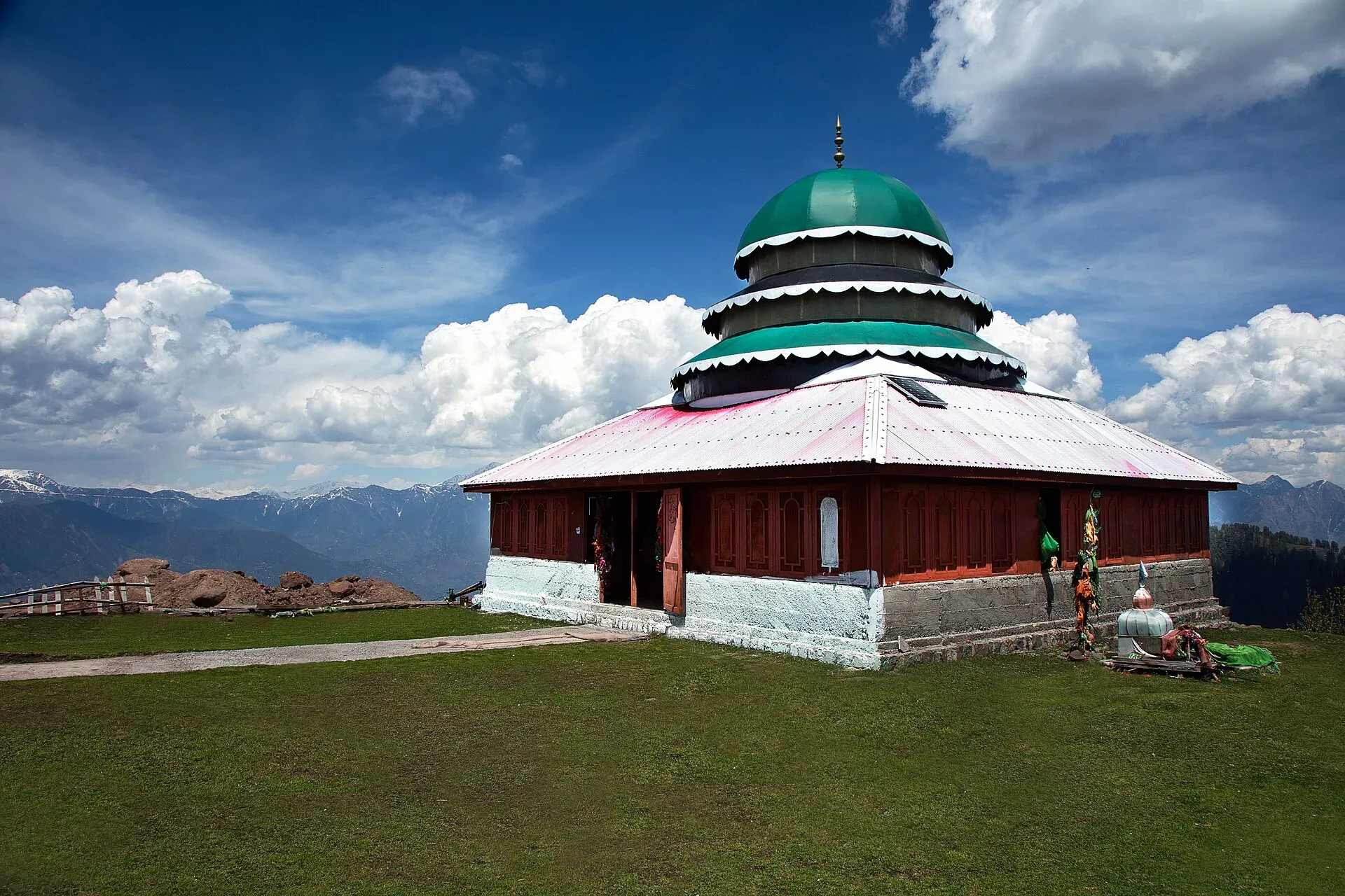
Photo: Furqanlw, with thanks · CC BY-SA 4.0 · via Wikimedia Commons · temporary stand-in photo

Pir Chinasi
A hilltop shrine and viewpoint at about 2,900 m above Muzaffarabad, Azad Kashmir, known for its sufi shrine, city views and snow. The road can become impassable in heavy snow.
Overview
Pir Chinasi (also spelled Peer Chinasi) is a hilltop shrine and viewpoint in Muzaffarabad district, Azad Jammu and Kashmir, east of the capital. Its height is given as about 2,900 m (9,500 ft) in one source and about 9,300 feet (about 2,835 m) in a Dawn report of 30 December 2022. The distance from Muzaffarabad is about 30 km in one source and about 34 km in Dawn.
Plan your visit
- Nearest town
- Muzaffarabad
- Getting there
From Muzaffarabad it is about 30 to 34 km, under an hour in good conditions by ordinary car, on the road via Sarran. OSRM models about 2 hours from Islamabad (checked 16 November 2026); allow more. More
Best months
Apr – Jun, Sep – Oct
- Pir Chinasi
- Related places nearby: Muzaffarabad, Azad Jammu and Kashmir, Neelum Valley
The shrine
The place takes its name from the shrine of Sayed Hussain Shah Bukhari, a saint. It is a mosque and Sufi mausoleum (dargah) with a dome, and it crowns the hill. Dress modestly and remove shoes at the entrance.
Views and snow
Visitors come for wide views over Muzaffarabad and the rural valleys around it. The hill is a favourite for first snow. Paragliding and snow-cross jeep rallies are also listed for the area.
Getting up the hill
Normal 4x2 vehicles can make the trip from Muzaffarabad in under an hour in good conditions, per Dawn. The road passes Sarran, where a state-run guesthouse stands at about 7,540 feet, about 5 km below Pir Chinasi. Visitors also use the name Sarran for the forest around the guesthouse. OSRM models about 2 hours from Islamabad to the area (checked 16 November 2026); allow more.
When to visit
Spring to autumn is easiest. Winter brings snow: in January 2017 about three to four feet fell on Sarran and the road from Niazpura was impassable, so visitors walked around 10 km (The Express Tribune, 17 January 2017).
Winter roads and safety
Dawn reported on 30 December 2022 that about 200 tourists, including women and children, were stranded after heavy snow made the road impossible to drive down. Rescue teams used 4x4 vehicles to take them first to the Sarran guesthouse and then to Muzaffarabad, and thirty drivers stayed the night at the guesthouse so they could bring the stranded vehicles down the next day. A 4x4 is the sensible choice in winter. Go only in daylight, carry chains, food and warm clothes, and turn back if snow has started. Ask Rescue 1122 or the district administration about the road before you set out.
For foreign visitors: the UK FCDO (checked 16 November 2026) advises against all but essential travel to Azad Jammu and Kashmir, and against all travel within 10 miles of the Line of Control. Muzaffarabad and Pir Chinasi are not named individually, but read the live page before you plan.
Where to stay and eat
Stay in Muzaffarabad, or at the government rest house at Sarran if it is open to the public; confirm availability locally. Take food and water up the hill. See Azad Kashmir and the Neelum Valley for what else is in the region.
Good to know
Dress warmly even in summer. Entry and parking charges are not confirmed; current fees will be added soon.
Highlights
- Sufi shrine of Sayed Hussain Shah Bukhari
- Views over Muzaffarabad
- First-snow outings
- Paragliding and snow jeep rallies (Wikipedia)
Getting there
From Muzaffarabad it is about 30 to 34 km, under an hour in good conditions by ordinary car, on the road via Sarran. OSRM models about 2 hours from Islamabad (checked 16 November 2026); allow more. In heavy snow the road can be closed.
Stay, eat and essentials near Pir Chinasi
Within 8 km of Pir Chinasi, nearest first.
Places to stay
- Lavish Hotel & Restaurant Neelam Road PatikkaMap of Lavish Hotel & Restaurant Neelam Road Patikka in Google Maps
- SpotLight Stay&DineCall SpotLight Stay&DineMap of SpotLight Stay&Dine in Google Maps
- RED FORT VIEW GUEST HOUSECall RED FORT VIEW GUEST HOUSEMap of RED FORT VIEW GUEST HOUSE in Google Maps
- Peerchanasi Guest HouseCall Peerchanasi Guest HouseMap of Peerchanasi Guest House in Google Maps
- Neelum View Hotel,نیلم ویو ہوٹل مظفرآبادCall Neelum View Hotel,نیلم ویو ہوٹل مظفرآبادMap of Neelum View Hotel,نیلم ویو ہوٹل مظفرآباد in Google Maps
Places to eat
- Tourist Lodge Saran, PirchanasiCall Tourist Lodge Saran, PirchanasiMap of Tourist Lodge Saran, Pirchanasi in Google Maps
- Kulcha ShopCall Kulcha ShopMap of Kulcha Shop in Google Maps
- Saver foodMap of Saver food in Google Maps
- Peer chanasi marketMap of Peer chanasi market in Google Maps
- Neelum View RestaurantCall Neelum View RestaurantMap of Neelum View Restaurant in Google Maps
Essential services fuel stations, mechanics, ATMs, banks and hospitals and clinics
Fuel
- Chellah Petrol PumpMap of Chellah Petrol Pump in Google Maps
- Otto petrol pumpMap of Otto petrol pump in Google Maps
- Petrol PumpMap of Petrol Pump in Google Maps
Mechanics and tyre shops
- Saad & Jawad Auto Workshop MuzaffarabadCall Saad & Jawad Auto Workshop MuzaffarabadMap of Saad & Jawad Auto Workshop Muzaffarabad in Google Maps
- Malik jee autos&work shopCall Malik jee autos&work shopMap of Malik jee autos&work shop in Google Maps
- Lala AutosCall Lala AutosMap of Lala Autos in Google Maps
- Chaudhry Tyre WorkshopMap of Chaudhry Tyre Workshop in Google Maps
- SHAYAN AUTOS Genuine Bike Parts Sale and ServiceCall SHAYAN AUTOS Genuine Bike Parts Sale and ServiceMap of SHAYAN AUTOS Genuine Bike Parts Sale and Service in Google Maps
- Alkaram Tyre TradersCall Alkaram Tyre TradersMap of Alkaram Tyre Traders in Google Maps
ATMs
Banks and money exchange
- Dollar East MuzaffarabadCall Dollar East MuzaffarabadMap of Dollar East Muzaffarabad in Google Maps
- Meezan Bank - Madina Market BranchCall Meezan Bank - Madina Market BranchMap of Meezan Bank - Madina Market Branch in Google Maps
- Allied Bank Limited Civil Sectt Branch Muzaffarabad 0032Call Allied Bank Limited Civil Sectt Branch Muzaffarabad 0032Map of Allied Bank Limited Civil Sectt Branch Muzaffarabad 0032 in Google Maps
Hospitals and clinics
- Hafsa ClinicMap of Hafsa Clinic in Google Maps
- PIMA ALHAJRI HospitalCall PIMA ALHAJRI HospitalMap of PIMA ALHAJRI Hospital in Google Maps
- Muzaffarabad General HospitalCall Muzaffarabad General HospitalMap of Muzaffarabad General Hospital in Google Maps
- Eman Cardiac and Family Clinic (Dr. Waqar Haider)Call Eman Cardiac and Family Clinic (Dr. Waqar Haider)Map of Eman Cardiac and Family Clinic (Dr. Waqar Haider) in Google Maps
- Jinnah Dental HospitalMap of Jinnah Dental Hospital in Google Maps
- Dr.Khalid Mahmood Orthopaedic SurgeonCall Dr.Khalid Mahmood Orthopaedic SurgeonMap of Dr.Khalid Mahmood Orthopaedic Surgeon in Google Maps
Listings come from Google Maps data and are unverified: phone numbers, opening months and prices may have changed. Report a problem · Own one of these? Claim it
Tips
- In winter use a 4x4 and go early; people have been stranded.
- Check road status with Rescue 1122 or local officials before leaving.
- Dress modestly at the shrine.
- Read the FCDO page for Azad Kashmir before you plan.
Photos we still need: the Sarran forest and the road in winter snow; the view over Muzaffarabad from the hilltop. Send us yours
Sources and last checked
Last checked Confidence medium5 sources4 still to check
- Last checked
- Method
- Desk research from published sources
- Confidence
- medium
- Checked by
- trek.pk research team
Researched from published sources; not yet checked on the ground by our team. Spot something out of date? Report a mistake.
Sources
- Pir Chinasi (Wikipedia) · Wikipedia · checked
- 200 tourists trapped in heavy AJK snowfall evacuated (30 December 2022) · Dawn · checked
- Winter attraction: snow draws hundreds to Pir Chinasi (17 January 2017) · The Express Tribune · checked
- Pakistan travel advice (updated 27 October 2026) · UK Foreign, Commonwealth & Development Office · checked
- OSRM driving routes (distances and modelled times) · OSRM / OpenStreetMap · checked
Still to be checked on the ground (4)
- Altitude: Wikipedia 2,900 m (9,500 ft); Dawn 9,300 ft (about 2,835 m); no survey figure
- Distance from Muzaffarabad: Wikipedia about 30 km; Dawn about 34 km
- Whether the Sarran rest house is open to visitors (Dawn Dec 2022: a state-run guesthouse at 7,540 ft, 5 km below Pir Chinasi, used to shelter evacuated tourists; booking rules unknown)
- Whether any part of the route falls within the FCDO Line of Control zone
Nearby and related

Muzaffarabad
The capital of Azad Jammu and Kashmir, at 737 m where the Neelum and Jhelum rivers meet. It is the gateway to the Neelum Valley and a rebuilt city after the 2005 earthquake.

Azad Jammu and Kashmir
A green, hilly region in the Himalayan foothills: Muzaffarabad, the Neelum and Leepa valleys, lakes and waterfalls. Visit with local advice on permission and the Line of Control.

Neelum Valley
A long, forested river valley in Azad Kashmir running north-east from Muzaffarabad to Sharda, Kel and Arang Kel. It runs close to the Line of Control, so check access before you go.