

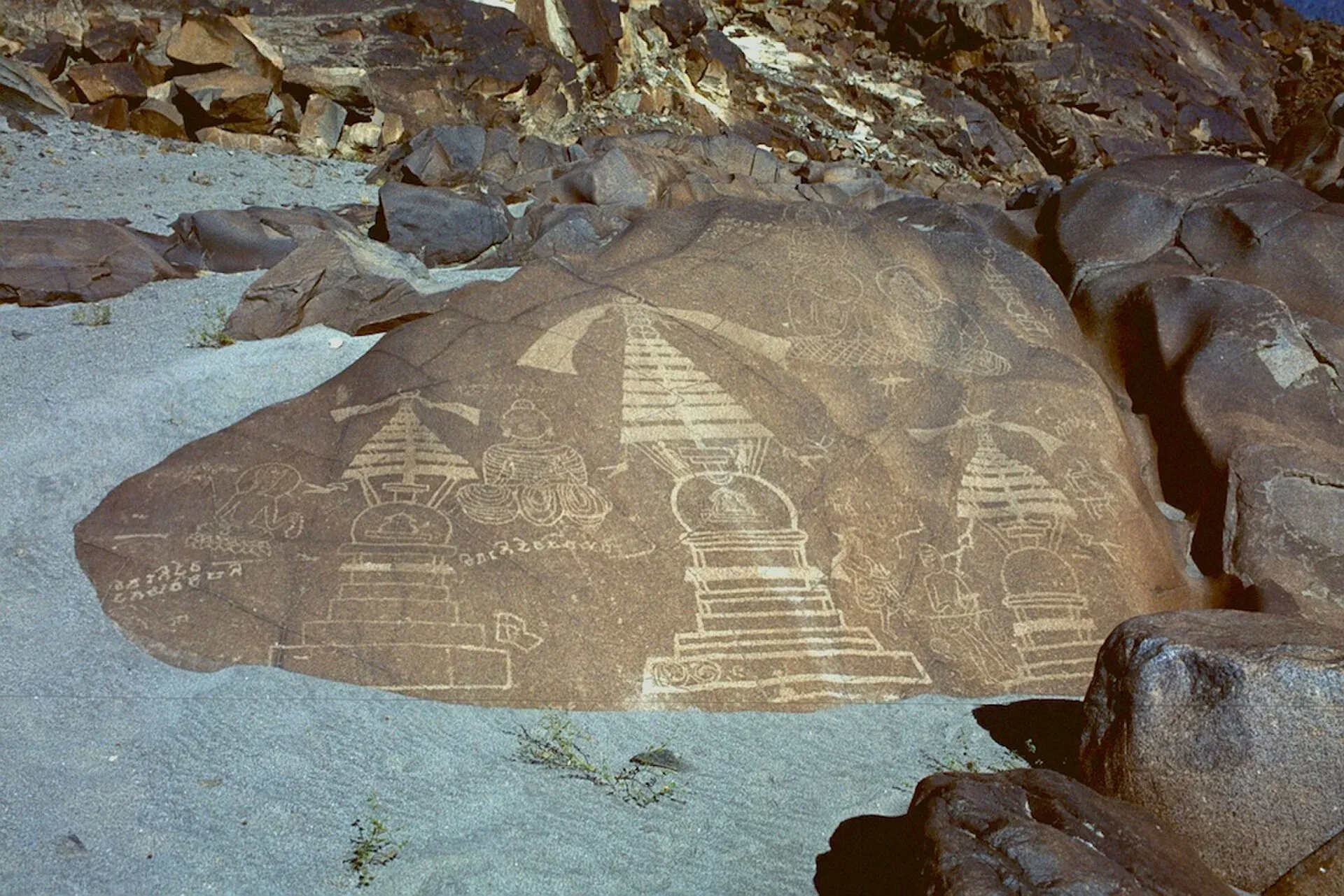
Photo: B.Degel, with thanks · Public domain (CC0) · via Wikimedia Commons · temporary stand-in photo

Shatial Rock Carvings
A site beside the Indus on the Karakoram Highway with more than 1,000 inscriptions, many by Sogdian merchants of the 3rd to 7th centuries, plus Buddhist carvings.
Overview
Shatial is a village and bridge on the Karakoram Highway about 60 km west of Chilas, on the Indus River. It was a junction of routes linking the Swat valley, Gilgit, Chilas and Chitral. Travellers cut their names and prayers into the rocks here, and the rocks around the Shatial bridge hold more than 1,000 inscriptions and about 700 petroglyphs.
Plan your visit
- Nearest town
- Chilas
- Getting there
Shatial is on the Karakoram Highway, about 60 km west of Chilas (Wikipedia), beside the Indus bridge. OSRM models about 73 km and 53 minutes by road, optimistic. More
Best months
Apr – Jun, Sep – Oct
The place and the old routes
Shatial today is mostly shops, rest places and sarais (caravanserais, old roadside inns) beside the bridge. In the past it was a junction where traders, Buddhist missionaries, Sogdian merchants and pilgrims all passed, and many left marks on the rock. That is why the carvings are in several languages and scripts. Nearby on the same highway, Chilas has its own carvings: see Chilas rock carvings.
History
Merchants from Sogdiana (in today's Uzbekistan) left more than 550 inscriptions in the Sogdian language, dated roughly from the 3rd to the 7th centuries CE. There are also nine in Bactrian and two each in Middle Persian and Parthian. Most inscriptions are short: a traveller's name, sometimes with family members. Some carry a date, but it is not clear whether it marks the arrival or the year of the journey, and some names refer to Zoroastrian and other deities. The longest is by Nanaivandak, a merchant from Samarkand, who prayed for a safe journey and a reunion with his brother. Most are thought to belong to the Sasanian period (224 to 651 CE). Brahmi and Kharosthi inscriptions show the site was also a Buddhist shrine, and a large triptych showing a stupa and the Sibi Jataka was venerated by travellers; it is dated to about 300 to 350 CE.
What to see and do
- Rock faces beside the bridge: inscriptions in several scripts.
- The Buddhist triptych: a stupa with the Sibi Jataka story.
- The setting: the Indus gorge.
Allow time to ask locally which rocks are now accessible, as the area is changing.
When to visit
Spring and autumn. Check road conditions on the Karakoram Highway.
Where to stay and eat
Services in Shatial are very limited. Chilas has hotels and restaurants.
Good to know
- UNESCO: not on the World Heritage List or the tentative list.
- Etiquette: do not touch or mark the carvings.
- Access and safety: For foreign visitors: the UK FCDO (updated 27 October 2026, checked 17 November 2026) advises against all travel on the Karakoram Highway between Mansehra and Chilas. Shatial is on the highway west of Chilas, so it lies on or beside that stretch. Read the live page and seek local advice before visiting.
- Threat: dams on the Indus are reported to threaten carvings along this part of the river.
Highlights
- More than 1,000 inscriptions and about 700 petroglyphs
- Sogdian merchant names from the 3rd to 7th centuries
- Buddhist stupa and Sibi Jataka triptych
- Junction of routes to Swat, Chitral and Gilgit
Getting there
Shatial is on the Karakoram Highway, about 60 km west of Chilas (Wikipedia), beside the Indus bridge. OSRM models about 73 km and 53 minutes by road, optimistic. Use a private vehicle from Chilas, and check road conditions first.
Tips
- Combine with a stop at Chilas.
- Ask locally for current access.
- Do not touch the rock surface.
- Carry water and cash, there are few services.
Photos we still need: carved rock faces at Shatial bridge (current photo is a nearby example). Send us yours
Sources and last checked
Last checked Confidence low4 sources3 still to check
- Last checked
- Method
- Desk research from published sources
- Confidence
- low
- Checked by
- trek.pk research team
Researched from published sources; not yet checked on the ground by our team. Spot something out of date? Report a mistake.
Sources
- Shatial (Wikipedia) · Wikipedia · checked
- Chilas (Wikipedia) · Wikipedia · checked
- Pakistan travel advice: warnings and insurance (updated 27 October 2026) · UK Foreign, Commonwealth & Development Office · checked
- OSRM driving route service: Shatial to Chilas, measured 17 November 2026 (optimistic, without stops) · OpenStreetMap / OSRM · checked
Still to be checked on the ground (3)
- Which carvings remain above water level and accessible (Wikipedia is silent)
- Whether the Wikipedia count of 1,000 inscriptions still applies after dam works
- Chinese pilgrim accounts of the site (not in sources checked)
Nearby and related

Gilgit
Gateway to Gilgit-Baltistan on the Karakoram Highway: a busy mountain town with the Kargah Buddha and the base for Hunza, Naltar and Skardu.

Gilgit-Baltistan
Pakistan's far north: three great ranges meet here, with K2, Nanga Parbat, giant glaciers, the Karakoram Highway and the valleys of Hunza, Skardu and Gilgit.