

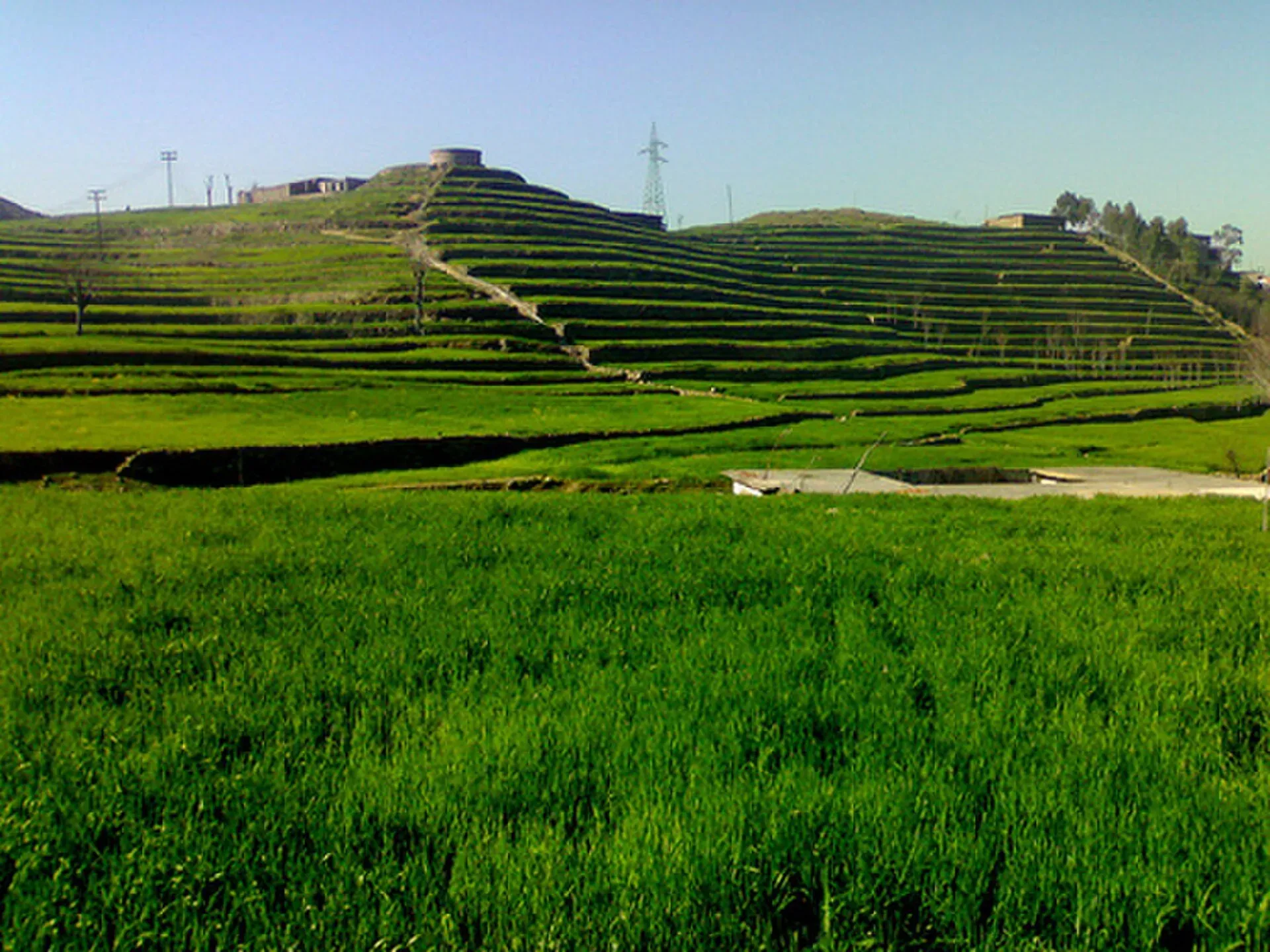
Photo: Kalival, with thanks · CC BY-SA 3.0 · via Wikimedia Commons · temporary stand-in photo

Timergara
District capital of Lower Dir on the Panjkora River, at about 823 m. For foreign visitors: the UK FCDO advises against all travel to Lower Dir, so this is for information only.
Overview
Timergara is the district headquarters of Lower Dir District in Khyber Pakhtunkhwa, on the east bank of the Panjkora River at about 823 m. Wikipedia also calls it the temporary headquarters of the newly created Central Dir District. It is the town through which Bajaur, Upper Dir and Chitral connect to the rest of the province. At the 2023 census it had 47,860 people.
This page is for information. The UK FCDO advises against all travel to Lower Dir for foreign visitors (see Good to know).
The setting
Most of the town lies along the riverbank. The Panjkora separates the main city from Balambat, the tehsil (sub-district) on the west bank. The river is about 220 km long. It rises in the Hindu Kush at about 3,600 m, flows south through Upper Dir and Lower Dir, and meets the Swat River at Chakdara, about 38 km down the valley (see Chakdara Fort).
Summers are hot and dry. Winters are cold and wet, and the coldest months are December and January, with a mean January minimum of about -8 C. Rain falls mainly in July, August, December, January and February. The Panjkora rises sharply in the monsoon from June to September, and heavy floods hit the valley in 2010.
History and archaeology
Wikipedia calls the town the site of excavated graves of Indo-Aryan people dated to about 1500 to 600 BC. At Balambat, across the river, excavations are reported to have found houses from about 500 BC and fire altars, which Wikipedia reads as signs of early Vedic religion; its Balambat page also mentions Zoroastrian remains. The early political history of the area was shaped by the Hindu Shahis. The sources give no information on access to any excavated site or on what is protected.
People and daily life
The population is mainly Pashtun, chiefly Yousafzai and Utmankhel. Wikipedia describes traditional dress: the chadar in winter and the white Diroji cap in summer. Eid al-Fitr and Eid al-Adha are the main festivals. The local economy has little industry and depends largely on money sent home by workers in the Middle East.
Food known in the area includes chapli kebab, seekh kebab and tikka made with beef or fish. Staples in homes include lobya (beans), saag (cooked greens) and juwar doday (maize bread). Young people often walk in nearby hills such as Kumrat and the Lowari Pass; see Kumrat Valley and Lowari Pass.
What to see and do
There are no known visitor-ready sights in the town. The archaeology matters mainly to specialists. Dir town is about 71 km north; see Dir. In the upper valley the Panjkora holds snowtrout, and brown and rainbow trout, which the British introduced in 1928 (Wikipedia).
When to visit
Summers are hot and dry and winters cold and wet, so spring and autumn are the milder months. Check the river and the weather in the monsoon.
Where to stay and eat
No verified information on hotels is available. Local restaurants serve grilled meat. The main health facility is District Headquarters Hospital Timergara, which Wikipedia says Médecins Sans Frontières supports with maternity, accident and emergency, and newborn units.
Good to know
- Safety. For foreign visitors: the UK FCDO Pakistan page (updated 27 October 2026, checked 17 November 2026) advises against all travel to Lower Dir and Upper Dir. It also notes emergency measures in Khyber Pakhtunkhwa and Governor's Rule since 11 October 2026. This page does not recommend planning a trip to Timergara.
- Peshawar's international airport is the nearest, about 172 km by road.
Highlights
- East bank of the Panjkora River
- About 823 m above sea level
- Site of ancient graves dated 1500-600 BC
- Road link to Dir, Bajaur and Chitral
Getting there
Road: Peshawar is about 172 km and roughly 2 hours 10 minutes (OSRM, checked 16 November 2026), but Peshawar and Lower Dir are both on the FCDO advise-against list. Dir town is about 71 km north. Air: Peshawar's international airport is the nearest. Rail: none.
Hotels, food, fuel and services in Timergara
Places to stay
- Apple Hotel & RestaurantCall Apple Hotel & RestaurantMap of Apple Hotel & Restaurant in Google Maps
- Shelton Hotel and RestaurantCall Shelton Hotel and RestaurantMap of Shelton Hotel and Restaurant in Google Maps
- Hayat Hotel & RestaurantCall Hayat Hotel & RestaurantMap of Hayat Hotel & Restaurant in Google Maps
- Qazi PlazaMap of Qazi Plaza in Google Maps
- Akhun Khail PlazaCall Akhun Khail PlazaMap of Akhun Khail Plaza in Google Maps
Places to eat
- Royal Dir Restaurant (best family Restaurant)Call Royal Dir Restaurant (best family Restaurant)Map of Royal Dir Restaurant (best family Restaurant) in Google Maps
- Food bank TimergaraCall Food bank TimergaraMap of Food bank Timergara in Google Maps
- Halwiyat Zamzam BakersCall Halwiyat Zamzam BakersMap of Halwiyat Zamzam Bakers in Google Maps
- Insaf Bar BQCall Insaf Bar BQMap of Insaf Bar BQ in Google Maps
- Rahat Bakers (Since 1950)Call Rahat Bakers (Since 1950)Map of Rahat Bakers (Since 1950) in Google Maps
Essential services fuel stations, mechanics, ATMs, pharmacies and hospitals and clinics
Fuel
- ABC Petroleum StationCall ABC Petroleum StationMap of ABC Petroleum Station in Google Maps
- Diya Filling StationMap of Diya Filling Station in Google Maps
- Khurasan Petroleum Service Lower DirCall Khurasan Petroleum Service Lower DirMap of Khurasan Petroleum Service Lower Dir in Google Maps
- Taj filling stationCall Taj filling stationMap of Taj filling station in Google Maps
- Ali & Brothers Filling stationCall Ali & Brothers Filling stationMap of Ali & Brothers Filling station in Google Maps
- Gull Filling stationCall Gull Filling stationMap of Gull Filling station in Google Maps
Mechanics and tyre shops
- Sharjah TyresCall Sharjah TyresMap of Sharjah Tyres in Google Maps
- China tyre centerCall China tyre centerMap of China tyre center in Google Maps
ATMs
- Allied BankCall Allied BankMap of Allied Bank in Google Maps
- ATM Al Falah BankMap of ATM Al Falah Bank in Google Maps
Pharmacies
- Muller and Phipps Timergara Dir lower near saddo WAPDA grid stationCall Muller and Phipps Timergara Dir lower near saddo WAPDA grid stationMap of Muller and Phipps Timergara Dir lower near saddo WAPDA grid station in Google Maps
- Tajak Pharmacy And CosmeticsCall Tajak Pharmacy And CosmeticsMap of Tajak Pharmacy And Cosmetics in Google Maps
- Al Azhar College Of Science And TechnologyCall Al Azhar College Of Science And TechnologyMap of Al Azhar College Of Science And Technology in Google Maps
- Shifa MedicoseCall Shifa MedicoseMap of Shifa Medicose in Google Maps
- Allied Pharmacy Wholesale Chemist & DruggistCall Allied Pharmacy Wholesale Chemist & DruggistMap of Allied Pharmacy Wholesale Chemist & Druggist in Google Maps
- Doctor's PharmacyCall Doctor's PharmacyMap of Doctor's Pharmacy in Google Maps
Hospitals and clinics
- Dr javaid iqbal and associates. Eye specialistCall Dr javaid iqbal and associates. Eye specialistMap of Dr javaid iqbal and associates. Eye specialist in Google Maps
- Azhar Medical CentreCall Azhar Medical CentreMap of Azhar Medical Centre in Google Maps
- Musarat Shaukat Medical Complex TimergaraCall Musarat Shaukat Medical Complex TimergaraMap of Musarat Shaukat Medical Complex Timergara in Google Maps
- الخدمت ہسپتالMap of الخدمت ہسپتال in Google Maps
- Allied Hospital & Research Center TimeregaraCall Allied Hospital & Research Center TimeregaraMap of Allied Hospital & Research Center Timeregara in Google Maps
- Badshah Medical centreCall Badshah Medical centreMap of Badshah Medical centre in Google Maps
Listings come from Google Maps data and are unverified: phone numbers, opening months and prices may have changed. Report a problem · Own one of these? Claim it
Tips
- Do not plan a trip without reading the FCDO page first.
- Winters are cold: January night temperatures can fall to about -8 C.
- If you go, avoid travel after dark.
- Peshawar is the nearest airport, about 172 km by road.
Photos we still need: the Panjkora River at Timergara or Balambat; a bazaar or street scene in Timergara. Send us yours
Sources and last checked
Last checked Confidence low6 sources4 still to check
- Last checked
- Method
- Desk research from published sources
- Confidence
- low
- Checked by
- trek.pk research team
Researched from published sources; not yet checked on the ground by our team. Spot something out of date? Report a mistake.
Sources
- Timergara · Wikipedia · checked
- OSRM driving routes (road distances and times, optimistic) · Project OSRM · checked
- Pakistan travel advice: warnings and insurance · UK FCDO (GOV.UK) · checked
- Panjkora River · Wikipedia · checked
- Balambat · Wikipedia · checked
- Chakdara · Wikipedia · checked
Still to be checked on the ground (4)
- Current security and access
- Archaeological site access (Wikipedia: Balambat is on the west bank of the Panjkora, across from the city; nothing on visiting)
- Hotels and services (Wikipedia names only District Headquarters Hospital Timergara)
- Population: Wikipedia's infobox also lists a 2026 figure that conflicts with the 2023 census figure used here
Nearby and related

Dir
The old capital of the princely state of Dir, on the Dir River at the foot of the Lowari Pass, with a palace on the hill above. A stop on the road between Peshawar and Chitral.

Peshawar
Khyber Pakhtunkhwa's capital and one of South Asia's oldest living cities: the Gandhara museum, Qissa Khwani Bazaar, mosques and a strong food culture.