

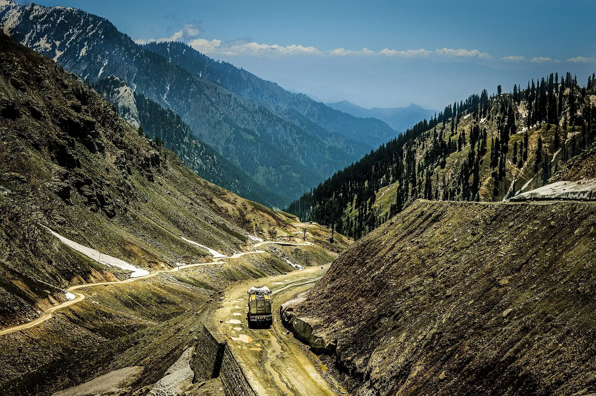
Photo: Msanamsaeed, with thanks · CC BY-SA 3.0 · via Wikimedia Commons · temporary stand-in photo

Lowari Pass
A 3,118 m road pass on the Hindu Raj between Upper Dir and Chitral. Snow shuts the old road for months each winter; the Lowari Tunnel, opened in July 2017, now carries the traffic.
Overview
Lowari Pass (also called Lowari Top) is the Hindu Raj crossing between Upper Dir and Chitral. Wikipedia gives its height as 3,118 m (10,230 ft), and the owner's trekking book gives the same figure. The Hindu Raj is a spur of the Hindu Kush. It is a road pass, not a trekking pass. For most of the year it is also the shortest way from Chitral to Peshawar; the other ways in are the long drive over Shandur to Gilgit, or the road down the Kunar river through Afghanistan.
Plan your visit
- Nearest town
- Dir (south side) or Chitral (north side)
- Getting there
From Peshawar the road goes north through Malakand and Dir to the south portal, then through the tunnel towards Chitral. More
Best months
Jun – Oct
- Lowari Pass
- Related places nearby: Dir, Chitral, Chitral Valley
The old road
Few people stop here. The old road climbed in tight bends to the top, with steep drops and avalanche slopes on both sides. Avalanches can strike without warning, and Wikipedia notes that several winter travellers have died on the pass, with bodies sometimes found only when the snow melts. Local history adds one more fact: the Mehtar of Chitral died in 1954 when his aircraft crashed at the pass.
People on both sides work the pass. Wikipedia says the Ashret (Palula-speaking) people on the Chitral side were appointed guardians of the pass by the Mehtar of Chitral, and that Khowar speakers on the Dir side often work as porters.
What to see and do
Today most traffic goes under the mountain. The Lowari Tunnel is two tunnels: 8.5 km and 1.9 km, about 10.4 km in total, per Wikipedia (Dawn in August 2026 calls it 10 km long, which agrees). It was started in September 1975, but work stopped about a year later for lack of money. Work resumed in 2005, stalled again in 2009 and picked up again in 2014. It opened in July 2017, at a reported cost of Rs 26.954 billion (about US$96 million). The National Highway Authority (NHA) runs it. Wikipedia describes it as a two-lane road tunnel. See Lowari Tunnel.
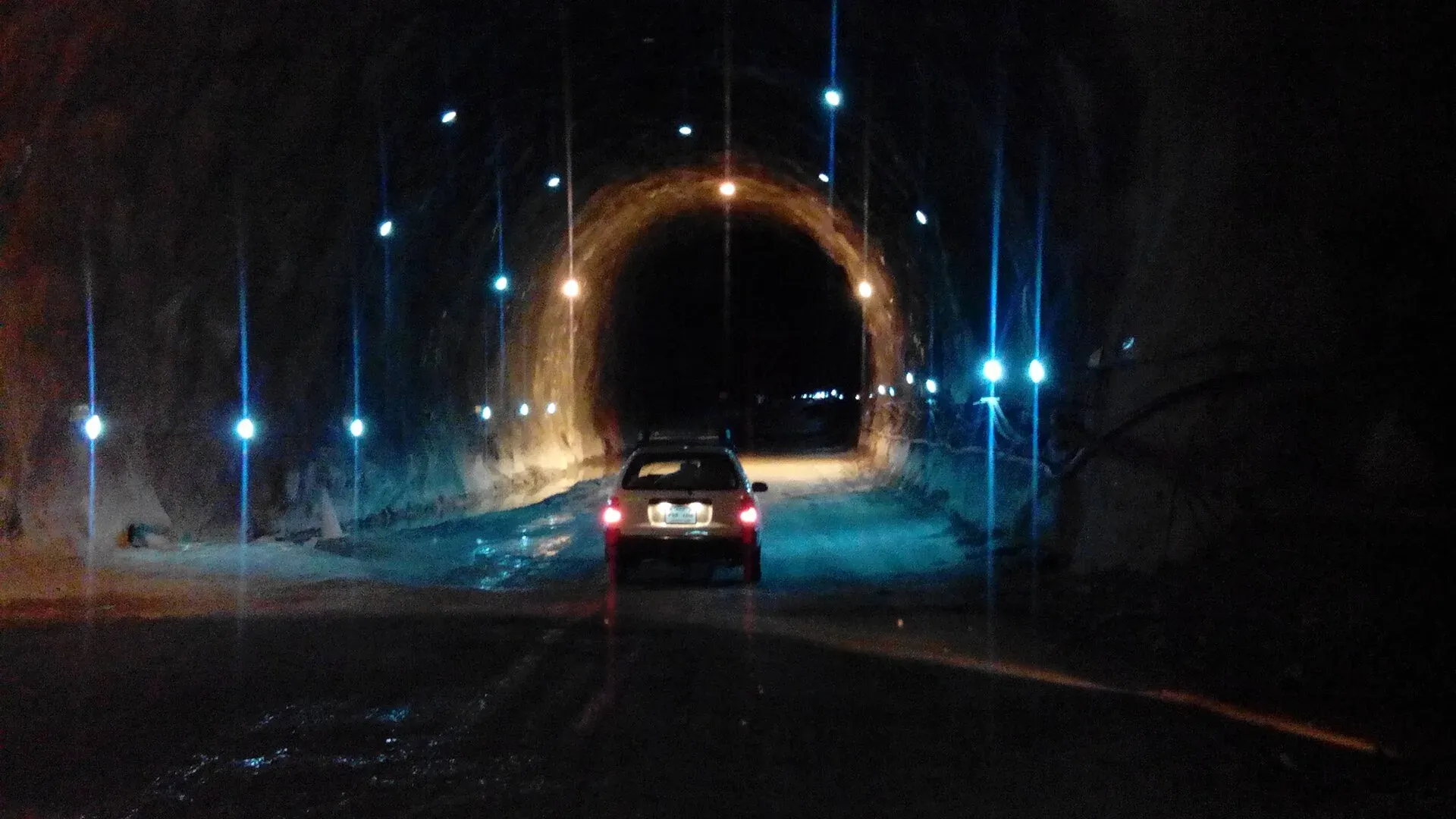
Photo: Ihsan Farid, with thanks · CC BY-SA 4.0 · via Wikimedia Commons · temporary stand-in photo

When to visit
The old pass road is closed by snow from about late November to late May (Wikipedia). The older trekking book gave 15 May to 15 November as the usual open dates, so treat dates as rough and weather-led. The tunnel, by contrast, is meant to stay open through winter, but heavy snow on the approaches still closes it for spells. Dawn reported on 3 August 2026 that the NHA had notified a plan to close the tunnel for 12 hours a day, in rotating three-hour blocks, and that residents objected. At that time the tunnel was open round the clock. We have not confirmed whether the plan was put into effect, so ask the NHA or local police before you rely on a time.
Where to stay and eat
There is nothing to stay in on the pass. Dir town (south) and Chitral (north) are the usual overnight stops, with small hotels and roadside tea shops in between.
Good to know
- Travel advice. For foreign visitors: the UK FCDO (updated 27 October 2026, checked 16 November 2026) advises against all travel to Upper Dir and Lower Dir, and against all travel on the N-45 up to the edge of Chitral city. It does not name the pass itself, but the road to it runs through those areas. Check the live page and local conditions first.
- Hazards. Avalanches, sudden weather and queues of trucks at the portals. Do not walk through the tunnel.
- Fees. No toll or charge is confirmed in the sources we read. Current fees, if any, will be added soon.
- Altitude. The top is high enough to feel it if you walk around; you will not notice it in a car.
Highlights
- 3,118 m Hindu Raj pass between Dir and Chitral
- Lowari Tunnel, about 10.4 km in two tunnels, opened July 2017
- Shortest road from Chitral to Peshawar
- Old road closed by snow for about six months
Getting there
From Peshawar the road goes north through Malakand and Dir to the south portal, then through the tunnel towards Chitral. The older trekking book quoted about 10 hours from Chitral to Peshawar in about 2002, so plan a long day. Public wagons and coaches run between Dir and Chitral. Check security advice before you go.
Tips
- Check tunnel hours with the NHA or local police before you set off
- Carry warm clothes in the car even in late spring
- Leave early: queues build at both portals
- Look at current security advice for Dir and the N-45 before planning
Photos we still need: old Lowari road bends (Dir side) in summer. Send us yours
Sources and last checked
Last checked Confidence medium6 sources2 still to check
- Last checked
- Method
- Desk research from published sources
- Confidence
- medium
- Checked by
- trek.pk research team
Researched from published sources; not yet checked on the ground by our team. Spot something out of date? Report a mistake.
Sources
- Lowari Pass (Wikipedia) · Wikipedia · checked
- Lowari Tunnel (Wikipedia) · Wikipedia · checked
- 12-hour daily closure plan for Lowari tunnel draws criticism (3 August 2026) · Dawn · checked
- Trekking in the Karakoram and Hindukush (road to Chitral) · Lonely Planet (owner book, ~2002) · checked
- Pakistan Tourism Guide 2021 · TDAP Pakistan · checked
- Pakistan travel advice: warnings and insurance (updated 27 October 2026) · UK FCDO · checked
Still to be checked on the ground (2)
- Whether the NHA 12-hour tunnel closure plan was implemented (Dawn, 3 Aug 2026: plan notified, tunnel still open round the clock; nothing later found)
- Current opening dates of the old pass road (Wikipedia: closed by snow about late Nov to late May; no official dates)
Nearby and related

Owir An
Tirich Mir Base Camp

Gokhshal An and Dooni An

Dir
The old capital of the princely state of Dir, on the Dir River at the foot of the Lowari Pass, with a palace on the hill above. A stop on the road between Peshawar and Chitral.

Chitral
The main town of Lower Chitral District, at about 1,500 m on the Chitral River, with a historic fort, a royal mosque and views of Tirich Mir. The base for the Kalash valleys.

Chitral Valley
The long Chitral River valley at the foot of the Hindu Kush, with Chitral town's fort and Shahi Mosque, the Lowari Tunnel route, Tirich Mir views and side valleys leading to Kalash and Shandur.

Shandur Pass
A high grassy pass of about 3,720 m between Ghizer in Gilgit-Baltistan and Upper Chitral. Home to the Shandur polo ground and a summer festival, reached by a rough road.

Chitral and Kalash
A 6-7 day road trip from Islamabad to Chitral through Dir and the Lowari Tunnel, with the Kalash valleys of Bumburet, Rumbur and Birir, Chitral Fort and Tirich Mir views.

Gilgit-Shandur-Chitral Summer Biker Route
A 3-4 day summer ride from Gilgit over Shandur Pass (about 3,720 m) to Chitral through the Ghizer and Yarkhun valleys. Rough track on the Chitral side; summer only.