

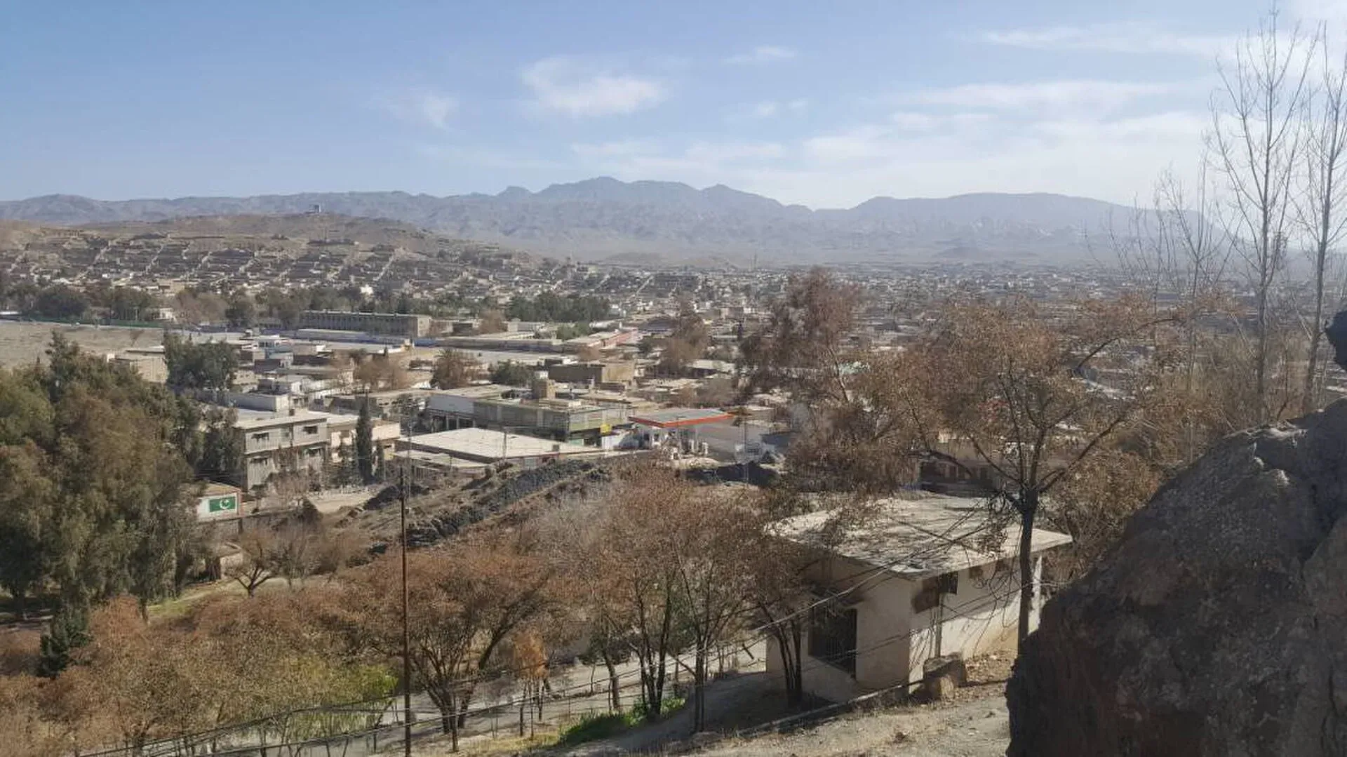
Photo: Hariskhan1212, with thanks · CC BY-SA 4.0 · via Wikimedia Commons · temporary stand-in photo

Zhob
District headquarters in the Zhob river valley, a Pashtun frontier town founded by the British as Fort Sandeman and renamed Zhob in 1976.
Overview
Zhob is the headquarters of Zhob District, on the Zhob River about 337 km from Quetta. Its name is Pashto and means roughly "oozing water". It stands at about 1,426 m, and the 2023 census counted 46,976 people, including Zhob Cantonment (CityPopulation.de). Most of the district's people are Pashtun, and Pashto is the first language of about 97.7% of them (Wikipedia). Roads out of the town are long and narrow in places, so it feels far from the main routes.
Plan your visit
- Getting there
Road: Quetta about 332 km (about 4 hours); Loralai about 214 km (about 2 hours 30 minutes) (OSRM, checked 16 November 2026). Rail and air: none we could verify. More
Best months
May – Sep
- Zhob
- Related place nearby: Sherani Chilgoza Forests
History of the valley
Wikipedia says the area lay within the sphere of Mongol raids in the early 13th century. After that the valley was little known to Europeans until the British Zhob Valley Expedition of 1884. In 1889 the British took control of the valley and the Gomal Pass, and in December 1889 they occupied the town, then called Apozai, and renamed it Fort Sandeman after Sir Robert Sandeman. It became a garrison and the headquarters of the Zhob Levy Corps. The colonial political agent lived in "the Castle", north of the town and about 150 feet above the plain. In 1894 a water supply from the Saliaza valley was built to irrigate fruit trees and supply drinking water. The government renamed the town Zhob in 1976.
The Zhob Valley Railway
Zhob once had a railway. The Zhob Valley Railway was a 762 mm narrow-gauge line of about 298 km from Bostan Junction, north of Quetta, to Zhob. The first section, Bostan to Muslimbagh, opened in 1916 to carry chromite from the mines there, and the line reached Zhob around 1930. Kan Mehtarzai station was described as one of the highest narrow-gauge stations in the world. Service ended in 1986 or 1991 (Wikipedia gives both), and the line was dismantled. Track and rolling stock remain at Bostan Junction. A proposal to rebuild it as a broad-gauge link under the China-Pakistan Economic Corridor has not been carried out.
What to see and do
The valley has orchards and streams. Wikipedia names Silyaza (also spelt Saliaza), a stream with apple and grape orchards and maize and wheat fields, as a popular picnic spot, home to Mandokhail Pashtuns. It names Paryan-o-Ghundi, an area of olive forests whose list of sites includes Oboo Shakh and Tarjana Narai, and describes it as a destroyed archaeological site. It also lists Darga Mandezai, a village near the river with cricket grounds. Shinghar, a former summer resort about 48 km away in the Sulaiman range at about 2,600 m, was a colonial summer sanitarium (Wikipedia, citing the colonial gazetteer). Access and facilities at all of these are unverified, so ask locally. For the high pine forests of the neighbouring district, see Sherani Chilgoza Forests.
Climate
Zhob has a semi-arid climate. Annual precipitation is about 274 mm, falling on about 35 days, and the monsoon rain is erratic. The record high is 42.8 °C and the record low is minus 8.9 °C. The town gets about 3,300 hours of sunshine a year (Wikipedia).
When to visit
Late spring to autumn is the most comfortable time. Winters are cold.
Where to stay and eat
Services are those of a district headquarters: expect a government hospital, pharmacies, fuel stations, banks or ATMs and basic guesthouses or hotels in the main bazaar. There is no verified list of facilities or businesses, so confirm before you rely on any of them, and carry cash and fuel.
Getting there
Zhob is on the N-50. Wikipedia gives the road distance to Quetta as 365 km and to Dera Ismail Khan as 225 km, and says the Dera Ismail Khan road is mostly a track that crosses streams. OSRM puts Quetta at about 332 km (about 4 hours) and Loralai at about 214 km (about 2 hours 30 minutes) (checked 16 November 2026, optimistic). Buses and vans run from Quetta. There is no rail service now, and no airport service has been verified.
Good to know
Ask the district administration or local police about current conditions before you go. Safety: For foreign visitors: the UK FCDO advises against all travel to Balochistan, including Quetta and Ziarat (page updated 27 October 2026; checked 16 November 2026). We do not recommend visiting as a tourist. If you live here or have essential business, follow current guidance from the provincial authorities and your embassy, expect checkpoints, and do not rely on this page for planning. The FCDO also notes an ongoing risk of terrorism across Pakistan.
Highlights
- Former Fort Sandeman
- Zhob river valley orchards
- Pashtun frontier town far from Quetta
Hotels, food, fuel and services in Zhob
Places to stay
- F.C Mess Zhob ایف سی میس ژوبCall F.C Mess Zhob ایف سی میس ژوبMap of F.C Mess Zhob ایف سی میس ژوب in Google Maps
Places to eat
- Islamabad BakersCall Islamabad BakersMap of Islamabad Bakers in Google Maps
Essential services fuel stations, ATMs, pharmacies and hospitals and clinics
Fuel
- PSO Petrol PumpMap of PSO Petrol Pump in Google Maps
- Al Quraish petroleum service psoCall Al Quraish petroleum service psoMap of Al Quraish petroleum service pso in Google Maps
- CaltexMap of Caltex in Google Maps
- Pakistan State Oil (PSO)Call Pakistan State Oil (PSO)Map of Pakistan State Oil (PSO) in Google Maps
- Awami Gas Agency new Abadi BranchCall Awami Gas Agency new Abadi BranchMap of Awami Gas Agency new Abadi Branch in Google Maps
- Syedabad Petroleum ServicesMap of Syedabad Petroleum Services in Google Maps
ATMs
- Habib Bank Ltd And ATMCall Habib Bank Ltd And ATMMap of Habib Bank Ltd And ATM in Google Maps
- Bank Islami Zhob And ATMMap of Bank Islami Zhob And ATM in Google Maps
Pharmacies
- Faisal Traders & Medical StoreCall Faisal Traders & Medical StoreMap of Faisal Traders & Medical Store in Google Maps
- BALOCHISTAN MEDICAL STOREMap of BALOCHISTAN MEDICAL STORE in Google Maps
Hospitals and clinics
- CMH ZhobCall CMH ZhobMap of CMH Zhob in Google Maps
- DHQ Civil HospitalMap of DHQ Civil Hospital in Google Maps
- Quetta Lab ZhobCall Quetta Lab ZhobMap of Quetta Lab Zhob in Google Maps
- Iltija mumta hospitalCall Iltija mumta hospitalMap of Iltija mumta hospital in Google Maps
- Amin Medical ComplexCall Amin Medical ComplexMap of Amin Medical Complex in Google Maps
- Al Zubair hospital 🏥Call Al Zubair hospital 🏥Map of Al Zubair hospital 🏥 in Google Maps
Listings come from Google Maps data and are unverified: phone numbers, opening months and prices may have changed. Report a problem · Own one of these? Claim it
Tips
- Allow a full day from Quetta.
- Take care on narrow mountain roads.
- Check security advice before travel.
Photos we still need: Zhob town, the river and the Silyaza orchards. Send us yours
Sources and last checked
Last checked Confidence medium6 sources5 still to check
- Last checked
- Method
- Desk research from published sources
- Confidence
- medium
- Checked by
- trek.pk research team
Researched from published sources; not yet checked on the ground by our team. Spot something out of date? Report a mistake.
Sources
- Zhob · Wikipedia · checked
- Balochistan: major cities, municipalities and towns, 2023 census (from Pakistan Bureau of Statistics) · CityPopulation.de · checked
- OSRM driving routes (road distances and times) · Project OSRM / OpenStreetMap · checked
- Pakistan travel advice (updated 27 October 2026) · UK Foreign, Commonwealth & Development Office · checked
- Zhob Valley Railway · Wikipedia · checked
- Zhob District · Wikipedia · checked
Still to be checked on the ground (5)
- Present state of the hill station (Shinghar) and picnic spots (Wikipedia describes Shinghar as a former summer resort and Silyaza as a popular picnic stream; no current source)
- Services and lodging (Wikipedia names no hotels; no source)
- Road security (no source beyond FCDO advising against all travel to Balochistan)
- Road distance to Quetta: Wikipedia gives 337 km (lead) and 365 km (transport); OSRM gives about 332 km
- Zhob Valley Railway closure year: 1986 or 1991 (Wikipedia)
Nearby and related

Balochistan
Pakistan's largest and least populated province: Quetta's high valleys, Ziarat's juniper forest, the Makran coast, Hingol and Gwadar. Security and permission rules need checking first.

Quetta
Balochistan's high-valley capital, the Fruit Garden of Pakistan: bazaars, sajji, orchard valleys and the base for Hanna Lake and Ziarat.

Loralai
A Pashtun hill town at about 1,400 m in north-eastern Balochistan, headquarters of Loralai District and Division, with a 16th-century Mughal fort.
Sherani Chilgoza Forests
High forests of chilgoza (pine-nut) pine on the Sulaiman range in Sherani district, Balochistan, around the Takht-i-Sulaiman ridge. Not set up for tourism; the UK FCDO advises against all travel to Balochistan.