

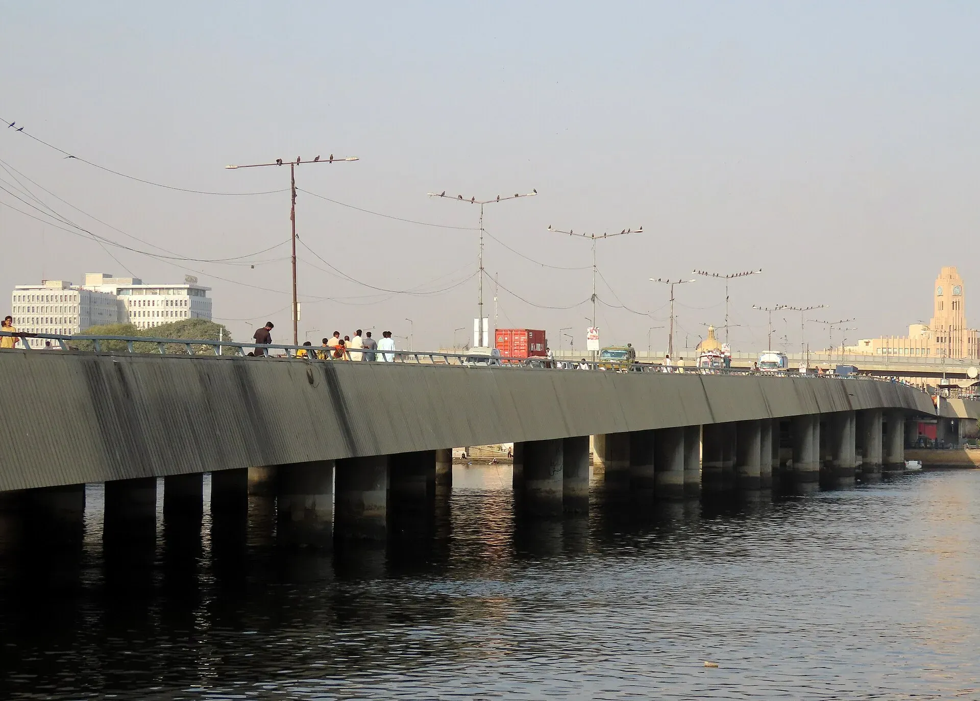
Photo: King Eliot, with thanks · CC BY-SA 4.0 · via Wikimedia Commons · temporary stand-in photo

M-10 Karachi Northern Bypass
The 57 km M-10 Karachi Northern Bypass connects the M-9 to Karachi Port at Keamari, avoiding the city centre. Opened in 2007, it has nine exits and two lanes.
The journey
Last verified: 16 November 2026.
Overview
The M-10, also called the Karachi Northern Bypass, is a 57 km road in Karachi. Wikipedia says President Pervez Musharraf inaugurated it on 6 August 2007, and that it was the second motorway in Pakistan after the M-2. It starts at the M-9 through a trumpet interchange, runs north, turns west and then south to join the KPT Flyover at Karachi Port. The NHA maintains it. Wikipedia describes it as two lanes. Dawn (4 September 2025) reported that the 57 km bypass was to be upgraded and extended into a new M-10 towards the M-6 at Jamshoro, with Nespak still doing the feasibility study and no start date. Other reports cite widening to eight lanes. None of this is built.
Exits
Wikipedia lists: M-9 interchange, Northern Bypass link road, Surjani Town, Hub Dam Road, Shara-e-Qaddafi, Orangi Link Road, Ittehad, Umer Goth flyover (N-25), and Keamari (KPT flyover). No kilometre markers are given.
Using it
The bypass lets trucks and long-distance traffic reach the port and the N-25 without crossing central Karachi. Visitors will mostly use it between the M-9 and the Hub or Balochistan roads.
Rules, tolls and M-Tag
Motorway Police (NHMP) patrol the road; for emergencies call 130. Reports in June 2026 say NHMP restored the motorway limits to 120 km/h for cars and light vehicles and 110 km/h for buses and heavy vehicles, after a temporary cut in March 2026. Limits can change and some stretches carry their own, so follow the signs. Keep left, overtake on the right, and do not stop on the carriageway.
Tolls are charged at interchanges and the NHA publishes the rates; news reports say rates were revised in 2026. Current fees will be added soon, so check the NHA toll chart before you go. Wikipedia does not state a toll or M-Tag arrangement for this road. Check with the NHA.
Fuel and services
Fuel is available in the city and at the Hub Road junction. There are no motorway service areas on this stretch.
Weather
Hot most of the year, and heavy rain can flood underpasses. The coast brings sea breezes and haze.
What to see near the exits
The M-10 is a working road, not a scenic one, but two places are reachable from it.
Hub Dam. The Hub Dam Road exit leads towards Hub Dam, an earth-fill reservoir on the Hub River on the Sindh-Balochistan border. Construction began in September 1963 and the dam opened in June 1981. It supplies drinking and industrial water to Karachi and is run by WAPDA. Wikipedia gives its distance from Karachi as 45 km in one place and 56 km in another, so treat both as approximate. A wildlife sanctuary of about 27,000 hectares was declared there in 1974, and the reservoir became a Ramsar wetland in 2001. Cranes, pelicans, ducks and waders feed and nest there, and Wikipedia says Karachi residents go at weekends for picnics and fishing. Wikipedia also notes a WAPDA rest house for tourists; check access and booking before you go.
Keamari and the port end. The bypass ends at the KPT Flyover by Karachi Port. Keamari lies on the east side of Karachi Harbour and was the landing point for goods and people entering Karachi in the colonial era. It was a low-lying island until well into that period; the Napier Mole Road (1854) joined it to the city. The Napier Mole Bridge, also called the Native Jetty Bridge, was built between 1861 and 1864 and is 167.64 m long. Wikipedia says the old bridge was converted into a food street, the Port Grand complex, and that traffic congestion led to the wider Jinnah Bridge beside it. A separate freight-only rail bridge runs alongside. Manora island, with a naval base, is not part of Keamari and is run as a cantonment, so check access before planning a visit.
Journey notes
Treat the M-10 as a connector. A typical use is the run from the M-9 round the north of the city to the port or to the N-25 at Umer Goth, for Hub and Balochistan. Wikipedia gives no journey times. Allow for heavy truck traffic, and note that the road runs through dense outer districts such as Surjani Town and Orangi, so exits can be congested at peak hours.
Safety
A bridge on the bypass, the Shershah Bridge, collapsed on 1 September 2007, killing six people (Wikipedia). Drive with care, and keep away from heavy trucks. For help call 130 on NHA roads or Karachi city emergency numbers.
Highlights
- 57 km, opened 6 August 2007
- Links the M-9 to Karachi Port
- Nine exits
- Reaches the N-25 at Umer Goth
Stops
- M-9 interchangeStart; trumpet junction
- Surjani TownExit 3
- Hub Dam RoadExit 4
- Orangi Link RoadExit 6
- Umer Goth (N-25)Exit 8; Hub and Balochistan
- Keamari (KPT Flyover)End at Karachi Port
Numbers follow the stops in order. The map shows the 2 stops that have a trek.pk page, not the road itself.
Road conditions
Two lanes per Wikipedia; heavy truck traffic.
Where to stay, eat and fuel up
Places to eat
- Ismail Industries - BisconniCall Ismail Industries - BisconniMap of Ismail Industries - Bisconni in Google Maps
Essential services fuel stations, mechanics, ATMs and hospitals and clinics
Fuel
- PSO Petrol PumpMap of PSO Petrol Pump in Google Maps
- Max Fuels Pvt Ltd (Petrol Pump)Map of Max Fuels Pvt Ltd (Petrol Pump) in Google Maps
- M.KHAN LPG GAS AJANCYCall M.KHAN LPG GAS AJANCYMap of M.KHAN LPG GAS AJANCY in Google Maps
- Ehsaan Petroleum serviceMap of Ehsaan Petroleum service in Google Maps
Mechanics and tyre shops
ATMs
Hospitals and clinics
- Wahab PlazaMap of Wahab Plaza in Google Maps
Listings come from Google Maps data and are unverified: phone numbers, opening months and prices may have changed. Report a problem · Own one of these? Claim it
More safety notes
Heavy trucks and floods in rain.
Tips
- Avoid peak truck times
- Check flooding after rain
- Use it to bypass central Karachi
Photos we still need: Hub Dam reservoir (a freely licensed image; the one on the Hub Dam place page is under a licence the site does not accept); the M-10 carriageway or an interchange. Send us yours
Sources and last checked
Last checked Confidence medium9 sources4 still to check
- Last checked
- Method
- Desk research from published sources
- Confidence
- medium
- Checked by
- trek.pk research team
Researched from published sources; not yet checked on the ground by our team. Spot something out of date? Report a mistake.
Sources
- M-10 motorway (Pakistan) · Wikipedia · checked
- National Highway Authority (official site; toll chart page could not be opened from our connection) · Government of Pakistan · checked
- National Highways and Motorway Police (helpline 130) · Government of Pakistan · checked
- Pakistan restores motorway speed limits to 120 km/h · DrivePK · checked
- Motorway Police begin fines for new speed limits on M2 · Dunya News · checked
- Karachi-Jamshoro M-10 plan (4 September 2025) · Dawn · checked
- Hub Dam · Wikipedia · checked
- Napier Mole Bridge · Wikipedia · checked
- Keamari Town · Wikipedia · checked
Still to be checked on the ground (4)
- Number of lanes today (Wikipedia says two lanes; no recent source found)
- Toll status (no source found)
- Exit km markers (none found)
- Whether the WAPDA rest house at Hub Dam is open to visitors
Nearby and related

Karachi
Pakistan's largest city and main port: colonial buildings, museums, beaches, busy bazaars and some of the country's best food.

Hub
Industrial town and headquarters of Hub District, just over the Sindh border from Karachi, on the Karachi–Quetta and coastal roads.

Hub Dam Wildlife Sanctuary
A 27,000-hectare reservoir on the Sindh and Balochistan border, about 55 km from Karachi: Ramsar site no. 1064 (2001) and a winter stop for pelicans, ducks, grebes and coots. Check access and safety first.

Napier Mole Bridge and Keamari
The Napier Mole (Native Jetty) Bridge, built 1861 to 1864, links central Karachi to the port. A historic causeway and a look at the working harbour, not a resort.

Karachi, Makran Coastal Highway and Gwadar
A reference page for the 632 km Makran Coastal Highway (N-10) from Karachi to Gwadar. For foreign visitors: the UK FCDO advises against all travel to Balochistan, and night travel is restricted on the road. Not recommended without current local advice.