

Photo: Tahir mq, with thanks · CC BY-SA 4.0 · via Wikimedia Commons · temporary stand-in photo

M-2 Islamabad-Lahore Motorway
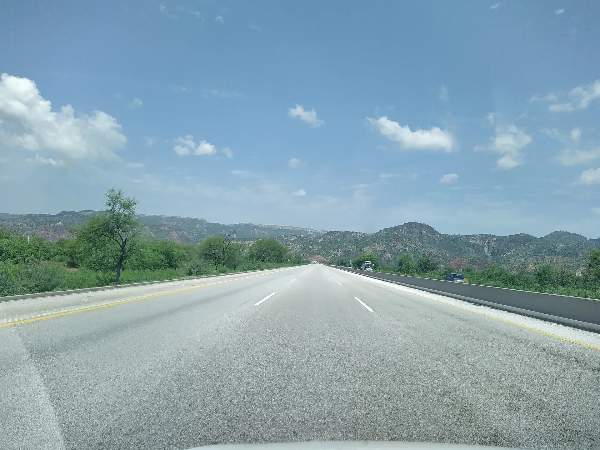
Pakistan's first long motorway, the 375 km M-2, links Islamabad and Lahore across the Salt Range. It has over 20 interchanges, five pairs of service areas and fog closures in winter.
The journey
Last verified: 16 November 2026.
Overview
The M-2 runs about 375 km from the M-1 at Islamabad to Lahore (Wikipedia and FWO both give 375 km; FWO's own page also says 367 km in another section). It has six lanes, opened on 26 November 1997 and is maintained by the National Highway Authority. The Frontier Works Organisation (FWO) resurfaced and rebuilt it in 2014 to 2016. The road crosses the Salt Range near Kallar Kahar and then runs over the plains to Lahore. Most drivers allow about four hours, depending on traffic and stops.
Interchanges and service areas
Wikipedia lists, from Lahore: Babu Sabu, the M-3 junction, Faiz Pur, Kot Abdul Malik, Kala Shah Kaku, Sheikhupura, Hiran Minar, Khanqah Dogran, Sukheki, the M-4 junction at Pindi Bhattian, Makhdoom, Kot Momin, Salaam, Bhera, Lilla, Kallar Kahar, Balkasar, Neela Dullah, Chakri, Capital Smart City, Thalian and Islamabad. Counts differ between sources, so use the signs. Wikipedia numbers only Exit 22 (Thalian) and Exit 23 (Islamabad); the one other distance given is 36 km between Sheikhupura and Khanqah Dogran. There are no known full kilometre markers.
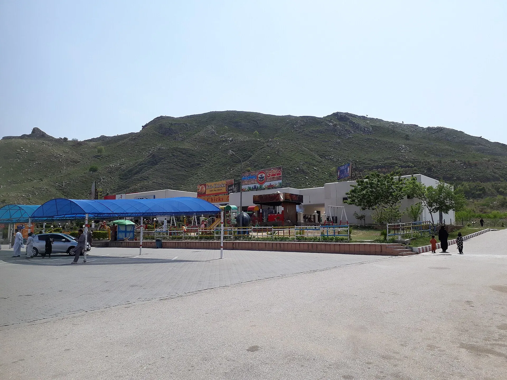
Photo: King Eliot, with thanks · CC BY-SA 4.0 · via Wikimedia Commons · temporary stand-in photo

There are five service areas, each on both sides: Sukheki, Sial, Bhera, Kallar Kahar and Chakri. Wikipedia and the FWO page say they are about 60 to 80 km apart and run by private operators under FWO supervision. Service areas have fuel, a car wash and repair, and restaurants such as KFC and McDonald's; rest areas have a mosque, takeaway food, a tuck shop, washrooms and workshops. Standards vary.
Rules, tolls and M-Tag
Motorway Police (NHMP) patrol the road; for emergencies call 130. DrivePK reported on 22 June 2026 that NHMP restored the motorway limits to 120 km/h for cars and light vehicles and 110 km/h for buses and heavy vehicles, after a temporary cut in March 2026. Limits can change and some stretches carry their own, so follow the signs. Keep left, overtake on the right, and do not stop on the carriageway.
Tolls are charged at interchanges and the NHA publishes the rates; news reports say rates were revised in 2026. Current fees will be added soon, so check the NHA toll chart before you go. Wikipedia says tolls are paid by M-Tag, introduced in December 2021, with toll plazas at every interchange since 2016. Ask your car-hire company whether a tag is fitted.
Weather
Fog is a real hazard from December to January. In January 2026 the Motorway Police closed sections of the M-2 several times, sometimes between Islamabad and Lahore for days. Visibility has dropped below 50 metres in reports. Check NHMP updates before you leave.
What to see near the exits
- Kallar Kahar and the Salt Range: the lake and Katas Raj temples are an easy diversion from the Kallar Kahar and Balkasar exits.
- Hiran Minar at Sheikhupura is close to its own exit.
- Lahore at the southern end for the Fort, mosques and the old city.
- Islamabad and Taxila at the northern end.
Three stops worth the diversion
Kallar Kahar. The town in Chakwal District sits beside the lake at the Salt Range. Wikipedia records that the first Mughal emperor, Babur, camped near the lake, noted the dense corn there and called nearby Takht-e-Babri a charming place with good air. The area was long a haunt of peacocks, though Wikipedia says their numbers have fallen because of population growth and illegal capture.
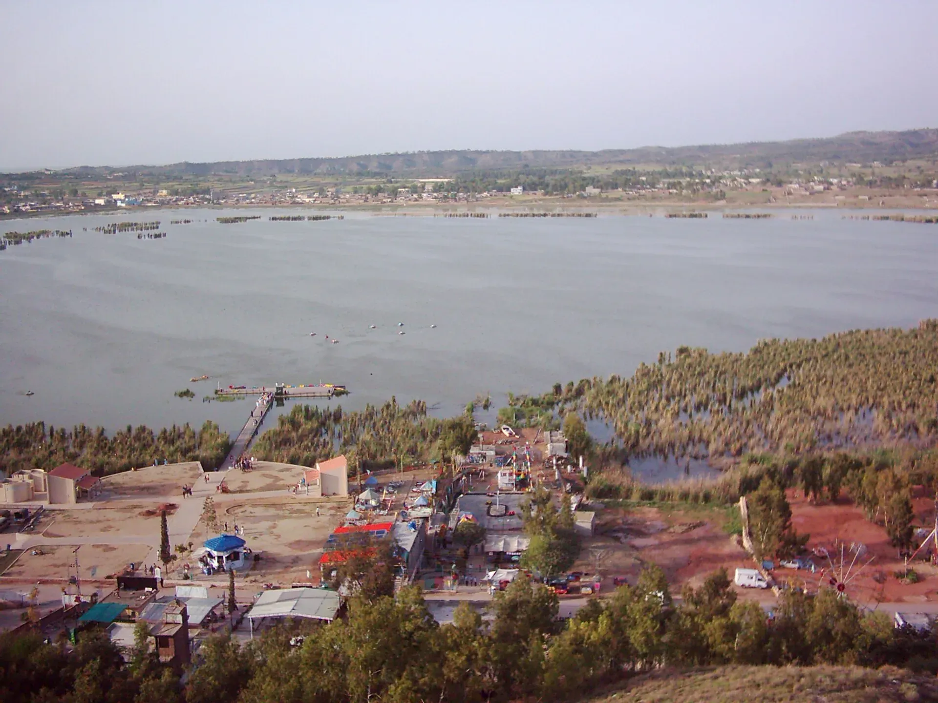
Photo: Mannadeem, with thanks · CC BY-SA 3.0 · via Wikimedia Commons · temporary stand-in photo

Bhera. The old walled town has eight gates and is divided into mohallas (neighbourhoods). Sher Shah founded a new town here in 1540, and it was a trading post on the road to Kabul. Wikipedia says Bhera is known for wood-carved items, quilts and khussas (traditional shoes), that its knife-makers once produced daggers and hunting knives, and that its desserts include pheni and patisa.
Hiran Minar, Sheikhupura. Jahangir built the complex in the early seventeenth century as a monument to his pet antelope, Mansraj. The minaret is about 30 m high with 108 internal steps. It stands beside a large rectangular tank, 229 m by 273 m, with an octagonal pavilion in the middle reached by a causeway of 21 arches. It is about 40 km north-west of Lahore and close to the Hiran Minar exit.
Safety
Do not drive tired. Stop at service areas. Carry your licence and vehicle papers. For breakdowns or emergencies call 130.
Highlights
- 375 km, opened 26 November 1997
- Over 20 interchanges and five service areas
- Crosses the Salt Range near Kallar Kahar
- Winter fog closures
Stops
- IslamabadM-1/M-2 junction at the northern end
- ChakriInterchange and service area
- BalkasarInterchange; Salt Range
- Kallar KaharInterchange and service area; Salt Range lake nearby
- BheraInterchange and service area
- Kot MominInterchange
- Pindi BhattianM-4 junction to Faisalabad and Multan
- SukhekiInterchange and service area
- Hiran MinarInterchange for Sheikhupura
- LahoreM-3 junction; southern end
km: distance from the start along the route.
Numbers follow the stops in order. The map shows the 5 stops that have a trek.pk page, not the road itself.
Road conditions
Six lanes. Rebuilt in 2014-2016. Fog closures happen in winter.
Fuel and services
Service areas at Sukheki, Sial, Bhera, Kallar Kahar and Chakri, each on both sides. Wikipedia says they are 60-80 km apart.
Where to stay, eat and fuel up
Places to stay
- Pearl Continental Hotel, LahoreCall Pearl Continental Hotel, LahoreMap of Pearl Continental Hotel, Lahore in Google Maps
- Avari Hotel LahoreCall Avari Hotel LahoreMap of Avari Hotel Lahore in Google Maps
- Serena HotelCall Serena HotelMap of Serena Hotel in Google Maps
- Islamabad Marriott HotelCall Islamabad Marriott HotelMap of Islamabad Marriott Hotel in Google Maps
- The Nishat HotelCall The Nishat HotelMap of The Nishat Hotel in Google Maps
- Faletti's Hotel LahoreCall Faletti's Hotel LahoreMap of Faletti's Hotel Lahore in Google Maps
Places to eat
- The Monal IslamabadCall The Monal IslamabadMap of The Monal Islamabad in Google Maps
- Tehzeeb Bakers Blue AreaCall Tehzeeb Bakers Blue AreaMap of Tehzeeb Bakers Blue Area in Google Maps
- TKR 3Call TKR 3Map of TKR 3 in Google Maps
- Savour FoodsCall Savour FoodsMap of Savour Foods in Google Maps
- Savour Foods ShadmanCall Savour Foods ShadmanMap of Savour Foods Shadman in Google Maps
- Cheezious Commercial MarketCall Cheezious Commercial MarketMap of Cheezious Commercial Market in Google Maps
Essential services fuel stations, mechanics, pharmacies and hospitals and clinics
Fuel
- Attock Petrol PumpMap of Attock Petrol Pump in Google Maps
- PSO Petrol PumpMap of PSO Petrol Pump in Google Maps
- PSO Petrol PumpMap of PSO Petrol Pump in Google Maps
- Total Parco LA TownCall Total Parco LA TownMap of Total Parco LA Town in Google Maps
- PSO-Al-Rafay Filling Station - Petrol Pump Thokar Niaz BaigCall PSO-Al-Rafay Filling Station - Petrol Pump Thokar Niaz BaigMap of PSO-Al-Rafay Filling Station - Petrol Pump Thokar Niaz Baig in Google Maps
- Total - Areeb Areel Filling StationCall Total - Areeb Areel Filling StationMap of Total - Areeb Areel Filling Station in Google Maps
Mechanics and tyre shops
- Mohammed Bilal tyre centreMap of Mohammed Bilal tyre centre in Google Maps
- Changan City SalesCall Changan City SalesMap of Changan City Sales in Google Maps
- Toyota Airport MotorsCall Toyota Airport MotorsMap of Toyota Airport Motors in Google Maps
- Honda GatewayCall Honda GatewayMap of Honda Gateway in Google Maps
- Saif Traders - Best Tyre Shop in LahoreCall Saif Traders - Best Tyre Shop in LahoreMap of Saif Traders - Best Tyre Shop in Lahore in Google Maps
- Mini MotorsCall Mini MotorsMap of Mini Motors in Google Maps
Pharmacies
- Imtiaz Mega - Ramzan Mall - islamabadCall Imtiaz Mega - Ramzan Mall - islamabadMap of Imtiaz Mega - Ramzan Mall - islamabad in Google Maps
- Raja Market Garden Town LahoreCall Raja Market Garden Town LahoreMap of Raja Market Garden Town Lahore in Google Maps
- Rainbow Cash & Carry - EME LahoreCall Rainbow Cash & Carry - EME LahoreMap of Rainbow Cash & Carry - EME Lahore in Google Maps
- D.WATSON CHEMIST BLUE AREACall D.WATSON CHEMIST BLUE AREAMap of D.WATSON CHEMIST BLUE AREA in Google Maps
- D.WATSON CHEMIST F-11 MARKAZCall D.WATSON CHEMIST F-11 MARKAZMap of D.WATSON CHEMIST F-11 MARKAZ in Google Maps
- Rainbow Cash & Carry - Valencia Town LahoreCall Rainbow Cash & Carry - Valencia Town LahoreMap of Rainbow Cash & Carry - Valencia Town Lahore in Google Maps
Hospitals and clinics
- Holistic CareCall Holistic CareMap of Holistic Care in Google Maps
- Lahore Care HospitalCall Lahore Care HospitalMap of Lahore Care Hospital in Google Maps
- Shifa International Hospitals LimitedCall Shifa International Hospitals LimitedMap of Shifa International Hospitals Limited in Google Maps
- Amanat Eye Hospital RawalpindiCall Amanat Eye Hospital RawalpindiMap of Amanat Eye Hospital Rawalpindi in Google Maps
- Maryam Memorial Hospital (MMH)Call Maryam Memorial Hospital (MMH)Map of Maryam Memorial Hospital (MMH) in Google Maps
- Evercare HospitalCall Evercare HospitalMap of Evercare Hospital in Google Maps
Listings come from Google Maps data and are unverified: phone numbers, opening months and prices may have changed. Report a problem · Own one of these? Claim it
More safety notes
Fog, fatigue and heavy trucks are the main risks. Call 130.
Tips
- Allow about four hours without stops
- Check NHMP for fog closures
- Use a main service area for fuel and rest
Photos we still need: Kallar Kahar lake and the Salt Range crossing. Send us yours
Sources and last checked
Last checked Confidence medium11 sources4 still to check
- Last checked
- Method
- Desk research from published sources
- Confidence
- medium
- Checked by
- trek.pk research team
Researched from published sources; not yet checked on the ground by our team. Spot something out of date? Report a mistake.
Sources
- M-2 motorway (Pakistan) · Wikipedia · checked
- National Highway Authority (official site; toll chart page could not be opened from our connection) · Government of Pakistan · checked
- National Highways and Motorway Police (helpline 130) · Government of Pakistan · checked
- Pakistan restores motorway speed limits to 120 km/h · DrivePK · checked
- Motorway Police begin fines for new speed limits on M2 · Dunya News · checked
- 7 motorways closed due to fog · ProPakistani · checked
- 5 major motorways closed due to fog · ProPakistani · checked
- M-2 Motorway · FWO Smart Motorways · checked
- Kallar Kahar · Wikipedia · checked
- Bhera · Wikipedia · checked
- Hiran Minar · Wikipedia · checked
Still to be checked on the ground (4)
- Toll rates (NHA): the official NHA notice could not be opened; press reports of a 7 percent rise from 5 July 2026 are not used as fees
- Interchange km markers (not given by Wikipedia or FWO, except Exit 22 and 23)
- Length: 375 km (Wikipedia, FWO) or 367 km (FWO elsewhere, Graana); no NHA figure found
- Which M-2 exit serves Bhera town (names differ between sources)
Nearby and related

Islamabad
Pakistan's green, planned capital at the foot of the Margalla Hills: Faisal Mosque, hillside trails, cafes and the gateway to the north.

Lahore
Punjab's capital and Pakistan's cultural city: Mughal forts, mosques and gardens, a lively Walled City, and some of the best food in the country.

Kallar Kahar Lake
A shallow salt lake beside the town of Kallar Kahar in the Salt Range, minutes from the M-2 motorway. Known for its peacocks and the Mughal-era Takht-e-Babri.

Hiran Minar and Tank
A Mughal hunting retreat near Sheikhupura: a tall brick minaret built by Jahangir for his pet antelope, a large tank and a pavilion on a causeway. On UNESCO's tentative list since 1993.
Sheikhupura
District capital 42 km from Lahore, founded by the Mughal emperor Jahangir in 1607. Home to Hiran Minar, a tower and tank built for his pet deer.

Sargodha
A planned canal-colony city in central Punjab, famous for kinnow oranges, with the dark Kirana Hills nearby and easy road links to Lahore, Faisalabad and Islamabad.
Bhera
Old walled market town in Sargodha District, founded again by Sher Shah in 1540. Known for its Jamia Mosque, wood carving, textiles and sweets.

Salt Range: Katas Raj, Khewra, Kallar Kahar
A two-day, about 360 km loop from Islamabad by the M-2 to Kallar Kahar, the Katas Raj temples and the Khewra Salt Mine. Khewra stopped receiving visitors in August 2026 until after the monsoon, so check first.

Mughal Lahore and the Grand Trunk Road
A four-day journey from Lahore's Mughal monuments up the Grand Trunk Road to Rohtas Fort. History from Akbar to Aurangzeb, OSRM-measured day plan and current safety notes.