

Photo: Jogi don, with thanks · CC BY-SA 4.0 · via Wikimedia Commons · temporary stand-in photo

M-9 Karachi-Hyderabad Motorway
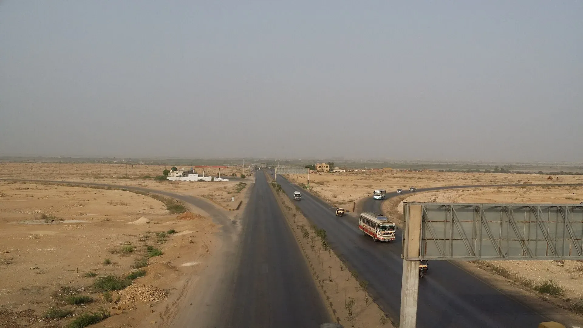
The 136 km M-9 links Karachi and Hyderabad on six lanes. It has four interchanges, a large toll plaza at Karachi's end and few service areas. A link to the M-10 bypass is near Karachi.
The journey
Last verified: 17 November 2026.
Overview
The M-9 runs 136 km between Karachi and Hyderabad. It has six lanes (a 2022 federal decision to widen it to eight was reported) and was built by the Frontier Works Organisation on a 25-year build-operate-transfer basis, with the NHA maintaining it. A 75 km section was inaugurated by Prime Minister Nawaz Sharif on 3 February 2017 (Dawn), when the full road was expected by March 2018. No source found gives a single full opening date, so treat it as open from 2017-18. Most drivers need about two hours.
Interchanges and services
Wikipedia names four interchanges: Dadabhai, Industrial Valley, Nooriabad and Thana Bola Khan. A trumpet interchange links to the M-10 Karachi Northern Bypass, a link road meets the N-5, and a cloverleaf at Kotri serves the Hyderabad end. No kilometre markers are given. Wikipedia says the motorway lacks proper service areas and service roads. The Express Tribune (19 January 2026) reports deep potholes and sunken stretches, with one 27 km section described as badly deteriorated, and no service roads. Expect rough patches. Fill up in Karachi or Hyderabad rather than relying on stops along the way.
Speed and traffic
Wikipedia states 120 km/h for light vehicles and 80 km/h for heavy vehicles on this road. News in June 2026 reports NHMP restoring 120 and 110 km/h limits nationally. Follow the signs. Traffic is heavy, around 30,000 vehicles a day per Wikipedia.
Rules, tolls and M-Tag
Motorway Police (NHMP) patrol the road; for emergencies call 130. Reports in June 2026 say NHMP restored the motorway limits to 120 km/h for cars and light vehicles and 110 km/h for buses and heavy vehicles, after a temporary cut in March 2026. Limits can change and some stretches carry their own, so follow the signs. Keep left, overtake on the right, and do not stop on the carriageway.
Tolls are charged at interchanges and the NHA publishes the rates; news reports say rates were revised in 2026. Current fees will be added soon, so check the NHA toll chart before you go. A 24-lane toll plaza opened on 24 December 2020 (six entry, 18 exit lanes). Wikipedia calls it the largest in Pakistan.
Along the route
The M-9 replaces the old Super Highway as the way out of Karachi. It carries freight from Karachi Port and Port Qasim as well as cars and buses.
- Karachi end. The road starts north of the city where the M-10 Northern Bypass meets it at a trumpet interchange, and a link road reaches the N-5.
- Dadabhai, Industrial Valley, Nooriabad and Thana Bola Khan. These are the four interchanges planned in 2015. Wikipedia says they were meant to serve areas including Tharparkar, Jimphir and Keenjhar. Dawn's 2017 report on the opening names them as Dada Bhoy, Industrial Valley, Nooriabad and Thano Bola Khan.
- Loni Kot to Lucky toll plaza. This 75 km section was the first to open, on 3 February 2017.
- Kotri. The road ends at a cloverleaf interchange at Kotri, where it joins the N-5. Kotri is about 6.7 km from the centre of Hyderabad, and the Kotri Bridge, finished in 1900, links the two banks of the Indus here.
The road has a central median and fencing, and slow traffic such as bicycles, motorcycles, animal carts and pedestrians is not allowed. The NHMP use heavy motorbikes for patrols.
Stopping in Hyderabad
Hyderabad was founded in 1768 by Mian Ghulam Shah Kalhoro of the Kalhora dynasty, after Indus floods threatened the old capital at Khudabad. It stands on a limestone ridge called Ganjo Takkar, "Bald Hill". Pacco Qillo, "Strong Fort" in Sindhi, was built of baked brick in 1768 to 1769 and covers about 36 acres; the Talpur rulers later lived there. Rani Bagh opened in 1861 as Das Gardens and was later renamed in honour of Queen Victoria. It is now a zoological and botanical garden. Wikipedia says Hyderabad makes almost all of Pakistan's ornamental glass bangles, centred on the Churi Parah neighbourhood, and the city is also known for silver and gold work, lacquerware and embroidered leather saddles.
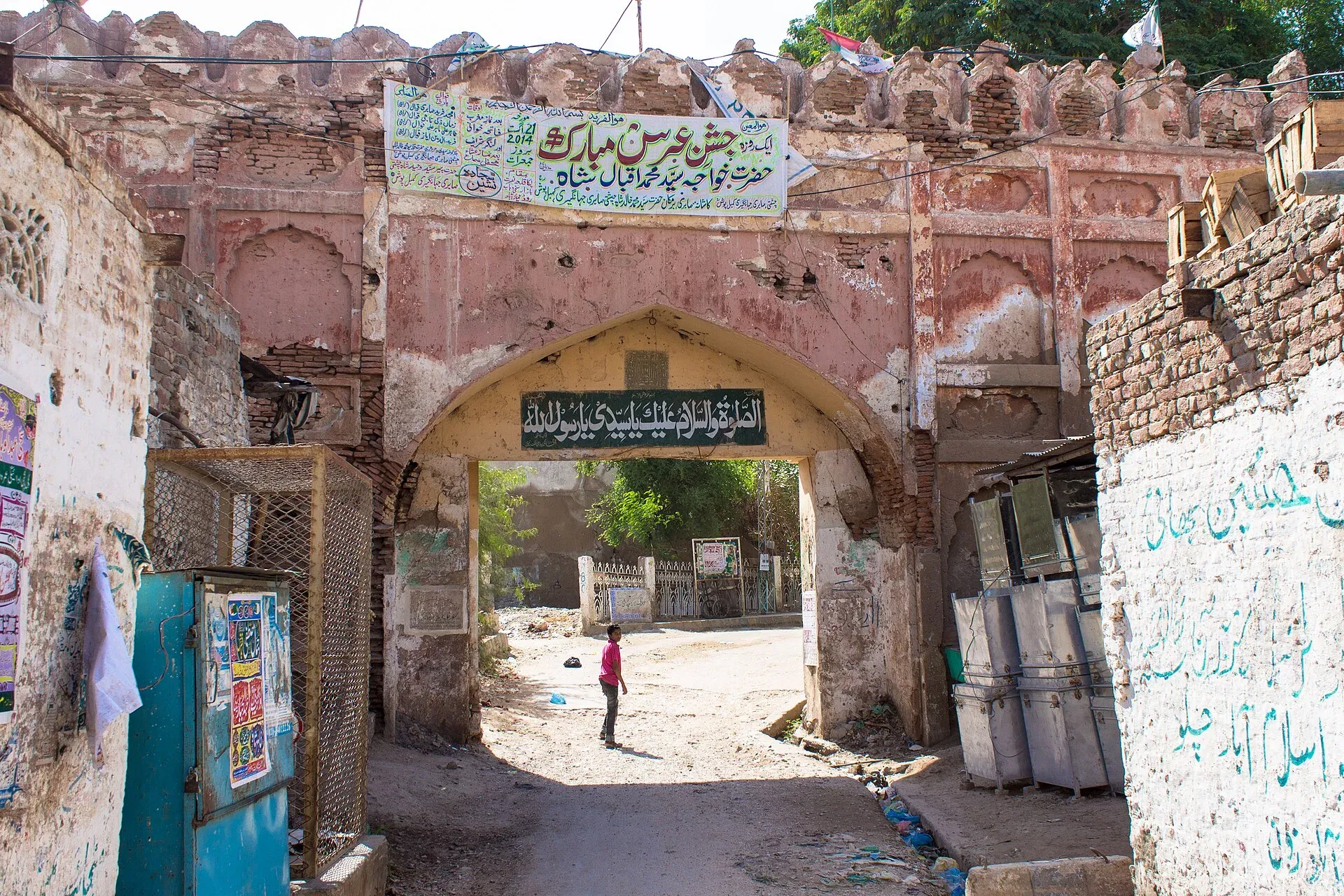
Photo: Soban, with thanks · CC BY-SA 3.0 · via Wikimedia Commons · temporary stand-in photo

Further afield, Thatta, Makli Necropolis and Keenjhar Lake are reached via the N-5 near Kotri. Ranikot Fort lies further north. The Karachi to Thatta route page covers the first three.
Weather
Summers are hot, so check tyres and coolant. In Hyderabad the hottest period runs from mid-April to late June, with May highs averaging about 41 degrees Celsius. Dust and rain can reduce visibility.
Safety
Watch for slow trucks, breakdowns and incomplete fencing. Keep to your lane. Call 130 for the Motorway Police.
Highlights
- 136 km, about two hours
- Six lanes, built under BOT
- Large toll plaza at Karachi end
- Link to the M-10 bypass
Stops
- Karachi (M-10 trumpet interchange)Start
- DadabhaiInterchange
- Industrial ValleyInterchange
- NooriabadInterchange
- Thana Bola KhanInterchange
- Kotri (Hyderabad)Cloverleaf interchange; N-5 link
km: distance from the start along the route.
Numbers follow the stops in order. The map shows the 2 stops that have a trek.pk page, not the road itself.
Road conditions
Six lanes. Wikipedia reports poor pavement in places.
Fuel and services
Few or no service areas on the motorway, per Wikipedia. Fill up at the ends.
Where to stay, eat and fuel up
Places to stay
- Avari Towers KarachiCall Avari Towers KarachiMap of Avari Towers Karachi in Google Maps
- Mövenpick KarachiCall Mövenpick KarachiMap of Mövenpick Karachi in Google Maps
- Ramada Plaza by Wyndham Karachi Airport HotelCall Ramada Plaza by Wyndham Karachi Airport HotelMap of Ramada Plaza by Wyndham Karachi Airport Hotel in Google Maps
- Beach Luxury HotelMap of Beach Luxury Hotel in Google Maps
- Karachi Marriott HotelCall Karachi Marriott HotelMap of Karachi Marriott Hotel in Google Maps
- Ramada by Wyndham Karachi CreekCall Ramada by Wyndham Karachi CreekMap of Ramada by Wyndham Karachi Creek in Google Maps
Places to eat
- Port Grand - KarachiCall Port Grand - KarachiMap of Port Grand - Karachi in Google Maps
- Kolachi RestaurantCall Kolachi RestaurantMap of Kolachi Restaurant in Google Maps
- Bar BQ Tonight CliftonCall Bar BQ Tonight CliftonMap of Bar BQ Tonight Clifton in Google Maps
- Kaybees MACHSCall Kaybees MACHSMap of Kaybees MACHS in Google Maps
- Karachi Hassan Zai Koyla KarahiCall Karachi Hassan Zai Koyla KarahiMap of Karachi Hassan Zai Koyla Karahi in Google Maps
- Gul Plaza Shopping CentreMap of Gul Plaza Shopping Centre in Google Maps
Essential services fuel stations, mechanics, banks, pharmacies and hospitals and clinics
Fuel
- PSO Petrol Pump (Stadium Service Station)Call PSO Petrol Pump (Stadium Service Station)Map of PSO Petrol Pump (Stadium Service Station) in Google Maps
- ShellCall ShellMap of Shell in Google Maps
- KHAZAN ASSOCIATES PARCO Petrol PumpCall KHAZAN ASSOCIATES PARCO Petrol PumpMap of KHAZAN ASSOCIATES PARCO Petrol Pump in Google Maps
- PSO Petrol PumpMap of PSO Petrol Pump in Google Maps
- PSO Petrol PumpCall PSO Petrol PumpMap of PSO Petrol Pump in Google Maps
- Attock Petrol Pump (Classic filling Station)Map of Attock Petrol Pump (Classic filling Station) in Google Maps
Mechanics and tyre shops
- Suzuki Naseer AutosCall Suzuki Naseer AutosMap of Suzuki Naseer Autos in Google Maps
- Ghazi Autos Karachi Hybrid & EFI Mechanics | Auto Electrician Services | Scanning & Diagnostic Workshop / GarageCall Ghazi Autos Karachi Hybrid & EFI Mechanics | Auto Electrician Services | Scanning & Diagnostic Workshop / GarageMap of Ghazi Autos Karachi Hybrid & EFI Mechanics | Auto Electrician Services | Scanning & Diagnostic Workshop / Garage in Google Maps
- Toyota Highway MotorsCall Toyota Highway MotorsMap of Toyota Highway Motors in Google Maps
- Bashir Autos Car ACCall Bashir Autos Car ACMap of Bashir Autos Car AC in Google Maps
Banks and money exchange
- State Bank of PakistanCall State Bank of PakistanMap of State Bank of Pakistan in Google Maps
Pharmacies
- Al Jadeed Super MarketCall Al Jadeed Super MarketMap of Al Jadeed Super Market in Google Maps
- Imtiaz Supermarket - Awami Markaz - KHICall Imtiaz Supermarket - Awami Markaz - KHIMap of Imtiaz Supermarket - Awami Markaz - KHI in Google Maps
- Hydri Super MarketCall Hydri Super MarketMap of Hydri Super Market in Google Maps
- Imtiaz Supermarket - Clifton - KHICall Imtiaz Supermarket - Clifton - KHIMap of Imtiaz Supermarket - Clifton - KHI in Google Maps
- SPAR SharfabadCall SPAR SharfabadMap of SPAR Sharfabad in Google Maps
- Springs StoreCall Springs StoreMap of Springs Store in Google Maps
Hospitals and clinics
- Hashmanis Hospital NumaishCall Hashmanis Hospital NumaishMap of Hashmanis Hospital Numaish in Google Maps
- A.O. HOSPITALCall A.O. HOSPITALMap of A.O. HOSPITAL in Google Maps
- Liaquat National Hospital - Institute for Undergraduate and Postgraduate Medical Studies and Health SciencesCall Liaquat National Hospital - Institute for Undergraduate and Postgraduate Medical Studies and Health SciencesMap of Liaquat National Hospital - Institute for Undergraduate and Postgraduate Medical Studies and Health Sciences in Google Maps
- Indus Hospital & Health NetworkCall Indus Hospital & Health NetworkMap of Indus Hospital & Health Network in Google Maps
- National Medical Centre (NMC)Call National Medical Centre (NMC)Map of National Medical Centre (NMC) in Google Maps
- Patel HospitalCall Patel HospitalMap of Patel Hospital in Google Maps
Listings come from Google Maps data and are unverified: phone numbers, opening months and prices may have changed. Report a problem · Own one of these? Claim it
More safety notes
Trucks, breakdowns and heat. Call 130.
Tips
- Fuel up before you start
- Carry water in summer
- Use the Kotri exit for Thatta
Photos we still need: the Kotri cloverleaf interchange and the Karachi end of the M-9. Send us yours
Sources and last checked
Last checked Confidence medium9 sources4 still to check
- Last checked
- Method
- Desk research from published sources
- Confidence
- medium
- Checked by
- trek.pk research team
Researched from published sources; not yet checked on the ground by our team. Spot something out of date? Report a mistake.
Sources
- M-9 motorway (Pakistan) · Wikipedia · checked
- National Highway Authority (official site; toll chart page could not be opened from our connection) · Government of Pakistan · checked
- National Highways and Motorway Police (helpline 130) · Government of Pakistan · checked
- Pakistan restores motorway speed limits to 120 km/h · DrivePK · checked
- Motorway Police begin fines for new speed limits on M2 · Dunya News · checked
- Nawaz inaugurates completed portion of Karachi-Hyderabad M-9 Motorway · Dawn · checked
- M-9 in a shambles 9 years after construction · The Express Tribune · checked
- NA committee demands decrease in toll plazas on Karachi-Hyderabad motorway · ProPakistani · checked
- Hyderabad, Sindh · Wikipedia · checked
Still to be checked on the ground (4)
- Exact full opening date (only the 3 February 2017 partial opening is documented; full completion was expected in 2018)
- Interchange km markers (none published; Dawn 2017 names Dada Bhoy, Industrial Valley, Nooriabad and Thano Bola Khan)
- Toll rates (NHA toll chart not reachable; a 25% rise was withdrawn in April 2026 per Dawn, so check the current chart)
- Present state of the surface (the latest dated report is the Express Tribune, 19 January 2026)
Nearby and related

Karachi
Pakistan's largest city and main port: colonial buildings, museums, beaches, busy bazaars and some of the country's best food.

Hyderabad
Sindh's second-largest city, founded in 1768 and famous for its glass bangles, Pacco Qillo fort and Talpur tombs, about 160 km from Karachi.

Thatta
Sindh's medieval capital, home to the UNESCO-listed Makli Necropolis and the tiled Shah Jahan Mosque, about 100 km from Karachi and Hyderabad.

Keenjhar Lake
Sindh's largest freshwater lake, about 36 km from Thatta and roughly 120 km from Karachi. A Ramsar site since 1976, with winter ducks, geese and flamingos and a shrine on an island.

Makli Necropolis
One of the world's largest burial grounds, near Thatta in Sindh, with hundreds of thousands of graves and royal tombs from the 14th to 18th centuries. A UNESCO World Heritage Site since 1981.

Ranikot Fort
A huge hill-top wall in the Kirthar hills of Sindh, often called the Great Wall of Sindh, with four gates and a smaller inner fort. On Pakistan's UNESCO tentative list since 1993.

Karachi to Thatta: Makli and Keenjhar
A two-day, 257 km loop from Karachi on the N-5 to Thatta, the Makli Necropolis and the Shah Jahan Mosque, then Keenjhar Lake and back. Makli became a UNESCO World Heritage Site in 1981.