

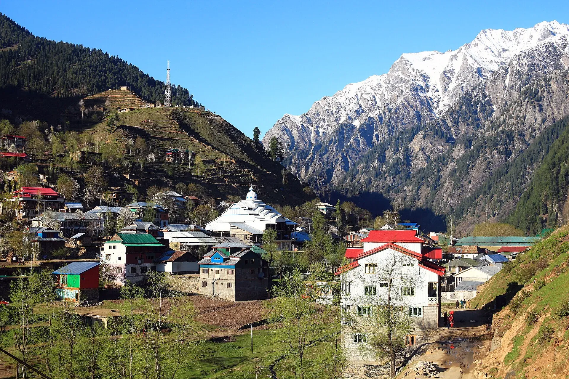
Photo: Furqanlw, with thanks · CC BY-SA 4.0 · via Wikimedia Commons · temporary stand-in photo

Neelum Valley
A 4-5 day road trip from Islamabad to Muzaffarabad and up the Neelum River by Athmuqam, Keran, Sharda and Kel, about 275 km, with a jeep track beyond Kel. Check current advice: the valley runs close to the Line of Control.
Customise this route Change the dates, stops and how you travel in the Road Trip Planner.
Overview
The Neelum Valley runs along the Neelum River in Azad Jammu and Kashmir (AJK). A paved road follows the river from Muzaffarabad to Kel, passing forest, small bazaars and side valleys. Beyond Kel the road becomes a rough jeep track to Taobat, the last village. The valley is about 165 km long from Nauseri to Taobat, and lies at roughly 1,200 to 2,300 m (Dawn, 2024; Wikipedia).
Who it suits
Travellers who are comfortable with long mountain drives, basic guesthouses and changing conditions. It is not a trip for a low saloon car beyond Sharda or Kel; you will need a 4x4 jeep and a local driver. Plan a few spare days for delays.
Read this first: security and permission
The valley runs close to the Line of Control (LoC), the ceasefire line with India. Ask the district administration or local police about current conditions before you go. For foreign visitors: the UK FCDO (updated 27 October 2026) advises against all travel within 10 miles of the Line of Control and against all but essential travel to Azad Jammu and Kashmir. Read the current advice and ask the Neelum district administration (Athmuqam) and your hotel about permission, checkposts and any restrictions before you set out. Carry your CNIC or passport; travellers have reported that officials may keep identity cards at checkposts in the upper valley. This page does not say that any road is safe to use on a given day.
When to go
June to October is the usual season for the upper valley (Dawn, 2023). December to March brings heavy snow and many upper roads close. Monsoon rain can bring landslides.
The route
Distances are from OSRM / OpenStreetMap, measured on 16 November 2026, and times are driving only.
- Islamabad to Muzaffarabad: 127 km, about 1 hour 35 minutes.
- Muzaffarabad to Athmuqam: 77 km, about 1 hour 35 minutes. Athmuqam is the district headquarters.
- Muzaffarabad to Keran: about 87 to 92 km. A fresh OSRM check with a point on the Neelum Valley Road in Keran gave 87 km (about 1 hour 40 minutes); our first figure of 92 km used a point 1.5 km from the road. Keran is strung out along the road, with hotels a few km further on.
- Muzaffarabad to Sharda: 130 km, about 2 hours 25 minutes.
- Muzaffarabad to Kel: 148 km, about 2 hours 50 minutes. Kel is the usual base for the upper valley.
- Kel to Taobat: not measured by us. Dawn (6 August 2023) described a little more than 40 km, nearly five hours by jeep on a rough, unpaved track; there is no known other source.
From the main road, side roads climb to places such as Ratti Gali Lake. The link road to the base of the lake is 18 km long (Dawn, 17 July 2024); take only a well-maintained vehicle and an experienced local driver.
Beyond Kel: Dawarian to Taobat
Dawn (6 August 2023) describes the jeep ride from Kel to Taobat in order. The track turns unpaved at Dawarian, then passes the villages of Machhal, Janoi, Phulwai, Sardari, Hilmat and Makroon. Herds of cattle with shepherds and dogs often block the way, and the writer's head hit the window at least six times on the ride. Hilmat, about 6 km before Taobat, has a checkpost where officials kept the travellers' national identity cards, and a hospital used for emergencies. Taobat, at 2,281 m, is the last village before the Line of Control. Fields around it grow maize, kidney beans and potatoes, houses are built of wood and painted in bright colours, and locals stock rations and firewood in summer for the winter. Most hotels are on the near side of a long, wobbly bridge over the river where jeeps stop; the bridge takes people, not vehicles, so luggage may be carried across by wheelbarrow. Dawn advises buying supplies for two days at Kel.
Ratti Gali Lake
Dawn (17 July 2024) calls Ratti Gali an alpine glacial lake at 3,683 m. The link road from the main valley road to the base of the lake is 18 km long. A jeep with tourists went into a water channel about 3 km along that road in July 2024. The same report says the valley has 40 link roads between Nauseri and Taobat, covered by 22 traffic police.
Practical information
Mobile coverage is poor in the upper valley; Dawn (2023) noted that mobile networks stop working once you enter and that SIMs must be bought in Muzaffarabad. Wikivoyage describes Arang Kel as a mountain village among meadows and pine forest, and says that photographing military sites near the Line of Control is not allowed. Accommodation is mostly small guesthouses and huts at Athmuqam, Keran, Sharda and Kel. Fees are not confirmed here; current fees will be added soon.
Highlights
- Muzaffarabad and the meeting of the Neelum and Jhelum
- Keran and Sharda along the river
- Kel as a base for the upper valley
- Jeep track to Taobat
- Ratti Gali Lake side trip
Stops
- MuzaffarabadAJK capital; last big town
- AthmuqamDistrict headquarters
- KeranVillage on the river
- ShardaUpper valley village
- KelUsual base for the upper valley; jeep track continues to Taobat
- TaobatLast village at 2,281 m; jeep track (Dawn: a little over 40 km from Kel)
km: distance from the start along the route.
Numbers follow the stops in order. The map shows the stops, not the road itself.
Day by day
Day 1 · Islamabad to Muzaffarabad
An easy first day. Buy a local SIM and ask about current road and checkpost conditions.
Day 2 · Muzaffarabad to Keran or Sharda
Follow the Neelum Valley Road to Athmuqam and Keran; carry on to Sharda if the road is open.
Day 3 · Sharda to Kel and side trips
Drive to Kel and explore from there. Ask locally about Arang Kel and Ratti Gali.
Day 4 · Optional jeep trip towards Taobat
Only with a local jeep and driver, and only if conditions and permission allow.
Day 5 · Return to Muzaffarabad or Islamabad
Leave early. Landslides can close the road, so keep a day in hand.
Road conditions
- Muzaffarabad to Kel: paved, narrow and winding. A travel report places the carpeted road as far as Sharda and Kel; beyond Kel it is a jeep track.
- Kel to Taobat: almost entirely unpaved and rough, passable only by jeeps; the bridge near Taobat cannot take vehicles (Dawn, August 2023).
- Closures: on 30 March 2026 large falling stones closed the Kel-Sharda highway and stranded thousands of tourists in the upper valley; the Army and the PWD reopened it after about 30 hours (Kashmir English, 1 April 2026).
- Seasons: heavy snow from December to March; best from June to October (Dawn, 2023).
Fuel and services
Fill up in Muzaffarabad and again at Athmuqam; supplies are limited beyond Sharda. Carry cash, since ATMs are rare in the upper valley. Mobile coverage is poor above Athmuqam; the army-run SCom network worked in 2023 (Dawn). Medical help is basic; the nearest large hospital is in Muzaffarabad.
Safety
- Government advice (checked 16 November 2026): the UK FCDO, updated 27 October 2026, advises against all travel within 10 miles of the Line of Control and against all but essential travel to AJK. Much of the Neelum Valley is near the Line of Control.
- Road accidents: in July 2024 a loader jeep carrying tourists fell into a water channel on a link road to Ratti Gali, killing two and leaving three missing. The Neelum Deputy Commissioner said the valley has 40 link roads but only 22 traffic police (Dawn, 17 July 2024). Use a sound vehicle and an experienced driver.
- Rockfall and landslides: frequent after rain and snowmelt.
Tips
- Ask about permission and checkposts before you go; do not rely on this page.
- Carry your CNIC or passport and several photocopies.
- Buy a local SIM in Muzaffarabad; coverage is limited in the upper valley.
- Hire a jeep with a driver who knows the link roads; avoid night driving.
- Keep three spare days for landslide closures.
Sources and last checked
Last checked Confidence medium9 sources6 still to check
- Last checked
- Method
- Desk research from published sources
- Confidence
- medium
- Checked by
- trek.pk research team
Researched from published sources; not yet checked on the ground by our team. Spot something out of date? Report a mistake.
Sources
- OSRM driving route service: distances and times measured 16 November 2026 (drive times are without stops) · OSRM / OpenStreetMap contributors · checked
- Pakistan Tourism Guide 2021 · Trade Development Authority of Pakistan (TDAP) · checked
- Neelum Valley · Wikipedia · checked
- Travel: the magical woodland (6 August 2023) · Dawn · checked
- 2 tourists killed, 3 missing after jeep plunges into water channel in AJK's Neelum Valley (17 July 2024) · Dawn · checked
- Pak Army, PWD restore Neelum Valley road after massive landslide (1 April 2026) · Kashmir English · checked
- Pakistan travel advice: warnings and insurance (latest update 27 October 2026) · UK Foreign, Commonwealth and Development Office · checked
- Keran place point (OpenStreetMap data via Nominatim, checked with OSRM) · OpenStreetMap · checked
- Azad Kashmir (Wikivoyage) · Wikivoyage · checked
Still to be checked on the ground (6)
- Whether foreign and domestic visitors currently need permission or an NOC for the upper valley (Dawn 2023 mentions only an ID check at Hilmat; no official notice found)
- Condition of the road beyond Sharda (Dawn 2023: almost all unpaved from Dawarian to Taobat; nothing recent)
- A unconfirmed report mentioned a landslide blocking the road near Kel on 24 June 2026; check whether the road has reopened
- Kel to Taobat distance (only Dawn 2023, a little over 40 km)
- Whether foreign visitors need an AJK Home Department permit for the Neelum Valley (Wikivoyage says permits apply outside a short list of places; no official notice opened)
- Route to Arang Kel from Kel (no source opened gives the method or time)