

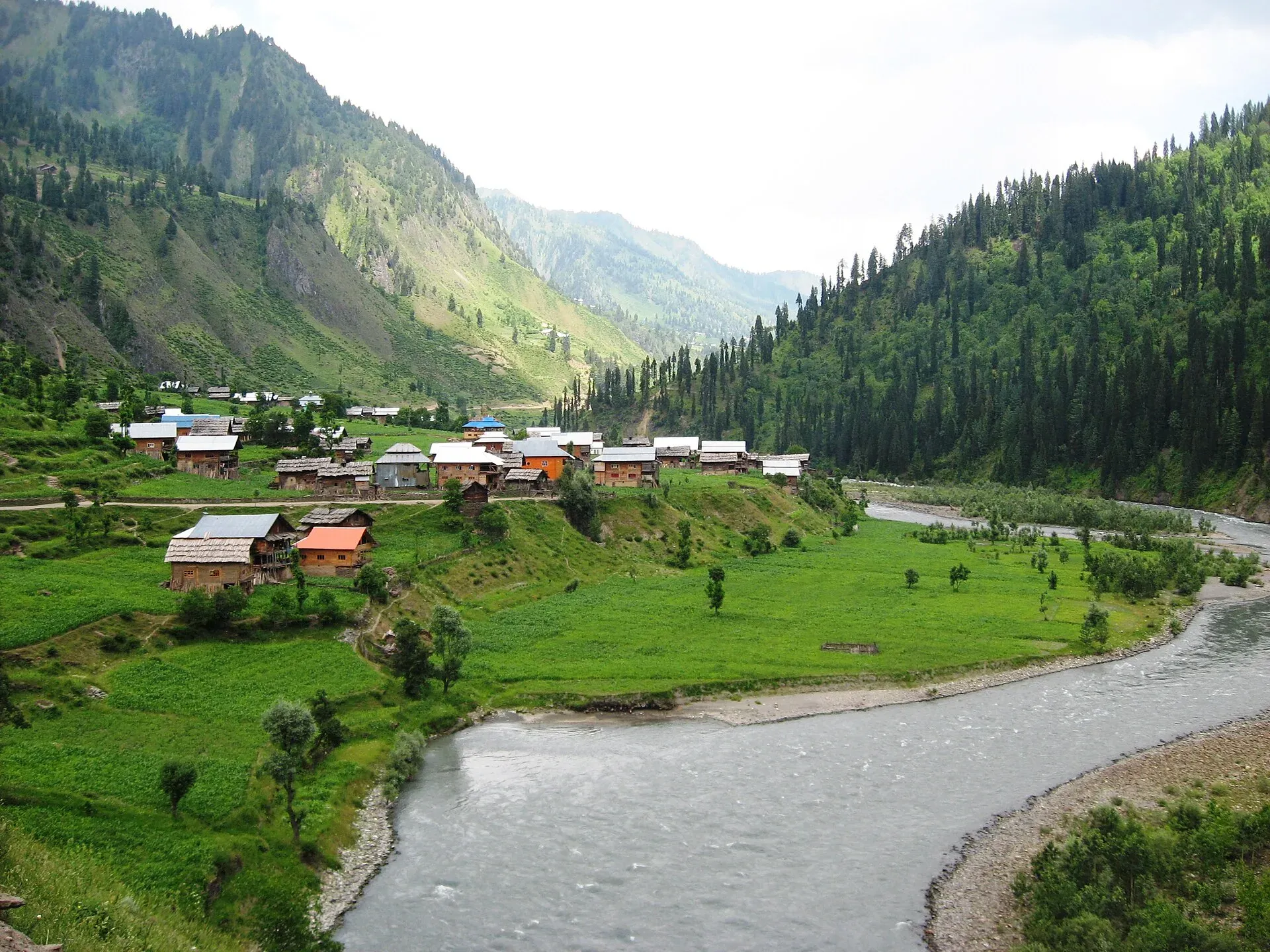
Photo: Muddusar suleman, with thanks · CC BY-SA 4.0 · via Wikimedia Commons · temporary stand-in photo

Taobat
The last village station in the Neelum Valley of Azad Kashmir at about 2,300 m, reached on a rough road from Kel. It is right beside the Line of Control, and official travel advice is strict.
Overview
Taobat (also spelled Taobutt) is a village in Sharda tehsil, Neelum District, Azad Kashmir, at about 2,300 m (Wikipedia). Wikipedia calls it the last station in the Neelum valley, and the nearest point where the Neelum river (the Kishanganga on the Indian side) enters Pakistani-administered territory. It is about 200 km from Muzaffarabad and 39 km from Kel (OSRM measures about 189 km by road from Muzaffarabad, 17 November 2026), reached by an unpaved road from Kel. The population was 720 in 1998.
Plan your visit
- Nearest town
- Sharda
- Getting there
Road: about 39 km from Kel on an unpaved road, and about 200 km from Muzaffarabad (Wikipedia). OSRM gives about 61 km from Sharda to Taobat (about 1.5 hours, checked 16 November 2026). More
Best months
Jun – Sep
- Taobat
- Related places nearby: Neelum Valley, Arang Kel, Sharda, Kel Camping (Neelum)
People and history
Before 1947 Taobat was part of Baramulla district. Wikipedia says it was not geographically, culturally or linguistically part of the Kashmir Valley. Urdu is the official language, and the local languages are Kashmiri and Shina. Across the upper valley, Shina is spoken in two varieties and Hindko is the most widely used language overall. Farming and handicrafts are the main livelihoods, and tourism is growing in importance.
The road to Taobat
The Neelum road is paved as far as Sharda. Beyond it the track to Kel and Taobat is rough in places, with landslides and washouts after rain. Sharda to Taobat is about 61 km (OSRM, about 1.5 hours, an optimistic estimate). The upper valley runs between roughly 1,200 and 2,300 m, so Taobat sits at the top of that range, with peaks above on both sides. The Line of Control follows the mountains and in places the river itself.
For the stops below it, see Sharda, Kel and Arang Kel, and the wider Neelum Valley page.
What to see and do
- Valley-end scenery: the river, forests and mountains at the head of the valley.
- Walks: short walks around the village. Ask locally about what is open.
When to visit
June to September, when the road is likely to be open. Heavy snow can block the track from late autumn.
Where to stay and eat
Wikipedia says there is a motel run by the AJK Tourism and Archaeology Department and a small number of hotels. Food is basic and simple.
Good to know
- The road from Kel is rough, with a jeep needed in places. A 2024-era travel piece mentions a new road section, but it is not confirmed.
- Supplies are very limited. Carry what you need from Muzaffarabad or Sharda.
- Sources disagree about foreign visitor access. There is no known current official notice. Check with the AJK Tourism and Archaeology Department and the relevant authorities first.
- Dress modestly and ask before photographing people, and do not photograph military or border areas.
Ask the district administration or local police about current conditions before you go. Travel advice: For foreign visitors: the UK FCDO advises against all travel within 10 miles of the Line of Control and against all but essential travel to Azad Jammu and Kashmir (advice updated 27 October 2026, checked 16 November 2026). Taobat is at the Line of Control, so that advice applies. Read the live advice before you plan.
Highlights
- Last village in Neelum Valley
- Remote head-of-valley scenery
- Line of Control area (restricted advice)
Getting there
Road: about 39 km from Kel on an unpaved road, and about 200 km from Muzaffarabad (Wikipedia). OSRM gives about 61 km from Sharda to Taobat (about 1.5 hours, checked 16 November 2026). Use a 4x4 and check conditions locally.
Stay, eat and essentials near Taobat
Within 8 km of Taobat, nearest first.
Places to stay
- Al sayyed Rahat kadah guest houseMap of Al sayyed Rahat kadah guest house in Google Maps
- Dream Land Guest House and Family Resort TaobatCall Dream Land Guest House and Family Resort TaobatMap of Dream Land Guest House and Family Resort Taobat in Google Maps
- Shangreela 1 Resort TaobutMap of Shangreela 1 Resort Taobut in Google Maps
Listings come from Google Maps data and are unverified: phone numbers, opening months and prices may have changed. Report a problem · Own one of these? Claim it
Tips
- Read the live UK FCDO advice first.
- Confirm access rules with AJK Tourism before you travel.
- Carry cash and supplies.
- Avoid photographing military or border areas.
Sources and last checked
Last checked Confidence low5 sources5 still to check
- Last checked
- Method
- Desk research from published sources
- Confidence
- low
- Checked by
- trek.pk research team
Researched from published sources; not yet checked on the ground by our team. Spot something out of date? Report a mistake.
Sources
- Taobat · Wikipedia · checked
- OSRM driving routes (road distances and times) · Project OSRM / OpenStreetMap · checked
- Pakistan travel advice · UK FCDO (GOV.UK) · checked
- OSRM route Muzaffarabad to Taobat · OSRM · checked
- Neelum Valley · Wikipedia · checked
Still to be checked on the ground (5)
- Foreign visitor access and any NOC rules (no official source found; Wikipedia silent)
- Road condition and new road sections
- Current accommodation (Wikipedia: tourism department motel and a few hotels; undated)
- Exact distance from the Line of Control
- What is open for walking near the village
Nearby and related

Neelum Valley
A long, forested river valley in Azad Kashmir running north-east from Muzaffarabad to Sharda, Kel and Arang Kel. It runs close to the Line of Control, so check access before you go.

Neelum River
A 245 km river called the Kishanganga in India. About 195 km flows through Azad Kashmir's Neelum Valley before it joins the Jhelum at Muzaffarabad. Border-zone travel advice applies.

Arang Kel
A hilltop village and meadow at about 2,554 m above Kel in the Neelum Valley, reached by a chairlift across the river and a steep walk.

Sharda
A small town in the upper Neelum Valley of Azad Kashmir at about 1,981 m, known for the ruins of the Sharada Peeth temple site. It is close to the Line of Control, and official travel advice is strict.

Kel Camping (Neelum)
Kel is a village in the upper Neelum Valley and the base for the Arang Kel chairlift and the Shounter Lake trips. Tent camps are common nearby, but the area is close to the Line of Control and UK advice is against travel.