

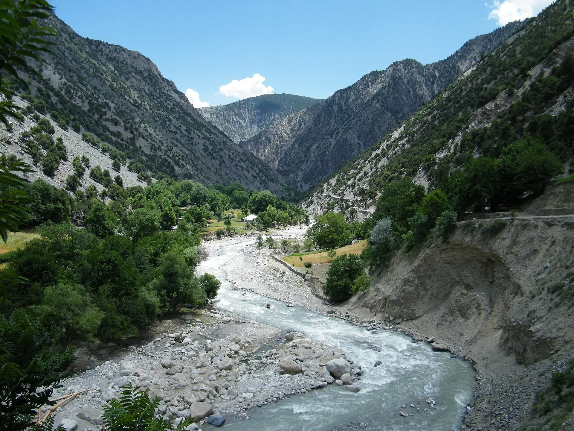
Photo: Majduddin, with thanks · CC BY-SA 3.0 · via Wikimedia Commons · temporary stand-in photo

Gokhshal An and Dooni An
- Duration
- 3–4 days
- Distance
- 24.8 km
- Grade
- Moderate
- Max altitude
- 3,720 m
- Season
- Jun – Sep
A three-day moderate crossing from Chitral Gol National Park over the Gokhshal An and Dooni An into the Kalasha valley of Rumbur. Faint trails, Tirich Mir views and markhor country.
Overview
This trek crosses two passes, the Gokhshal An and the Dooni An, to link Chitral Gol National Park with Rumbur, the northernmost of the Kalasha valleys. Dooni An is also called Chimirsan An by people in Rumbur. You start at the park's Chaghbini hut above Chitral town, cross the Ishperudeh ridge to the Gokhshal stream, cross a second ridge into the Chimirsan valley and then go down through old cedar forest to the road at Shekhanandeh.
Chitral Gol National Park covers 7,750 hectares and was set up in 1984. It is known for markhor, the spiral-horned wild goat. A 2021 count of about 2,278 is reported, which Wikipedia describes as the largest population in the world. The trails here are often faint and rough, and give good views of Tirich Mir and good chances of seeing wildlife.
The park ranges from about 1,450 m to roughly 5,000 m, with three valleys and several glaciers. Besides markhor it is reported to hold Siberian ibex, snow leopard, Himalayan black bear and wolf. Birmoghlasht, the former summer residence of the Mehtar of Chitral, lies above 2,800 m inside the park. Until 1983 the park was treated as the Mehtar's private property, and its legal status has been disputed in court since.
Who it suits
The trek is moderate and short, three days and about 25 km, but each day is demanding. Day 1 climbs 795 m and drops 1,070 m. Day 2 is 7 to 8 hours with 1,340 m of ascent and 890 m of descent, partly on a faint trail. You need steady fitness and the ability to follow a vague route. A local game watcher or guide is a good idea. Operators state that a licensed guide is a government requirement.
When to go
July to September on the old guide's advice. Lower sections are hot and dry in summer. Chaghbini lies at 2,925 m, so bring full water bottles from Chitral. Snow on the higher parts may linger until early summer.
The route
Day 1: Chaghbini to Gokhshal. Follow the south side of the ridge through open forest above the head of the Ishperudeh stream. Avoid the ridge-top trail, which involves a Class 3 rock traverse. Angle up grassy slopes to the Ishperudeh ridge, where the pass is a small notch south of a larger, higher saddle. A livestock trail leads to Gokhshal An (3,720 m) after about 2.75 to 3 hours, with views from the Lowari Pass to Buni Zom. The descent has steep loose gravel switchbacks. Below, cross streams and reach the game watchers' house at Gokhshal (2,650 m), in a rocky amphitheatre with walnut trees. Cattle graze nearby.
Day 2: Gokhshal to Chimirsan Ghari. Climb the first of three forested spurs, then follow a faint former bridle trail and a very faint game-watchers' route. The main trail into Dooni Gol was destroyed by a landslide. Reach Dundini Gol (about 2,772 m), cross a log bridge and climb to a forested ridge. Cross the Dooni Gol on a snow bridge that is usually present even late in the season. Climb to Dooni Ghari (3,350 m), then up grassy slopes to Dooni An. Tirich Mir comes into view. Descend into a bowl and cross to the huts of Chimirsan Ghari (3,100 m).
Day 3: Chimirsan Ghari to Shekhanandeh. Descend old moraine and cross the Utak Gol. Walk down through cedar forest to Baltum hut and the Jajok Gol, then through cornfields to the roadhead at Shekhanandeh (2,250 m).
Terrain underfoot
Day 1 begins with open forest and grassy slopes at Chaghbini (2,925 m), then reaches the Ishperudeh ridge by a livestock trail. The ridge-top itself has a Class 3 rock traverse, which the route avoids. The descent from Gokhshal An is steep loose gravel in switchbacks, then streams and a rocky amphitheatre with walnut trees at Gokhshal. Day 2 climbs three forested spurs on a faint former bridle trail, crosses a log bridge at Dundini Gol and a snow bridge over the Dooni Gol, and finishes on grass slopes to the pass. Day 3 descends old moraine and cedar forest, some of it said to be 500 years old, to cornfields at Shekhanandeh.
Preparing for the trek
Plan food and water for the whole route. Chaghbini has no water at the hut, the Gokhshal area has been grazed bare, and the Dooni Ghari spring is small. Ask the Divisional Forest Officer in Chitral about the rest houses and the game watchers, who know the route and cook if you bring food. Wikipedia describes the park access road as narrow and dangerous in rain, so check the weather before driving up. One operator runs the route in the opposite direction, starting from the Kalasha valleys and finishing down the Chitral Gol stream to Chitral, in four trekking days.
Culture and people
Rumbur and Uchust people, both Kalasha and Muslim, herd goats at Chimirsan Ghari. Shekhanandeh is a Kati-speaking village of the Bashgali people, once called Bashgaliandeh. "Shekh" means a convert to Islam. Rumbur is a Kalasha valley, where families follow their own religion, festivals and dress. Be modest, ask before photographing, and follow the guidance of your hosts. Balanguru and Grom, the main villages, have guest houses and a few restaurants. Chitral to Rumbur transport is sporadic, so ask in Ataliq Bazaar.
Practical information
- Stages. The stage system applies: four stages from Chaghbini, to Gokhshal (or Kasavir), Dooni Ghari, Chimirsan Ghari and Shekhanandeh.
- Maps. The US AMS Chitral sheet (I-42 F) is too small a scale to help. British survey sheets 38 M/9, 38 M/13 and 38 M/10 show more, but not the trail between Gokhshal and Dooni Gol.
- Accommodation at the start. The Divisional Forest Officer runs two-room rest houses at Merin, Gokhshal and Chaghbini. Book through the DFO. Camping is free and the game watchers cook if you supply the food.
- Water. At Chaghbini carry water from a spring 30 minutes away or melt snow.
- Wildlife. Look for markhor on the slopes above the Dooni Gol feeder streams in summer. Please keep your distance.
Highlights
- Chitral Gol National Park, home to markhor
- Views of Tirich Mir from both passes
- Old cedar forests above Chimirsan
- Ends in Rumbur, a Kalasha valley
- Quiet, rugged trails
Day by day
| Day | Camp | Altitude |
|---|---|---|
| 1 | Gokhshal | 2,650 m |
| 2 | Chimirsan Ghari | 3,100 m |
| 3 | Shekhanandeh | 2,250 m |
| Day | Route | Hours | Distance | Ascent / descent | Camp and altitude |
|---|---|---|---|---|---|
| Day 1 | Chaghbini to Gokhshal | 5–6.5 h | 5.8 km | +795 m / −1,070 m | Gokhshal, 2,650 m |
Day 1 notesFollow the south-facing side of the ridge through open forest, past a spring, then up grass to the Ishperudeh ridge. Take the cow trail to the pass at Gokhshal An, in the small notch south of a bigger saddle. Enjoy views from the Lowari Pass to Buni Zom. Descend carefully on steep loose gravel, cross two streams and walk to the game watchers' house at Gokhshal. | |||||
| Day 2 | Gokhshal to Chimirsan Ghari over Dooni An | 7–8 h | 11 km | +1,340 m / −890 m | Chimirsan Ghari, 3,100 m |
Day 2 notesClimb a forested spur to a ridge, then follow a very faint game-watchers' route round to Dundini Gol. Cross a log bridge, climb to a ridge and contour to the Dooni Gol. Cross it on a snow bridge and climb to Dooni Ghari. Follow switchbacks, then grassy slopes to the Dooni An, with Tirich Mir ahead. Descend into the bowl and cross to Chimirsan Ghari. Camp on the sloping grass with plenty of clear water. | |||||
| Day 3 | Chimirsan Ghari to Shekhanandeh | 4–4.5 h | 8 km | −850 m | Shekhanandeh, 2,250 m |
Day 3 notesDescend old moraine and cross the Utak Gol. Walk through cedar forest, some of it 500 years old, to a canal near Baltum hut. Continue above the Chimirsan Gol past Nuristani-style houses and down through cornfields to the roadhead at Shekhanandeh. | |||||
Getting there
Only special hires go from Chitral to Chaghbini (17 km, about one hour). Jeeps follow a sealed road west from PIA Chowk, then the first unsealed road on the left. It forks left to the microwave relay tower, known locally as the booster, and right into Chitral Gol National Park. Birmogh Lasht, the old summer residence of the Mehtar of Chitral, is 2 km before Chaghbini. Another source gives 18 km.
You can also walk. Uphill to Chaghbini takes 3.5 to 5 hours, and to the booster about two hours. It is hot and dry.
At the end, jeeps and special hires run from Shekhanandeh to Grom, or you can walk the road to Balanguru and Grom in one to 1.5 hours. Chitral to Rumbur jeeps leave from Ataliq Bazaar. Transport can be sporadic. Islamabad to Chitral takes 9 to 10 hours via the Swat Motorway, N-45 and the Lowari Tunnel.
Permits and rules
- Permit needed
- Usually not, Open zone
- Fee
- Current fees will be added soon
- Last checked
- 16 November 2026
Zone. The old guide says open and restricted, no permit, toll tax. The trek is open for trekking, but the national park has entry rules.
Park. Chitral Gol National Park is managed by the KP forest and wildlife departments. A secondary source says a fee applies, higher for foreigners. There is no known official amount. Ask the DFO in Chitral.
Foreign visitors. KP Tourism launched an online NOC system in July 2025 for tourist-visa holders visiting Chitral and other northern areas. The Express Tribune reported on 6 May 2026 that foreigners still need an NOC to visit Chitral. Operators state that a licensed guide is a government requirement.
How trekking permits, NOCs and registration work: Visa and permits.
Season
Best: Jun – Sep
Water and camps
Chaghbini has no water at the hut, so carry it from a spring 30 minutes away or melt snow. Gokhshal (2,650 m) has a spring near willows, but cattle have grazed the area bare. Dundini Gol is a good water stop. Dooni Ghari (3,350 m) has a small spring among willows. Chimirsan Ghari (3,100 m) has abundant clear water. The DFO rest houses at Chaghbini, Gokhshal and Merin have two rooms each.
Gear and safety
The route has steep loose gravel on the Gokhshal descent and faint trails on day 2, where the main trail was lost to a slide. Do not take the ridge-top trail on day 1, which has a Class 3 rock traverse. Cross the Dooni Gol on the snow bridge. Heat and dryness can be strong on the lower slopes. Markhor live on these slopes, so do not approach them, and be careful of falling stones. Bring a map, a GPS track if you can, and local help. There is no rescue facility on the route, but the park's game watchers know the area.
Ask the district administration or local police about current conditions before you go. For foreign visitors: the UK FCDO advises against all travel on the N-45 from north of the Mardan ring road to the edge of Chitral city, including the Kalash valleys (advice updated 27 October 2026, checked 16 November 2026). Most road routes to Chitral use the N-45. Read the live advice before you plan.
Variations
The old guide mentions the Utak An route from Chimirsan Ghari, and the Kasavir trek in Chitral Gol is a shorter option. The classic route can be walked from Rumbur to Chitral Gol in the other direction. One operator runs it that way, from Kalash over Dooni An to Gokhshal and down the Chitral Gol stream to Chitral.
Tips
- Bring full water bottles from Chitral if you start at Chaghbini.
- Avoid the ridge-top trail on day 1, which has a Class 3 rock traverse.
- Take a game watcher or guide for day 2, where the trail is faint and the main route was destroyed.
- Book the DFO rest houses early if you want a bed.
- Ask about the park fee and toll tax before you set out.
Stay and eat in Chitral
Chitral is the nearest town to the trek: somewhere to sleep and stock up before and after.
Places to stay
- Tirch Mir View Hotel ChitralCall Tirch Mir View Hotel ChitralMap of Tirch Mir View Hotel Chitral in Google Maps
- Hindukush HeightsCall Hindukush HeightsMap of Hindukush Heights in Google Maps
- Tower Hotel ChitralCall Tower Hotel ChitralMap of Tower Hotel Chitral in Google Maps
- Legendary Hotel ChitralCall Legendary Hotel ChitralMap of Legendary Hotel Chitral in Google Maps
- Hindukush Sarai ChitralCall Hindukush Sarai ChitralMap of Hindukush Sarai Chitral in Google Maps
- BnB Chitral TownCall BnB Chitral TownMap of BnB Chitral Town in Google Maps
Places to eat
- Diwan Hotel & RestaurantCall Diwan Hotel & RestaurantMap of Diwan Hotel & Restaurant in Google Maps
- Kashmir Bakers and Sweet HouseCall Kashmir Bakers and Sweet HouseMap of Kashmir Bakers and Sweet House in Google Maps
- Chitral Guest House and Zowalo RestaurantCall Chitral Guest House and Zowalo RestaurantMap of Chitral Guest House and Zowalo Restaurant in Google Maps
Essential services fuel stations, mechanics, ATMs, pharmacies and hospitals and clinics
Fuel
- PSO Filling StationMap of PSO Filling Station in Google Maps
- PSO oil fill Station Danin ChitralMap of PSO oil fill Station Danin Chitral in Google Maps
- By Pass Petrol PumpCall By Pass Petrol PumpMap of By Pass Petrol Pump in Google Maps
- Rehman Filling Station Bakrabad ChitralMap of Rehman Filling Station Bakrabad Chitral in Google Maps
- Filling Station BakrabadCall Filling Station BakrabadMap of Filling Station Bakrabad in Google Maps
- Chumurkone Petrol PumpMap of Chumurkone Petrol Pump in Google Maps
Mechanics and tyre shops
- Car Repairing Near Al Khidmat FoundationMap of Car Repairing Near Al Khidmat Foundation in Google Maps
ATMs
- Bank AlfalahMap of Bank Alfalah in Google Maps
- NBP AitemaadCall NBP AitemaadMap of NBP Aitemaad in Google Maps
- Summit BankMap of Summit Bank in Google Maps
- Soneri Bank LtdMap of Soneri Bank Ltd in Google Maps
- JS bankMap of JS bank in Google Maps
Pharmacies
- Alim MedicosCall Alim MedicosMap of Alim Medicos in Google Maps
- Alam MedicoseCall Alam MedicoseMap of Alam Medicose in Google Maps
- Miftah Medicose Ataliq BazarMap of Miftah Medicose Ataliq Bazar in Google Maps
- Rastan PharmacyMap of Rastan Pharmacy in Google Maps
Hospitals and clinics
- District Headquarter HospitalMap of District Headquarter Hospital in Google Maps
- CHILDREN HOSPITALMap of CHILDREN HOSPITAL in Google Maps
- Aga Khan Diagnostic Center, ChitralCall Aga Khan Diagnostic Center, ChitralMap of Aga Khan Diagnostic Center, Chitral in Google Maps
- Chitral Scout HospitalCall Chitral Scout HospitalMap of Chitral Scout Hospital in Google Maps
- Dr.Jan, Endovascular Neurosurgeon, Neurovascular SpecialistMap of Dr.Jan, Endovascular Neurosurgeon, Neurovascular Specialist in Google Maps
- Alkhidmat Diagnostic CenterCall Alkhidmat Diagnostic CenterMap of Alkhidmat Diagnostic Center in Google Maps
Listings come from Google Maps data and are unverified: phone numbers, opening months and prices may have changed. Report a problem · Own one of these? Claim it
Photos we still need: Gokhshal An and Dooni An passes, and Chimirsan Ghari. Send us yours
Health and emergency
Mobile signal is patchy on most treks, so tell someone your plan before you go. Emergency numbers
Sources and last checked
Last checked Confidence medium8 sources7 still to check
- Last checked
- Method
- Desk research from published sources
- Confidence
- medium
- Checked by
- trek.pk research team
Researched from published sources; not yet checked on the ground by our team. Spot something out of date? Report a mistake.
Sources
- Legacy trek.pk page (text from Lonely Planet, Trekking in the Karakoram and Hindukush, c. 2002; facts only) · trek.pk / Lonely Planet · checked
- Chitral Gol National Park · Wikipedia · checked
- Gokhshal An and Dooni An Trek · Apricot Tours · checked
- Chitral Gol National Park · Apricot Tours · checked
- Chitral Gol National Park · Visit Silk Road · checked
- KP Tourism Department launches online NOC system for foreign tourists · Associated Press of Pakistan · checked
- Senate panel flags hurdles to Chitral tourism (6 May 2026) · The Express Tribune · checked
- NHA flayed for stopping traffic through Lowari Tunnel · Dawn · checked
Still to be checked on the ground (7)
- Dooni An height: 3,713 m (old guide) vs 3,350 m (Apricot Tours; its page gives 3,350 m for a pass on the way to Dooni An Ghari, not explicitly the pass itself)
- Gokhshal height: 2,650 m (old guide) vs 2,750 m (Apricot Tours); unresolved
- Park entry fee and toll tax (not found from an official source)
- Whether the route has been changed by landslides or floods since the old guide
- Whether foreigners need a KP NOC for the Kalasha valleys and the park: the Express Tribune (6 May 2026) says foreigners need an NOC for Chitral; the specific requirement for the park and Kalasha valleys is not confirmed
- Chaghbini road distance: 17 or 18 km
- Daily times and distances (old guide); Apricot Tours gives similar times for its own version (Kalash to Chimirsan Ghari 5-6 h, to Dooni An Ghari about 4 h, to Gokhshal about 4 h) but no distances
Nearby and related

Lohigal An

Ansoo Lake Trail

Bashigram Lake Trail
Gokhshal An
A pass of about 3,720 m over the Ishperudeh ridge above Chaghbini in Chitral Gol National Park, with views from the Lowari Pass to Buni Zom. First pass of the Gokhshal and Dooni crossing.
Dooni An (Chimirsan An)
A pass of about 3,713 m between Chitral Gol National Park and Rumbur, one of two passes on a three-day crossing into the Kalasha valley. Called Chimirsan An in Rumbur.

Lowari Pass
A 3,118 m road pass on the Hindu Raj between Upper Dir and Chitral. Snow shuts the old road for months each winter; the Lowari Tunnel, opened in July 2017, now carries the traffic.