

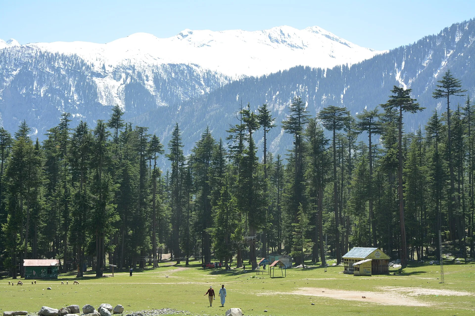
Photo: Usmanghani242, with thanks · CC BY-SA 4.0 · via Wikimedia Commons · temporary stand-in photo

Kachakani An
- Duration
- 6 days
- Distance
- 57.5 km
- Grade
- Strenuous
- Max altitude
- 4,766 m
- Season
- Jul – Sep
A demanding six-day crossing from Mahodand in Swat to Sor Laspur in Chitral over the glaciated Kachakani An (about 4,766 m). Forest, lakes and meadows, then snow and moraine.
Overview
The Kachakani An is a glacier pass of about 4,766 m that crosses from the head of the Ushu valley in Swat to the Bashqar Gol in Chitral. The trek starts at Machiangaas, next to Mahodand Lake, and ends at Sor Laspur. Over six days you pass pine forest, birch groves, flower meadows, small falls and blue-green lakes. On day 4 you climb a snow slope and cross the pass, then drop onto a glacier and its moraine.
This is the hardest of the old Chitral and Swat treks in this group. Pass day is 8 to 9 hours and involves snow, glacier and rock fall.
Who it suits
The old guide rates the trek as very demanding, and we have listed it as strenuous. You need good fitness, experience at 4,000 to 4,800 m and comfort on snow slopes and glacier ice. A reliable guide is essential. The old guide advises hiring one through a trekking company or a government source. Laspur porters may be more dependable than those from Swat. Porters ask a flat daily rate that includes food.
When to go
July to September. The pass keeps snow into July, and snow that has softened in the sun is hard going. Rock fall from the moraine increases late in the season. Start the pass day very early.
The route
Day 1. From Machiangaas (about 2,890 m), just south of the cedar and pine ringed Mahodand Lake, follow the wide trail along the Ushu Gol to the summer settlement of Diwangar (3,050 m). Falak Sar (5,918 m), Swat's highest peak, rises above the valley. The Dadarelli An route heads north from Diwangar.
Day 2. The trail rises through pine forest, crosses to the right bank, and continues to Shonz (3,200 m), a Gujar summer camp at the foot of the Bashkaro An.
Day 3. Follow the stream up through willow and birch, past small falls and lakes, to the summer pasture of Bokhtshal (3,875 m), at the foot of the pass.
Day 4. Start early. Climb an ever-steeper trail, with side glaciers coming into view, then snow slopes, to the Kachakani An (about 4,766 m). Descend steeply on snow-covered glacier, then follow the right edge of the moraine. Watch for rock fall. Pass the snout of the Kachakani Glacier and go down to the grassy camp at Khunza Uts (3,750 m, "Queen's Spring").
Day 5. Follow the Kachakani Gol to the Bashqar Gol and camp at 3,415 m.
Day 6. Walk down the right bank of the Bashqar Gol, through the hamlet of Nalagh, to Sor Laspur (2,850 m).
The pass day in detail
One Chitral operator describes the crossing in the Laspur-to-Swat direction. In its itinerary the first three hours of the pass day are over boulders and glacier moraine, then about two and a half hours on the glacier, with crevasses to watch for. The descent on the Swat side is over snow through a narrow, slippery gully, then a loose stony trail down to a stone hut at Bokht Shal (the operator gives about 3,840 m). Our route description above runs the other way and calls the same grass pasture Bokhtshal (3,875 m). Treat the two figures as one place with an uncertain height. Underfoot the pass day changes from grass and scree to snow, glacier ice, then loose moraine, so waterproof boots, gaiters and trekking poles all earn their weight.
The Laspur side
The operator's itinerary starts from Chitral by jeep to Sor Laspur (5 to 6 hours), and arranges porters in Laspur. It then walks 2 to 4 hours to a sandy camp at Subar, and on day 3 follows the left bank of the Subar stream for 6 to 7 hours to Khoonza Uch, a spring it calls the queen spring (our route calls it Khunza Uts, "Queen's Spring"). Names for the same camps vary between sources, so confirm each camp with your guide.
Culture and people
The upper Ushu valley is used in summer by Gujar herders. Kalam, the usual base, is a market town in upper Swat with many small hotels. Laspur, on the Chitral side, is a Khowar-speaking valley on the road to the Shandur Pass. One operator runs this trek in the other direction, from Sor Laspur to Mahodand.
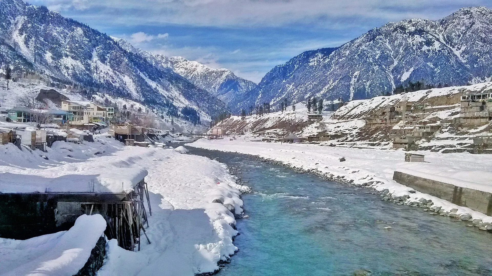
Photo: M. Hamza Shahab, with thanks · CC BY-SA 4.0 · via Wikimedia Commons · temporary stand-in photo

Practical information
- Maps. US AMS 1:250,000 sheets Churrai (NJ 43-1) and Mastuj (NJ 43-13).
- Safety and security. The old guide warned of a heavily armed local population and advised trekking with an armed escort and registering with the police in Kalam. That advice is more than twenty years old. Ask KP Tourism, the Swat police or your operator for current guidance before you go.
- Pass height. An operator itinerary also gives 4,766 m, but there is no known independent measurement.
- Mahodand Lake. The lake lies at about 2,865 m, about 40 km from Kalam, on the Ushu stream (a tributary of the Swat River). In summer alpine flowers such as geum, blue poppy, potentilla and gentian grow along the valley, and pines ring the lake (Wikipedia).
- Exit. Sor Laspur lies on the Chitral to Gilgit road over the Shandur Pass. No regular public transport runs from there to Chitral, but occasional jeeps go to Mastuj, and special hires go to Chitral or Gilgit.
- Season of road. The Swat road is sealed as far as Matiltan, about 16 km beyond Kalam. Jeeps go on to Mahodand Lake.
Highlights
- Glacier pass of about 4,766 m between Swat and Chitral
- Mahodand Lake, forest, birch and flower meadows on the Swat side
- Turquoise lakes in the upper Ushu valley
- Ends in Laspur on the Shandur road
Day by day
| Day | Camp | Altitude |
|---|---|---|
| 1 | Diwangar | 3,050 m |
| 2 | Shonz | 3,200 m |
| 3 | Bokhtshal | 3,875 m |
| 4 | Khunza Uts | 3,750 m |
| 5 | Bashqar Gol camp | 3,415 m |
| 6 | Sor Laspur | 2,850 m |
| Day | Route | Hours | Distance | Ascent / descent | Camp and altitude |
|---|---|---|---|---|---|
| Day 1 | Machiangaas to Diwangar | 4–5 h | 9.5 km | +160 m | Diwangar, 3,050 m |
Day 1 notesStart at the meadows just south of Mahodand Lake. Follow the wide trail through alpine forest along the Ushu Gol to the summer settlement of Diwangar. Falak Sar (5,918 m) towers above. The Dadarelli An trail heads north from here. | |||||
| Day 2 | Diwangar to Shonz | 4–5 h | 10 km | +150 m | Shonz, 3,200 m |
Day 2 notesThe broad trail rises through pine forest. Cross to the right bank of the Ushu Gol and continue to Shonz, a Gujar summer camp at the foot of the Bashkaro An. | |||||
| Day 3 | Shonz to Bokhtshal | 4–5 h | 8 km | +675 m | Bokhtshal, 3,875 m |
Day 3 notesThe trail follows the stream up through willow and birch groves, past small falls and blue-green lakes, to the summer pasture of Bokhtshal at the foot of the pass. A pleasant, sheltered camp with wildflowers. | |||||
| Day 4 | Bokhtshal to Khunza Uts over Kachakani An | 8–9 h | 11 km | +891 m / −1,016 m | Khunza Uts, 3,750 m |
Day 4 notesStart early. The trail steepens as views of side glaciers open. Climb snow slopes, which are difficult when soft, to the pass (about 4,766 m). Descend steeply on snow-covered glacier, then follow the right edge of the moraine, watching for rock fall. Pass the glacier snout and go down to the grassy camp at Khunza Uts. | |||||
| Day 5 | Khunza Uts to Bashqar Gol camp | 4 h | 9 km | −335 m | Bashqar Gol camp, 3,415 m |
Day 5 notesFollow the Kachakani Gol downstream to its meeting with the Bashqar Gol and camp at the confluence. | |||||
| Day 6 | Bashqar Gol camp to Sor Laspur | 4–5 h | 10 km | −565 m | Sor Laspur, 2,850 m |
Day 6 notesWalk down the right bank of the Bashqar Gol. Pass through the hamlet of Nalagh and reach Sor Laspur on the Shandur road. | |||||
Getting there
From Rawalpindi, take a bus to Saidu Sharif or Mingora in Swat, then a bus or van to Kalam (about 2.5 hours from Mingora). The old guide mentions a PTDC luxury bus from Rawalpindi at 9 am. Check whether it still runs.
From Kalam, minibuses run to Matiltan (16 km), where the road is sealed. Jeeps and special hires continue to Mahodand Lake (two to three hours from Kalam). You can also walk from Matiltan to Machiangaas (13 km, six to seven hours).
At the end, Sor Laspur has no regular public transport. Look for occasional jeeps to Mastuj, or hire a vehicle to Chitral or Gilgit.
Permits and rules
- Permit needed
- Usually not, Open zone
- Fee
- Current fees will be added soon
- Last checked
- 16 November 2026
Zone. The old guide lists this route as open, with no trekking permit.
Foreign visitors. The route crosses from Swat to Chitral, both in Khyber Pakhtunkhwa. KP Tourism launched an online NOC system in July 2025 for tourist-visa holders visiting Swat, Chitral and other northern areas. The Express Tribune reported on 6 May 2026 that foreigners still need an NOC for Chitral. We have not confirmed if the portal covers trekking. Ask a licensed operator.
Registration. The old guide advises registering with the police at Kalam.
How trekking permits, NOCs and registration work: Visa and permits.
Season
Best: Jul – Sep
Water and camps
Streams are plentiful on the Swat side and at Bokhtshal. On the Chitral side the camps at Khunza Uts and the Bashqar Gol are beside streams. Camps are meadows with no facilities. At Khunza Uts, a spring feeds a clear stream. Bring a stove, because wood may be scarce at higher camps.
Gear and safety
The pass day is 8 to 9 hours and crosses soft snow, a snow-covered glacier and loose moraine. Bring crampons, an ice axe, a rope and harness, and know how to use them or hire someone who does. Rock fall is a risk on the moraine, especially late in the season. Cross the snow before it softens. Altitude of nearly 4,800 m calls for good acclimatisation: the early camps lie at 2,890 to 3,200 m. Rescue is very slow, a long way from roads. Tell the police, your operator or the PTDC your plans. The old guide also warned of theft and advised posting a guard at night.
Ask the district administration or local police about current conditions before you go. For foreign visitors: the UK FCDO advises against all travel to Swat, and on the N-45 to the edge of Chitral city including the Kalash valleys (advice updated 27 October 2026, checked 16 November 2026). Most road routes to Chitral use the N-45. Read the live advice before you plan.
Variations
Several nearby routes start from Diwangar and Shonz: the Dadarelli An to Ghizer and the Bashkaro An. One operator runs this trek in the opposite direction, from Sor Laspur to Mahodand. The Phargam An trek links Laspur with the Golen valley (see lohigal-an).
Tips
- Hire a reliable guide through a trekking company or a government source.
- Start pass day before dawn, since the snow slope is hard when soft.
- Watch for rock fall on the moraine, especially late in the season.
- Ask police or KP Tourism for the current security advice in upper Swat.
- Pay porters a flat daily rate that includes food.
Stay and eat in Kalam
Kalam is the nearest town to the trek: somewhere to sleep and stock up before and after.
Places to stay
- New Honey Moon Hotel & Restaurant, Kalam Swat, KPKCall New Honey Moon Hotel & Restaurant, Kalam Swat, KPKMap of New Honey Moon Hotel & Restaurant, Kalam Swat, KPK in Google Maps
- Hotel Diamond HillsCall Hotel Diamond HillsMap of Hotel Diamond Hills in Google Maps
- Holiday inn kalamCall Holiday inn kalamMap of Holiday inn kalam in Google Maps
- The Glamping Spot KalamCall The Glamping Spot KalamMap of The Glamping Spot Kalam in Google Maps
- Hotel Al-Khaleej Kalam SwatCall Hotel Al-Khaleej Kalam SwatMap of Hotel Al-Khaleej Kalam Swat in Google Maps
- New Golden Star Hotel KalamCall New Golden Star Hotel KalamMap of New Golden Star Hotel Kalam in Google Maps
Places to eat
- River Chaarpai ParkCall River Chaarpai ParkMap of River Chaarpai Park in Google Maps
- Broadway Pizza & Fast Food KalamCall Broadway Pizza & Fast Food KalamMap of Broadway Pizza & Fast Food Kalam in Google Maps
Essential services fuel stations, ATMs, banks and hospitals and clinics
Fuel
- PSO petrol pumpMap of PSO petrol pump in Google Maps
- Go Chaudhary PetroleumMap of Go Chaudhary Petroleum in Google Maps
- Shah Filling Station KalamCall Shah Filling Station KalamMap of Shah Filling Station Kalam in Google Maps
- PSO PumpCall PSO PumpMap of PSO Pump in Google Maps
- BJ Filling stationCall BJ Filling stationMap of BJ Filling station in Google Maps
ATMs
- Sheraz Mobile Zone KalamMap of Sheraz Mobile Zone Kalam in Google Maps
Banks and money exchange
- Bank Al Habib Kalam BranchMap of Bank Al Habib Kalam Branch in Google Maps
Hospitals and clinics
- Basic Health Unit LaikotMap of Basic Health Unit Laikot in Google Maps
Listings come from Google Maps data and are unverified: phone numbers, opening months and prices may have changed. Report a problem · Own one of these? Claim it
Photos we still need: Bokhtshal pasture and the Kachakani An pass and glacier; no open-licence photo of the pass itself was found. Send us yours
Health and emergency
Mobile signal is patchy on most treks, so tell someone your plan before you go. Emergency numbers
Sources and last checked
Last checked Confidence low9 sources5 still to check
- Last checked
- Method
- Desk research from published sources
- Confidence
- low
- Checked by
- trek.pk research team
Researched from published sources; not yet checked on the ground by our team. Spot something out of date? Report a mistake.
Sources
- Legacy trek.pk page (text from Lonely Planet, Trekking in the Karakoram and Hindukush, c. 2002; facts only) · trek.pk / Lonely Planet · checked
- Kachakani Pass to Swat Valley Trek · Chitral Travel · checked
- Kalam Kachikani Pass Sor Laspur Trek · VE Pakistan · checked
- Kalam via Biasin Pass to Lake Mahodand · Mountain Wilderness · checked
- KP Tourism Department launches online NOC system for foreign tourists · Associated Press of Pakistan · checked
- Senate panel flags hurdles to Chitral tourism (6 May 2026) · The Express Tribune · checked
- Pakistan travel advice · UK FCDO (updated 27 Oct 2026) · checked
- Swat River (Mahodand Lake, 2,865 m) · Wikipedia · checked
- KP launches online NOC system for foreign tourists · Daily Times (14 Jul 2025) · checked
Still to be checked on the ground (5)
- Pass height: 4,766 m from the old guide and one operator itinerary only
- Whether the KP NOC portal covers trekking, and any escort rule (FCDO advises against all travel to Swat and Upper Dir; the NOC covers Swat, Chitral and other northern areas)
- State of the glacier and moraine route (changes each year)
- Daily times and distances (old guide only)
- Height of Bokht Shal: 3,875 m (route description) against about 3,840 m (one operator)
Nearby and related

Lohigal An

Ansoo Lake Trail

Bashigram Lake Trail
Bashkaro Pass
A rarely crossed glacier pass of about 4,924 m between the Ushu valley in Swat and the Khokush valley in upper Ghizer. Also called Bashkaro An or Kukush Pass.
Kachakani An
A glaciated pass of about 4,766 m between the head of the Ushu valley in Swat and the Bashqar Gol in Chitral. Strenuous six-day trek from Mahodand to Sor Laspur.
Dadarelli An
A rarely crossed glaciated pass of about 5,030 m at the head of the Handrap valley in Ghizer, leading south to the Ushu valley of Kalam Kohistan. Demanding, with rock fall on the south side.

Shandur Pass
A high grassy pass of about 3,720 m between Ghizer in Gilgit-Baltistan and Upper Chitral. Home to the Shandur polo ground and a summer festival, reached by a rough road.