

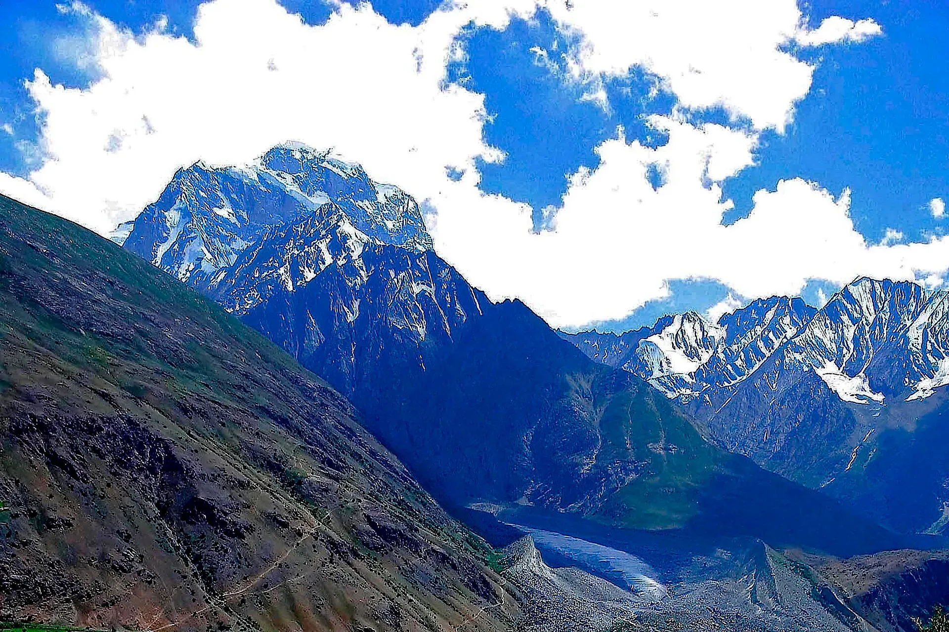
Photo: Pervez Ahmad Khan, with thanks · CC BY-SA 3.0 · via Wikimedia Commons · temporary stand-in photo

Khot An
- Duration
- 2 days
- Distance
- 16.2 km
- Grade
- Moderate
- Max altitude
- 4,230 m
- Season
- Jun – Sep
A two-day moderate crossing of the 4,230 m Khot An, from Khot Lasht in Turikho to Dizg in the Yarkhun valley, through yak pastures. Short, but with a long loose descent.
Overview
Khot An (4,230 m) is a broad grassy pass over the Hindu Raj. It links the Khot valley, a side valley of Turikho, with Dizg in the Yarkhun valley. The slopes are gentle, there is no glacier and the pass is used by herders and by villagers from upper Khot who walk to relatives in Dizg. A carved Buddhist stupa on a boulder beside the road to Khot suggests that people have crossed here for a very long time.
The trek is short, two days and about 16 km, but it climbs and descends a lot. The best way is west to east, from Khot Lasht to Dizg. The Khot side is gentle, and the 8 km drop to Dizg is steep and tiring, so it is better to go down it than up.
Who it suits
This is a moderate trek. The first day is easy. The second is long, five to seven hours, with 450 m of climbing and then 1,730 m of descent on loose ground. You should be fit, comfortable at nearly 4,000 m and happy to walk long downhills on scree. Spend a night at Khot Lasht (3,048 m) before you start, because Shahglasht, the first camp, is at 3,780 m.
When to go
June to mid-September. Snow lies on the pass in early summer. Yaks graze on the pass in summer.
The route
Day 1: Khot Lasht to Shahglasht. The road continues beyond Khot Lasht to Shahglasht. You pass a bridge over the Khot Gol above Ewatch, then Purkhot, the highest year-round village, and summer houses. The meadow of Shahglasht lies where several streams join to form the Khot Gol. There is a solar-powered weather station here. Shepherds' huts dot the slopes. A trail up the Jacha Gol leads to the Ghochhar An, a high pass towards Bang Gol.
Day 2: Shahglasht to Dizg. Follow the left bank of the Warmin Gol to a level meadow called Graz, about 1 hour 15 minutes from camp. It makes a good alternative high camp if your porters are equipped for 3,900 m. Truskho Chhat (3,950 m) is the last reliable water and the last possible camp. Climb to a knoll, then to the pass 30 minutes later. From Khot An you see the peaks above Thui to the east, and the high Hindu Kush to the west, including Akher Chhish (7,019 m) at the head of the Uzhnu Gol.
Descend over scree for 30 minutes to a small cold spring. This is the only water until Dizg. Contour round the south slopes with views of the Shandur range and the Yarkhun valley. Then follow a ridge, zigzag down loose gravel, and descend a steep gully between eroded loess towers to the valley floor. Cross the alluvial fan to the jeep road and reach Dizg (2,500 m).
Terrain underfoot
Day 1 follows a road and then a track, with a bridge over the Khot Gol and a crossing of the stream near Purkhot, before easy rolling hills and flat meadows. On day 2 the ground changes often: creek-side grass to Graz, grassland at Truskho Chhat, rocky ground on the approach to the pass, then scree. The east side is the hard part. It has a contouring path, a ridge of loose gravel and a steep gully between eroded loess towers (pillars of wind-blown silt), roughly 2 to 3 hours in all. An operator itinerary notes a 30-minute walk across the alluvial fan from the foot of the gully to Dizg, plus 15 minutes to the shops.
Timings in order
One operator lists these times on day 1: about 1 to 1.5 hours from Khot Lasht to the bridge near Ewatch (3,180 m), 45 minutes to Purkhot, 30 minutes to the summer houses, 45 minutes over the hills and 15 minutes to the weather station at Shahglasht. On day 2 it gives about 1 hour 15 minutes from Shahglasht to Graz and about 30 minutes more to Truskho Chhat. These are one operator's figures, not measured times.
Preparation
- Rest a night at Khot Lasht (3,048 m) and drink plenty; the first camp is 730 m higher.
- Carry full bottles from Truskho Chhat. Below the pass there is one cold spring and then no water until Dizg.
- Poles help on the long descent. Choose boots with a firm sole for loose gravel.
- A licensed operator usually supplies tents, cook and porters. Porters can sleep in herders' cottages at Shahglasht.
- Build in a spare day for road or weather delays; one operator's 10-day schedule keeps one.
Culture and people
Dizg is an Ismaili village with shops and plenty of water. Shopkeepers can show you places to camp. Khot is a Khowar-speaking valley, and its upper reaches are used as summer pasture. Hire porters at Khot Lasht, where they ask a lump sum. They appreciate the chance to stay in herders' huts at Shahglasht.
Practical information
- Maps. US AMS 1:250,000 sheet Mastuj (NJ 43-13) covers the route. Ewatch and Purkhot are not properly named. Shahglasht is labelled Shah Lasht. Many herders' huts are not shown.
- Water. Reliable at Shahglasht and Graz. After Truskho Chhat only one cold spring lies below the pass on the east side. Carry full bottles from the camp.
- Food. Buy supplies in Chitral or Mastuj. Dizg has some shops.
- Zone. The old guide lists this as a restricted area without a trekking permit. We have not confirmed this. See the permit section.
- Exit. From Dizg, jeeps and special hires run to Mastuj and Chitral.
Highlights
- Broad grassy pass at 4,230 m with yak pastures
- Views of Hindu Kush peaks including Akher Chhish (7,019 m)
- Old route between Turikho and Yarkhun, with a carved stupa on the road to Khot
- Ends at an Ismaili village, Dizg
Day by day
- StartKhot Lasht
- Day 1Shahglasht
- Day 2Dizg
| Day | Route | Hours | Distance | Ascent / descent | Camp and altitude |
|---|---|---|---|---|---|
| Day 1 | Khot Lasht to Shahglasht | 3.5–4 h | 4.7 km | +372 m | Shahglasht, 3,780 m |
Day 1 notesFirst spend a night at Khot Lasht (3,048 m) to acclimatise. Follow the road past Ewatch, over the bridge above it, and on to Purkhot and the highest summer houses. Climb through rolling hills to the level meadows of Shahglasht, where several streams meet. Camp near the weather station and visit the herders' huts. One operator gives about 1 to 1.5 hours to the bridge above Ewatch, then 45 minutes to Purkhot and a further hour or so to camp. | |||||
| Day 2 | Shahglasht to Dizg over Khot An | 5–7 h | 11.5 km | +450 m / −1,730 m | Dizg, 2,500 m |
Day 2 notesFollow the Warmin Gol up to the meadow of Graz, then to Truskho Chhat (3,950 m), the last water before the pass. Climb to a knoll and reach Khot An (4,230 m) about 30 minutes later. Descend scree to a small cold spring, contour round the south slopes, then follow a ridge and a steep gully between loess towers to the valley floor. Cross the fan to Dizg. Allow about 2 to 3 hours for the steep descent from the ridge, then about 45 minutes across the fan and into Dizg. | |||||
Getting there
From Chitral, jeeps run to Khot Lasht in about six hours. There is no fixed departure place in Chitral. Ask at the Mastuj jeep stand just north of Ataliq Bridge, or at the jeep workshop behind the petrol pump opposite the PTDC Chitral Motel. Special hires will go on to Shahglasht for more money.
From Dizg, jeeps and special hires go to Mastuj and to Chitral. Islamabad to Chitral by road takes 9 to 10 hours via the Swat Motorway, N-45 and the Lowari Tunnel. Ask NHA about closures.
Permits and rules
- Permit needed
- Yes, Restricted zone
- Fee
- Current fees will be added soon
- Last checked
- 16 November 2026
Zone. The old guide lists this area as restricted but says no trekking permit is needed. These two statements do not fit together and we have not confirmed either. Ask a licensed operator or the Chitral district administration.
Foreign visitors. KP Tourism launched an online NOC system in July 2025 for tourist-visa holders visiting Chitral and other northern areas. The Express Tribune reported on 6 May 2026 that foreigners still need an NOC for Chitral. Whether the portal covers trekking is not confirmed.
Guide. Operators state a licensed guide is a government requirement.
How trekking permits, NOCs and registration work: Visa and permits.
Season
Best: Jun – Sep
Water and camps
Water is reliable at Shahglasht and Graz (about 3,900 m). Truskho Chhat (3,950 m) is the last reliable stream and the last camp before the pass. On the east side there is a single small cold spring about 30 minutes below the pass, and no other water until Dizg. Camp at Shahglasht (3,780 m) or Graz. In Dizg, shopkeepers can offer grassy places to camp.
Gear and safety
The pass is only 4,230 m, but you start from 3,048 m and sleep at 3,780 m, so take a rest night at Khot Lasht and drink plenty. The descent to Dizg is 1,730 m on loose gravel and scree, with a steep gully below the ridge. Poles help. Heat can be intense in the lower valley. Snow lies on the upper slopes in early summer. There is no phone coverage on the pass.
Ask the district administration or local police about current conditions before you go. For foreign visitors: the UK FCDO advises against all travel on the N-45 from north of the Mardan ring road to the edge of Chitral city, including the Kalash valleys (advice updated 27 October 2026, checked 16 November 2026). Most road routes to Chitral use the N-45. Read the live advice before you plan.
Variations
A trail from Shahglasht up the Jacha Gol leads to the Ghochhar An, a high pass to the Bang Gol on the Hindu Raj crest. From Dizg you can continue up the Yarkhun valley towards Broghil. See broghil-and-karambar-an for the Yarkhun valley and Karambar An.
Tips
- Spend a night at Khot Lasht (3,048 m) before climbing to Shahglasht.
- Fill all bottles at the last spring, since there is no water between the pass spring and Dizg.
- Walk the route west to east; the descent to Dizg is steep and loose.
- Hire porters at Khot Lasht.
- Confirm current permit rules with your operator, because the area borders sensitive zones.
Stay and eat in Mastuj
Mastuj is the nearest town to the trek: somewhere to sleep and stock up before and after.
Places to stay
- Hot Spring Guest HouseCall Hot Spring Guest HouseMap of Hot Spring Guest House in Google Maps
- Noor Mahal GuesthouseCall Noor Mahal GuesthouseMap of Noor Mahal Guesthouse in Google Maps
- Mastuj Hindukash HeightsMap of Mastuj Hindukash Heights in Google Maps
- PTDC Motel -MastujCall PTDC Motel -MastujMap of PTDC Motel -Mastuj in Google Maps
- Al Salah Hotel & Restaurant MastujCall Al Salah Hotel & Restaurant MastujMap of Al Salah Hotel & Restaurant Mastuj in Google Maps
Listings come from Google Maps data and are unverified: phone numbers, opening months and prices may have changed. Report a problem · Own one of these? Claim it
Photos we still need: Khot An pass and the Khot side (the current photo shows the Thui An range above the Yarkhun); Shahglasht meadow and Dizg village. Send us yours
Health and emergency
Mobile signal is patchy on most treks, so tell someone your plan before you go. Emergency numbers
Sources and last checked
Last checked Confidence medium9 sources6 still to check
- Last checked
- Method
- Desk research from published sources
- Confidence
- medium
- Checked by
- trek.pk research team
Researched from published sources; not yet checked on the ground by our team. Spot something out of date? Report a mistake.
Sources
- Legacy trek.pk page (text from Lonely Planet, Trekking in the Karakoram and Hindukush, c. 2002; facts only) · trek.pk / Lonely Planet · checked
- Khot An Pass Trek, Chitral · Apricot Tours · checked
- Exploring the Yarkhun · American Alpine Journal · checked
- KP Tourism Department launches online NOC system for foreign tourists · Associated Press of Pakistan · checked
- Senate panel flags hurdles to Chitral tourism (6 May 2026) · The Express Tribune · checked
- NHA flayed for stopping traffic through Lowari Tunnel · Dawn · checked
- KP launches online NOC system for foreign tourists · Daily Times · checked
- List of Restricted/Prohibited/Border Areas in Pakistan (14 Jan 2026; operator page, supporting only) · Apricot Tours · checked
- Khot An Pass Trek itinerary (times and terrain, re-read) · Apricot Tours (operator) · checked
Still to be checked on the ground (6)
- Zone and permit: the Express Tribune (6 May 2026) says foreign tourists need a KP NOC before visiting Chitral, and Daily Times (14 Jul 2025) describes the online NOC system. An operator list (14 Jan 2026) treats Khot Pass as a restricted trek needing a permit (supporting only). The exact permit for this route is still open
- Chitral to Khot Lasht jeep time and current road state (old guide: six hours)
- Pass height 4,230 m (Apricot Tours itinerary again; no independent source found)
- Distances: none found. Apricot's times for Shahglasht to Dizg add up to roughly 7 to 8 hours including the pass; the old guide's times were not independently checked
- Current water sources: Apricot gives Truskho Chhat (3,950 m) as the last dependable water before the pass and a small cold spring about 30 minutes down scree from the pass as the only water until Dizg; seasonal flow is not confirmed
- Walking times are from one operator itinerary only
Nearby and related

Broghil and Karambar An

Ansoo Lake Trail

Bashigram Lake Trail
Ghochhar An
A high pass of about 4,727 m on the Hindu Raj crest in Chitral, reached from the Jacha Gol above Shahglasht. First pass of the five-day Khot Lasht to Yashkist crest traverse.
Bang Gol Muli An
A rarely used pass of about 4,763 m on the Hindu Raj crest in Chitral, crossed on the five-day Khot Lasht to Yashkist traverse. Cross-country, for self-reliant trekkers.
Khot An (Khot Pass)
A broad grassy pass of 4,230 m over the Hindu Raj, from Khot Lasht in Turikho to Dizg in the Yarkhun valley. A two-day moderate crossing with a long loose descent.