

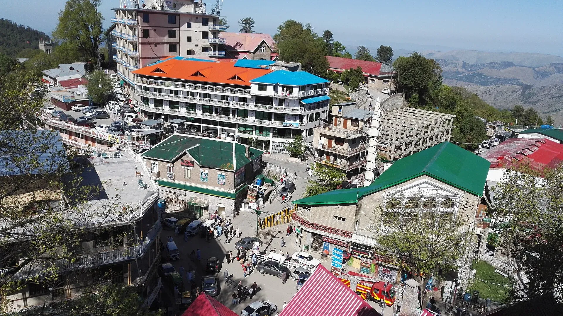
Photo: Usama javaid, with thanks · CC BY-SA 4.0 · via Wikimedia Commons · temporary stand-in photo
Kuldana Trail (Murree)
- Duration
- 1 day
- Distance
- 3.4 km
- Grade
- Easy
- Season
- Mar – Jun, Sep – Nov
A fairly level 3.4 km British-era forest path from Murree's main bazaar to Karamkot ground, with old buildings and cemeteries. Reported neglected in 2023.
Overview
The Kuldana Trail is a 3.4 km path in Murree that links the main bazaar with Karamkot ground. It dates to the British era, when infantry battalions were stationed at Kuldana. The Express Tribune reported in 2023 that the terrain is fairly level, which makes it popular with walkers who want an easy outing.
Murree stands at about 2,291 m in the Pir Panjal range. Work on the town began in 1851 as a sanatorium for British troops, and it served as the summer capital of British Punjab from 1873 to 1875. Kuldana is one of its old military areas.
Who it suits
Families, casual walkers and anyone who wants a gentle walk in the forest rather than a climb. We grade it easy because the source describes the terrain as fairly level. It does not suit anyone who needs a well-kept, signed path, as it was reported neglected.
When to go
Murree is cool even in summer, so March to November is comfortable. Wikivoyage describes frequent light rain in summer and thick snow in winter, with temperatures that can fall below freezing. Snow and ice may make the path slippery. There is no known official season. Avoid heavy rain.
Getting to the start
Murree has no airport or railway station. The nearest airport is Islamabad International and the nearest station is Rawalpindi Cantonment. Wikivoyage gives about 1 hour from Islamabad on the Islamabad-Murree Expressway (M-75) or about 1.5 hours by the old road, with buses and vans from Rawalpindi. The trail starts at Murree's main bazaar (the Mall Road area). The Express Tribune reported in August 2023 that many tourists do not know the trail exists, so ask locally for the start.
The route
From the main bazaar the path leads through dense conifer forest to Karamkot ground. Along the way the Tribune notes old buildings, a stone engraving at the Karamkot cricket ground, a playground, two old cemeteries, a small chapel and 19th-century structures used by the armed forces. No walking time is given. At an easy pace, expect around an hour one way, but that is our estimate and not from a source.
The ground underfoot is a forest path, fairly level but reported neglected in 2023, with some benches added by the cantonment authorities. There are no shops or water points on the way, so the bazaar is the place to buy what you need.
Culture and people
Kuldana has long been a military area. The Army School of Logistics, Kuldana, is responsible for maintaining the trail, and says that with enough funding it could become one of the best trails in Murree. Treat the cemeteries and chapel with respect, and do not photograph military buildings or personnel.
Preparing for the walk
Wear shoes with a good grip, because fallen needles, mud and ice can make the path slippery. Carry water and a rain layer. Murree can be cold and wet at any time of year. Walk in daylight, because the forest holds leopards and wild boar, and go in a group. Return the same way or arrange a pickup at Karamkot ground.
Practical information
- Distance: 3.4 km (Express Tribune, 2023).
- Access: part of an army-managed area, so check locally that you can enter.
- Wildlife: leopards live in the forest; walk in daylight and in company.
- Fees: none found.
Highlights
- 3.4 km, fairly level forest walk
- British-era buildings, chapel and two old cemeteries
- Stone engraving at Karamkot cricket ground
- Conifer forest with wildlife
Day by day
- StartMurree main bazaar
- Day 1Karamkot ground
| Day | Route | Hours | Distance | Ascent / descent | Camp and altitude |
|---|---|---|---|---|---|
| Day 1 | Murree main bazaar to Karamkot ground | not given | 3.4 km | not given | Karamkot ground |
Day 1 notesBegin in Murree's main bazaar and follow the forest path towards Karamkot ground. The route is fairly level and passes old British-era buildings, a small chapel, cemeteries and a playground. Karamkot cricket ground has a stone engraving. Return the same way or arrange a pickup. | |||||
Getting there
The trail starts from Murree's main bazaar (Mall Road area) and ends at Karamkot ground. Murree is reached by road from Islamabad and Rawalpindi, and buses and vans run from both. The Express Tribune reported in August 2023 that many tourists do not know the trail exists, so ask locally for the start.
Permits and rules
- Permit needed
- Usually not, Open zone
- Fee
- Current fees will be added soon
- Last checked
- 16 November 2026
Part of the trail is maintained by the Army School of Logistics, Kuldana, and access status is unclear. Check locally before you go. No fee was found in the source.
How trekking permits, NOCs and registration work: Visa and permits.
Season
Best: Mar – Jun, Sep – Nov
Water and camps
No water on the trail; carry what you need. There is no known camping information.
Gear and safety
Wildlife
The Express Tribune says the forest has leopards, monkeys, wild boar, foxes and pheasants. Walk in daylight and in a group.
Condition
The 2023 report calls the trail neglected, with some benches added by the cantonment authorities, RADO and the Army School of Logistics. Expect uneven or overgrown sections.
Weather
Murree gets heavy snow and rain. Check the forecast and avoid the trail in storms or when it is icy.
Variations
Ghora Gali Seven Sisters Trail is another forest walk in the Murree area.
Tips
- Check locally that the route is open to visitors
- Walk in daylight and with others
- Keep to the path and take rubbish with you
- Wear walking shoes: the path was reported neglected
Stay and eat in Murree
Murree is the nearest town to the trek: somewhere to sleep and stock up before and after.
Places to stay
- Murree Hotels MurreeMap of Murree Hotels Murree in Google Maps
- Ramada by Wyndham Murree Lower Topa ResortCall Ramada by Wyndham Murree Lower Topa ResortMap of Ramada by Wyndham Murree Lower Topa Resort in Google Maps
- Shangrila Hotels And Resorts MurreeCall Shangrila Hotels And Resorts MurreeMap of Shangrila Hotels And Resorts Murree in Google Maps
- Marco Polo Resort MurreeMap of Marco Polo Resort Murree in Google Maps
- Hotel Mehran MurreeCall Hotel Mehran MurreeMap of Hotel Mehran Murree in Google Maps
- Mehran LodgesCall Mehran LodgesMap of Mehran Lodges in Google Maps
Places to eat
- Kashmir PointMap of Kashmir Point in Google Maps
- McDonald's Lower Topa MurreeCall McDonald's Lower Topa MurreeMap of McDonald's Lower Topa Murree in Google Maps
- Monal MurreeCall Monal MurreeMap of Monal Murree in Google Maps
- TDCP HillTop Resort KhajutCall TDCP HillTop Resort KhajutMap of TDCP HillTop Resort Khajut in Google Maps
- The New York PizzaCall The New York PizzaMap of The New York Pizza in Google Maps
- Terrace Grill RestaurantCall Terrace Grill RestaurantMap of Terrace Grill Restaurant in Google Maps
Essential services fuel stations, mechanics, ATMs, pharmacies, hospitals and clinics and Rescue 1122
Fuel
- Faran Petroleum (PSO)Call Faran Petroleum (PSO)Map of Faran Petroleum (PSO) in Google Maps
- Petrol ShopMap of Petrol Shop in Google Maps
- Mustaqeem LPGMap of Mustaqeem LPG in Google Maps
- Bukhari CNGMap of Bukhari CNG in Google Maps
Mechanics and tyre shops
- Abrar Auto WorkshopCall Abrar Auto WorkshopMap of Abrar Auto Workshop in Google Maps
- New Gujranwala autos workshopCall New Gujranwala autos workshopMap of New Gujranwala autos workshop in Google Maps
ATMs
- BankIslami - Mall Road Muree BranchCall BankIslami - Mall Road Muree BranchMap of BankIslami - Mall Road Muree Branch in Google Maps
- HBL Bank & ATMMap of HBL Bank & ATM in Google Maps
Pharmacies
- A Rauf & Sons Medical Store Surgical & Provision Store MurreeCall A Rauf & Sons Medical Store Surgical & Provision Store MurreeMap of A Rauf & Sons Medical Store Surgical & Provision Store Murree in Google Maps
- Abbasi PharmacyMap of Abbasi Pharmacy in Google Maps
- Abbasi ChemistsCall Abbasi ChemistsMap of Abbasi Chemists in Google Maps
Hospitals and clinics
- THQ HOSPITAL MURREEMap of THQ HOSPITAL MURREE in Google Maps
- Shifa General Hospital barianCall Shifa General Hospital barianMap of Shifa General Hospital barian in Google Maps
Rescue 1122
- Rescue 1122 Central Station MurreeCall Rescue 1122 Central Station MurreeMap of Rescue 1122 Central Station Murree in Google Maps
- Rescue 1122 Khajot Key Point, MurreeCall Rescue 1122 Khajot Key Point, MurreeMap of Rescue 1122 Khajot Key Point, Murree in Google Maps
Listings come from Google Maps data and are unverified: phone numbers, opening months and prices may have changed. Report a problem · Own one of these? Claim it
Photos we still need: the old British-era buildings, chapel and cemeteries along the Kuldana trail, and Karamkot ground. Send us yours
Health and emergency
Mobile signal is patchy on most treks, so tell someone your plan before you go. Emergency numbers
Sources and last checked
Last checked Confidence low3 sources4 still to check
- Last checked
- Method
- Desk research from published sources
- Confidence
- low
- Checked by
- trek.pk research team
Researched from published sources; not yet checked on the ground by our team. Spot something out of date? Report a mistake.
Sources
- Kuldana trail forgotten (7 Aug 2023) · The Express Tribune · checked
- Murree · Wikipedia · checked
- Murree (travel guide) · Wikivoyage · checked
Still to be checked on the ground (4)
- Walking time (not sourced; the Express Tribune gives the length, 3.4 km, but no time)
- Whether public access is currently allowed (the track is under the Army School of Logistics, Kuldana; no current statement found)
- Current condition of the path (only the 2023 report found)
- Exact trailheads (the 2023 report names only the main bazaar and Karamkot ground)


