

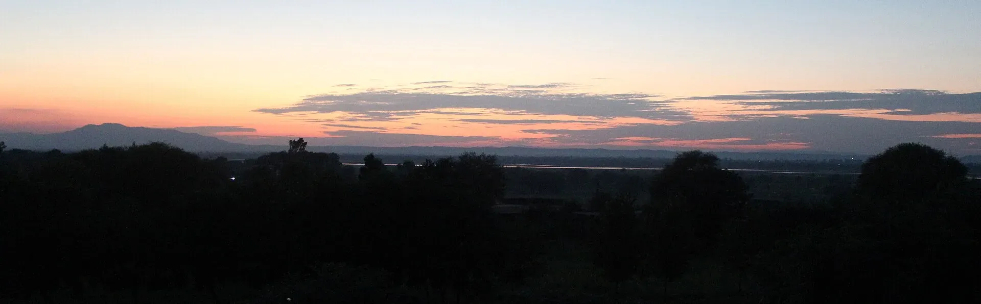
Photo: Tilla Jogian, with thanks · CC BY-SA 3.0 · via Wikimedia Commons · temporary stand-in photo
Tilla Jogian Trail
- Duration
- 1 day
- Distance
- 3 km
- Grade
- Moderate
- Max altitude
- 975 m
- Season
- Oct – Mar
A climb of about 3 km and nearly 500 m from Bhet village to the old Jogi temple complex on Tilla Jogian (975 m), the highest peak of the eastern Salt Range near Jhelum.
Overview
Tilla Jogian ("hill of the jogis", also known as Balnath Tilla or Gorakh Tilla) is the highest peak in the eastern Salt Range, at 975 m, in Jhelum district, Punjab. It lies about 25 km west of Jhelum and Dina, on the Pothohar Plateau near the Jhelum River and the Grand Trunk Road. Rohtas Fort and Katas Raj lie nearby. Near the summit stands a ruined complex of Hindu temples and monastic buildings, once the main centre of the Kanphata jogi order (ascetics who wear large earrings) and the most important jogi pilgrimage site in Punjab before 1947.
Who it suits
Walkers of average fitness who like a short, steep climb with a historic site at the top. This page grades it moderate. Wikipedia gives about 3 km with nearly 500 m of climbing on the most common route. About 2 hours up is an estimate from earlier research and is not from Wikipedia, so treat it as a rough guide. There is no developed path.
When to go
October to March is the comfortable season, as an estimate; summers are hot. The Salt Range is cooler and wetter than the plains below, which is also why a British deputy commissioner built a bungalow on the hill.
The route
The common route starts at Bhet village on the north side and climbs about 3 km, gaining nearly 500 m. Other trails start near Rohtas Fort and at Sanghoi on the Jhelum River side. No developed paths lead to the complex, so expect rough ground, and ask in Bhet for the start of the path. Dirt bikes also use the tracks.
The summit is heavily forested with olive, pine and Acacia modesta (a thorny acacia). Near the top an old stone path, the Poorhiwaala Rah, passes the Ratti Banni ravine before reaching the temples. Wikipedia reports that this path is disintegrating, so take care on loose stone.
What remains at the top
Wikipedia lists a complex of temples with at least three baths, a network of waterworks including at least two minor dams, a temple tank (sarovar) from Ranjit Singh's reign, and two cupolas with descending stairs. Several structures survive in poor condition. As of 2012 the site was reported overgrown by olive trees, with no conservation work. Wikipedia gives conflicting construction dates (9th century CE in one place, 1st century BCE in a caption), so the age of the complex is uncertain.
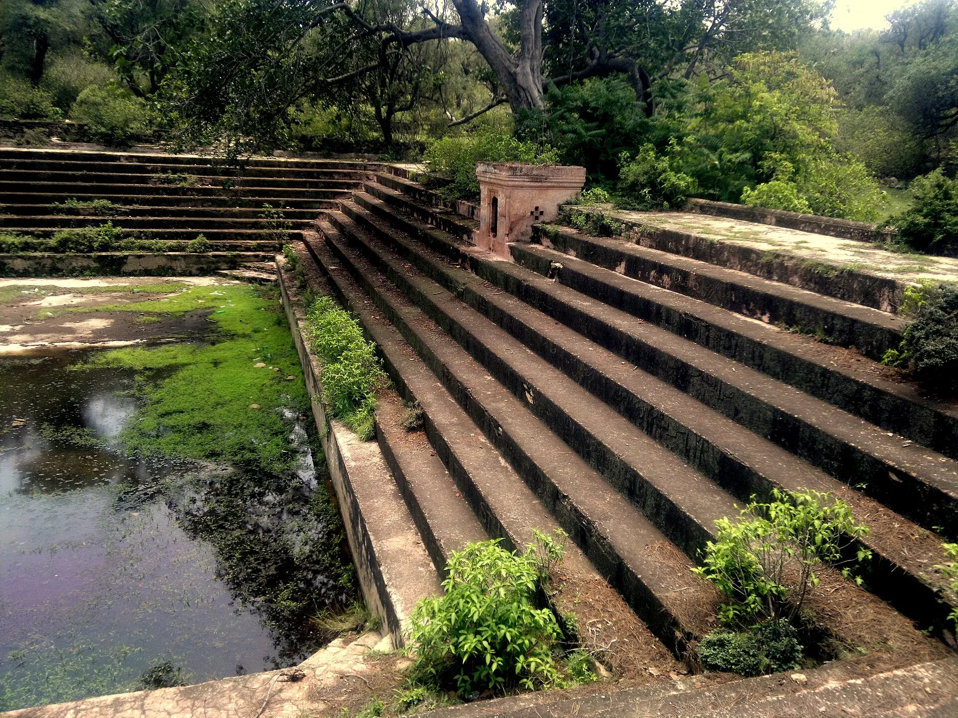
Photo: Tilla Jogian, with thanks · CC BY-SA 3.0 · via Wikimedia Commons · temporary stand-in photo
Culture and history
Tradition places the founding of the Kanphata order with Guru Gorakhnath. Tilla Jogian was its centre, and hundreds of jogis lived here before 1947, alongside a Brahminical seminary. Before Partition the mahant (head of the monastery) was regarded as head of all Kanphatas of the Nath sampradaya, and an annual festival was held on the first day of the Hindu month of Chaitra, with communal meals.
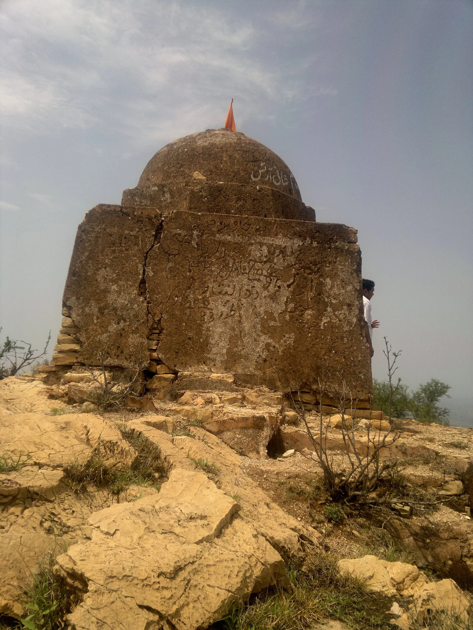
Photo: Tilla Jogian, with thanks · CC BY-SA 3.0 · via Wikimedia Commons · temporary stand-in photo
Guru Nanak is reported to have meditated here for 40 days in the early 1500s. Akbar visited the "Shrine of Balnath" and Jahangir came in the 17th century. Ahmad Shah Abdali sacked the complex in a raid, and it was soon rebuilt. In the early 19th century Ranjit Singh built a stone-lined pond and a small monument at Guru Nanak's meditation spot; the monument has since been damaged by vandals. Waris Shah's 1766 poem Heer Ranjha also has Ranjha come to Tilla Jogian after heartbreak, to become a jogi.
After 1947 most of the Hindu population left. The last mahant, Samandnath Jogi, left a local village official as caretaker, never returned and the belongings were auctioned. Villagers have searched the site for coins and souvenirs to sell. Treat the site with respect and take nothing away.
Practical information
- Distance and climb: about 3 km, nearly 500 m (Wikipedia).
- Time: about 2 hours up (earlier research, unconfirmed).
- Fees: none found. The site is privately owned and not officially protected.
- Water: no source is described; carry all you need.
- Camping: no information found.
Highlights
- Highest peak of the eastern Salt Range, 975 m
- About 3 km and nearly 500 m of climbing from Bhet
- Old Kanphata Jogi temples and a ravine path
- Olive, pine and Acacia modesta forest
Day by day
- StartBhet village (north side)
- Day 1Tilla Jogian summit and temples
| Day | Route | Hours | Distance | Ascent / descent | Camp and altitude |
|---|---|---|---|---|---|
| Day 1 | Bhet village to Tilla Jogian summit and temples | about 2 h (up, unconfirmed) | 3 km | +500 m | not given |
Day 1 notesStart at Bhet on the north side and climb through olive, pine and acacia forest, gaining nearly 500 m in about 3 km. Near the top the old stone Poorhiwaala Rah path leads past the Ratti Banni ravine to the ruined temples, tank and cupolas. Look but do not take anything. Return the same way, taking care on loose stone. | |||||
Getting there
Tilla Jogian is about 25 km west of Jhelum and Dina, near the Jhelum River and the Grand Trunk Road (Wikipedia). The most common route starts from Bhet village on the north side. Other trails start near Rohtas Fort and at Sanghoi on the Jhelum River side. A jeep track from the Rohtas side is mentioned in earlier research. Ask locally in Bhet for the start of the path.
Permits and rules
- Permit needed
- Usually not, Open zone
- Fee
- Current fees will be added soon
- Last checked
- 16 November 2026
No permit or fee was found. Wikipedia says the complex is not officially protected and is privately owned. Check locally before you go.
How trekking permits, NOCs and registration work: Visa and permits.
Season
Best: Oct – Mar
Water and camps
No water source is described; carry all you need. No camping information was found.
Gear and safety
Heat
Summers in the Salt Range are hot. Walk in the cooler months and start early.
Terrain
No developed paths lead to the complex (Wikipedia). Near the top an old stone path called the Poorhiwaala Rah is deteriorating. Take care on loose stone.
Access
The site is not officially protected and is privately owned. Dirt bikes also use the tracks.
Help
Go with a companion and tell someone your plan.
Variations
Nandana Fort, also in Jhelum district, is a shorter walk (not covered here).
Tips
- Start early and take water; there is no developed path
- Respect the ruins: do not remove or damage anything
- Wear shoes with grip for loose stone
- Check the weather: hot in summer
Stay and eat in Jhelum
Jhelum is the nearest town to the trek: somewhere to sleep and stock up before and after.
Places to eat
- Chaaye Khana JhelumCall Chaaye Khana JhelumMap of Chaaye Khana Jhelum in Google Maps
- 2nd Wife RestaurantCall 2nd Wife RestaurantMap of 2nd Wife Restaurant in Google Maps
- Pizzalicious Fast FoodCall Pizzalicious Fast FoodMap of Pizzalicious Fast Food in Google Maps
- Chicken Cottage JhelumCall Chicken Cottage JhelumMap of Chicken Cottage Jhelum in Google Maps
- Handi House Restaurant JhelumCall Handi House Restaurant JhelumMap of Handi House Restaurant Jhelum in Google Maps
- Habibi Restaurant JhelumCall Habibi Restaurant JhelumMap of Habibi Restaurant Jhelum in Google Maps
Essential services fuel stations, mechanics, ATMs, pharmacies, hospitals and clinics and Rescue 1122
Fuel
- Noor PSO Filling StationCall Noor PSO Filling StationMap of Noor PSO Filling Station in Google Maps
- Four Star Petroleum- Total Petrol StationCall Four Star Petroleum- Total Petrol StationMap of Four Star Petroleum- Total Petrol Station in Google Maps
- GO Petroleum & Heera CNG.Call GO Petroleum & Heera CNG.Map of GO Petroleum & Heera CNG. in Google Maps
- Admore Petrol PumpCall Admore Petrol PumpMap of Admore Petrol Pump in Google Maps
- Jhelum CNGMap of Jhelum CNG in Google Maps
- Al Rehman CNG StationMap of Al Rehman CNG Station in Google Maps
Mechanics and tyre shops
- Fazal Din & Sons Honda DealerCall Fazal Din & Sons Honda DealerMap of Fazal Din & Sons Honda Dealer in Google Maps
- Haji Pervez Autos & Battery StoreCall Haji Pervez Autos & Battery StoreMap of Haji Pervez Autos & Battery Store in Google Maps
- Al-Makkah Autos WorkshopCall Al-Makkah Autos WorkshopMap of Al-Makkah Autos Workshop in Google Maps
- Munir Autos Sara-e-AlamgirCall Munir Autos Sara-e-AlamgirMap of Munir Autos Sara-e-Alamgir in Google Maps
- Al-Haseeb Auto StoreCall Al-Haseeb Auto StoreMap of Al-Haseeb Auto Store in Google Maps
- Shehzad Auto Workshop & Spare PartsCall Shehzad Auto Workshop & Spare PartsMap of Shehzad Auto Workshop & Spare Parts in Google Maps
ATMs
- HBL Kharala Branch JhelumCall HBL Kharala Branch JhelumMap of HBL Kharala Branch Jhelum in Google Maps
- Faysal BankMap of Faysal Bank in Google Maps
- UBL ATMCall UBL ATMMap of UBL ATM in Google Maps
- ATM UBLMap of ATM UBL in Google Maps
Pharmacies
- Shifa PharmacyCall Shifa PharmacyMap of Shifa Pharmacy in Google Maps
- Tariq PharmacyCall Tariq PharmacyMap of Tariq Pharmacy in Google Maps
- MD Clinic and PharmacyMap of MD Clinic and Pharmacy in Google Maps
- Sunny Medical StoreCall Sunny Medical StoreMap of Sunny Medical Store in Google Maps
- Awan Medical StoreCall Awan Medical StoreMap of Awan Medical Store in Google Maps
- A.S Pharmacy (المدینہ میڈیکل سٹور)Call A.S Pharmacy (المدینہ میڈیکل سٹور)Map of A.S Pharmacy (المدینہ میڈیکل سٹور) in Google Maps
Hospitals and clinics
- Jhelum Doctors HospitalCall Jhelum Doctors HospitalMap of Jhelum Doctors Hospital in Google Maps
- Jhelum Poly ClinicCall Jhelum Poly ClinicMap of Jhelum Poly Clinic in Google Maps
- Jhelum Cardiac CentreCall Jhelum Cardiac CentreMap of Jhelum Cardiac Centre in Google Maps
- Hijama Center Hakeem Zubair Khan JhelumCall Hijama Center Hakeem Zubair Khan JhelumMap of Hijama Center Hakeem Zubair Khan Jhelum in Google Maps
- Dr Fozia Kazmi Clinic & Maternity HomeCall Dr Fozia Kazmi Clinic & Maternity HomeMap of Dr Fozia Kazmi Clinic & Maternity Home in Google Maps
- Mirza HospitalCall Mirza HospitalMap of Mirza Hospital in Google Maps
Rescue 1122
- Rescue 1122 Office Sarai AlamgirMap of Rescue 1122 Office Sarai Alamgir in Google Maps
- Rescue 1122 JhelumCall Rescue 1122 JhelumMap of Rescue 1122 Jhelum in Google Maps
Listings come from Google Maps data and are unverified: phone numbers, opening months and prices may have changed. Report a problem · Own one of these? Claim it
Photos we still need: the Bhet start and the Poorhiwaala Rah path. Send us yours
Health and emergency
Mobile signal is patchy on most treks, so tell someone your plan before you go. Emergency numbers
Sources and last checked
Last checked Confidence medium3 sources5 still to check
- Last checked
- Method
- Desk research from published sources
- Confidence
- medium
- Checked by
- trek.pk research team
Researched from published sources; not yet checked on the ground by our team. Spot something out of date? Report a mistake.
Sources
- Tilla Jogian · Wikipedia · checked
- Tilla Jogian · Department of Archaeology and Museums, Punjab · checked
- Tilla Jogian (re-read for history, layout and condition) · Wikipedia · checked
Still to be checked on the ground (5)
- Time up (about 2 h is from earlier research)
- Current access and land ownership
- Jeep track from the Rohtas side
- Construction date of the complex (Wikipedia gives 9th century CE and 1st century BCE)
- DOAM page (doam.gov.pk/sites/10363) only redirects to an app; its content could not be read


