

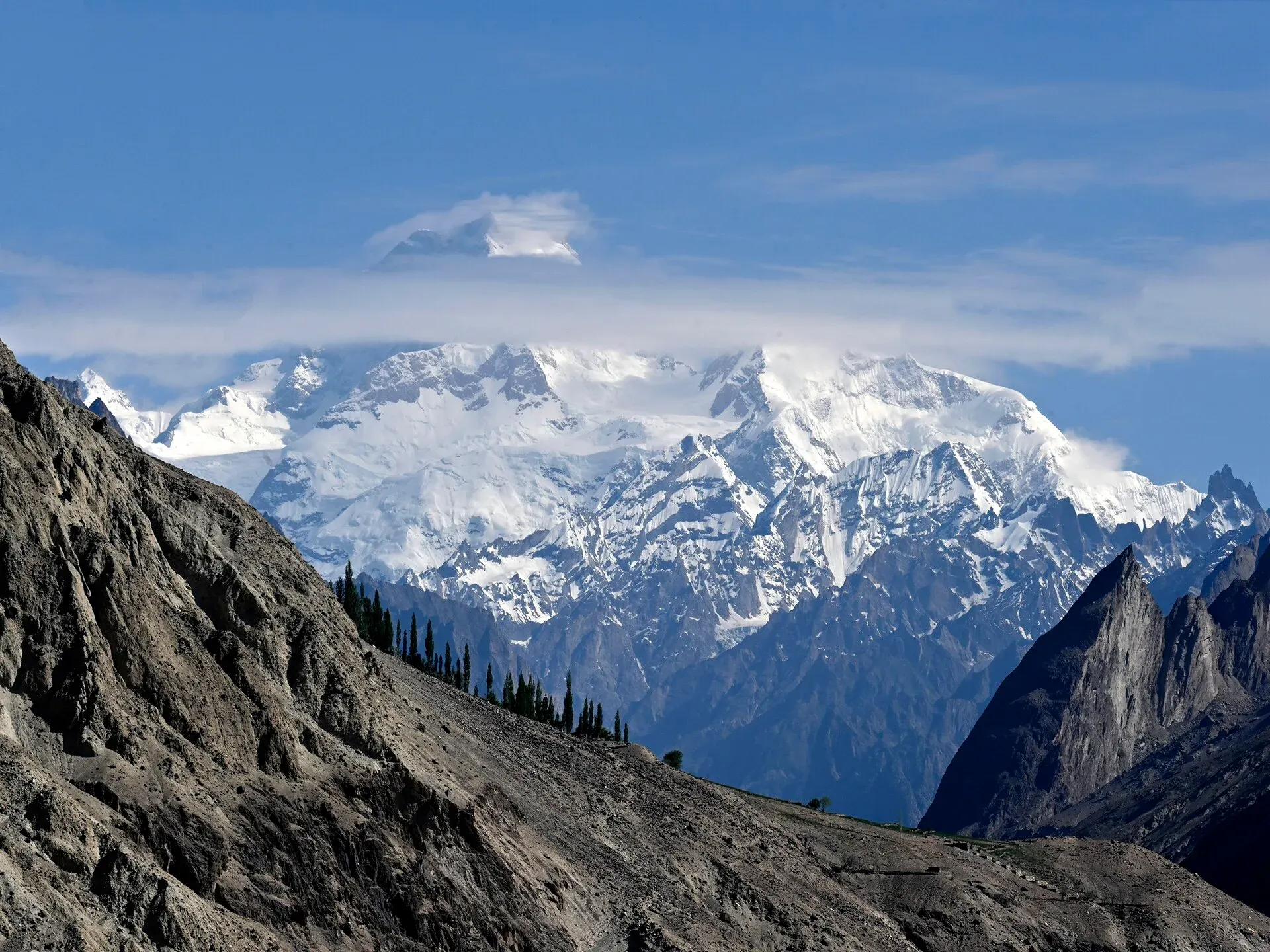
Photo: Moskenes, with thanks · CC BY 4.0 · via Wikimedia Commons · temporary stand-in photo
Masherbrum Base Camp
- Duration
- 4–6 days
- Distance
- 31 km
- Grade
- Moderate
- Max altitude
- 4,280 m
- Season
- Jun – Sep
A four-day return trek from Hushe to the base camp of Masherbrum (7,821 m), with close views of its south face. Short but steep, and a good acclimatisation trek. Needs a permit.
Overview
This is one of the shortest ways to reach the base camp of a Karakoram giant. Masherbrum (7,821 m), once called K1, rises straight above the head of the Hushe valley, and the trek gets you close to its south face. The route is four days return from Hushe. It follows the Hushe River, then the Masherbrum Glacier's side valley, and ends with a 30-minute walk across the glacier to the base camp (4,280 m by the old guide; some operators say 4,500 m).
The mountain
Masherbrum is the 22nd highest mountain in the world and the highest peak of the Masherbrum Mountains, a subrange of the Karakoram south of the Baltoro Glacier. Thomas Montgomerie named it K1 in 1856, as the first peak he recorded in the Karakoram. The origin of the local name is disputed. One suggestion links it to a muzzle-loader, from the shape of the summit. Another reads masha as "lady" and gives "queen of peaks". The Hushe valley is the normal approach to the mountain.
Fanny Bullock Workman and William Workman reconnoitred it in 1911. A New Zealand party reached about 7,000 m in 1955, and a British party in 1957 came to about 200 m below the summit. The first ascent came in 1960, by George Bell and Willi Unsoeld, followed two days later by Nick Clinch and Jawed Akhter. The trek to base camp needs no climbing skill.
Who it suits
A moderate trek for walkers with some mountain experience. Daily climbs are short but steady, and you end at 4,280 m, so the last day is a real altitude gain. It is a good first trek in the Hushe area and is often used as acclimatisation for the Gondogoro valley or K7. You do not need technical skills; the only glacier section is straightforward.
When to go
Mid-June to September. June has more snow and cold nights, while July and August are the warmest and busiest. Streams are higher in the afternoons. Snow bridges on the Pushuka stream last into July; after that you hop across rocks.
The route
You leave Hushe by one of two footbridges over the Hushe River and follow the west bank through fields and past stone huts. After Wesuk you cross the Aling River on a footbridge and soon reach Dumsum summer village. A walk of about two hours from the start brings you to Parbisan (also written Farbisang), a pleasant camp site.
The second day goes towards the snout of the Masherbrum Glacier. You climb a steep, faint trail up a side slope marked by occasional cairns, follow the lateral moraine past a stone animal barrier, and cross the Pushuka stream. Brumbrama is the camp at the top of the ablation valley. The old guide calls this stage 575 m of climbing in about two hours; most operators allow more time and note it is steep.
On day three you follow the ablation valley, cross an outwash stream and pass the Chogospnag meadow. After the final moraine you cross a short section of white rock-covered glacier. Masherbrum Base Camp is on a meadow beside a small pool, with the mountain filling the view. You return to Hushe on day four, about 5–6 hours down.
An alternative return goes down the glacier to Pushuka, then along the Gondogoro River to Darya Chowk and Tir Sir, over the Gondogoro Glacier to Shaishcho, and down to Hushe. This takes three days. It lies in a restricted zone and is useful if you plan to go on to the Gondogoro valley or K7.
Terrain underfoot
- Day 1. Footbridges over the Hushe River, then the west bank through fields, past stone fodder huts and across the Aling River on a footbridge to Parbisan.
- Day 2. A steep, faint trail with occasional cairns, then the lateral moraine (the ridge of loose rock beside the glacier), a stone animal barrier and the Pushuka stream, which is a snow bridge in early summer and stepping stones later.
- Day 3. A contouring trail to the huts at Chogospnag meadow, an outwash stream, the last moraine, then about 30 minutes over white rock-covered ice to base camp.
Stream levels rise in the afternoon, so cross early where there is a choice.
Getting to Hushe
The Hushe valley runs south from Masherbrum and other glaciers to the Shyok River, opposite Khaplu. Fly or drive to Skardu, then take a jeep via Khaplu to Hushe, about 5 to 6 hours. Khaplu is 103 km east of Skardu on the Shyok River. Hushe is the last village on the road, and the checkpoint for the permit is at the roadhead.
Culture and people
Hushe is the last village on the road and has a long tradition of providing porters and guides for expeditions. Many of its people are Balti Muslims. The summer pastures along the route, such as Parbisan, are used for grazing. A guide from the village will help with route-finding on the moraine. The first ascent of Masherbrum was in 1960 by George Bell and Willi Unsoeld, then two days later by Nick Clinch and Jawed Akhter.
Practical information
Zone and permits. The trek is in a restricted zone, and the Hushe side is within CKNP's core zone. You need a permit arranged through a licensed operator and a guide.
Maps. The Swiss 1:250,000 Karakoram sheet 2 marks only Dumsum, and in the wrong place; the trail beyond is not shown.
Camps. Camping is on meadows and moraine. Water comes from the stream near each camp and can be silty. There are no shops beyond Hushe.
Highlights
- Close views of Masherbrum (7,821 m), the 22nd highest mountain in the world
- Only a short stretch of easy glacier walking, no technical skills
- Meadows, summer pastures and stone huts on the way up
- Works as acclimatisation for the Gondogoro valley or K7
Day by day
| Day | Camp | Altitude |
|---|---|---|
| 1 | Parbisan | 3,300 m |
| 2 | Brumbrama | 3,900 m |
| 3 | Masherbrum Base Camp | 4,280 m |
| 4 | Hushe | not given |
| Day | Route | Hours | Distance | Ascent / descent | Camp and altitude |
|---|---|---|---|---|---|
| Day 1 | Hushe to Parbisan | 2–2½ h | 6.9 km | +425 m | Parbisan, 3,300 m |
Day 1 notesCross the Hushe River on one of two footbridges and follow the west bank through fields and past stone fodder huts. Wesuk is about 90 minutes from the start. Cross the Aling River on a footbridge near Dumsum and carry on to Parbisan, a camp site by the river. | |||||
| Day 2 | Parbisan to Brumbrama | 2–2½ h | 4.1 km | +575 m | Brumbrama, 3,900 m |
Day 2 notesWalk along the river towards the snout of the Masherbrum Glacier, cross a side stream and climb steeply up a faint trail with occasional cairns. Follow the lateral moraine, pass a stone animal barrier, and cross the Pushuka (a snow bridge in early summer, rocks later). Brumbrama is in the ablation valley. | |||||
| Day 3 | Brumbrama to Masherbrum Base Camp | 1½–2 h | 4.5 km | +230 m | Masherbrum Base Camp, 4,280 m |
Day 3 notesA good trail contours the hillside and climbs the lateral moraine to the huts at Chogospnag meadow. Continue up the ablation valley, cross a side-glacier moraine and walk about 30 minutes over white rock-covered ice. Base camp is just beyond, on a meadow by a small pool. | |||||
| Day 4 | Base camp to Hushe | 5–6 h | 15.5 km | −1,230 m | not given |
Day 4 notesReturn by the same route to Hushe. An alternative three-day return via Darya Chowk, Tir Sir and Shaishcho is described in the guide and suits parties going on to the Gondogoro valley. | |||||
Getting there
Fly or drive to Skardu, then take a jeep 5–6 hours via Khaplu to Hushe. Your operator will arrange a private jeep, and local jeeps also run when the road is open.
Permits and rules
- Permit needed
- Yes, Restricted zone
- Fee
- Current fees will be added soon
- Last checked
- 16 November 2026
Zone: restricted. You need a trekking permit arranged through a licensed Pakistani tour operator, a licensed guide, and (inside Central Karakoram National Park, CKNP) the park fees. You cannot walk this route alone. The checkpoint is at the roadhead; keep your permit papers with you.
Fees. A trekking permit fee, Central Karakoram National Park fees and a waste-management fee apply. Current fees will be added soon. Until then, ask your licensed operator for the current written fee list.
How trekking permits, NOCs and registration work: Visa and permits.
Season
Best: Jun – Sep
Water and camps
Water comes from streams along the valley; clear water is available at Dumsum and near Brumbrama, and the Pushuka stream carries meltwater. Treat all water. Campsites are on meadows and moraine, with a pool at base camp. There is no fuel wood at base camp, so carry kerosene.
Gear and safety
The trail is steep in places and crosses loose moraine. Altitude reaches about 4,280–4,500 m. Take a rest day at Brumbrama if you feel unwell, and descend if symptoms worsen. The glacier section is short, but carry a rope and ice axe if conditions are icy, and stay with your guide. Streams are higher in the afternoon.
Variations
- Return via Shaishcho: a three-day alternative (Darya Chowk, Tir Sir, Shaishcho, Hushe) in a restricted zone.
- Gondogoro Valley and Gondogoro La (see those treks).
- K7 Base Camp (see K7 Base Camp) from Shaishcho.
- Honbrok pastures are a day hike from Hushe (see Other treks in Baltistan).
Tips
- The old guide gives 4,280 m for base camp and Wikipedia cites about 4,500 m; carry an altimeter or ask your guide.
- Start early; afternoon river crossings are higher.
- Allow extra time on day 2, the steepest.
- Hire local Hushe guides, who know the moraine route.
Photos we still need: the trail between Hushe and Parbisan, the Pushuka crossing and the rock-covered glacier section before base camp (no open-licence photo found). Send us yours
Health and emergency
Mobile signal is patchy on most treks, so tell someone your plan before you go. Emergency numbers
Sources and last checked
Last checked Confidence medium8 sources6 still to check
- Last checked
- Method
- Desk research from published sources
- Confidence
- medium
- Checked by
- trek.pk research team
Researched from published sources; not yet checked on the ground by our team. Spot something out of date? Report a mistake.
Sources
- Masherbrum Base Camp (old trek.pk page, text from Lonely Planet Trekking in the Karakoram and Hindukush, c. 2002; used for facts only) · trek.pk / Lonely Planet · checked
- Masherbrum · Wikipedia · checked
- Masherbrum Base Camp (4500m), Karakoram, Pakistan · SummitPost · checked
- Visiting CKNP: permits, season, logistics (unofficial-looking summary; figures approximate) · cknp.org · checked
- Trekkers and Climbers Stranded Amid Pakistan Permit Dispute (March 2025) · ExplorersWeb · checked
- K2 Base Camp Trek - 2025 price increases · Jagged Globe · checked
- Masherbrum base camp trek (itinerary) · Apricot Tours · checked
- Hushe Valley · Wikipedia · checked
Still to be checked on the ground (6)
- Base camp altitude: 4,280 m (old guide, and an Apricot Tours itinerary) vs about 4,500 m (SummitPost); no official figure
- Daily times: operators often schedule 4½ h for the first two days; the guide says 2–2½ h
- Current permit and CKNP fees: the CKNP site says a Core Zone permit, liaison officer and environment fee apply to the Hushe approach but gives no current amounts; operator 2026-27 listings quote USD 150 and USD 190 (commercial, not used)
- Condition of the footbridges and the Pushuka crossing
- Whether the Hushe side is open-zone or restricted: the CKNP page says a Core Zone permit is needed, but the open/restricted split comes only from the old guide and operators
- Whether the glacier snout area and the Pushuka crossing need a rope in July and August (guide says only if icy)


