

Photo: Guilhem Vellut, with thanks · CC BY-SA 2.0 · via Wikimedia Commons · temporary stand-in photo
Karakoram
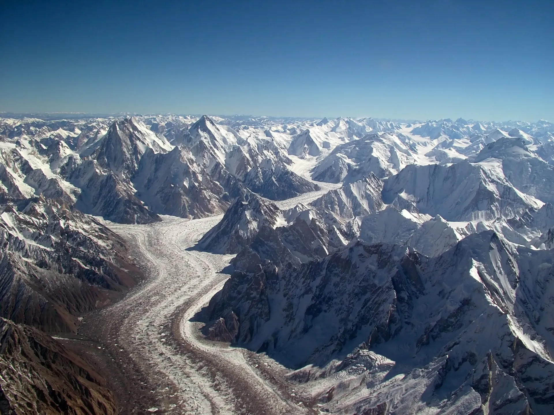
The Karakoram holds K2 (8,611 m) and three other 8,000 m peaks, with some of the longest glaciers outside the polar regions. Most of Pakistan's classic treks start here.
Overview
The Karakoram is a high, narrow range that runs for about 500 km across northern Pakistan, with its ends reaching into China and India. Pakistan holds the heart of it. Four of the world's fourteen peaks above 8,000 m stand here: K2 (8,611 m), Gasherbrum I (8,080 m), Broad Peak (8,051 m) and Gasherbrum II (8,035 m). Nanga Parbat, Pakistan's fifth, belongs to the Himalaya.
It is also one of the most glaciated places outside the polar regions. Wikipedia says its glaciers cover more than 15,000 square kilometres, and that most are slightly retreating while some central and western ones have held steady or gained, a pattern called the "Karakoram Anomaly". Biafo (63 km), Baltoro (62 km) and Hispar (49 km), by Central Karakoram National Park's figures, are long enough to be walked for days. Wikipedia's Biafo page gives 67 km, without a citation.
Peaks and sub-ranges
The Karakoram is split into smaller groups, each named after a leading peak or glacier.
- Baltoro and Masherbrum: K2, Broad Peak and the Gasherbrums gather around Concordia, where the Baltoro and Godwin-Austen glaciers meet. Masherbrum (7,821 m) rises to the south.
- Hispar Muztagh: a high wall of 7,000 m peaks above the Hispar and Biafo glaciers. Sources commonly give Distaghil Sar at about 7,885 m as its highest.
- Batura Muztagh: the long ridge above Passu and the Batura Glacier, topped by Batura I (7,795 m).
- Rakaposhi-Haramosh: Rakaposhi (7,788 m) rises above Gilgit and Nagar, and Haramosh (7,409 m) stands further south-east.
Wikipedia's list of mountains in Pakistan, citing a trekking guide, says Pakistan has 108 peaks above 7,000 m, and a large share are in the Karakoram. Heights are rarely exact: many Karakoram peaks differ by over 100 m on different maps.
Trekking in the Karakoram
This is the range most people mean when they talk about trekking in Pakistan. The best-known routes include the Baltoro Glacier and Concordia for K2, Gondogoro La, the Biafo-Hispar traverse, Rakaposhi Base Camp, and shorter walks around Passu, Ultar and Rush Lake. Easier valley treks suit first-timers. The glacier crossings and high passes are demanding and need experienced guides.
When to go
The main season is June to September. Concordia and the high passes are best from late June to August. The snow line drops quickly in autumn, and most high routes are closed by October. Check weather and glacier conditions with your operator before you go.
Getting there and access
Skardu and Gilgit are the two main gateways, by air or by road. Both connect to the Karakoram Highway. Access rules differ by area: some zones are open, some need a permit, and some are closed. Rules change, so check with the Gilgit-Baltistan tourism department or your licensed operator before you travel.
Good to know
- The Karakoram, Himalaya and Hindu Kush meet near Jaglot, south-east of Gilgit. It is better described as a place where three great ranges meet than as the only such place on Earth.
- Distances to Jaglot from Gilgit vary by source (roughly 25 to 45 km), so use the road signs rather than a fixed figure.
- Glacier lengths change with the survey and the year, and many are retreating or advancing locally.
Geology
Crumpled rock on the collision zone between the Indian and Eurasian plates, one of the most active zones on Earth. Heavily glaciated.
Notable peaks
Sources and last checked
Last checked Confidence high5 sources2 still to check
- Last checked
- Method
- Desk research from published sources
- Confidence
- high
- Checked by
- trek.pk research team
Researched from published sources; not yet checked on the ground by our team. Spot something out of date? Report a mistake.
Sources
- Karakoram · Wikipedia · checked
- List of mountains in Pakistan · Wikipedia · checked
- Karakoram glaciers: Baltoro, Biafo, Hispar · Central Karakoram National Park · checked
- Junction of three mountain ranges · Gilgit-Baltistan Tourism · checked
- Biafo Glacier · Wikipedia · checked
Still to be checked on the ground (2)
- Peak heights can vary by 100 m or more between maps and sources (Wikipedia says so for the Karakoram)
- Biafo glacier length: 63 km (CKNP, the park authority) vs 67 km (Wikipedia, uncited); the page uses 63 km


