

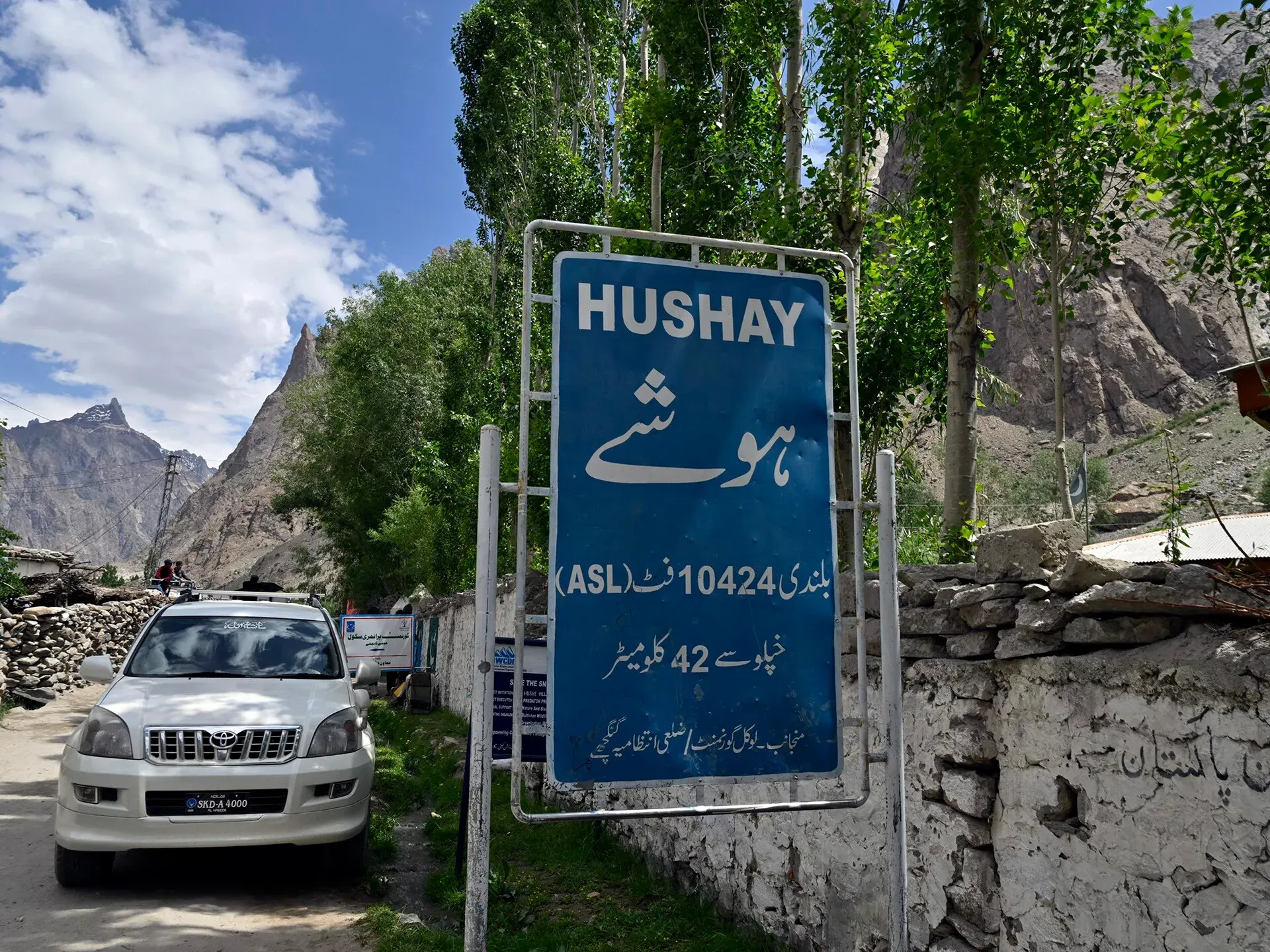
Photo: Moskenes, with thanks · CC BY 4.0 · via Wikimedia Commons · temporary stand-in photo

K7 Base Camp
- Duration
- 5–8 days
- Distance
- 57.6 km
- Grade
- Moderate
- Max altitude
- 4,600 m
- Season
- Jun – Sep
A five-day return trek from Hushe up the Tsarak Tsa (Charakusa) valley to the base of K7 (6,934 m), a huge granite wall. Moderate effort; needs a permit.
Overview
The Tsarak Tsa valley (also spelled Charakusa) runs east from the Hushe valley towards K7 (6,934 m), one of the great granite walls of the Karakoram. K7 and Link Sar (7,041 m) form a ridge north-east of the upper glacier, and K6 (7,281 m) lies to the south. K7 was first climbed in 1984 by a Japanese expedition. The trek to K7 Base Camp is a short, rewarding walk beside big rock walls and several 5,000 m peaks that have not been climbed. Climbers know the area for its granite; trekkers go for the views and the quiet.
The Hushe valley
The Hushe valley runs south from Masherbrum and nearby glaciers to the Shyok River, opposite Khaplu. Its side valleys include Gondogoro, Charakusa (Tsarak Tsa), Nangmah and the Masherbrum valley itself. Laila Peak, K6 and K7 are among the peaks above 6,000 m around it. Hushe is the last village on the road, at about 3,050 m according to one operator, and it has basic guesthouses and homestays.
Who it suits
A moderate trek for people who are fit and happy walking five to eight hours a day. It is a good choice if you want to see steep rock walls rather than a long glacier walk. It is also useful acclimatisation for the Gondogoro La. There is no technical climbing.
When to go
Mid-June to September. Operators generally recommend June to September. The highest pasture, Spangser, is used by herders in mid-July to mid-August.
The route
On day 1 you walk from Hushe to Shaishcho, as for the Gondogoro valley. On day 2 you head east into the ablation valley north of the Tsarak Tsa Glacier. K7 and Link Sar appear ahead. Tikchumik is a small spring at the base of the ridge, with good water. You cross the west margin of the Chogolisa Glacier to reach Spangser (4,000 m), a green, flower-covered pasture above the glacier junction. Modern operators sometimes put this camp at 3,850 m. Granite slabs rise above it.
Day 3 continues through the ablation valley, at times over difficult ground, to K7 Base Camp. The old guide says 4,600 m. Other sources say 4,350 m or 4,550 m, so treat the figure as uncertain. You return to Hushe in two days, camping at Shaishcho.
Culture and people
Hushe is the last village on the road, and many of its men are guides and climbers. Summer pastures such as Shaishcho and Spangser are used for grazing. Herders' stone huts dot the pastures. A guide from Hushe will help with route-finding and local customs.
What you see
The approach is a steady climb beside walls of clean granite. The ridge of K7 and Link Sar closes the head of the valley, and K6 (7,281 m, also called Baltistan Peak) stands on the south side of the upper glacier. Between Spangser and base camp there are several 5,000 m peaks and a great deal of rock that nobody has climbed. The nearby Nangmah valley, reached from Kande village, is also known for steep granite walls and the Great Tower (5,800 m). It is worth asking your guide which walls are which, because the names on older maps are often wrong.
Getting to Hushe
Skardu is the usual starting point. A jeep goes through the Shigar and Khaplu valleys to Hushe, which this page puts at about 5 to 6 hours. Khaplu lies on the Shyok River, 103 km east of Skardu, and is a popular base for trekking into the Hushe valley. Fly or drive to Skardu first, and arrange the jeep through your operator.
Planning the days
Five days is the minimum. Many parties add a day at Spangser or at base camp to acclimatise and to walk up the glacier margin. One operator's ten-day plan walks from Hushe to Saitcho (3,400 m) in an easy 3 to 4 hours, goes on to Spangsar, takes a day to acclimatise, reaches the base camp on day 6 and spends day 7 exploring ridges and glacial lakes. The last three days cover the walk back to Hushe and the drive to Skardu. Its season is July to early September. Because the trek starts at only about 3,300 m, the climb from Shaishcho (3,330 m) to base camp is about 1,300 m in two days. That is fast for people who have not been at altitude, so it helps to do the Masherbrum Base Camp trek first, or to add a rest night at Shaishcho. Descent is quick: the old guide allows two days back to Hushe.
Practical information
Zone and permits. Restricted zone, with a permit through a licensed operator and CKNP fees. Some operators list the trek as 12 days with Islamabad transfers.
Maps. The Swiss 1:250,000 Karakoram sheet 2 labels the glacier as Charakusa; Tsarak Tsa is the local Balti name. Spangser appears as Supanset and Tikchumik as Techimic.
Rock climbing. The valley is known for big-wall climbing. Climbing above 6,500 m needs a separate permit.
Highlights
- One of the largest granite walls in the world on K7 (6,934 m)
- Spangser pasture, the highest camp used by herders
- Views of Link Sar (7,041 m) and K6 (7,281 m)
- Quiet, side-valley trek close to the Gondogoro and Masherbrum routes
Day by day
| Day | Camp | Altitude |
|---|---|---|
| 1 | Shaishcho | 3,330 m |
| 2 | Spangser | 4,000 m |
| 3 | K7 Base Camp | 4,600 m |
| 4 | Shaishcho | 3,330 m |
| 5 | Hushe | 3,050 m |
| Day | Route | Hours | Distance | Ascent / descent | Camp and altitude |
|---|---|---|---|---|---|
| Day 1 | Hushe to Shaishcho | 4 h | 9.3 km | +280 m | Shaishcho, 3,330 m |
Day 1 notesFollow the Hushe River's true left bank north, as on the first day of the Gondogoro valley trek. Cross a footbridge to the north bank and reach Shaishcho. | |||||
| Day 2 | Shaishcho to Spangser | 4 h | 8.5 km | +670 m | Spangser, 4,000 m |
Day 2 notesHead east into the ablation valley north of the Tsarak Tsa Glacier. K7 and Link Sar come into view. Tikchumik, a small spring, has good water. Cross the west edge of the Chogolisa Glacier to reach the flowery pasture of Spangser, used by herders mid-July to mid-August. | |||||
| Day 3 | Spangser to K7 Base Camp | 4 h | 11 km | +600 m | K7 Base Camp, 4,600 m |
Day 3 notesContinue through the ablation valley north of the Tsarak Tsa Glacier, over difficult ground at times, to the base camp below the wall. | |||||
| Day 4 | K7 Base Camp to Shaishcho | 7–8 h | 19.5 km | −1,270 m | Shaishcho, 3,330 m |
Day 4 notesRetrace your route down the valley to Shaishcho (this stage is the sum of the two upper sections). | |||||
| Day 5 | Shaishcho to Hushe | 4 h | 9.3 km | −280 m | Hushe, 3,050 m |
Day 5 notesA good trail along the Hushe River to the village. | |||||
Getting there
Fly or drive to Skardu, then a jeep via Khaplu to Hushe, about 5–6 hours. Local jeeps run when the road is open; your operator will usually arrange transport.
Permits and rules
- Permit needed
- Yes, Restricted zone
- Fee
- Current fees will be added soon
- Last checked
- 16 November 2026
Zone: restricted. You need a trekking permit arranged through a licensed Pakistani tour operator, a licensed guide, and (inside Central Karakoram National Park, CKNP) the park fees. You cannot walk this route alone. The checkpoint is at the roadhead; keep your permit papers with you.
Fees. A trekking permit fee, Central Karakoram National Park fees and a waste-management fee apply. Current fees will be added soon. Until then, ask your licensed operator for the current written fee list.
How trekking permits, NOCs and registration work: Visa and permits.
Season
Best: Jun – Sep
Water and camps
Clear water is available at Tikchumik and in side streams; glacier streams are silty. Spangser has water and flat ground. Carry kerosene, as wood is scarce.
Gear and safety
The ablation valley path can be hard to follow and crosses scree and moraine. The Chogolisa Glacier crossing is on ice, and stream levels rise in the afternoon. Altitude reaches about 4,600 m. Carry warm layers; weather changes quickly beside big walls.
Variations
- Masherbrum Base Camp from Hushe (see that trek).
- Gondogoro Valley and Gondogoro La (see those treks).
- K6 Base Camp from Kande village (see Other treks in Baltistan).
- Technical climbs and big-wall routes need separate permits.
Tips
- Base camp height is given as 4,350–4,600 m by different sources; plan acclimatisation for the highest figure.
- Camp at Shaishcho on the way back, as the old guide does.
- Take a guide from Hushe; there is no marked trail near the glacier.
- Combine with Masherbrum Base Camp or the Gondogoro valley for acclimatisation.
Photos we still need: the ablation valley route and Spangser pasture (no open-licence photo found). Send us yours
Health and emergency
Mobile signal is patchy on most treks, so tell someone your plan before you go. Emergency numbers
Sources and last checked
Last checked Confidence low8 sources7 still to check
- Last checked
- Method
- Desk research from published sources
- Confidence
- low
- Checked by
- trek.pk research team
Researched from published sources; not yet checked on the ground by our team. Spot something out of date? Report a mistake.
Sources
- K7 Base Camp (old trek.pk page, text from Lonely Planet Trekking in the Karakoram and Hindukush, c. 2002; used for facts only) · trek.pk / Lonely Planet · checked
- Karakoram · Wikipedia · checked
- K6, K7 Trek (operator itinerary) · Pleiades Adventures · checked
- Charakusa Valley Trek · 10adventures · checked
- Visiting CKNP: permits, season, logistics (unofficial-looking summary; figures approximate) · cknp.org · checked
- Trekkers and Climbers Stranded Amid Pakistan Permit Dispute (March 2025) · ExplorersWeb · checked
- Hushe Valley · Wikipedia · checked
- Khaplu · Wikipedia · checked
Still to be checked on the ground (7)
- Base camp altitude: 4,600 m (old guide) vs 4,350 m or 4,550 m (operators); Pleiades Adventures gives no base camp height
- Spangser altitude: 4,000 m (old guide) vs 3,850 m (operator); Pleiades gives no height
- Whether the Hushe-valley side of this trek is currently a restricted-zone or open-zone route (Pleiades says a Gilgit-Baltistan trekking permit is needed; zone not stated)
- Daily distances and times (from c. 2002 guide); no recent official source found. Pleiades gives Hushe to Saitcho (3,400 m) as an easy 3 to 4 hour hike
- Current permit and CKNP fees
- Hushe altitude: about 3,050 m (operator); no second source
- Saitcho (operator) against Shaishcho (old guide): the same camp under two spellings?
Nearby and related

Gondogoro Valley

Masherbrum Base Camp
Gondogoro La
Chogolisa
Chogolisa (7,665 m) is a double-summit peak near Concordia on the Baltoro Glacier. Hermann Buhl died on it in 1957, and it was first climbed in 1975.
Gondogoro La
A fixed-rope trekking pass of about 5,585 to 5,620 m between Concordia on the Baltoro Glacier and the Hushe valley. Famous for its view of K2; technical and restricted-zone.
K7 (Gomgma Gangri)
K7 (6,934 m) is a granite peak at the head of the Charakusa valley, with one of the largest granite walls in the Karakoram. The K7 Base Camp trek from Hushe reaches its foot.
K6 (Baltistan Peak)
K6, also called Baltistan Peak, is a 7,282 m peak in the Masherbrum Mountains above the Charakusa and Hushe valleys. It was first climbed in 1970 by an Austrian expedition. It is seen on the K7 Base Camp trek.