

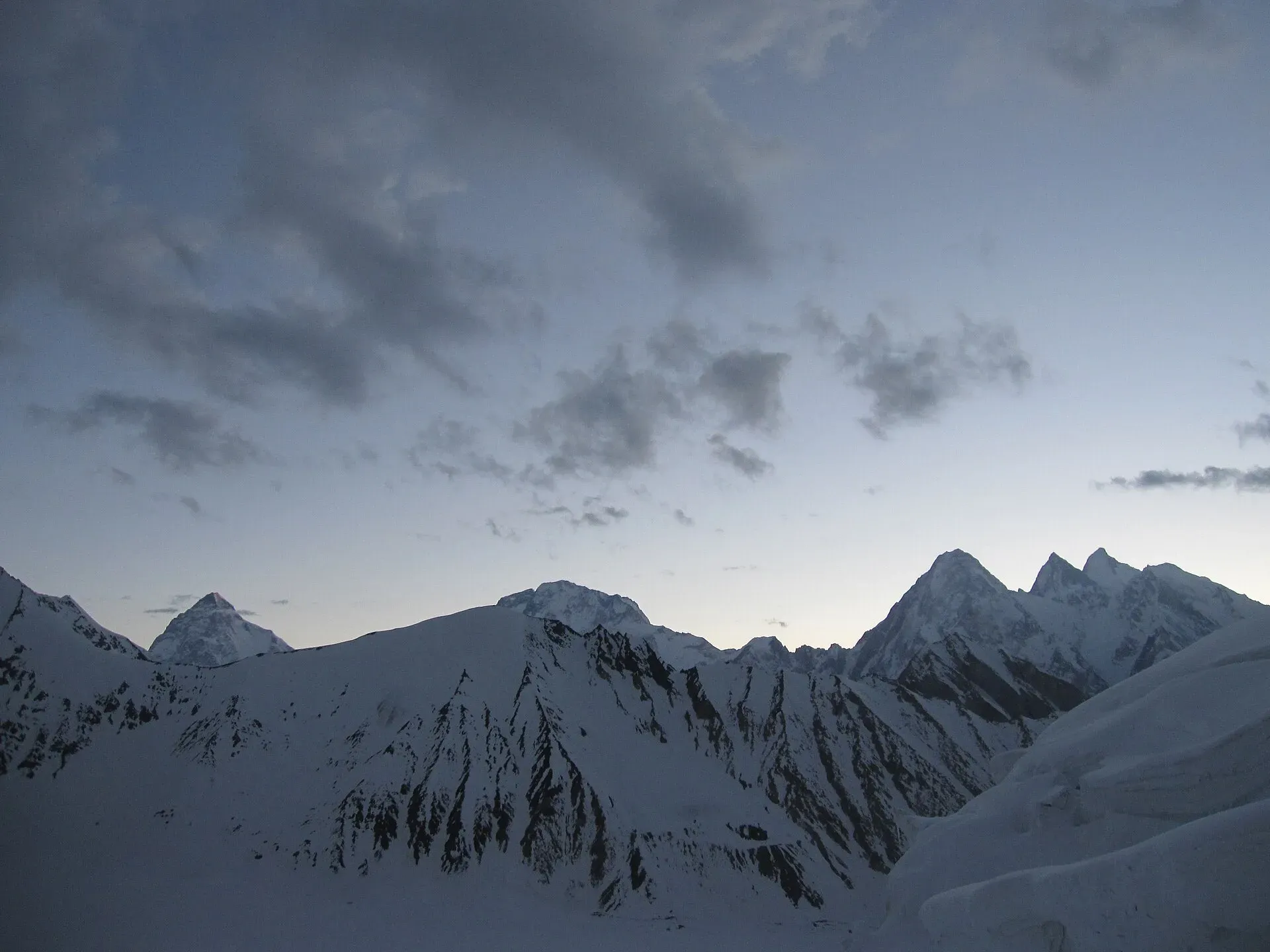
Photo: Shikari7, with thanks · CC BY-SA 3.0 · via Wikimedia Commons · temporary stand-in photo

Gondogoro Valley
- Duration
- 8–9 days
- Distance
- 50.2 km
- Grade
- Strenuous
- Max altitude
- 4,680 m
- Season
- Jul – Sep
A nine-day return trek from Hushe up the Gondogoro valley to Xhuspang (4,680 m), with icefalls, granite spires and a glacier crossing. Good acclimatisation for the Gondogoro La; needs a permit.
Overview
The Gondogoro valley runs north from Hushe towards the Gondogoro La. Hushe herders once used it for grazing. Now the valley's trekking income matters more to them, and the high pastures are mostly used for camps. The trail is steep but easy to follow as far as Daltsampa. Beyond that you cross the broken Gondogoro Glacier to Xhuspang, a flower-covered camp at about 4,680 m below the pass. You get icefalls, rock spires such as Balti Peak and Laila Peak, and a close view of Gondogoro Peak.
Who it suits
A good choice if you are fit and want a nine-day trek that goes well above 4,000 m but needs no technical gear. It is also the usual way to acclimatise before the Gondogoro La. The glacier crossing near Xhuspang takes care: the route changes every year and there is no trail. Go with a guide who knows it.
When to go
Mid-July to September is the best time in the old guide. In late June the pass is cold and there may be snow lower in the valley. September has clear weather but shorter days. Check the forecast before you commit to the pass, because weather can change quickly at altitude.
The route
You leave Hushe along the true left bank of the Hushe River, with sheer granite cliffs above. At the Odungstan summer settlement the valley bends east. After a footbridge you reach Shaishcho. On day 2 you walk through the ablation valley on the east side of the Gondogoro Glacier to Astor, a flat, grassy area with water, willows and junipers. A little further is Gondogoro Camp (3,950 m), marked by a big rock. Spend a night here to acclimatise.
The third stage goes to Golong, where a landslide has wiped out part of the trail. You then pick your way along the glacier edge, climb to a pasture, and descend to Daltsampa. It is a sheltered ablation valley with a clear stream, meadows and two small lakes at its south end. Many parties rest here.
The next stage is the hardest. You cross the heavily broken south side of the Gondogoro Glacier. Use the big granite prow above Xhuspang, about 5 km away, as your landmark. Xhuspang (4,680 m) is a hillside camp with platforms and porters' shelters. It is named for the turquoise flowers that grow there.
From Xhuspang a day trip goes to Gondogoro Peak (5,650 m; about 970 m of climbing, technical, pre-dawn start) or towards the pass. You retrace your steps to Hushe in three days.
Where the valley sits
The Hushe valley runs south from the glaciers below Masherbrum to the Shyok River, opposite Khaplu (Wikipedia). Several side valleys branch off it: Charakusa, Nagma, Nanbroq, Masherbrum and Gondogoro. The Gondogoro valley is the one that leads to the Gondogoro Pass. Laila Peak, K6 and K7 are among the high peaks on the skyline.
Terrain underfoot
The route is a sequence of different surfaces. The first stage follows the river through granite cliffs on a steep but clear trail. Stages 2 and 3 run through the ablation valley on the east side of the glacier, a grassy trough with willows and juniper at Astor, then rough ground along the glacier edge with a landslide scar near Golong. Daltsampa is a sheltered grassy basin with a clear stream and two small lakes. The fifth stage is the hard one: the south side of the Gondogoro Glacier is heavily broken ice and rubble, with no fixed trail, before the ground steepens to the flowery slope of Xhuspang.
The pass beyond Xhuspang
The Gondogoro Pass itself is not part of this trek, but it explains why the valley is busy. Wikipedia gives the pass as 5,585 m on satellite data, with the climbing route crossing slightly higher at about 5,618 m. It links the Gondogoro Glacier with the Vigne Glacier on the Concordia side and has long steep snow slopes with rockfall and avalanche risk. Fixed ropes are put in each season, and local climbers stay near the top to maintain them. Wikipedia says the pass can be tried from the last days of June and that hazards rise by August as the snow melts. Crossing it needs crampons and climbing experience, which is why this page treats Xhuspang as a separate goal.
Culture and people
Hushe is a Balti village in the Ghanche district and the last settlement on the road. The village has guides and porters with long experience on the glaciers and on K7, Masherbrum and Gondogoro La. The Hushe rescue team fixes the ropes on the pass each season. Using local guides keeps the income in the valley.
Practical information
Season in practice. The valley is quiet before July, and Hushe guides say the high camps can still hold snow. Late in the season the glacier crossing is more broken, so give yourself time.
Food and supplies. Hushe has only basic shops. Buy most food in Skardu and have porters carry it. Porters are paid per stage. In the old guide their food was included in the rate for the four stages from Hushe to Xhuspang, and you supplied it beyond; agree this with your operator.
Zone and permits. The trek is in a restricted zone. You need a permit through a licensed operator, a guide, and CKNP fees. See the permits section.
Maps. The Swiss 1:250,000 Karakoram sheet 2 shows the area but labels Shaishcho as Chospah and the route up the middle of the Gondogoro Glacier is wrong.
Getting there. See Hushe: a jeep from Skardu takes about 5–6 hours.
Highlights
- Xhuspang camp (4,680 m) with turquoise-flower meadows
- Daltsampa's meadows and two small lakes
- Views of Laila Peak, Balti Peak and Gondogoro Peak
- Optional climb of Gondogoro Peak (5,650 m) or a day towards the Gondogoro La
Day by day
| Day | Camp | Altitude |
|---|---|---|
| 1 | Shaishcho | 3,330 m |
| 2 | Gondogoro Camp | 3,950 m |
| 3 | Daltsampa | 4,300 m |
| 4 | Rest day at Daltsampa | not given |
| 5 | Xhuspang | 4,680 m |
| 6 | Side trip: Gondogoro Peak or the pass | not given |
| 7 | Daltsampa | 4,300 m |
| 8 | Shaishcho | 3,330 m |
| 9 | Hushe | not given |
| Day | Route | Hours | Distance | Ascent / descent | Camp and altitude |
|---|---|---|---|---|---|
| Day 1 | Hushe to Shaishcho | 4 h | 9.3 km | +280 m | Shaishcho, 3,330 m |
Day 1 notesA good trail follows the true left bank of the Hushe River north from the village. Two hours out, the Aling and Masherbrum rivers join the Gondogoro and Tsarak Tsa rivers. After the summer settlement of Odungstan the valley bends east. A footbridge takes you to the north bank and Shaishcho. | |||||
| Day 2 | Shaishcho to Gondogoro Camp | 2–3 h | 3.9 km | +620 m | Gondogoro Camp, 3,950 m |
Day 2 notesFollow a good trail through the ablation valley on the east side of the Gondogoro Glacier to Astor (3,750 m), a flat grassy area with water, willows and junipers. Continue to Gondogoro Camp, marked by a big rock. Camp here to acclimatise. | |||||
| Day 3 | Gondogoro Camp to Daltsampa | 3–4 h | 5.1 km | +350 m | Daltsampa, 4,300 m |
Day 3 notesA trail leads in 1–1½ hours to Golong, a lunch spot beside a large boulder. A landslide has destroyed the trail beyond it. Drop to the glacier edge and walk about 1.5 km over rubble, watching for rockfall. Climb to a pasture where male yaks graze and continue to Daltsampa. | |||||
| Day 4 | Rest day at Daltsampa | not given | not given | not given | not given |
Day 4 notesMany parties stay a day. Walk to the small lakes at the south end of the meadow, or explore the ablation valley. | |||||
| Day 5 | Daltsampa to Xhuspang | 3½–4½ h | 6.8 km | +380 m | Xhuspang, 4,680 m |
Day 5 notesThe trail ends at the glacier's heavily broken south margin in about 30 minutes. Cross onto the ice at a point that changes each year. Head for the granite prow above Xhuspang, about 5 km away, working across ice bands and two medial moraines (one brown, one rust-coloured). Xhuspang is a hillside camp with tent platforms. | |||||
| Day 6 | Side trip: Gondogoro Peak or the pass | full day | 9.4 km | +1,260 m / −1,260 m | not given |
Day 6 notesFor Gondogoro Peak (5,650 m), head north behind the granite prow and climb the snow slope to the summit, about 970 m of ascent. Start before dawn and be back by noon. A day trip towards the Gondogoro La from Gondogoro High Camp needs climbing gear and an early start. | |||||
| Day 7 | Xhuspang to Daltsampa | 2½–3 h | 6.8 km | −380 m | Daltsampa, 4,300 m |
Day 7 notesRetrace your route across the glacier. | |||||
| Day 8 | Daltsampa to Shaishcho | 6–7 h | 9 km | −970 m | Shaishcho, 3,330 m |
Day 8 notesWalk down the valley past Golong and Gondogoro Camp to Shaishcho. | |||||
| Day 9 | Shaishcho to Hushe | 4 h | 9.3 km | −280 m | not given |
Day 9 notesThe final easy day along the Hushe River. | |||||
Getting there
Reach Skardu, then take a jeep to Hushe (about 5–6 hours via Khaplu on the Skardu–Khaplu road and the Hushe valley road). Public jeeps run to Hushe; your operator will usually arrange a private hire.
Permits and rules
- Permit needed
- Yes, Restricted zone
- Fee
- Current fees will be added soon
- Last checked
- 16 November 2026
Zone: restricted. You need a trekking permit arranged through a licensed Pakistani tour operator, a licensed guide, and (inside Central Karakoram National Park, CKNP) the park fees. You cannot walk this route alone. The checkpoint is at the roadhead; keep your permit papers with you.
Fees. A trekking permit fee, Central Karakoram National Park fees and a waste-management fee apply. Current fees will be added soon. Until then, ask your licensed operator for the current written fee list.
How trekking permits, NOCs and registration work: Visa and permits.
Season
Best: Jul – Sep
Water and camps
Clear side streams run at Astor, Gondogoro Camp, Golong and Daltsampa. Water at Shaishcho comes from the river and can be silty. Xhuspang has a pool and streams. Treat water. Wood is scarce above Shaishcho, so carry kerosene.
Gear and safety
The trail is steep and rocky, with rockfall below Golong and on the glacier edge. The crossing near Xhuspang is on ice with crevasses; use a guide and wear crampons if the ice is hard. Altitude reaches about 4,700 m, so take rest days and descend if symptoms get worse. Nights can be cold. Carry waterproofs for afternoon storms.
Variations
- Gondogoro La (see the Gondogoro La trek) from Xhuspang, as a one-day technical side trip or the first part of a crossing to Concordia.
- Gondogoro Peak (about 5,650 m), a one-day technical climb from Xhuspang.
- K7 Base Camp and Masherbrum Base Camp are good acclimatisation treks from Hushe.
- A loop returning via Masherbrum Base Camp is possible (see Masherbrum Base Camp).
Tips
- Spend extra nights at Gondogoro Camp and Daltsampa to acclimatise.
- Take a guide who knows the glacier crossing above Daltsampa; the route changes each year.
- Watch for rockfall near Golong, where landslides have cut the trail.
- Leave Xhuspang or Gondogoro Peak early; the snow softens by midday.
Photos we still need: Daltsampa camp and the glacier crossing to Xhuspang. Send us yours
Health and emergency
Mobile signal is patchy on most treks, so tell someone your plan before you go. Emergency numbers
Sources and last checked
Last checked Confidence medium7 sources8 still to check
- Last checked
- Method
- Desk research from published sources
- Confidence
- medium
- Checked by
- trek.pk research team
Researched from published sources; not yet checked on the ground by our team. Spot something out of date? Report a mistake.
Sources
- Gondogoro Valley (old trek.pk page, text from Lonely Planet Trekking in the Karakoram and Hindukush, c. 2002; used for facts only) · trek.pk / Lonely Planet · checked
- Gondogoro Pass · Wikipedia · checked
- Visiting CKNP: permits, season, logistics (unofficial-looking summary; figures approximate) · cknp.org · checked
- Trekkers and Climbers Stranded Amid Pakistan Permit Dispute (March 2025) · ExplorersWeb · checked
- Beyond K2 Base Camp: The Pass That Decides The Trek (10 Nov 2026; written by a trekking operator) · The Friday Times · checked
- K2 Base Camp Trek - 2025 price increases · Jagged Globe · checked
- Hushe Valley · Wikipedia · checked
Still to be checked on the ground (8)
- Daily distances and times from the c. 2002 guide (The Friday Times, 10 Nov 2026, gives Ali Camp to Khuspang as about 8 km and 9 to 12 hours on the crossing day, for the pass stage only)
- Current permit and CKNP fees (no official amounts found; The Friday Times also gives none)
- Gondogoro Peak height (5,650 m in the old guide) and route; Wikipedia's Gondogoro Pass page does not cover the peak
- Whether Daltsampa camp and the glacier crossing route are still used as described (not covered by recent sources found)
- Hushe to Skardu road time
- Gondogoro Pass height: Wikipedia gives 5,585 m (SRTM) and about 5,618 m for the climbing route; not an official survey
- Who fixes the ropes on the pass each season (Wikipedia says local climbers maintain them; the older text credits the Hushe rescue team)
- Photo: the hero shows the glacier looking south from the pass side (Shikari7, July 2012); a view from the trek's own camps would be a better hero
Nearby and related

Gondogoro La

Masherbrum Base Camp

K7 Base Camp

Baltoro Glacier and K2 Base Camp
Gondogoro La
A fixed-rope trekking pass of about 5,585 to 5,620 m between Concordia on the Baltoro Glacier and the Hushe valley. Famous for its view of K2; technical and restricted-zone.
Laila Peak (Hushe)
Laila Peak (Hushe) is a needle-shaped Karakoram summit above the Gondogoro Glacier, about 6,096 m by one map. Heights differ between sources. Trekkers see it from the Gondogoro valley.