

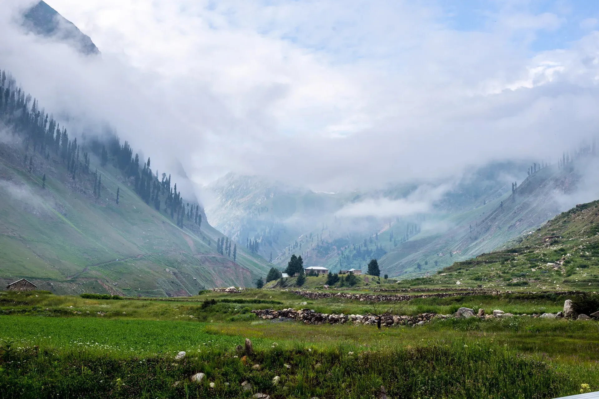
Photo: Waseemazam, with thanks · CC BY-SA 4.0 · via Wikimedia Commons · temporary stand-in photo

Batakundi
A meadow village on the Kunhar River about 15 to 16 km above Naran at roughly 2,624 m, the base for the Lalazar road and a stop on the way to Babusar.
Overview
Batakundi (also Battakundi) lies about 15 km east of Naran in the Kaghan Valley, Mansehra District, at 2,624 m (Wikipedia). OSRM measures 16.0 km and 11 minutes from Naran. Wikipedia calls it the last town in the valley that stays open all year, and says most residents are Gujars who now speak Hindko. Open pasture lies beside the Kunhar River, with forest and snow peaks on the slopes.
Plan your visit
- Nearest town
- Naran
- Getting there
From Naran drive about 16 km east on the Kaghan road (OSRM 16.0 km, 11 minutes, optimistic). Islamabad to Naran is about 252 km (OSRM 3.1 hours, optimistic; allow 6 to 8 hours in summer). More
Best months
May – Oct
- Batakundi
- Related places nearby: Kaghan Valley (with Naran), Naran, Saiful Muluk, Babusar Pass
What to see and do
- Meadows beside the river. Flat grass where families picnic and graze animals in summer.
- Batakundi Waterfall. Wikipedia lists a waterfall here as a draw for visitors.
- Gateway to Lalazar. The steep Lalazar road branches off nearby; see the Lalazar page.
- Onward. The road continues towards Jalkhad, Besal and Babusar. Besal is the start for Dudipatsar Lake.
- Walks. Easy strolls along the river and the village lanes; for longer walks ask hotel owners about local guides.
The valley setting
Wikipedia describes the Kaghan Valley as 155 km long, rising from about 650 m to Babusar Pass at roughly 4,170 m. The Kunhar River begins at Lulusar Lake (3,410 m) and passes Jalkhand, Naran, Paras and Balakot before joining the Jhelum. Jalkhand is about 40 km from Naran, and Pyala Lake lies within it. Gittidas Meadow, near the top of Babusar, is at 3,678 m.
Gujars are a major community in the valley, and Hindko is the main language, with Pashto and Gujari speakers too. Forest on the slopes is deodar, blue pine, silver fir, yew and spruce, with walnut and Indian horse-chestnut in the broadleaf stands.
Season and snow
The valley has an alpine climate. Wikipedia gives May temperatures of about 3 to 11 °C. Snow blocks the upper roads in winter and usually melts between February and April. After the 2005 earthquake, landslides destroyed many of the roads into the valley, which have since been rebuilt. The Kaghan Development Authority was set up in 2020 to manage the valley.
When to visit
May to October for most visitors. Snow closes the road beyond for much of the year, but Wikipedia says Batakundi itself stays open all year. The upper valley road beyond Naran usually opens in summer; check before driving.
Where to stay and eat
The village has many hotels and restaurants (Wikipedia). It is quieter and cheaper than Naran in the peak weeks, and prices rise at Eid and in June and July. Camping on the meadow is possible; ask the owner of the land. Hotel and camping prices will be added soon.
Good to know
- Road. Landslides and summer traffic can slow the short drive from Naran, so allow extra time. Fuel and supplies are better in Naran, so stock up there before heading higher.
- Hydropower. Wikipedia notes a hydropower project on the Kunhar basin begun by PEDO in 2014 at feasibility stage.
- Ask the district administration or local police about current conditions before you go. Advice. For foreign visitors: the UK FCDO (updated 27 October 2026, checked 16 November 2026) advises against all travel on the Karakoram Highway between Mansehra and Chilas; it does not list the Kaghan Valley road. Check the page and conditions before you go.
- Altitude. At 2,600 m, mild symptoms are possible if you arrive quickly from the plains.
Highlights
- About 2,624 m, 15 to 16 km above Naran
- Open meadows on the Kunhar River
- Waterfall and many hotels
- Base for Lalazar and the Babusar road
Getting there
From Naran drive about 16 km east on the Kaghan road (OSRM 16.0 km, 11 minutes, optimistic). Islamabad to Naran is about 252 km (OSRM 3.1 hours, optimistic; allow 6 to 8 hours in summer).
Tips
- Book ahead around Eid and in June.
- Check the Babusar and Lalazar roads before moving on.
- Keep your rubbish and avoid plastic.
Photos we still need: Batakundi meadow and the Kunhar River. Send us yours
Sources and last checked
Last checked Confidence medium4 sources3 still to check
- Last checked
- Method
- Desk research from published sources
- Confidence
- medium
- Checked by
- trek.pk research team
Researched from published sources; not yet checked on the ground by our team. Spot something out of date? Report a mistake.
Sources
- Batakundi · Wikipedia · checked
- Kaghan Valley · Wikipedia · checked
- Pakistan travel advice (warnings and insurance; updated 27 October 2026) · UK Foreign, Commonwealth & Development Office · checked
- OSRM driving route service (distances and times, measured 16 November 2026; times are optimistic) · OSRM · checked
Still to be checked on the ground (3)
- Altitude: Wikipedia gives 2,624 m with no citation; no second source opened
- Current hotel and camping rules (none published)
- Opening dates of the road beyond (Wikipedia's Kaghan Valley page says the roads and Babusar Pass usually stay open from May to the end of September; no official notice found)
Nearby and related

Kaghan Valley (with Naran)
A 155 km Himalayan valley above Balakot along the Kunhar River, with Shogran, Naran, Saiful Muluk and Lulusar lakes, and the road to Babusar Pass. Open mainly from May to October.

Naran
The main base of the Kaghan Valley, at 2,409 m beside the Kunhar River. Naran is the starting point for Saiful Muluk, Lulusar and the road to Babusar Top.
Lalazar Meadows
A high pine-edged meadow plateau at about 3,123 m above Batakundi in the Kaghan Valley, reached by a steep jeep road from the valley road.

Saiful Muluk
The best-known lake of the Kaghan Valley, at 3,224 m above Naran, with Malika Parbat behind it. It is about 9 km from Naran, reached by jeep, and is snowbound and frozen in winter.

Babusar Pass
A 4,173 m summer road pass on the N-15 linking the Kaghan valley with Chilas on the Karakoram Highway. Open only in summer and known for steep, sharp bends.

Naran, Kaghan and Babusar
A 4-day summer road trip from Islamabad up the Kaghan valley to Naran, Saiful Muluk and Lulusar Lake, over Babusar Pass (4,173 m) to Chilas on the KKH.