

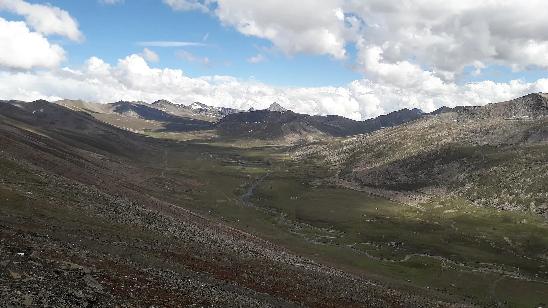
Photo: King Eliot, with thanks · CC BY-SA 4.0 · via Wikimedia Commons · temporary stand-in photo

Babusar Pass
A 4,173 m summer road pass on the N-15 linking the Kaghan valley with Chilas on the Karakoram Highway. Open only in summer and known for steep, sharp bends.
Overview
Babusar Pass, also called Babusar Top, links the head of the Kaghan valley in Khyber Pakhtunkhwa with Chilas in Diamer, Gilgit-Baltistan. Wikipedia gives its height as 4,173 m. The road over it is the N-15, and it gives a much shorter route from Naran to Chilas than the long way round by the Karakoram Highway. It is a road pass, not a trekking pass.
Plan your visit
- Nearest town
- Chilas
- Getting there
From Naran, the Babusar road climbs about 2 to 3 hours to the top in a private vehicle, then drops to Chilas in a similar time. Jeeps and cars with a driver can be hired in Naran. Public vans run in season. More
Best months
Jun – Sep
- Babusar Pass
- Related places nearby: Kaghan Valley (with Naran), Naran, Chilas, Lulusar-Dudipatsar National Park
Setting and landscape
The pass is the high point of the Kaghan Valley road that a car can reach. The ranges around it are offshoots of the Himalayan system. On the Kaghan side the range runs along the right bank of the Kunhar River and includes Malika Parbat, the valley's highest peak at over 17,000 ft. Summer grazing nomads bring sheep and goats up to the high grassland. Thick forest grows on the higher slopes, though heavy felling means dense forest is now mostly found in places that are hard to reach.
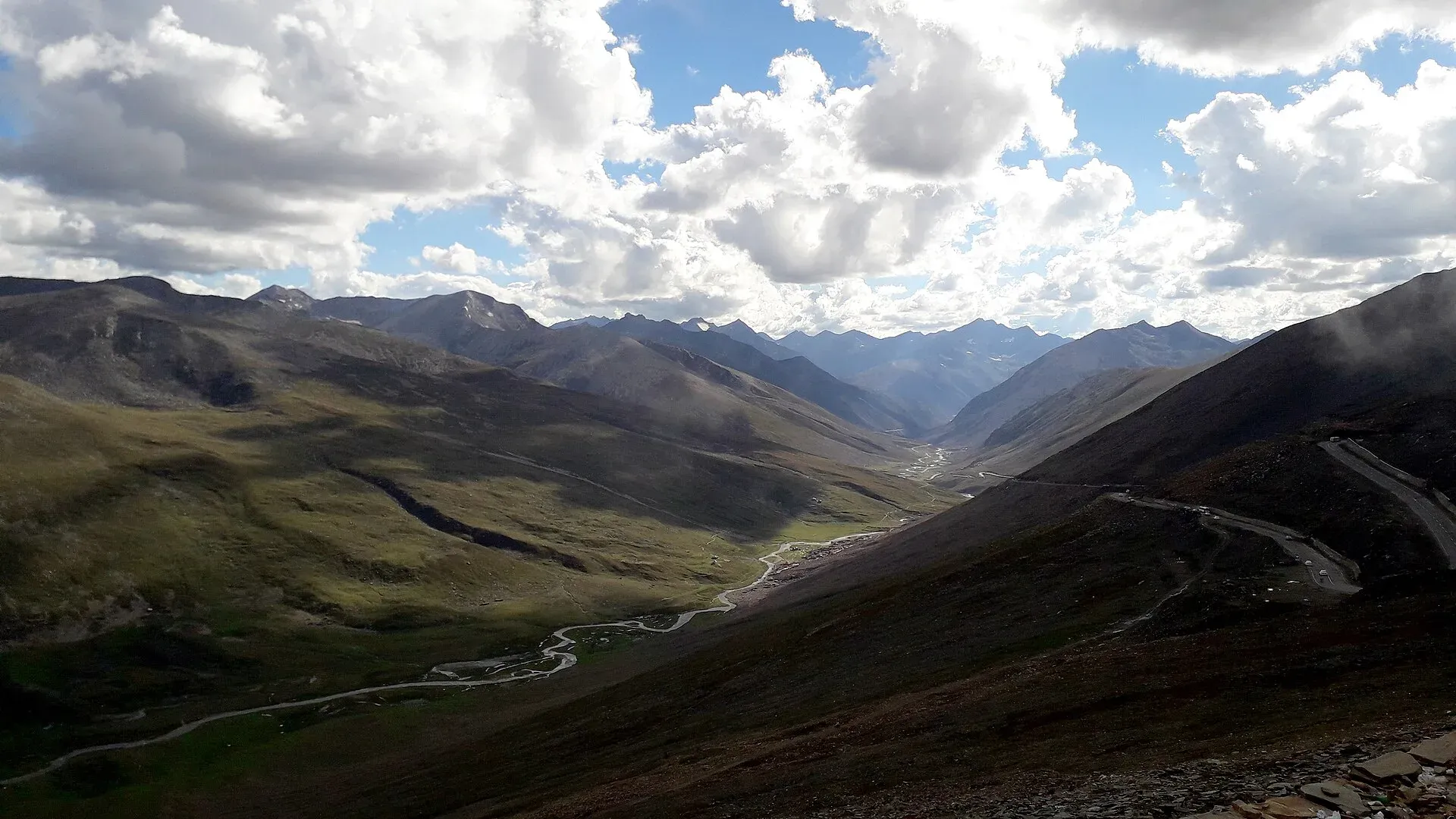
Photo: King Eliot, with thanks · CC BY-SA 4.0 · via Wikimedia Commons · temporary stand-in photo

What to see and do
The top is a broad saddle with a roadside milestone and wide views north and south. Wikipedia mentions Malika Parbat, the highest peak of the Kaghan valley, and Musa ka Musalla on the range to the north. On the Kaghan side, Lulusar Lake and Dudipatsar Lake lie within Lulusar-Dudipatsar National Park, and are good stops on the way up. On the Gilgit-Baltistan side you drop in tight zigzags to the Babusar valley and on to Chilas.
When to visit
The pass is a seasonal road. Wikipedia says it is open only from about April to September. It also says that from mid-July to the end of September the road north of Naran stays open all the way to the pass, while movement is limited in the monsoon and winter. Maximum temperatures in the Kaghan valley in May are about 11 degrees Celsius, with minimums of about 3. In 2026, ProPakistani reported on 25 May that the road had reopened after seven months of snow closure, and the Express Tribune reported on 5 June that it was closed to all traffic again until 6 June while snow, glacier ice and debris were cleared, after a period of one-way traffic. ProPakistani adds that it normally closes between November and December. In winter, heavy snow closes the pass, and travellers use the Karakoram Highway instead. Treat late June to September as the reliable window, and expect delays after any snowfall. The road is also affected by monsoon landslides.
Where to stay and eat
There are no hotels at the top. Stay in Naran or Kaghan before the pass and in Chilas after it. A few roadside stalls operate in season, but carry water and food.
Good to know
- Road safety. Wikipedia calls it one of the more dangerous routes in Pakistan, with most accidents blamed on brake failure on the long, steep descents. Use a low gear, let brakes cool, and use a driver who knows the road. Avoid driving it in the dark or fog.
- Fees. There is no known official fee information. Current fees will be added soon; ask the Mansehra district administration or NHA.
- Travel advice. For foreign visitors: the UK FCDO (updated 27 October 2026) advises against all travel on the Karakoram Highway between Mansehra and Chilas, up to the N-15 junction. It does not list Kaghan or Babusar by name on its warnings page, but the descent ends at Chilas on that highway. Re-check the live page and local conditions before travelling.
- Altitude. The top is over 4,000 m. Take it slowly if you have come up quickly from Islamabad.
Highlights
- 4,173 m crossing between Kaghan and Chilas
- Views of Malika Parbat and the Babusar valley
- Lulusar and Dudipatsar lakes on the Kaghan side
- A short cut that avoids the long KKH detour
Getting there
From Naran, the Babusar road climbs about 2 to 3 hours to the top in a private vehicle, then drops to Chilas in a similar time. Jeeps and cars with a driver can be hired in Naran. Public vans run in season. Chilas is on the Karakoram Highway, about 2 hours from Gilgit's side of the valley and a long day from Islamabad.
Tips
- Check with police or NHA in Naran before going up
- Start early and aim to cross before afternoon cloud
- Do not attempt it after snowfall without local advice
- Carry warm clothes: it is cold even in July
Photos we still need: the zigzag descent to the Chilas side and the Naran-side approach. Send us yours
Sources and last checked
Last checked Confidence medium4 sources3 still to check
- Last checked
- Method
- Desk research from published sources
- Confidence
- medium
- Checked by
- trek.pk research team
Researched from published sources; not yet checked on the ground by our team. Spot something out of date? Report a mistake.
Sources
- Babusar Pass (Wikipedia) · Wikipedia · checked
- Babusar Top Road reopens after seven months (25 May 2026) · ProPakistani · checked
- Babusar Top road closed again (5 June 2026) · The Express Tribune · checked
- Pakistan travel advice (updated 27 October 2026) · UK FCDO · checked
Still to be checked on the ground (3)
- Exact opening and closing dates each year (sources give April to September, mid-July to end September, and a November to December closure)
- Current surface and landslide damage on both sides
- Whether any local fee or checkpost registration applies (none mentioned in the sources opened)
Nearby and related

Other treks in Diamir

Kaghan Valley (with Naran)
A 155 km Himalayan valley above Balakot along the Kunhar River, with Shogran, Naran, Saiful Muluk and Lulusar lakes, and the road to Babusar Pass. Open mainly from May to October.

Naran
The main base of the Kaghan Valley, at 2,409 m beside the Kunhar River. Naran is the starting point for Saiful Muluk, Lulusar and the road to Babusar Top.

Chilas
Headquarters of Diamer on the Karakoram Highway and the Indus, with thousands of ancient rock carvings, views towards Nanga Parbat, and the road junctions for Fairy Meadows and Babusar Pass.

Lulusar Lake
A large lake beside the Naran-Babusar road in upper Kaghan, at roughly 3,350–3,410 m. It is the main source of the Kunhar River and the gateway to Lulusar-Dudipatsar National Park.

Dudipatsar Lake
An alpine lake at about 3,800 m in Lulusar-Dudipatsar National Park, reached by a 5 to 8 hour walk from Besal on the Babusar road. Mid-June to late September.

Lulusar-Dudipatsar National Park
A high national park at the head of the Kaghan Valley, created in 2003. It protects Lulusar Lake, Dudipatsar Lake and the wildlife of the Babusar area.

Naran, Kaghan and Babusar
A 4-day summer road trip from Islamabad up the Kaghan valley to Naran, Saiful Muluk and Lulusar Lake, over Babusar Pass (4,173 m) to Chilas on the KKH.

Grand Northern Loop
A 12-14 day circuit of the north from Islamabad: Naran and Babusar, Hunza and Khunjerab, Skardu and Deosai, Gilgit, then Swat or the KKH back. Distances, passes and seasons.