

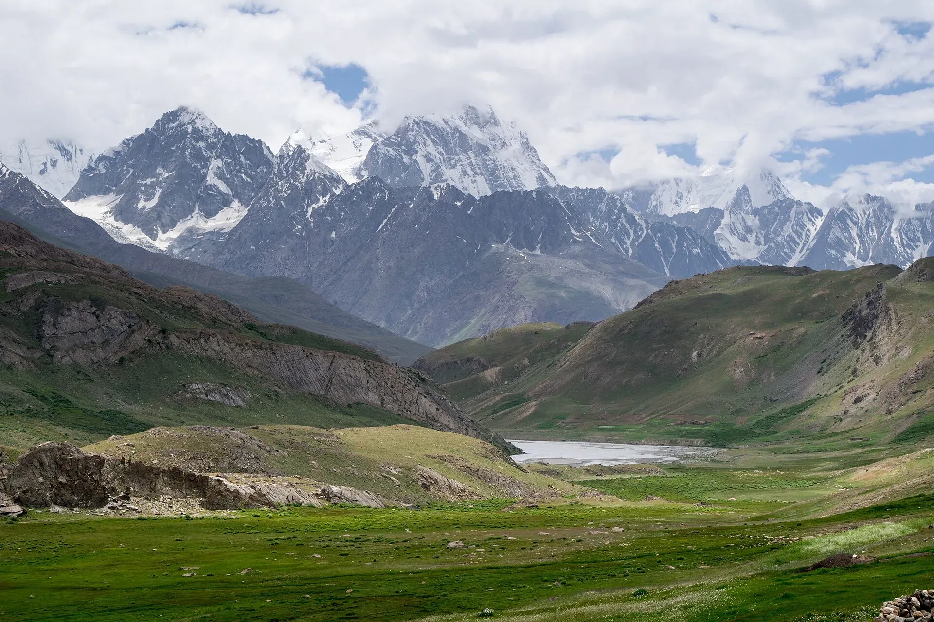
Photo: Talha Mahin Mir, with thanks · CC BY-SA 4.0 · via Wikimedia Commons · temporary stand-in photo

Broghil Valley National Park
A remote high valley at the northern tip of Chitral beside the Wakhan Corridor, with about 30 lakes, glaciers, Wakhi and Kyrgyz communities and rare wildlife. Reached only by a long mountain drive.
Overview
Broghil Valley National Park lies in the far north of Upper Chitral, near the border with Afghanistan's Wakhan Corridor, about 250 km from Chitral town by Wikipedia's figure (a routing tool gives over 300 km and about 10 hours of driving to the map pin, so allow for a long journey). It was declared a national park in 2010 and covers about 1,348 square kilometres (ICIMOD fact sheet). It adjoins Qurumber National Park in Gilgit-Baltistan. The park runs from about 3,217 m to 5,696 m and takes in grass plains, glaciers and roughly 30 freshwater lakes, with about 3,400 hectares of peatland and lakes.
The area was once part of the Silk Route. Dawn describes the local Wakhi people, with their own language and culture, as living simply and famously hospitable, with sports that reflect ties to neighbouring Central Asian states. Chitral Scouts keep posts in the park. Wakhi and Kyrgyz people have lived in the valley for hundreds of years, grazing yaks, sheep and goats in summer pastures. A 32 km all-weather road built by the Aga Khan Rural Support Programme now links Kishmanja with Pechus, Vedin Khot and other villages (Dawn, March 2024). Before it, the track was often cut off by rockfalls and avalanches. In October 2019 the park received a visit from Prince William and Catherine, then the Duke and Duchess of Cambridge, during their Pakistan tour.
Plan your visit
- Nearest town
- Chitral
- Getting there
From Chitral, a rough mountain road runs north through Mastuj and Yarkhun valley to Broghil, about 250 km by Wikipedia's figure (routing tools suggest 300 km or more). Allow one long day or two by 4x4. More
Best months
Jun – Sep
- Broghil Valley National Park
- Related place nearby: Karambar Lake
The route from Chitral
Both Dawn and Wikipedia put Broghil about 250 km from Chitral town, though a routing tool gives more than 300 km. The road goes up the Yarkhun valley through Mastuj, where the Laspur and Yarkhun rivers meet. A Dawn travel writer spent a night in Mastuj, then drove a mountainous but jeepable road to Kishmanja, the usual starting point of the park. The ground is grassy in the Yarkhun valley but rocky higher up, and difficult in rain. Kishmanja, Pechus and Vedin Khot are linked by a 32 km all-weather road with two suspension bridges, built by the Aga Khan Rural Support Programme and finished around 2022. Before it, a jeep track built about ten years earlier was often closed by rockfall and avalanches, and residents sometimes carried luggage on foot for more than 12 hours.
What to see and do
- Lakes and high pastures. Walks to meadows and lakes from the villages; Karambar Lake is on the Gilgit-Baltistan side of the border. Dawn calls Lake Qurumber (also spelled Karmber or Kromber) Pakistan's second-highest lake and says half of it was still frozen in June, with snow falling overnight. Dawn counts 34 lakes in the park (a caption says 35), and the area is a recognised wetland. Trout is a local food.
- Wildlife. Records list about 23 mammal species and 120 birds. Mammals include Siberian ibex, bharal, snow leopard (Vulnerable), Marco Polo sheep (Near Threatened), Himalayan musk deer, Himalayan wolf, Himalayan brown bear and Turkestan lynx. Birds include Himalayan snowcock, chukar and lammergeier.
- Broghil Festival. An annual festival, reported by Dawn as lasting three days, with yak polo, handicrafts, music and food. Yak polo is played at over 3,900 m; the Shandur festival, by contrast, uses horses. There is no published dates; ask the Chitral tourism office.
- Trekking. The valley is a starting point for the Broghil and Karambar An route and several high passes towards Gilgit-Baltistan and Wakhan. The Darkot Pass (4,703 m) links Broghil with the Rawat valley in Ghizer, Gilgit-Baltistan. Dawn says the Darkot glacier is safer to cross at night, when the ice is firmer than in morning sun, and reports expedition groups camping around Lake Qurumber. Horses can be hired for those who prefer to ride. See Broghil and Karambar An.
When to visit
Plan for June to September. The valley is snowbound and cut off in winter, and the road can close at any time after heavy rain or snow.
Where to stay and eat
Facilities are very limited. Visitors usually stay in basic guest houses in village houses or camp, with food arranged beforehand. Bring your own supplies and a stove.
Good to know
- Because of the border position, check current entry rules, permits and security advice with the Chitral district administration or Khyber Pakhtunkhwa tourism before you travel. A fee may apply. Current fees will be added soon; check with the park office or the provincial wildlife department before you go.
- The road is rough and long; allow a full day or more from Chitral and use a 4x4 with an experienced driver.
- Follow the standard park rules: take your litter out with you, do not light fires outside marked sites, do not pick plants or disturb animals, and do not hunt. Hunting and trapping inside a national park are offences. Ask the park office before flying a drone; many parks need written permission and drones are banned near borders and sensitive sites.
- Respect local customs: dress modestly and ask before photographing people.
Travel advice
Ask the district administration or local police about current conditions before you go. For foreign visitors: the UK FCDO advises against all travel on the N-45 from north of the Mardan ring road to the edge of Chitral city, including the Kalash valleys (advice updated 27 October 2026, checked 16 November 2026). Most road routes to Chitral use the N-45. Read the live advice before you plan.
Highlights
- Remote Wakhi and Kyrgyz valley near the Wakhan Corridor
- About 30 lakes and large peatlands
- Snow leopard, ibex and Marco Polo sheep habitat
- Broghil Festival with yak polo
Getting there
From Chitral, a rough mountain road runs north through Mastuj and Yarkhun valley to Broghil, about 250 km by Wikipedia's figure (routing tools suggest 300 km or more). Allow one long day or two by 4x4. There is no public transport to the upper valley; hire a jeep with an experienced driver in Chitral.
Tips
- Check permits and security before travelling
- Allow extra days for road delays
- Bring food and fuel
- Dress modestly in villages
Wildlife
Facilities
- Village guest houses
- Road from Chitral
- Camping
Photos we still need: Lake Qurumber / Karambar Lake, Broghil festival yak polo, Darkot glacier. Send us yours
Sources and last checked
Last checked Confidence medium5 sources4 still to check
- Last checked
- Method
- Desk research from published sources
- Confidence
- medium
- Checked by
- trek.pk research team
Researched from published sources; not yet checked on the ground by our team. Spot something out of date? Report a mistake.
Sources
- Broghil Valley National Park (Wikipedia) · Wikipedia · checked
- Pakistan Tourism Guide 2021 · TDAP Pakistan · checked
- Broghil National Park (fact sheet: established 2010, 1,348 km2) · ICIMOD · checked
- Travel piece on Broghil Valley National Park (250 km from Chitral town; three-day annual festival with yak polo) · Dawn · checked
- New 32 km all-weather road from Kishmanja to Pechus (4 March 2024) · Dawn · checked
Still to be checked on the ground (4)
- Permits or NOC for foreign visitors (no official source found; Dawn 2016 and 2024 articles do not mention any)
- Road distance and conditions from Chitral (Dawn and Wikipedia say 250 km; routing tools suggest 300 km or more; Mastuj to Kishmanja described as jeepable in 2016)
- Dates of the Broghil Festival (three days, yearly; no published dates found)
- Whether visitors can use the Darkot Pass crossing and which permits apply (Dawn describes a crossing; no official rules found)
Nearby and related

Broghil and Karambar An

Qachqar-e-Dur and Shpodeen Pass

Other treks in Chitral

Karambar Lake
A large, very clear glacial lake at about 4,272 m at the top of the Karambar valley in Ishkoman, near the Afghan border. It has no road and is reached on multi-day treks over or beside the Karambar An.
Garam Chashma (Pechugh), Upper Yarkhun
A hot spring in the upper Yarkhun valley, Upper Chitral, reached by a bridge near Vidinkot on the Broghil trek. Not the Garam Chashma of the Lotkoh valley. Known only from trek and climbing reports.
Thin Yupk Hot Spring
A hot spring that flows into a warm lake on the Yarkhun route to Broghil, in Upper Chitral. Known only from our Broghil and Karambar An trek page.