

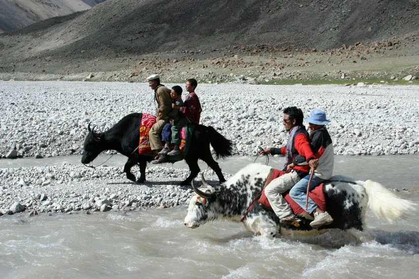
Photo: Pm.pfeiffer, with thanks · Public domain (CC0) · via Wikimedia Commons · temporary stand-in photo

Qachqar-e-Dur and Shpodeen Pass
- Duration
- 7 days
- Distance
- 55.5 km
- Grade
- Strenuous
- Max altitude
- 5,346 m
- Season
- Jun – Sep
A seven-day loop from Shimshal into the South Ghuzherav mountains, with blue sheep and views of the Hispar Muztagh. It crosses snow-covered Shpodeen Pass (5,346 m) with no glacier travel.
Overview
This seven-day loop starts and ends in Shimshal village. It goes up to the Pamir Mai Dur and Qachqar-e-Dur valleys in the South Ghuzherav mountains, then crosses Shpodeen Pass (5,346 m) and drops to the Zardgarben valley and home. It is one of the easier treks beyond Shimshal, though all of them are strenuous. The reward is wildlife and views. Blue sheep are common in Pamir Mai Dur and upper Qachqar-e-Dur, and the Hispar Muztagh peaks stand across the skyline.
Getting to Shimshal
Shimshal is a Wakhi village at about 3,113 m (Wikipedia; the 2002 guide gives 3,000 m). It is the highest settlement in the district and has a mobile signal in the village, which has been served by SCOM since December 2016, though not on the route. The jeep road from the Karakoram Highway at Passu opened in October 2003 and is 56 km long. Many parties spend a day in the village before starting, to acclimatise and to meet guides and porters.
Who it suits
You need to be fit, used to camping above 4,500 m and comfortable on steep scree. The first day is long and exposed, and the pass has a 1,000 m scree descent. You do not need a rope or glacier skills, since the pass has no glacier on either side, but early in the season it can be snowy and corniced. Take a guide from Shimshal.
When to go
Mid-June to September. Early in the season the pass can be snow-covered and icy on the west side. Later, streams are lower and easier to cross.
The route
Day 1 is the hardest for navigation and exposure. From Shimshal (3,000 m) you cross Michael Bridge and follow the river to its junction with the Pamir-e-Tang. You then climb a spur to the viewpoint at Gar-e-Sar, traverse exposed galleries and scree to the birch groves of Past Furzeen and Wuch Furzeen (3,365 m). This is the "tang" (gorge) trail. It is about 15 km, 7 to 9 hours, with almost no water for the first hours.
Day 2 follows the Pamir-e-Tang to Purien-e-Ben, climbs the juniper "staircase" to Purien-e-Sar, then turns north-west above the Pamir Mai Dur river to the huts at Pamir Mai Dur (4,348 m). Day 3 heads up the Qachqar-e-Dur to Bipardah Pert (4,726 m), a grassy hill with big views. A side trip leads to Farhad Base Camp (4,992 m) in a ring of unclimbed peaks. You return to Pamir Mai Dur on day 4.
Day 5 climbs the Pamir Mai Dur valley to Khush Dur-e-Gush (4,929 m). Day 6 crosses Shpodeen Pass (5,346 m) by a snowfield. The west side is a steep scree descent, best taken in the limestone gully slightly to the left. You camp at Shpodeen (4,471 m) in the Zardgarben valley. Day 7 follows the Zardgarben stream down to Shimshal, a descent of about 1,470 m.
If you do not want to cross the pass, you can retrace your steps from Pamir Mai Dur to Wuch Furzeen and Shimshal in two days.
Culture and people
Shimshal is a Wakhi village, and the herding year shapes the area. The summer pastures around the Pamir are used by families from the village, and the names on this route (Yarzeen for juniper, Furzeen for birch, Zardgarben for the yellow cliffs) come from Wakhi. The dangerous trail sections are maintained by the villagers. Before leaving, spend a day in Shimshal to acclimatise and meet your team. Most porters and guides come from the village, and their stage counts are agreed in advance.
Terrain underfoot
The trek changes character each day. Day 1 follows a river bed, then climbs a steep spur and crosses exposed galleries and scree, with birch groves at Past Furzeen and Wuch Furzeen. Day 2 climbs a juniper "staircase" and then traverses a hillside above the Pamir Mai Dur river. Day 3 crosses scree and granite moraine to a grassy hill. Day 5 crosses black moraine rubble and a gorge section where the trail fades. Day 6 is a snowfield up to the pass, then 25 to 35 degree scree for about two hours on the west side. Day 7 follows the Zardgarben stream through a narrow canyon and crosses it several times, with rockfall risk on the scree slope near Tung-e-Sar.
Community and mountains
Shimshal has produced several well-known Pakistani mountaineers, among them Rajab Shah, Samina Baig and Abdul Joshi. The Shimshal Nature Trust is a community organisation. Each summer a yak race is held at Shimshal Pass, which Wikipedia places at 4,735 m above the village.
Preparing for the trek
Plan at least a day in Shimshal. You sleep above 4,300 m on four nights and cross 5,346 m, so previous experience of altitude helps. Bring a tent or tarp for porters at the three camps with no shelter, carry a stove and fuel, and carry enough water on day 1 because there is almost none for the first hours. Poles help on the long scree descents, and an ice axe is worth carrying if you go early in the season.
Practical information
Access is by jeep road from Passu to Shimshal (see Getting there). There are no huts for porters at Bipardah Pert, Farhad Base Camp or Khush Dur-e-Gush, so bring a tent or tarp for them. The Swiss Karakoram map (1:250,000) does not name Pamir Mai Dur or Qachqar-e-Dur, and it marks the trail between Pamir Mai Dur and Bipardah Pert on the wrong river bank (it is on the true right bank). Shpodeen is labelled Shekhdalga on it, and the pass appears as Shipedin Pir.
Highlights
- Blue sheep sightings in Pamir Mai Dur and upper Qachqar-e-Dur
- Viewpoint at Gar-e-Sar over the Yazghil Glacier and Hispar Muztagh
- Bipardah Pert and Farhad Base Camp in a ring of unclimbed 5,000 m peaks
- Snow-covered Shpodeen Pass (5,346 m) with no glaciers
Day by day
| Day | Camp | Altitude |
|---|---|---|
| 1 | Wuch Furzeen | 3,365 m |
| 2 | Pamir Mai Dur | 4,348 m |
| 3 | Bipardah Pert | 4,726 m |
| 4 | Pamir Mai Dur | 4,348 m |
| 5 | Khush Dur-e-Gush | 4,929 m |
| 6 | Shpodeen | 4,471 m |
| 7 | Shimshal village | 3,000 m |
| Day | Route | Hours | Distance | Ascent / descent | Camp and altitude |
|---|---|---|---|---|---|
| Day 1 | Shimshal to Wuch Furzeen | 7–9 h | 15.1 km | +685 m / −320 m | Wuch Furzeen, 3,365 m |
Day 1 notesCross Michael Bridge, follow the river bed to the Pamir-e-Tang junction, ford or bridge the Pamir-e-Tang and climb a steep spur to Gar-e-Sar (3,502 m), with views of the Yazghil Glacier. Take the right fork at the split. The exposed galleries beyond Shanj are the dangerous part. Past Furzeen has the first reliable water. Wuch Furzeen has a hut and a small spring. | |||||
| Day 2 | Wuch Furzeen to Pamir Mai Dur | 6 h | 11.5 km | +983 m | Pamir Mai Dur, 4,348 m |
Day 2 notesCross the footbridge over the Pamir-e-Tang and climb to Purien-e-Ben (3,596 m), then up the juniper staircase to Purien-e-Sar (3,916 m). Turn north-west and traverse high above the Pamir Mai Dur river. After about four hours you pass Chashkin and reach the huts. Ford the Qachqar-e-Dur and camp on the terrace north of the huts. A spring is upstream. | |||||
| Day 3 | Pamir Mai Dur to Bipardah Pert | 2½–3 h | 3.3 km | +378 m | Bipardah Pert, 4,726 m |
Day 3 notesGo north over scree above the river. Blue sheep often rest on the rocks around the primula meadows. Cross the river, often on a snow bridge, and cross granite moraine to the foot of the grassy hill of Bipardah Pert (4,726 m). From its top you see Kanjut Sar, Jutmo Sar and Yukshin Gardan. An optional side trip reaches Farhad Base Camp (4,992 m) in about 2½ to 3 hours return. | |||||
| Day 4 | Bipardah Pert back to Pamir Mai Dur | 2–2½ h | 3.3 km | −378 m | Pamir Mai Dur, 4,348 m |
Day 4 notesRetrace your steps. A short day that lets you rest at altitude and look for wildlife on the way down. | |||||
| Day 5 | Pamir Mai Dur to Khush Dur-e-Gush | 3–4 h | 6.3 km | +581 m | Khush Dur-e-Gush, 4,929 m |
Day 5 notesClimb the hill behind the huts and follow the true left bank of the river west. Pass Rana Kuk spring, cross the black moraine rubble and a gorge section where the trail fades. Cross to the true right bank before the valley divides. Take the left (south-west) branch to the grassy camp at Khush Dur-e-Gush. | |||||
| Day 6 | Khush Dur-e-Gush over Shpodeen Pass to Shpodeen | 5–6 h | 3 km | +417 m / −875 m | Shpodeen, 4,471 m |
Day 6 notesClimb left of the cascades, cross the stream and go up the snowfield to Shpodeen Pass (5,346 m), two to two and a half hours from camp. There is no glacier, but the snow can be corniced early. The west side is steep 25 to 35 degree scree for two hours. Follow the limestone gully slightly left to avoid a harder rock face. Camp on the grassy flats at Shpodeen above the Zardgarben River. | |||||
| Day 7 | Shpodeen to Shimshal village | 4–5 h | 13 km | −1,471 m | Shimshal village, 3,000 m |
Day 7 notesFollow the Zardgarben valley down past the yellow cliffs, through the narrow canyon and across the river several times, then out past Band-e-Sar fields to Michael Bridge and the village. Watch for rockfall on the scree slope near Tung-e-Sar. | |||||
Getting there
From the Karakoram Highway near Passu, a rough jeep road runs about 56 km up the Shimshal River gorge to Shimshal village. It opened in 2003 and takes about three hours by jeep. It is unsealed, narrow and exposed, with rockfall and washouts, so allow for delays. Arrange the jeep in Passu or Gulmit, or through your operator.
The trek starts and finishes at the village. When you leave, send word ahead to have a jeep meet you.
Permits and rules
- Permit needed
- Yes, Restricted zone
- Fee
- Current fees will be added soon
- Last checked
- 16 November 2026
The old guidebook lists this trek as open with no permit. Current advice is less clear. Dawn reported in February 2026 that foreign trekkers in restricted zones need permits from the Gilgit-Baltistan tourism department, and that permit fees rose sharply in 2025. Some operators list Shimshal-area treks as restricted. Check with a licensed Pakistani operator or the GB tourism department before you book. Checked 16 November 2026. Current fees will be added soon.
How trekking permits, NOCs and registration work: Visa and permits.
Season
Best: Jun – Sep
Water and camps
Water is the main challenge on day 1: fill bottles at the spring before Michael Bridge. After that, water is reliable at Past Furzeen, Wuch Furzeen (spring, or the river), Pamir Mai Dur (spring upstream), Bipardah Pert (small stream) and Shpodeen (stream or springs). Farhad Base Camp has stone shelters and platforms by moraine pools. Porters have no shelter at Bipardah Pert, Farhad Base Camp or Khush Dur-e-Gush.
Gear and safety
You sleep above 4,300 m for four nights and cross 5,346 m. Expect cold and wind. Exposure: the tang trail on day 1 has narrow galleries 450 m above the river. Do not do it in a hurry, or in bad weather. Rockfall and steep scree are common on both sides of the pass. The pass needs no rope, but an ice axe and trekking poles help on snow, and early in the season the west side can be icy. The nearest road is Shimshal, a day or more away, and there is no phone signal on the route. Carry a satellite messenger. Keep your distance from the blue sheep.
Variations
You can go back the way you came from Pamir Mai Dur: return to Purien-e-Sar, descend the Pamir-e-Tang and camp at Wuch Furzeen. That saves a day. This trek can be joined to the Shimshal Pamir trek at Purien-e-Sar, and the Boisum and Chafchingol Passes trek passes through Shpodeen, so you can link the two. See the Shimshal Pamir and Boisum and Chafchingol Passes pages.
Tips
- Day 1 has almost no water for hours. Fill bottles before Michael Bridge.
- Bring a tent or tarp for porters at Bipardah Pert, Farhad Base Camp and Khush Dur-e-Gush.
- Take the limestone gully slightly left on the west side of Shpodeen to avoid a harder rock face.
- Spend a day in Shimshal first. Everything beyond it gains height quickly.
- Start early on pass day.
Photos we still need: Pamir Mai Dur huts, Bipardah Pert and the snowfield below Shpodeen Pass. Send us yours
Health and emergency
Mobile signal is patchy on most treks, so tell someone your plan before you go. Emergency numbers
Sources and last checked
Last checked Confidence medium6 sources6 still to check
- Last checked
- Method
- Desk research from published sources
- Confidence
- medium
- Checked by
- trek.pk research team
Researched from published sources; not yet checked on the ground by our team. Spot something out of date? Report a mistake.
Sources
- Trekking in the Karakoram and Hindukush (Lonely Planet, ~2002), Gojal chapters; old trek.pk text · Lonely Planet / trek.pk archive · checked
- Shimshal · Wikipedia · checked
- Hunza Shimshal Pass trek (road details) · Lokalee · checked
- GB winter adventure tourism hit by soaring permit fee, visa delays · Dawn (1 Feb 2026) · checked
- List of Restricted/Prohibited/Border Areas in Pakistan · Apricot Tours (operator, undated) · checked
- Khunjerab National Park · Wikipedia · checked
Still to be checked on the ground (6)
- Current permit and Khunjerab National Park rules for this route (guidebook says open, some operators say restricted; no official source found)
- Pass height: 5,346 m is from the 2002 guidebook (one operator also lists 5,346 m)
- All distances, times and campsites are from the ~2002 guidebook
- Condition of exposed trail sections on day 1 (Dhurik Purien, Guldin Purien)
- Current jeep road condition and fare from Passu
- Shimshal village altitude: Wikipedia gives 3,113 m, the 2002 guide 3,000 m
Nearby and related

Shimshal Pamir

Boisum and Chafchingol Passes

Shimshal Village
Shpodeen Pass
A snow-covered pass of about 5,346 m in the South Ghuzherav mountains above Shimshal, crossed without glacier travel on a seven-day loop.
Yukshin Gardan Sar
Yukshin Gardan Sar is a Hispar Muztagh peak above the Shimshal valley, given as 7,530 m, 7,469 m or 7,641 m. It was first climbed in 1984. Shimshal-area treks see it.