

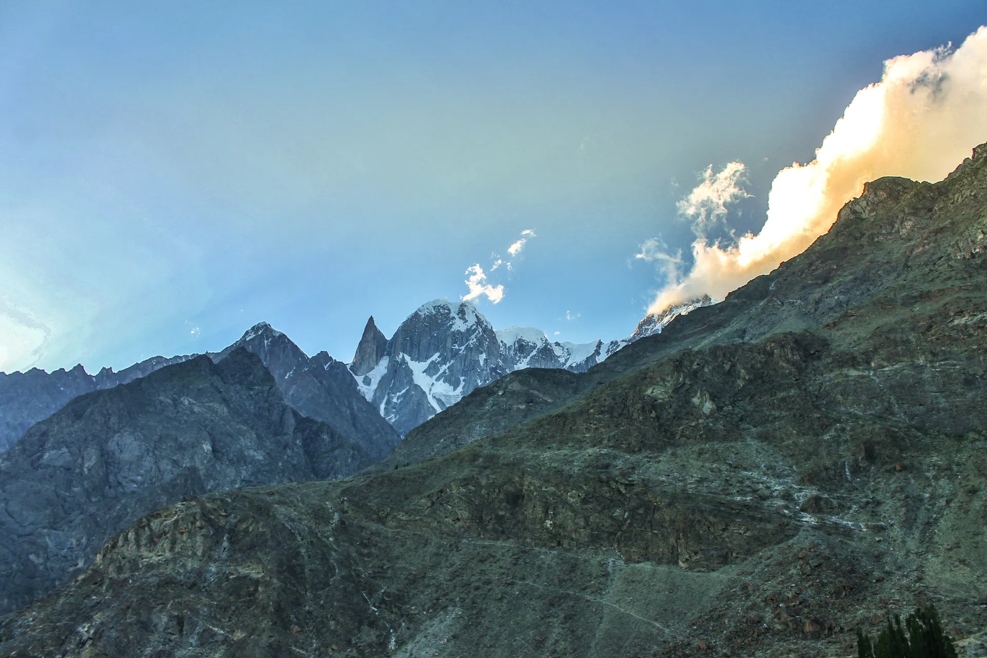
Photo: Irfansheen, with thanks · CC BY-SA 4.0 · via Wikimedia Commons · temporary stand-in photo

Bublimotin (Ladyfinger Peak)
Bublimotin, also called Ladyfinger Peak, is a rock spire of about 6,000 m on the south-west ridge of Ultar Sar above Karimabad in Hunza. It was first climbed in 1982.
Overview
Bublimotin is about 6,000 m high (Wikipedia gives an approximate figure only). It stands on the south-west ridge of Ultar Sar in the Batura Muztagh, the westernmost sub-range of the Karakoram, rising steeply above the Hunza valley. It is also known as Ladyfinger Peak, Lady Finger, Bubli Motin and Bublimating. Wikipedia lists its prominence as under 200 m, marked as needing a citation, and describes a sharp, relatively snow-free rock spire with little rise above the saddle that joins it to Hunza Peak.
Plan your visit
- Nearest town
- Karimabad
- Getting there
Karimabad is the main town of Hunza on the Karakoram Highway. Eagle's Nest is the ridge above Duikar village on the hill behind Karimabad; ask locally for the current way up. More
Best months
Jun – Sep
- Bublimotin (Ladyfinger Peak)
- Related places nearby: Ultar Sar, Eagle's Nest (Duikar), Karimabad (Hunza), Hunza Valley
Where it sits
Ultar Sar (7,388 m) is the south-easternmost major peak of the Batura Muztagh, about 10 km north-east of Karimabad. Its south flank rises more than 5,300 m above the Hunza River in about 9 km. Hunza Peak and the spire of Ladyfinger lie along its south-west ridge. The Ultar Glacier drains the massif and is visible from the roof of Baltit Fort.
First ascent
Patrick Cordier and Jacques Maurin made the first ascent on 22 May 1982 by the east ridge. Cordier's note in the 1983 American Alpine Journal describes a 6,000 m tower that is a satellite of the Ultar group, south-west of Bojohaghur Duanasir and between the Ultar and Hasanabad glaciers. The approach from Karimabad went north and was threatened by avalanches. The climbers reached the summit in three days from Karimabad, by the east col and east ridge, on mixed ice and rock that was at times very difficult. The final granite tooth was some 2,500 to 3,000 feet high.
Wikipedia records the climb as a roughly 6,000 m rock climb with a very serious alpine approach. It also notes that Kiyoshi Matsuoka, who made the first ascent of Ultar Sar in 1996, died on Ladyfinger Peak a year later.
A local story
Wikipedia gives, without a source, a folk tale about the spire. A magical prince called Kisar from Baltistan married a princess named Bubli in Hunza. After his first wife was kidnapped, he left Bubli on the mountain, which was later named after her, with a sack of grain and a hen, and told her to feed the hen one grain a year and wait until the sack was empty. The tale is told here as reported, and local versions may differ.
What to see and do
- Eagle's Nest: the viewpoint above Duikar village looks across the valley to Ladyfinger, with Rakaposhi, Ultar Sar, Diran and Golden Peak. See the Eagle's Nest page.
- Baltit Fort: the roof of the fort gives a view of the Ultar Glacier and the peaks behind Karimabad.
- Ultar Meadow: our Ultar trek climbs from Baltit to a glacier bowl under Ultar Sar. Our page does not name Bublimotin, so check with your guide which spire you are looking at.
When to visit
The Ultar trek is listed for June to September. Eagle's Nest is most visited at sunrise and sunset.
Where to stay and eat
Karimabad has hotels, guesthouses and cafes; Duikar has a small hotel and restaurant at Eagle's Nest.
Good to know
Climbing context. Bublimotin is a technical expedition peak for experienced, well-equipped mountaineers only. It is not a trekking peak and this page does not describe a climbing route. Climbing needs an expedition permit from the Gilgit-Baltistan authorities, arranged through a licensed Pakistani operator. No permit fees are quoted here; ask the operator for the current rules.
Getting there safely. For foreign visitors: the UK FCDO (updated 27 October 2026) advises against travel on the Karakoram Highway between Mansehra and Chilas but does not name Gilgit-Baltistan as a whole. Ask your operator which route they use.
Highlights
- Rock spire of about 6,000 m above Hunza
- First climbed in 1982 by two French climbers
- Seen from Eagle's Nest at Duikar
Getting there
Karimabad is the main town of Hunza on the Karakoram Highway. Eagle's Nest is the ridge above Duikar village on the hill behind Karimabad; ask locally for the current way up.
Tips
- The height is approximate; sources differ in name spelling too.
- Ask a local guide to point it out among the Ultar peaks.
- This page is not a climbing guide.
Photos we still need: Ladyfinger Peak from Eagle's Nest at Duikar. Send us yours
Sources and last checked
Last checked Confidence medium4 sources5 still to check
- Last checked
- Method
- Desk research from published sources
- Confidence
- medium
- Checked by
- trek.pk research team
Researched from published sources; not yet checked on the ground by our team. Spot something out of date? Report a mistake.
Sources
- Bublimotin (Wikipedia) · Wikipedia · checked
- Pakistan travel advice: warnings and insurance (updated 27 October 2026) · UK FCDO · checked
- Bubuli-Mo-Tin, Ultar Group · American Alpine Journal (1983) · checked
- Ultar Sar · Wikipedia · checked
Still to be checked on the ground (5)
- Height (Wikipedia gives only 'approximately 6,000 m')
- Wikipedia does not mention Karimabad; the 'above Karimabad' position is from the Ultar Sar ridge location
- Best viewpoint for Ladyfinger beyond Eagle's Nest
- Current royalty and permit rules (not confirmed from an official source)
- No openly licensed photo found; none added
Nearby and related

Ultar Meadow

Ultar Sar
Ultar Sar (7,388 m) towers about 10 km north-east of Karimabad in Hunza. Its south flank rises over 5,300 m above the river. The Ultar Meadow trek is the standard way to get close.

Eagle's Nest (Duikar)
A ridge viewpoint above Duikar village in Hunza, a short drive from Karimabad, with views over the valley to Rakaposhi, Ultar Sar, Diran and Golden Peak. Best at sunrise and sunset.

Karimabad (Hunza)
The main town of Hunza, set on a terrace below Baltit Fort with Rakaposhi, Ultar and Diran in view. A good base for forts, viewpoints, Attabad Lake and the road to Gojal.
Hunza Valley
A long Karakoram valley on the Karakoram Highway, with Karimabad, Baltit and Altit forts, Ganish village and Attabad Lake, below Rakaposhi and Ultar Sar. About 100 km from Gilgit.