

Photo: Samar irfan, with thanks · CC BY-SA 4.0 · via Wikimedia Commons · temporary stand-in photo

Hunza Valley
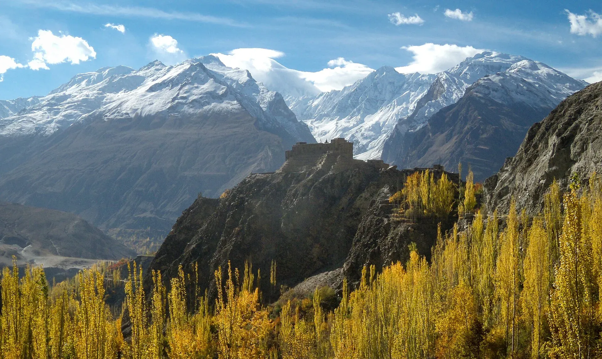
A long Karakoram valley on the Karakoram Highway, with Karimabad, Baltit and Altit forts, Ganish village and Attabad Lake, below Rakaposhi and Ultar Sar. About 100 km from Gilgit.
Overview
Hunza is the best-known valley in Gilgit-Baltistan and the one most visitors plan their trip around. The Hunza River runs through it, and the Karakoram Highway (KKH) follows the river for most of its length. The valley floor is at about 2,438 m, and peaks above 7,000 m stand on both sides: Rakaposhi (7,788 m) to the south and Ultar Sar (7,388 m) above Karimabad. It is usually split into three parts: Lower Hunza (Shinaki), Central Hunza around Karimabad, and Upper Hunza, or Gojal, towards the Chinese border.
This page covers the main valley, Karimabad and its neighbours. Across the river, Nagar has its own page, and Gojal and Shimshal in the north are described on theirs.
Plan your visit
- Nearest town
- Karimabad
- Getting there
By road: about 100 km from Gilgit to Karimabad on the Karakoram Highway (N-35); minibuses run Gilgit to Aliabad, with local transport on to Karimabad. OSRM models about 1 h 20 min, real time is often 2 to 3 hours. More
Best months
May – Oct
- Hunza Valley
- Related places nearby: Attabad Lake, Borith Lake, Gilgit, Khunjerab National Park, Nagar Valley, Gojal and Shimshal, Ganish Village (Ganish Khun), Hunza
Getting there
Hunza lies on the KKH, about 100 km by road from Gilgit to Karimabad. OSRM (OpenStreetMap routing) models this at roughly 1 hour 20 minutes, but real journeys take longer because of road works, checkposts and slow trucks; Wikivoyage suggests 2 to 3 hours. Minibuses run between Gilgit and Aliabad, the valley's business centre. Hunza is about 490 km by road from Islamabad (OSRM), and the Islamabad to Gilgit drive is normally treated as a long day or two. Flights between Islamabad and Gilgit are often cancelled in poor weather, so keep spare days.
Official travel times from Aliabad, from the Gilgit-Baltistan Tourism and Culture Department: Baltit Fort 7 km (about 20 minutes), Altit Fort 9 km (28 minutes), Attabad Lake 28 km (42 minutes), Borith Lake 45 km (1 hour), Passu 50 km (1 hour 10 minutes) and Khunjerab Pass 175 km (3 hours 15 minutes).
History in brief
Hunza began to separate from the Gilgit valley as its own polity around 997 CE, according to Wikipedia, and the Ayash ruling family was established in the 15th century. Buddhism, and to a lesser extent Bon, were the main religions before Islam. In 1891 the ruler, Mir Safdar Ali Khan, fled to Kashgar and the British installed Mir Nazim Khan, who ruled from 1892 to 1938. The princely states of Hunza and Nagar were dissolved on 25 September 1974.
Villages and sights
- Karimabad (Baltit). The main tourist town, high above the river, with hotels, shops and views of Ultar Sar, Rakaposhi and the valley.
- Baltit Fort. A historic fort above Karimabad, once the seat of the Mirs of Hunza. It was restored with support from the Aga Khan Trust for Culture, re-opened in 1996, and now runs as a museum. It has been on UNESCO's Tentative List since 2004; it is not a World Heritage Site. Dating differs by source: Wikipedia says 1990s work indicated that the core structures date to the 8th century CE, and that the fort was rebuilt by artisans in the 16th century (a cannon is dated 1539). An entry fee applies; current fees will be added soon.
- Altit Fort. An older fort in the village of Altit, below Karimabad. Restoration finished in 2010, and it received a UNESCO Asia-Pacific heritage award in 2011.
- Ganish. One of Hunza's oldest villages, with old watchtowers, mosques and carved wood. Nearby, the Sacred Rock of Hunza carries ancient inscriptions and petroglyphs.
- Duikar (Eagle's Nest). A village on a ridge above Altit, known for sunrise and sunset views and clear night skies.
- Aliabad. The transport and shopping hub on the KKH, with many hotels.
- Borith Lake. A lake in Gojal, 45 km from Aliabad and about 1 hour by road on the official Tourism Department figures above.
- Attabad Lake. Formed after a landslide on 4 January 2010. The highway now bypasses it through tunnels. Boating is popular.
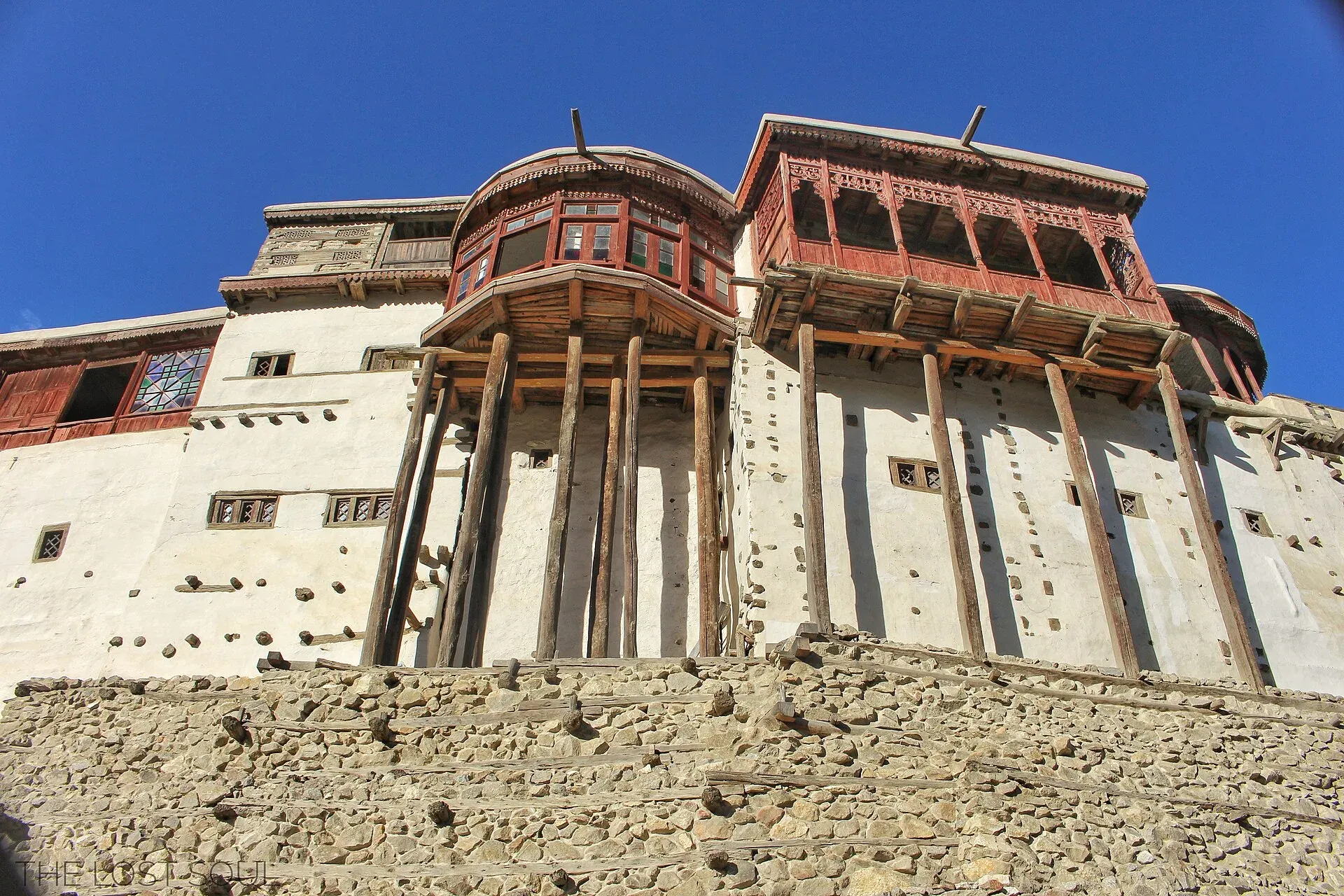
Photo: Fassifarooq, with thanks · CC BY-SA 4.0 · via Wikimedia Commons · temporary stand-in photo

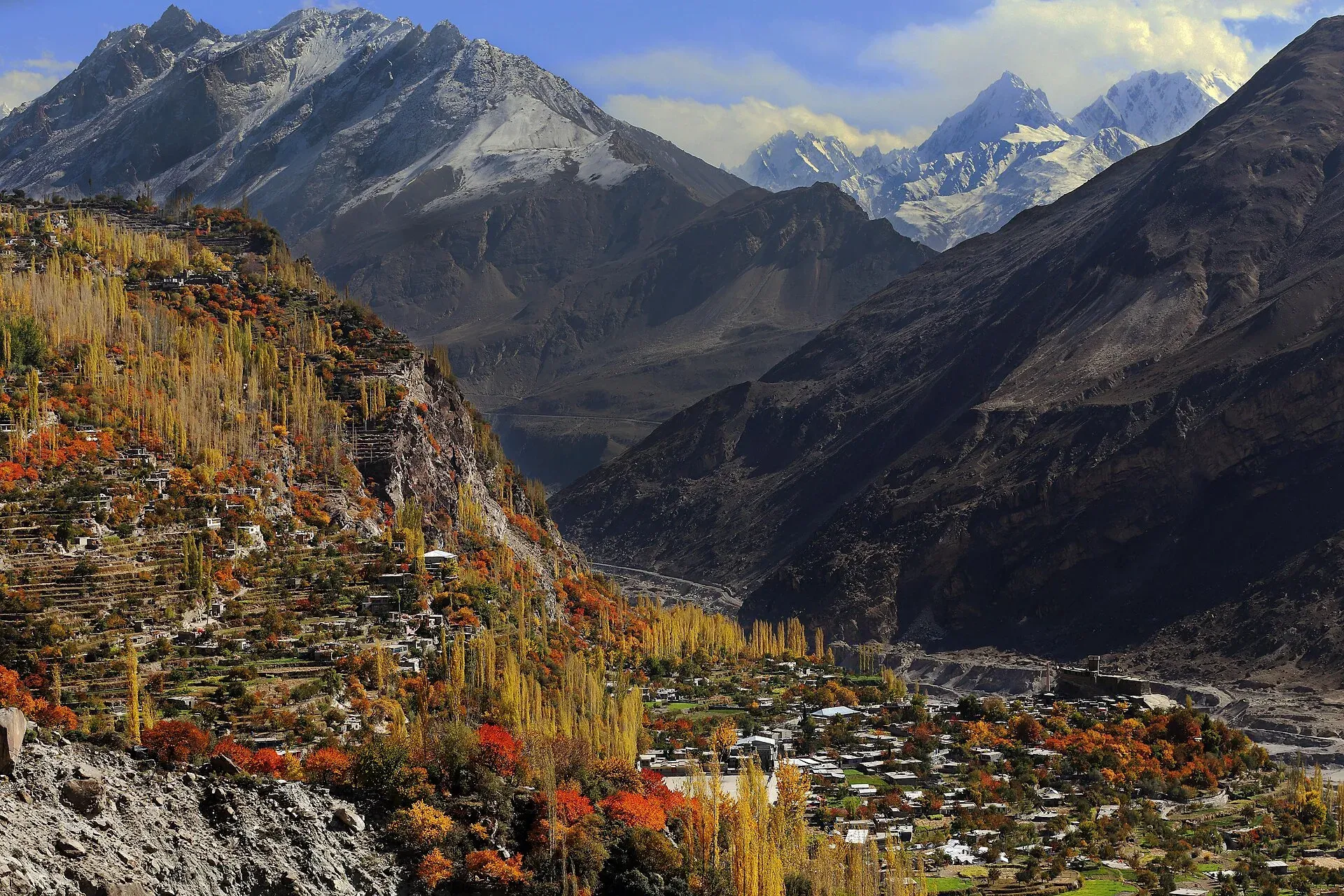
Photo: Usmanmiski, with thanks · CC BY-SA 3.0 · via Wikimedia Commons · temporary stand-in photo

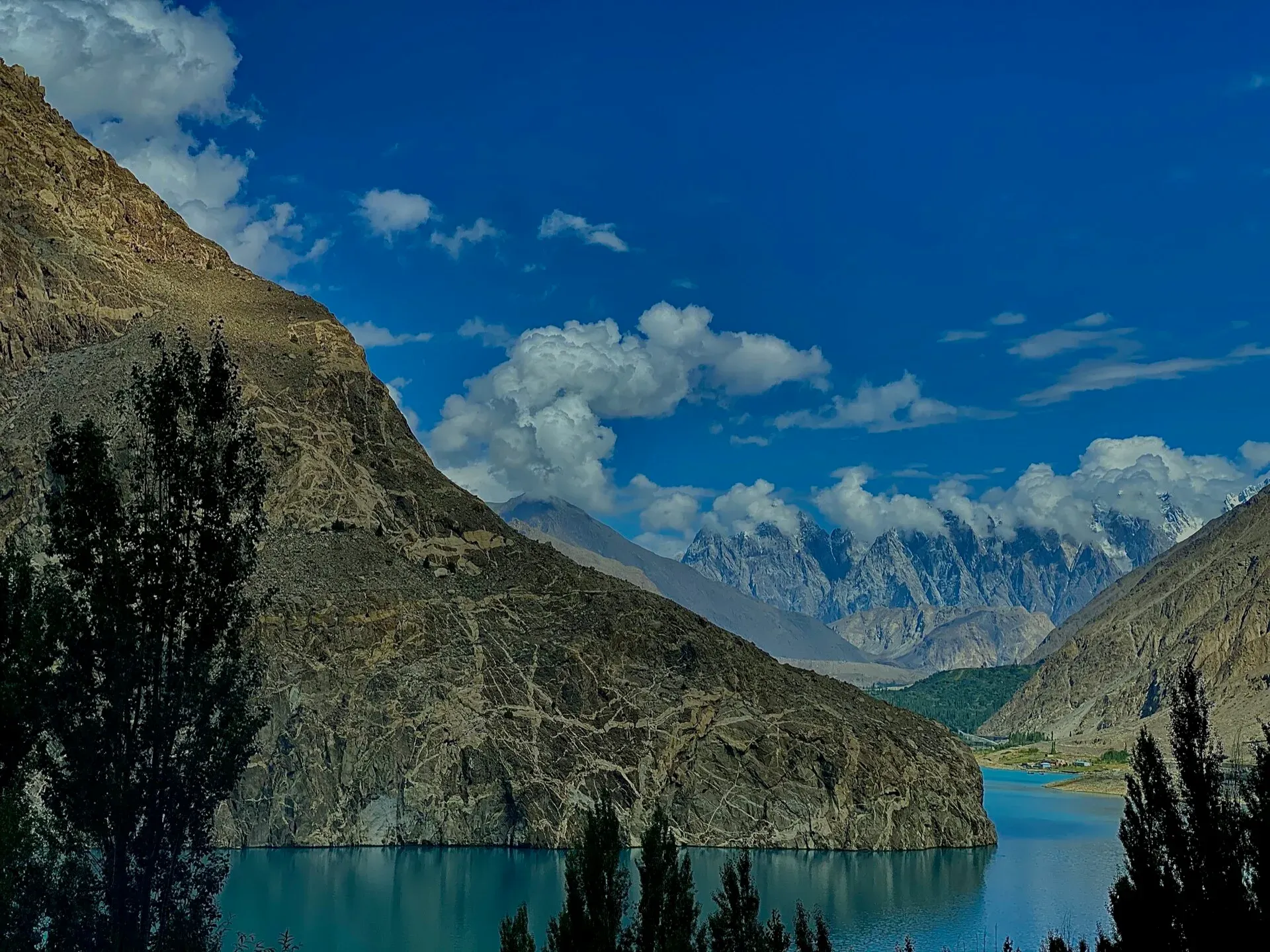
Photo: Amalooloo, with thanks · CC BY-SA 4.0 · via Wikimedia Commons · temporary stand-in photo

Treks and walks from the valley
Short walks to viewpoints start in Karimabad. The Ultar trek is the main easy hike and leads to a high glacial bowl below Ultar Sar. Looking back down the trail, Baltit Fort and Karimabad sit far below, which makes the walk a good way to read the layout of the valley. Rakaposhi Base Camp and the Hopar treks start across the river in Nagar. Other shorter routes are in the Other treks in Hunza roundup, and Gojal has its own set.
When to go
The main season is May to October, from fresh spring colour and apricot and cherry fruiting to the golden leaves of October. Wikivoyage gives temperatures of about 14 to 27 degrees Celsius in May and 0 to 10 in October. Winters are cold and quiet, and some guest houses close. Rain and landslides are most likely in July and August.
Where to stay and eat
Karimabad, Aliabad, Altit and Ganish have a range from simple guest houses to mid-range hotels, many with terraces facing the peaks. Gulmit and Passu in Gojal also have good lodgings. Book ahead in July and August and during public holidays. Traditional dishes include giyalin (thin pancakes), burus berikutz (cheese bread) and dried apricot soup. Hunza is famous for apricots, apples, cherries, mulberries and grapes.
Culture and languages
Burushaski is spoken in Central Hunza, Shina in Lower Hunza and Wakhi in Gojal. English and Urdu are widely understood. Most people are Ismaili Muslims. Dress modestly in villages, ask before photographing people, and be sensitive around jamaat khanas (community centres).
Safety and practical points
- The KKH can be blocked by landslides, especially in July and August. Check road reports each morning.
- Foreign visitors have not needed a no-objection certificate (NOC) for Gilgit-Baltistan since March 2019, but strips along the borders remain restricted. Trekking permit rules and fees change, and fees rose in 2025. Ask a licensed operator and the Tourism Department, Gilgit (05811-920173) for the current position.
- The Gilgit-Baltistan Tourist Police helpline is 1422.
- Karimabad is at about 2,500 m. Take it easy for the first day if you have come from low altitude.
Ask the district administration or local police about current conditions before you go. For foreign visitors: the UK FCDO advises against all travel on the Karakoram Highway between Mansehra and Chilas (advice updated 27 October 2026, checked 16 November 2026), but does not advise against Gilgit-Baltistan generally. Read the live advice before you plan.
Highlights
- Baltit and Altit forts, both restored by the Aga Khan Trust for Culture
- Views of Rakaposhi (7,788 m) and Ultar Sar (7,388 m) from Karimabad
- Ganish watchtowers and the Sacred Rock of Hunza
- Attabad Lake and the KKH tunnels
- Autumn colour and fruit harvests
Tips
- Allow two to three hours for Gilgit to Karimabad; road works and checkposts add time.
- Book hotels early for July, August and public holidays.
- Check road reports each morning; landslides on the KKH are common in summer.
- Carry your passport or national ID for checkposts.
- Ask your operator for current permit rules before any trek.
Photos we still need: Hunza apricot harvest or local food; Karimabad bazaar street; Ultar trail terrain and a trekking scene. Send us yours
Sources and last checked
Last checked Confidence medium9 sources5 still to check
- Last checked
- Method
- Desk research from published sources
- Confidence
- medium
- Checked by
- trek.pk research team
Researched from published sources; not yet checked on the ground by our team. Spot something out of date? Report a mistake.
Sources
- Land of Culture: District Hunza tourist guide sheet · Tourism & Culture Department, Gilgit-Baltistan · checked
- Pakistan Tourism Guide 2021 · Trade Development Authority of Pakistan (TDAP) · checked
- Hunza Valley (Wikipedia) · Wikipedia · checked
- Baltit Fort (Wikipedia) · Wikipedia · checked
- Altit Fort (Wikipedia) · Wikipedia · checked
- Hunza Valley (travel guide) · Wikivoyage · checked
- OSRM driving routes (distances and modelled times between towns) · OSRM / OpenStreetMap · checked
- NOC requirements for foreigners visiting Pakistan abolished (26 March 2019) · Dawn · checked
- GB winter adventure tourism hit by soaring permit fee, visa delays (1 Feb 2026) · Dawn · checked
Still to be checked on the ground (5)
- Real driving time Gilgit to Karimabad (OSRM models about 1 h 20; sources say 2 to 3 hours; no newer source found)
- Baltit Fort age: Wikipedia now says 8th-century core (1990s work) and a 16th-century rebuild; other sources give different dates; no official statement found
- Current entry fees for Baltit and Altit forts (no official dated source found; official Baltit site did not resolve)
- Current trekking permit rules and fees for foreign visitors (no official source found)
- Borith Lake: no description beyond access time (official source gives distance only)
Nearby and related

Ultar Meadow

Other treks in Hunza

Rakaposhi Base Camp

Daintar Pass

Attabad Lake
A turquoise lake about 21 km long in Gojal, Hunza. It formed when a landslide blocked the Hunza River on 4 January 2010. The Karakoram Highway now passes it through five tunnels.

Borith Lake
A small lake in Gojal, upper Hunza, a short walk from Hussaini and Gulmit. It lies at about 2,600 m, fed by meltwater from Hussaini Glacier, and is a resting stop for migrating wildfowl.

Gilgit
Gateway to Gilgit-Baltistan on the Karakoram Highway: a busy mountain town with the Kargah Buddha and the base for Hunza, Naltar and Skardu.

Khunjerab National Park
A high-altitude park on the Pakistan-China border, created in 1975 to protect Marco Polo sheep, snow leopard and Himalayan ibex. It surrounds the Khunjerab Pass on the Karakoram Highway.

Nagar Valley
The quieter bank of the Hunza River, facing Karimabad: Minapin, Hoper and Hispar villages, Rakaposhi viewpoints and easy treks below Rakaposhi, Diran and Spantik.

Gojal and Shimshal
Upper Hunza: Gulmit, Ghulkin, Passu and Sost on the Karakoram Highway, with big glaciers and the Passu Cones, plus the remote Shimshal valley, its Wakhi village and its mountaineering community.
Ganish Village (Ganish Khun), Hunza
Ganish Khun is described as the oldest settlement in Hunza, at least 1,000 years old, with old watchtowers and restored mosques. It won a UNESCO Asia-Pacific heritage award for conservation.

Hunza and Khunjerab (KKH)
A 7-8 day road trip from Islamabad up the Karakoram Highway to Hunza and on to Khunjerab Pass (4,693 m), with overnight stops at Besham, Chilas and Gilgit.

Grand Northern Loop
A 12-14 day circuit of the north from Islamabad: Naran and Babusar, Hunza and Khunjerab, Skardu and Deosai, Gilgit, then Swat or the KKH back. Distances, passes and seasons.