

Photo: Sheikh Danish Ejaz, with thanks · CC BY-SA 4.0 · via Wikimedia Commons · temporary stand-in photo

Karimabad (Hunza)
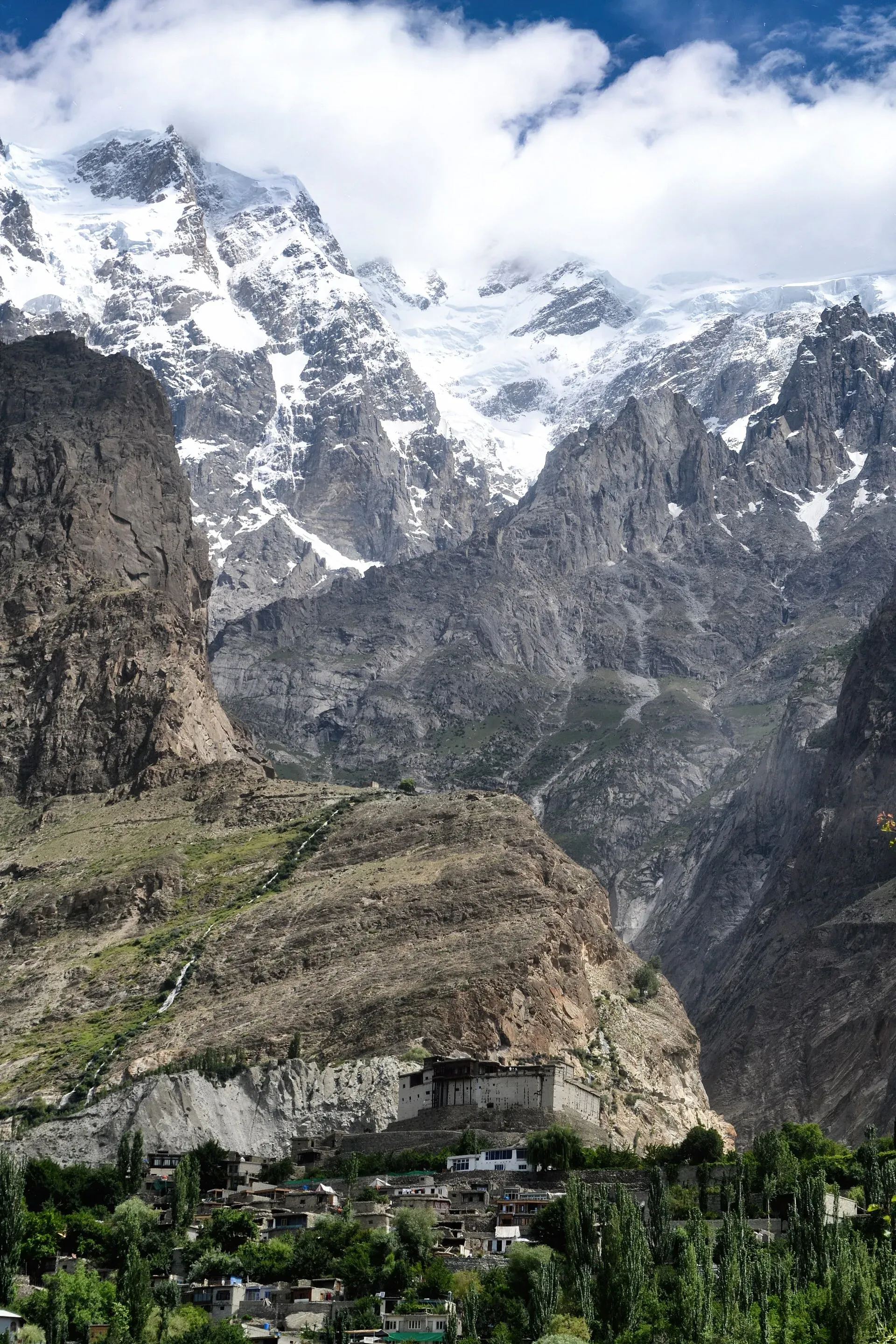
The main town of Hunza, set on a terrace below Baltit Fort with Rakaposhi, Ultar and Diran in view. A good base for forts, viewpoints, Attabad Lake and the road to Gojal.
Overview
Karimabad, once called Baltit, is the seat of Hunza District in Gilgit-Baltistan. It climbs a hillside above the Hunza River, with Baltit Fort at its top. Wikipedia gives the height as about 2,500 m (some pages say 2,603 m). On clear days you can see Rakaposhi, Diran, Golden Peak and Ultar Sar from terraces and rooftops.
The town was named in honour of Karim Aga Khan, the late spiritual leader of the Shia Ismaili Nizari community. It was formerly Baltit, and Baltit was the capital of Hunza for over 750 years, until the middle of the 20th century. Wikipedia says the Mir moved the seat down the hill to the new town, which grew into a tourist centre after the Karakoram Highway opened. The Aga Khan Foundation has supported roads, water supply, schools and health centres here.
The valley has Burushaski and Wakhi speakers, and Urdu and English are widely used (GB Tourism guide). Hunza is mainly Ismaili. There is no known 2023 census figure for Karimabad itself.
Plan your visit
- Nearest town
- Aliabad
- Getting there
Road: Gilgit to Karimabad about 103 km (OSRM, optimistic 1 h 25 min); Islamabad about 571 km. Nearest airport is Gilgit. Buses and vans run Gilgit to Aliabad. More
Best months
Apr – Jun, Sep – Oct
- Karimabad (Hunza)
- Related places nearby: Hunza Valley, Baltit Fort, Altit Fort, Attabad Lake, Borith Lake, Nagar Valley, Gojal and Shimshal, Gilgit, Ganish Village (Ganish Khun), Hunza
What to see and do
- Baltit Fort: the restored former home of the Mirs of Hunza, now a museum, on UNESCO's tentative list since 2004. A ticket is needed; fees will be added soon. See Baltit Fort.
- Altit Fort and village: another restored fort, with lanes of stone houses, about 3 km west of Karimabad. See Altit Fort.
- Ganish and the bazaar: Ganish lies directly south of the town, with old watchtowers and mosques. The Hunza and Nagar rivers meet near Ganish. It also has the Sacred Haldekish Rocks, listed in the district guide. See Ganish village.
- Eagle's Nest at Duikar: a ridge viewpoint north-west of the town for sunrise and sunset. The district guide calls Duikar the best place to see sunrise, sunset and the night sky. Wikipedia lists viewpoints for each of the four peaks: Rakaposhi (7,788 m), Diran, Golden Peak and Ultar Sar.
- The Ultar channels. Water from Ultar Nala (a nala is a mountain stream) is carried to the terraces by irrigation channels, and some run through the town. A channel walk gives views over the valley. Wikipedia says the water has a velvety colour from fine mica particles.
- Queen Victoria Monument. A memorial built into a rock face at the back of the town by Mir Nazim Khan, known in Burushaski as Malikamu Shikari. Wikipedia says it takes about an hour on foot, past irrigation channels, a polo ground and an old watchtower, over rocky ground.
- Ultar Base Camp path: the main trek from here.
- Crafts and food: dried apricots, walnuts and cherries are sold in the bazaar. Wikivoyage lists local dishes: giyalin (thin pancakes), burus berikutz (cheese bread), baterin xy dawdo (dried apricot soup) and diram fiti (sweet bread).
Getting there
- Road: the Karakoram Highway runs through Aliabad, and a link road climbs to Karimabad. Gilgit is about 103 km (about 1 hour 25 minutes on OSRM, optimistic). Islamabad is about 571 km by OSRM, but allow two days on the KKH because of Kohistan and Diamer delays.
- Air and bus: the nearest airport is Gilgit. Buses and shared vans run between Gilgit and Aliabad.
- Around town: most things are walkable. Taxis from Aliabad bazaar climb the hill.
When to visit
Late April has apricot blossom, and September to October has autumn colour. Summer is comfortable. Winter is cold, many hotels close, and the road can be blocked by snow or slides. Check road conditions with the Tourism Directorate or the Tourist Police (1422) before travel.
Where to stay and eat
Stay in the old Baltit area for views and short walks to the fort. Aliabad bazaar is on the highway and handy for transport. Altit and Ganish are quieter. There are guesthouses, hotels and a few restaurants serving local dishes. Rooms fill up at Eid and in July and August.
A day or two in Karimabad
This outline uses only places on this page.
- Morning. Baltit Fort, allowing about an hour, then the lanes below it.
- Afternoon. A walk along an Ultar irrigation channel, or down to Altit (3 km west) and its fort.
- Evening. Sunset at Eagle's Nest, Duikar.
- Second day. Ganish village in the morning, then the Queen Victoria Monument walk, or a drive to Attabad Lake.
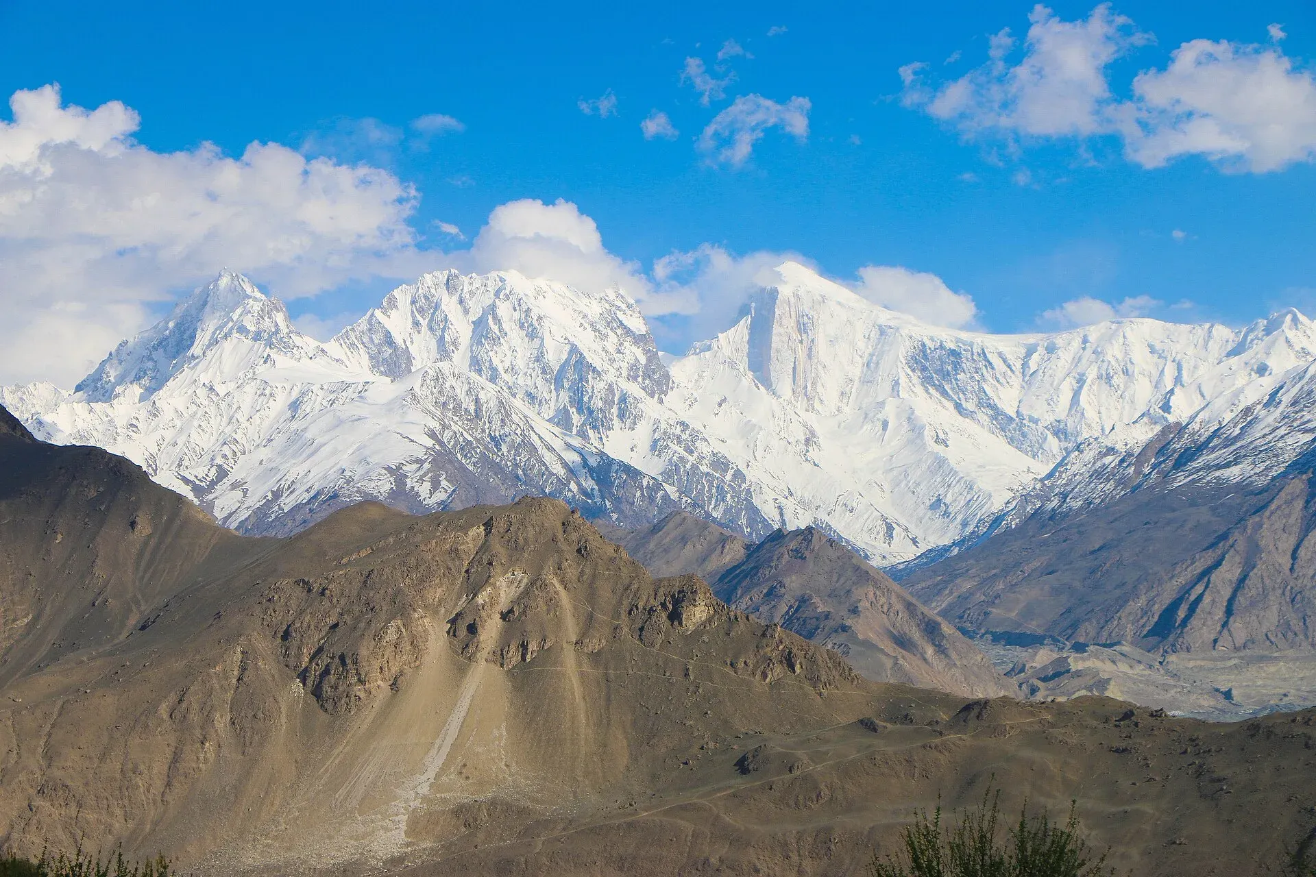
Photo: Akbar Khan Niazi, with thanks · CC BY-SA 3.0 · via Wikimedia Commons · temporary stand-in photo

Treks and day trips
- Ultar Base Camp, Rakaposhi Base Camp and other valley walks.
- Attabad Lake, about 28 km from Aliabad (the district guide gives about 42 minutes).
- Borith Lake and Passu, up in Gojal.
- Nagar Valley across the river.
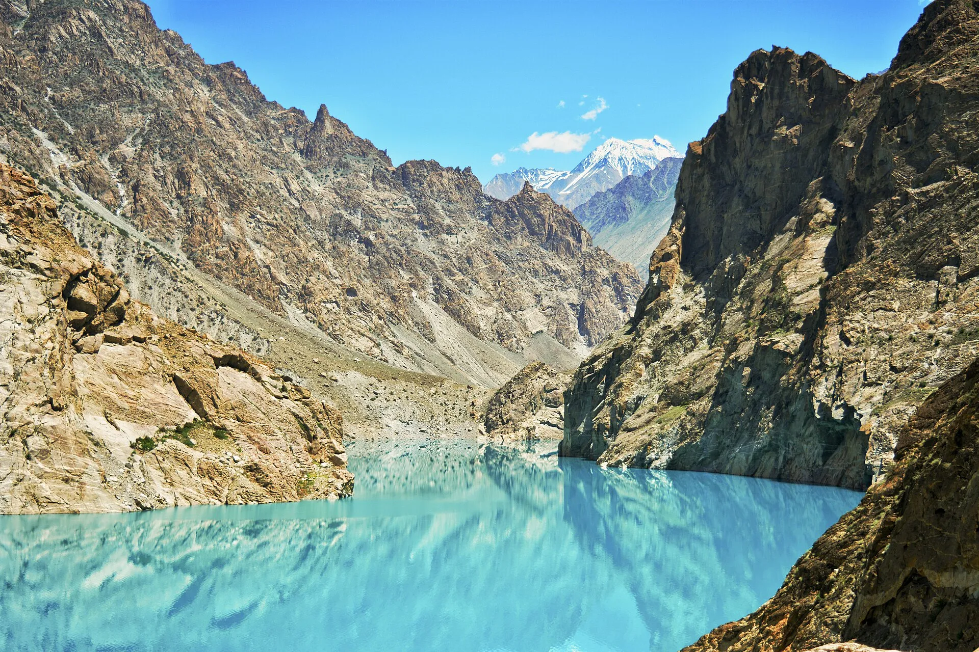
Photo: Hassanzealous, with thanks · CC BY-SA 4.0 · via Wikimedia Commons · temporary stand-in photo

Safety and good to know
The road above the town is steep. After rain, rockfall closes the KKH regularly. Dress modestly, ask before photographing people, and carry your passport or national ID. Tourist Police: 1422.
Highlights
- Baltit Fort and Altit Fort
- Views of Rakaposhi, Ultar and Diran
- Eagle's Nest sunrise viewpoint
- Base for Attabad, Passu and Khunjerab
Stay, eat and essentials near Karimabad (Hunza)
Within 8 km of Karimabad (Hunza), nearest first.
Places to stay
- Farman LodgesCall Farman LodgesMap of Farman Lodges in Google Maps
- Rainbow Hotel & RestaurantCall Rainbow Hotel & RestaurantMap of Rainbow Hotel & Restaurant in Google Maps
- World Roof Hotel hunzaCall World Roof Hotel hunzaMap of World Roof Hotel hunza in Google Maps
- The Hunza Lodge By FolksCall The Hunza Lodge By FolksMap of The Hunza Lodge By Folks in Google Maps
- Hilltop HotelCall Hilltop HotelMap of Hilltop Hotel in Google Maps
- Mulberry Hotel HunzaCall Mulberry Hotel HunzaMap of Mulberry Hotel Hunza in Google Maps
Places to eat
- Morning Glory RestaurantMap of Morning Glory Restaurant in Google Maps
- Hunza food pavilion by Laal ShehzadiCall Hunza food pavilion by Laal ShehzadiMap of Hunza food pavilion by Laal Shehzadi in Google Maps
- Pizza PamirCall Pizza PamirMap of Pizza Pamir in Google Maps
- Yak Bar HunzaCall Yak Bar HunzaMap of Yak Bar Hunza in Google Maps
- Mountain Cup CaféMap of Mountain Cup Café in Google Maps
- Silk Route CaféCall Silk Route CaféMap of Silk Route Café in Google Maps
Essential services fuel stations, ATMs, banks, pharmacies and hospitals and clinics
Fuel
- Passu Petrol Filling StationMap of Passu Petrol Filling Station in Google Maps
- PSO Pump NoorshahMap of PSO Pump Noorshah in Google Maps
- PSO PumpMap of PSO Pump in Google Maps
- Attock - Silk Route Filling StationMap of Attock - Silk Route Filling Station in Google Maps
- Caltex Techron Petrol Pump by Be EnergyCall Caltex Techron Petrol Pump by Be EnergyMap of Caltex Techron Petrol Pump by Be Energy in Google Maps
- Attock Petrol PumpMap of Attock Petrol Pump in Google Maps
ATMs
- National Bank ATMMap of National Bank ATM in Google Maps
- Bank AlfalahCall Bank AlfalahMap of Bank Alfalah in Google Maps
- Habib Metro Bank AliabadCall Habib Metro Bank AliabadMap of Habib Metro Bank Aliabad in Google Maps
- Habib Bank Limited (HBL)Call Habib Bank Limited (HBL)Map of Habib Bank Limited (HBL) in Google Maps
Banks and money exchange
- Karakorum Cooperative BankMap of Karakorum Cooperative Bank in Google Maps
- First Micro BankMap of First Micro Bank in Google Maps
- Soneri Bank LtdCall Soneri Bank LtdMap of Soneri Bank Ltd in Google Maps
- The Aliabad Co.op Thrift & Credit Society Ltd Agakhan Abad Branch HunzaCall The Aliabad Co.op Thrift & Credit Society Ltd Agakhan Abad Branch HunzaMap of The Aliabad Co.op Thrift & Credit Society Ltd Agakhan Abad Branch Hunza in Google Maps
Pharmacies
- Sana MedicosMap of Sana Medicos in Google Maps
Hospitals and clinics
- Govt Civil Hospital AskurdasMap of Govt Civil Hospital Askurdas in Google Maps
- Hunza ClinicsCall Hunza ClinicsMap of Hunza Clinics in Google Maps
- Aliabad Civil HospitalMap of Aliabad Civil Hospital in Google Maps
Listings come from Google Maps data and are unverified: phone numbers, opening months and prices may have changed. Report a problem · Own one of these? Claim it
Tips
- Come in late April for blossom or in October for colour.
- Book hotels ahead in July and August.
- Ask your hotel for current road news before heading north.
- Walk the old bazaar early or late for the best light.
Photos we still need: Karimabad bazaar and Hunza dishes (giyalin, burus berikutz); Ultar irrigation channel walk. Send us yours
Sources and last checked
Last checked Confidence medium8 sources4 still to check
- Last checked
- Method
- Desk research from published sources
- Confidence
- medium
- Checked by
- trek.pk research team
Researched from published sources; not yet checked on the ground by our team. Spot something out of date? Report a mistake.
Sources
- Karimabad, Hunza · Wikipedia · checked
- District Hunza tourist guide and map · Tourism & Culture Department, Gilgit-Baltistan (tourism.gov.pk) · checked
- Pakistan Tourism Guide 2021 · TDAP Pakistan · checked
- OSRM driving route service: distances and times measured 16 November 2026 (times are optimistic, without stops) · OSRM / OpenStreetMap · checked
- Baltit Fort · Wikipedia · checked
- Karimabad, Gilgit-Baltistan · Wikipedia · checked
- Hunza Valley travel guide · Wikivoyage · checked
- Hunza District · Wikipedia · checked
Still to be checked on the ground (4)
- Karimabad altitude (Wikipedia: 2,500 m citing Britannica; its infobox: 2,603 m, uncited)
- Baltit Fort entry fee (no live official page found)
- Winter hotel and road status
- Queen Victoria Monument walk: time and route from a local source (Wikipedia: about an hour)
Nearby and related

Ultar Meadow

Other treks in Hunza

Rakaposhi Base Camp
Hunza Valley
A long Karakoram valley on the Karakoram Highway, with Karimabad, Baltit and Altit forts, Ganish village and Attabad Lake, below Rakaposhi and Ultar Sar. About 100 km from Gilgit.

Baltit Fort
A restored fort and museum above Karimabad in Hunza, once the home of the Mirs of Hunza. Its core is centuries old and it has been on UNESCO's tentative list since 2004.

Altit Fort
An old fort above the Hunza River at Altit, restored by the Aga Khan Trust for Culture and open to visitors since 2007. Often described as the oldest monument in Gilgit-Baltistan.

Attabad Lake
A turquoise lake about 21 km long in Gojal, Hunza. It formed when a landslide blocked the Hunza River on 4 January 2010. The Karakoram Highway now passes it through five tunnels.

Borith Lake
A small lake in Gojal, upper Hunza, a short walk from Hussaini and Gulmit. It lies at about 2,600 m, fed by meltwater from Hussaini Glacier, and is a resting stop for migrating wildfowl.

Nagar Valley
The quieter bank of the Hunza River, facing Karimabad: Minapin, Hoper and Hispar villages, Rakaposhi viewpoints and easy treks below Rakaposhi, Diran and Spantik.

Gojal and Shimshal
Upper Hunza: Gulmit, Ghulkin, Passu and Sost on the Karakoram Highway, with big glaciers and the Passu Cones, plus the remote Shimshal valley, its Wakhi village and its mountaineering community.

Gilgit
Gateway to Gilgit-Baltistan on the Karakoram Highway: a busy mountain town with the Kargah Buddha and the base for Hunza, Naltar and Skardu.
Ganish Village (Ganish Khun), Hunza
Ganish Khun is described as the oldest settlement in Hunza, at least 1,000 years old, with old watchtowers and restored mosques. It won a UNESCO Asia-Pacific heritage award for conservation.
Hunza and Khunjerab (KKH)
A 7-8 day road trip from Islamabad up the Karakoram Highway to Hunza and on to Khunjerab Pass (4,693 m), with overnight stops at Besham, Chilas and Gilgit.

Grand Northern Loop
A 12-14 day circuit of the north from Islamabad: Naran and Babusar, Hunza and Khunjerab, Skardu and Deosai, Gilgit, then Swat or the KKH back. Distances, passes and seasons.