

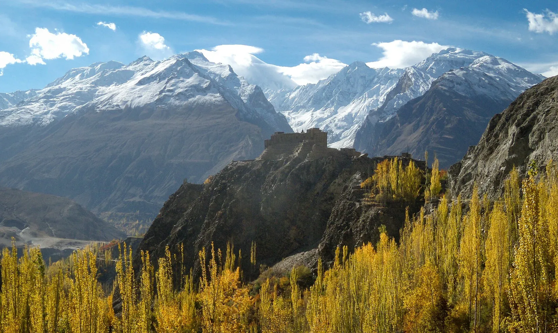
Photo: Samar irfan, with thanks · CC BY-SA 4.0 · via Wikimedia Commons · temporary stand-in photo

Ultar Meadow
- Duration
- 1–2 days
- Distance
- 6.2 km
- Grade
- Easy
- Max altitude
- 3,270 m
- Season
- May – Oct
A short, steep walk from Baltit in Karimabad to Ultar Meadow, a glacier bowl under Ultar Sar (7,388 m). Do it as a hard day hike or an overnight, with an optional climb to Hon Pass.
Overview
Ultar Meadow sits in the high bowl under Ultar Sar (7,388 m), straight above Karimabad and Baltit Fort. A steep trail climbs the narrow Ultar Nala to a pasture with herders' huts, a glacier icefall and granite walls on three sides. Local stories place a fairy queen's crystal palace on the summit, and the glacier feeds the irrigation canals of Baltit and Karimabad.
You can walk up and back in a hard day. Sleeping at the meadow is better: avalanches rumble off the icefall, and the stars and moonlit peaks are the reason people stay.
Who it suits
Fit walkers with a day or two to spare. The route is short but steep, with about 770 m of climbing from the village. It is graded easy because it is short and open to anyone, but the loose, exposed trail in the lower gorge demands care. People have been injured here, and a solo trekker disappeared in 1994. Go with a guide, especially if it has rained.
When to go
May to October. The meadow is cold in the morning because sun arrives late and wind comes off the glacier. After rain, wind or a thaw the lower trail is prone to rockfall, so avoid those days.
The route
From the signed junction above Baltit (about 2,500 m), go straight north along the canal into the gorge. After a spring at the canal headworks, the trail climbs the steep rubble on the true right bank, then leaves the river on cairned moraine below the cliffs. You pass the canal that feeds the Victoria Monument area and see the black snout of the Ultar Glacier. Quru Phari (about 3,000 m) is the first level grass, with a spring and, in season, a seller of drinks and meals. One more gentle hour leads to Ultar Meadow (about 3,270 m), with views south to Diran. Apricot Tours also gives about 3,270 m.
A second way starts through Diramishal village and follows the Dilbar canal. It is the more direct route but crosses private land and an irrigation canal that was built as a water channel, not a path. Ask permission and get a local to show the way.
Hon Pass side trip. The grassy notch (4,257 m) southwest of the meadow gives an aerial view of the Nagar treks: Barpu, Minapin and Pisan glaciers, and Rakaposhi, Diran, Malubiting and Spantik. Allow 3 to 4 hours up and 1.5 to 2 down. There is no clear trail except for the last 20 minutes, and no reliable water above the meadow.
Ultar Sar and the glacier
Ultar Sar (7,388 m) is the south-eastern end of the Batura Muztagh, about 10 km north-east of Karimabad. Its first ascent was only in 1996, by a Japanese expedition led by Akito Yamazaki and Kiyoshi Matsuoka, after fifteen earlier expeditions in the 1980s and 1990s failed, some with fatalities. Neighbouring peaks include Bojohagur Duanasir (7,329 m) and Shispare (7,611 m). The normal climbing route does not use this trek: it goes via Bathbakor Base Camp. The trek gives a view of the Ultar Glacier and icefall from below, not of a climbing route.
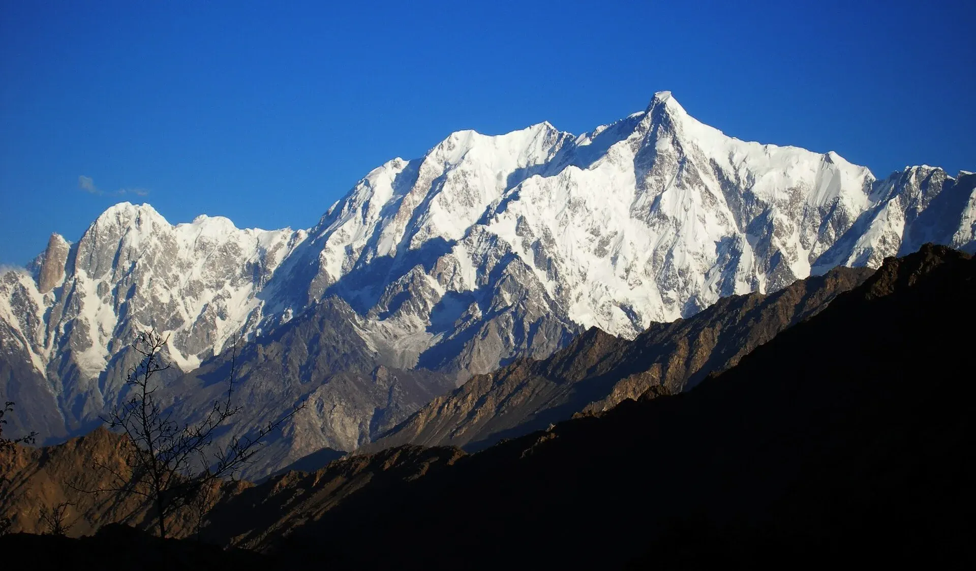
Photo: Eleutherosmartin, with thanks · CC BY-SA 3.0 · via Wikimedia Commons · temporary stand-in photo

Terrain underfoot
The trek has three kinds of ground. The first stretch is a path and a canal beside it above Baltit. The gorge then has steep rubble on the right bank, with rockfall danger, and cairned moraine below the cliffs. Above Quru Phari the ground eases into grass and the walled camping area. If you add Hon Pass, the last 20 minutes are the only clear trail; the rest is grass and rock without a path, and there is no reliable water above the meadow.
Culture and people
Baltit sits at the old heart of Hunza. The Ultar canal is a lifeline for the village, so do not damage or walk on channels. In Diramishal, houses stand tight beside the footpath, so keep voices low and ask before photographing. Some herders' huts at the meadow are run by local families who sell tea and meals in season.
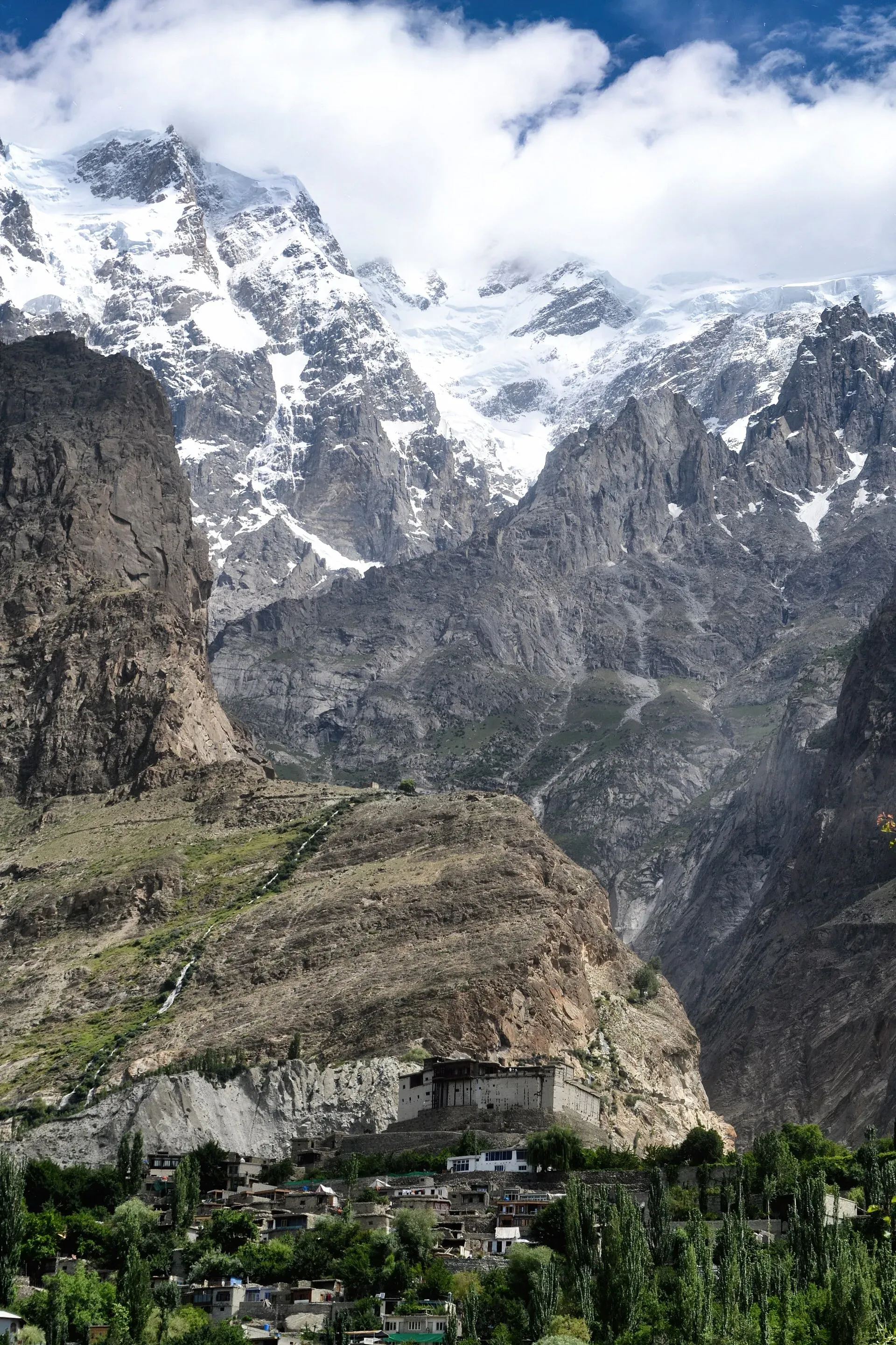
Photo: Sheikh Danish Ejaz, with thanks · CC BY-SA 4.0 · via Wikimedia Commons · temporary stand-in photo

Practical information
- Guide: ask your hotel in Karimabad for a reliable one. Many people go without, but the trail is indistinct in places.
- Food and fees: the camping area and kitchen hut at the meadow have been run by local families. Prices from 2002 are out of date, so confirm locally.
- Map: DAV 1:100,000 Hunza-Karakoram.
- Water: springs near the headworks, at Quru Phari and at the meadow. Treat it.
- Day hike: about 4 hours up and 3 back, longer if you add Hon Pass.
Planning notes
Because there is only one steep gorge approach, leave early so you are off the lower trail before afternoon winds and any thaw. If you are staying at the meadow, bring a warm sleeping bag: nights are cold even in summer. Pack out your rubbish.
Highlights
- Glacier icefall and avalanches at close range
- Views of Diran and Rakaposhi from the meadow
- Quiet night at 3,270 m with a night sky
- Hon Pass side trip with views of Nagar treks
Day by day
- StartBaltit (Karimabad)
- Day 1Ultar Meadow
- Day 2Baltit
| Day | Route | Hours | Distance | Ascent / descent | Camp and altitude |
|---|---|---|---|---|---|
| Day 1 | Baltit to Ultar Meadow | 2–3 h | 3.1 km | +770 m | Ultar Meadow, 3,270 m |
Day 1 notesWalk 15 minutes from Karimabad hotels to the signed junction, then go straight (north) along the canal into the gorge. Climb steep rubble on the right bank for an hour, then follow cairns over moraine. Rockfall risk is high after rain. Pass the high canal, reach Quru Phari for water and snacks, and finish with an hour of easier climbing to the meadow. Camp inside the walled area or sleep in a local tent. | |||||
| Day 2 | Ultar Meadow to Baltit | 1.5–2 h | 3.1 km | −770 m | Baltit, 2,500 m |
Day 2 notesReturn the way you came. Take care not to follow an irrigation canal by mistake as you descend the gorge. If you wish, add the Hon Pass side trip (4,257 m, 995 m climb) before heading down. It adds roughly 4.5 to 6 hours and is best done in clear weather with plenty of water carried from the meadow. | |||||
Getting there
Karimabad is on the Karakoram Highway about 100 km from Gilgit (roughly 2.5 hours by road). Local wagons and taxis run between Gilgit, Aliabad and Karimabad. From most Karimabad hotels the trailhead near Baltit Fort is a 15-minute walk. Check current vehicle schedules locally.
Permits and rules
- Permit needed
- Usually not, Open zone
- Fee
- Current fees will be added soon
- Last checked
- 16 November 2026
Zone: open. Dawn reported on 29 March 2026 that foreign visitors to open-zone areas do not need a trekking permit, while permits from the Gilgit-Baltistan tourism department are needed only for treks and climbs in restricted zones. Older rules (a 2017 interior-ministry NOC for foreigners) were reported at the time; there is no known 2025-26 source confirming that it still applies. No fee or camping rule was found for this route. Check with the Gilgit-Baltistan Tourism Department in Gilgit, or a local operator, before you go.
How trekking permits, NOCs and registration work: Visa and permits.
Season
Best: May – Oct
Water and camps
Springs at the canal headworks (15 minutes up), at Quru Phari and at the meadow. Treat all water. A walled camping area below the herders' huts is the usual place to camp. Outside it the ground is not level. A kitchen hut and tents have been available in summer. Confirm before relying on them.
Gear and safety
Rockfall is the main danger in the lower gorge, especially after rain or a thaw. The route is steep and has been the scene of accidents and one disappearance. Do not walk on the Dilbar canal without permission. Avalanches falling off the glacier are loud but far away. Carry warm layers, rain cover and water for Hon Pass. Rescue is by helicopter or police from Karimabad. Tell your hotel your return time.
Variations
Combine with the Hon Pass day hike (4,257 m). Many visitors add the Rakaposhi Base Camp trek from Minapin (rakaposhi-base-camp). For multi-day treks from Hunza, see the Ahmedabad Glacier and Shishpar notes in other-treks-in-hunza.
Tips
- Skip the gorge section after rain, wind or a thaw
- Carry water above the meadow: there is none on Hon Pass
- Take a guide: trails are faint and the Diramishal route is confusing
- Pack warm layers: mornings are cold and windy
Stay and eat in Karimabad
Karimabad is the nearest town to the trek: somewhere to sleep and stock up before and after.
Places to stay
- Eagle's Nest Hotel HunzaCall Eagle's Nest Hotel HunzaMap of Eagle's Nest Hotel Hunza in Google Maps
- Hunza Darbar HotelCall Hunza Darbar HotelMap of Hunza Darbar Hotel in Google Maps
- Hunza Embassy Hotel by ZeezCall Hunza Embassy Hotel by ZeezMap of Hunza Embassy Hotel by Zeez in Google Maps
- Karakoram Highway Inn HunzaCall Karakoram Highway Inn HunzaMap of Karakoram Highway Inn Hunza in Google Maps
- GreenPak Hotel Hunza, Gilgit-BaltistanCall GreenPak Hotel Hunza, Gilgit-BaltistanMap of GreenPak Hotel Hunza, Gilgit-Baltistan in Google Maps
- Karakorum View Hotel Karimabad HunzaCall Karakorum View Hotel Karimabad HunzaMap of Karakorum View Hotel Karimabad Hunza in Google Maps
Places to eat
- Café De HunzaCall Café De HunzaMap of Café De Hunza in Google Maps
- Rewayat Restaurant Ganish HunzaCall Rewayat Restaurant Ganish HunzaMap of Rewayat Restaurant Ganish Hunza in Google Maps
- Pizza PamirCall Pizza PamirMap of Pizza Pamir in Google Maps
- Hidden Paradise HunzaMap of Hidden Paradise Hunza in Google Maps
- Pizza Pamir AliabadCall Pizza Pamir AliabadMap of Pizza Pamir Aliabad in Google Maps
- Yak Bar HunzaCall Yak Bar HunzaMap of Yak Bar Hunza in Google Maps
Essential services fuel stations, ATMs, banks, pharmacies and hospitals and clinics
Fuel
- PSO Pump NoorshahMap of PSO Pump Noorshah in Google Maps
- Attock - Silk Route Filling StationMap of Attock - Silk Route Filling Station in Google Maps
- Caltex Techron Petrol Pump by Be EnergyCall Caltex Techron Petrol Pump by Be EnergyMap of Caltex Techron Petrol Pump by Be Energy in Google Maps
- Attock Petrol PumpMap of Attock Petrol Pump in Google Maps
- Passu Petrol Filling StationMap of Passu Petrol Filling Station in Google Maps
- Hunza Petroleum ServiceMap of Hunza Petroleum Service in Google Maps
ATMs
- Habib Bank Limited (HBL)Call Habib Bank Limited (HBL)Map of Habib Bank Limited (HBL) in Google Maps
- Bank AlfalahCall Bank AlfalahMap of Bank Alfalah in Google Maps
- Habib Metro Bank AliabadCall Habib Metro Bank AliabadMap of Habib Metro Bank Aliabad in Google Maps
- National Bank ATMMap of National Bank ATM in Google Maps
Banks and money exchange
- Soneri Bank LtdCall Soneri Bank LtdMap of Soneri Bank Ltd in Google Maps
- Karakorum Cooperative BankMap of Karakorum Cooperative Bank in Google Maps
- First Micro BankMap of First Micro Bank in Google Maps
- The Aliabad Co.op Thrift & Credit Society Ltd Agakhan Abad Branch HunzaCall The Aliabad Co.op Thrift & Credit Society Ltd Agakhan Abad Branch HunzaMap of The Aliabad Co.op Thrift & Credit Society Ltd Agakhan Abad Branch Hunza in Google Maps
Pharmacies
- Sana MedicosMap of Sana Medicos in Google Maps
Hospitals and clinics
- Aliabad Civil HospitalMap of Aliabad Civil Hospital in Google Maps
- Civil Hospital Nagar khasMap of Civil Hospital Nagar khas in Google Maps
- Govt Civil Hospital AskurdasMap of Govt Civil Hospital Askurdas in Google Maps
- Hunza ClinicsCall Hunza ClinicsMap of Hunza Clinics in Google Maps
Listings come from Google Maps data and are unverified: phone numbers, opening months and prices may have changed. Report a problem · Own one of these? Claim it
Photos we still need: Ultar Meadow, Quru Phari and the lower gorge trail. Send us yours
Health and emergency
Mobile signal is patchy on most treks, so tell someone your plan before you go. Emergency numbers
Sources and last checked
Last checked Confidence medium5 sources4 still to check
- Last checked
- Method
- Desk research from published sources
- Confidence
- medium
- Checked by
- trek.pk research team
Researched from published sources; not yet checked on the ground by our team. Spot something out of date? Report a mistake.
Sources
- Trekking in the Karakoram and Hindukush (route facts, ~2002) · Lonely Planet · checked
- Gilgit-Baltistan tourism bounces back despite Middle East war (permit rules for open and restricted zones, 29 March 2026) · Dawn · checked
- Ultar Meadows trek (route, timings, altitude 3,270 m vs 3,600 m) · Hunza Guides Pakistan / Apricot Tours · checked
- Hon Pass and Rakaposhi Base Camp Trek · Hunza Guides Pakistan · checked
- Ultar Sar · Wikipedia · checked
Still to be checked on the ground (4)
- Current guide rates and camping fees at the meadow (2002 prices removed)
- Whether the Diramishal / Dilbar canal route is still open to walkers
- Current state of the gorge trail and rockfall
- Whether the 2017 interior-ministry NOC for foreigners still applies to open zones (Dawn, 29 Mar 2026, does not mention an NOC)
Nearby and related

Rakaposhi Base Camp

Other treks in Hunza

Asumbar Haghost
Hon Pass
A grassy notch of 4,257 m south-west of Ultar Meadow above Karimabad, with an aerial view of the Nagar treks. A side trip from the Ultar trek.

Bublimotin (Ladyfinger Peak)
Bublimotin, also called Ladyfinger Peak, is a rock spire of about 6,000 m on the south-west ridge of Ultar Sar above Karimabad in Hunza. It was first climbed in 1982.
Ultar Meadow
A high pasture at about 3,270 m under Ultar Sar, reached by a steep trail from Baltit in Karimabad, with a glacier icefall and herders' huts.