

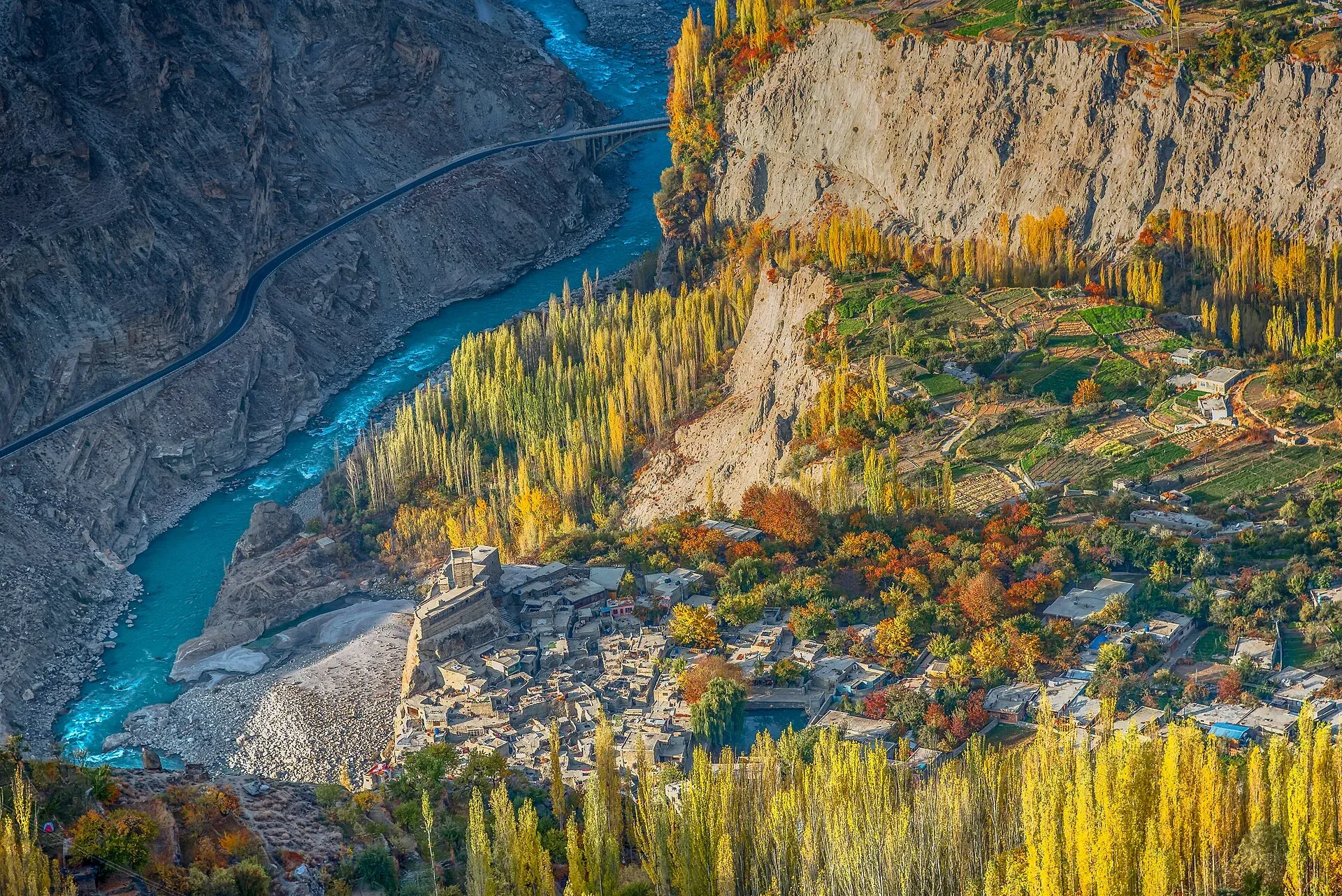
Photo: AdnanKakazai, with thanks · CC BY-SA 4.0 · via Wikimedia Commons · temporary stand-in photo

Eagle's Nest (Duikar)
A ridge viewpoint above Duikar village in Hunza, a short drive from Karimabad, with views over the valley to Rakaposhi, Ultar Sar, Diran and Golden Peak. Best at sunrise and sunset.
Overview
Eagle's Nest is a ridge above Duikar village, on the hill behind Karimabad in Hunza. It is the most popular place in Hunza for sunrise and sunset. The Government of Pakistan's Hunza tourist sheet names Duikar as the best place to see both, and adds that the night sky is clear enough to show a great many stars.
Sources disagree on the height. The most repeated figure is about 2,850 m. Others range from 2,900 m to 3,800 m, so treat any single number with care.
Plan your visit
- Nearest town
- Karimabad
- Getting there
From Karimabad, Duikar is about 8 km by road (OSRM: 12 minutes, optimistic; local reports say 20 to 30 minutes by jeep). From Gilgit, Duikar is about 105 km (OSRM 1 h 23). Jeeps are available in Karimabad. More
Best months
Apr – Jun, Sep – Oct
- Eagle's Nest (Duikar)
- Related places nearby: Karimabad (Hunza), Hunza Valley, Rakaposhi, Ultar Sar, Diran, Altit Fort, Bublimotin (Ladyfinger Peak)
The peaks in view
From the ridge you look across the Hunza valley to Rakaposhi (7,788 m), Ultar Sar (7,388 m), Diran (7,265 m), Golden Peak (7,027 m) and the pointed Ladyfinger (about 6,000 m). Heights are from Wikipedia. See Rakaposhi, Ultar Sar and Diran. Below the ridge, Baltit Fort sits above Karimabad and Altit Fort stands lower in the valley (see Baltit Fort and Altit Fort).
What to see and do
Most visitors come for a sunrise or sunset session, then eat or have tea at the small hotel and restaurant that share the name. Duikar village, a short way down, has guesthouses.
When to visit
Go early in the morning or late in the afternoon, when the low light falls on the snow. Clouds often build later in the day, so mornings are usually clearer (general advice, not an official forecast). The season quoted by guides is April to October. In winter the road can close with snow.
Where to stay and eat
There is a hotel and restaurant at the viewpoint, and more guesthouses in Duikar and Karimabad. Rooms fill quickly around sunrise in the summer season, so book ahead.
Getting there
Karimabad to Duikar is about 8 km by road (OSRM, 12 minutes, optimistic). Local reports give 20 to 30 minutes by jeep, or a steep walk of 2 to 2.5 hours. Guides describe the final stretch as rough and recommend a 4x4. Hire a local driver if you are not used to mountain tracks.
Good to know
- Safety. The edges are steep and often unfenced. Stay back in the dark and in wind. Carry a warm layer, as it is cold before dawn.
- Travel advice. For foreign visitors: the UK FCDO does not advise against Gilgit-Baltistan generally (updated 27 October 2026, checked 16 November 2026). Check the live page for changes.
Highlights
- Sunrise and sunset over the Hunza valley
- Views of Rakaposhi, Ultar Sar, Diran and Golden Peak
- A short drive from Karimabad
- Clear night skies
Tips
- Arrive 30 to 45 minutes before sunrise or sunset to settle in and find a spot.
- Wear warm clothes; it is cold before dawn even in summer.
- Use a local jeep driver if you do not have a 4x4.
- Check the road with your hotel after rain or snow.
Facilities
- Small hotel and restaurant
- Guesthouses in Duikar and Karimabad
Photos we still need: the Duikar road and the sunset view toward Rakaposhi. Send us yours
Sources and last checked
Last checked Confidence medium6 sources4 still to check
- Last checked
- Method
- Desk research from published sources
- Confidence
- medium
- Checked by
- trek.pk research team
Researched from published sources; not yet checked on the ground by our team. Spot something out of date? Report a mistake.
Sources
- District Hunza tourist guide and map · Government of Pakistan tourism portal · checked
- Eagle's Nest and Duikar: best views of Hunza · GoPleiades (travel guide; internally inconsistent on altitude) · checked
- Hunza Valley (Wikipedia) · Wikipedia · checked
- Duikar (OpenStreetMap place node) · OpenStreetMap contributors · checked
- OSRM driving route service: distances and times measured 16 November 2026 (times are optimistic, without stops) · OpenStreetMap / OSRM · checked
- Pakistan travel advice: warnings and insurance (updated 27 October 2026) · UK Foreign, Commonwealth & Development Office · checked
Still to be checked on the ground (4)
- Viewpoint altitude: sources give 2,850 m to 3,800 m (unresolved; no official figure)
- Jeep and walking times from Karimabad (only secondary reports)
- Current road surface and winter closure dates
- Exact viewpoint coordinates (Duikar locality point used)
Nearby and related

Karimabad (Hunza)
The main town of Hunza, set on a terrace below Baltit Fort with Rakaposhi, Ultar and Diran in view. A good base for forts, viewpoints, Attabad Lake and the road to Gojal.

Hunza Valley
A long Karakoram valley on the Karakoram Highway, with Karimabad, Baltit and Altit forts, Ganish village and Attabad Lake, below Rakaposhi and Ultar Sar. About 100 km from Gilgit.

Rakaposhi
Rakaposhi (7,788 m) rises above the Hunza and Nagar valleys north of Gilgit. It can be seen from the KKH and Karimabad, and open-zone treks lead to Tagaphari and Diran Base Camp.

Ultar Sar
Ultar Sar (7,388 m) towers about 10 km north-east of Karimabad in Hunza. Its south flank rises over 5,300 m above the river. The Ultar Meadow trek is the standard way to get close.

Diran
Diran (7,266 m) is a pyramid-shaped peak in the Bagrot Valley, east of Rakaposhi. It was first climbed in 1968 and is seen from Karimabad, Minapin and the open-zone Diran Base Camp trek.

Altit Fort
An old fort above the Hunza River at Altit, restored by the Aga Khan Trust for Culture and open to visitors since 2007. Often described as the oldest monument in Gilgit-Baltistan.

Bublimotin (Ladyfinger Peak)
Bublimotin, also called Ladyfinger Peak, is a rock spire of about 6,000 m on the south-west ridge of Ultar Sar above Karimabad in Hunza. It was first climbed in 1982.
Hunza and Khunjerab (KKH)
A 7-8 day road trip from Islamabad up the Karakoram Highway to Hunza and on to Khunjerab Pass (4,693 m), with overnight stops at Besham, Chilas and Gilgit.