

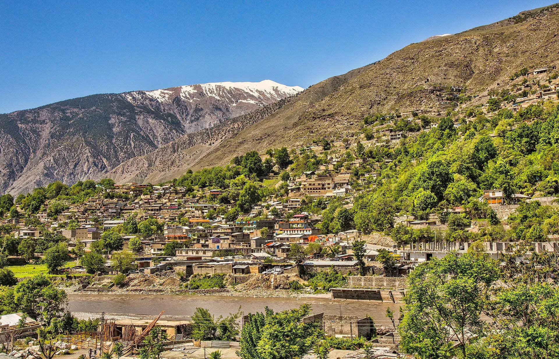
Photo: Shah Tahsin Anwar, with thanks · CC BY-SA 4.0 · via Wikimedia Commons · temporary stand-in photo

Chitral Bazaar
The main market street of Chitral town, running between the river, the old fort area and the polo ground. A place for caps, dried fruit, wool and tea. Check FCDO advice for the N-45 road first.
Overview
Chitral town sits on the Chitral River at about 1,500 m (Wikipedia gives 1,494 m) and is the capital of Lower Chitral District. Its bazaar is the working centre of the town: a street of small shops, tea houses and restaurants that runs through the middle of town. Operators describe it as running from the small airstrip end to the polo ground at the other. One operator notes that many of its stalls and restaurants are run by Afghan refugees.
Plan your visit
- Nearest town
- Chitral
- Getting there
The bazaar is in the middle of Chitral town; the polo ground at the south end is under 1 km away (OSRM). More
Best months
Apr – Oct
- Chitral Bazaar
- Related places nearby: Chitral, Chitral Fort (Shahi Qila), Chitral Museum, Chitral Valley, Chitral Polo Ground
Why visit
Most visitors pass through Chitral on the way to the Kalash valleys, Shandur or the Hindu Kush treks, and the bazaar is where you buy supplies, change money and arrange transport. The town was cut off for about half the year until the Lowari Tunnel opened in 2017, according to one operator. Khowar is the main language of the region, and the 2023 census counted 57,157 people in the town.
What the bazaar sells
The best-known local item is the pakol, the soft, flat-topped woollen cap with a rolled brim. The name comes from the Khowar word for a men's cap. Wikipedia says it is usually hand-spun wool in earthy browns, greys, black or white, and that some are dyed red with walnut. The cap is traced to Gilgit and Astore and had reached Chitral by the 19th century, and Chitrali traders later made it familiar in Peshawar. A white "Chitrali" version with a markhor (wild goat) badge and a peacock feather is often given to honoured guests.
Look also for woollen shawls, dried fruit and walnuts. Stop for tea or a simple meal at one of the small restaurants along the street, and ask at shops and hotels about onward jeeps and drivers.
A day in the old centre
The bazaar sits between the river, the old fort area and the polo ground, so one walk covers most of the town. Start in the bazaar, then walk along the river towards Chitral Fort and the Shahi Mosque beside it, and on to the polo ground and Chitral Museum. Frontier polo, played at altitude, can be watched when a match is scheduled.
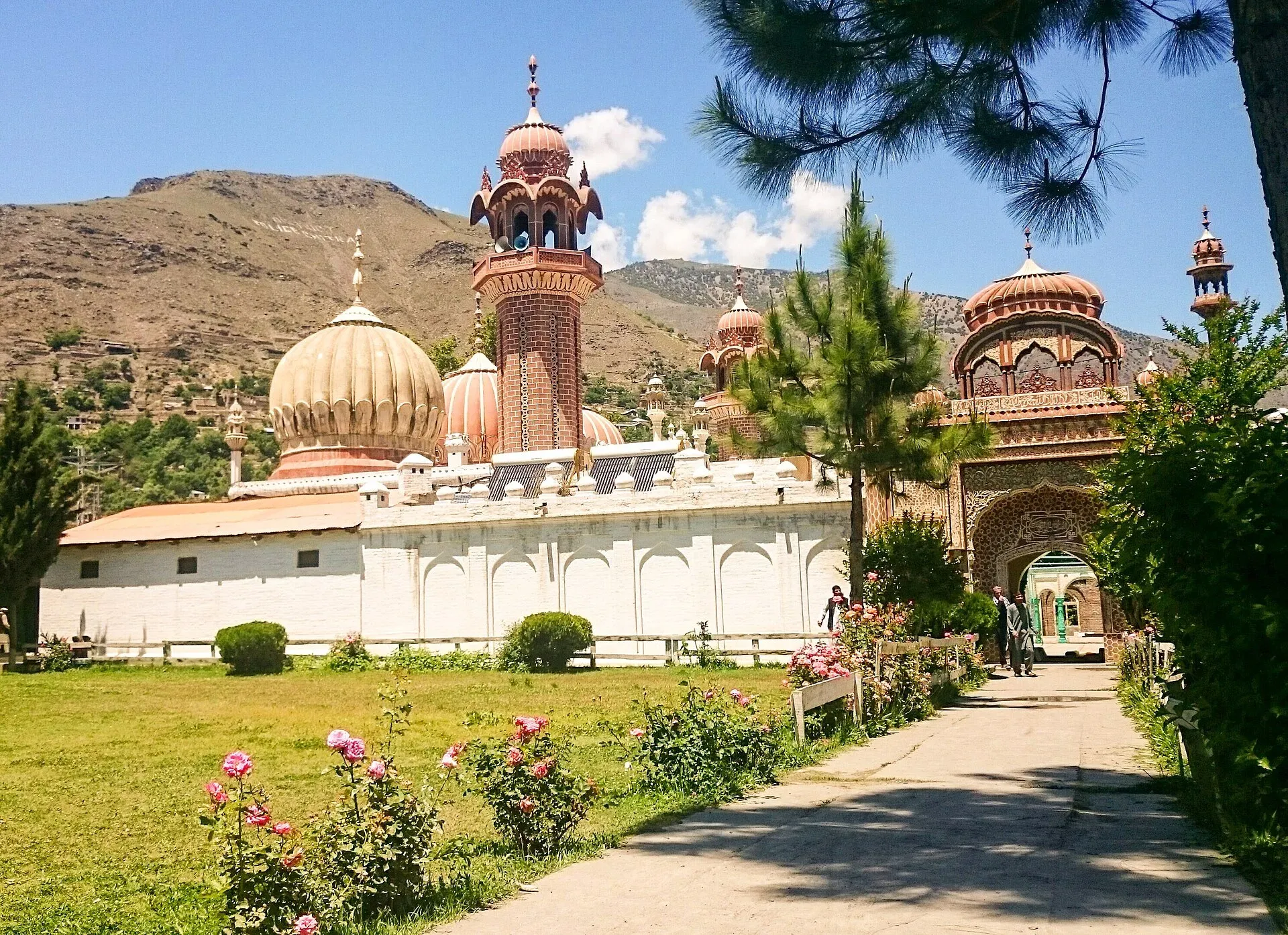
Photo: Fassifarooq, with thanks · CC BY-SA 4.0 · via Wikimedia Commons · temporary stand-in photo

History
The Katur dynasty made Chitral its capital from 1571, and the town was the capital of the former princely state. The Shahi Qila (Chitral Fort), beside the river, was besieged for about six weeks in 1895 before the British garrison was relieved. Chitral joined Pakistan in 1947 and was fully integrated as a district between 1969 and 1972. The bazaar grew up around this old centre.
Climate and when to visit
Wikipedia describes a dry Mediterranean climate: very hot, almost rainless summers, with most rain in spring thunderstorms. Winter nights can fall to about -10 C and snow of up to 60 cm is common in town. Spring to autumn is the pleasant time. In festival periods (Kalash festivals, Shandur Polo) the town is busier and rooms book up. Wikivoyage lists the Kalash festivals as Joshi in mid-May, Uchau in late August and Chaumos in December; check current dates locally.
Good to know
- Ask the district administration or local police about current conditions before you go. Travel advice. For foreign visitors: the UK FCDO (updated 27 October 2026, checked 16 November 2026) does not name Chitral town, but it advises against all travel on the N-45 highway up to the edge of Chitral city, including the Kalash valleys, and notes emergency measures in Khyber Pakhtunkhwa. Read the current page before making any plans.
- Shopping hours. Shop hours are not published in an official source.
- Etiquette. Dress modestly, and ask before photographing women or shopkeepers.
- Nearby. Chitral Fort, Chitral Museum, Chitral Polo Ground, Chitral Valley and the Kalash valleys.
Highlights
- Main market street of Chitral town
- Chitrali caps, wool and dried fruit
- Between the fort area and the polo ground
- Base for Kalash, Shandur and Hindu Kush trips
Getting there
The bazaar is in the middle of Chitral town; the polo ground at the south end is under 1 km away (OSRM). Chitral is reached by the N-45 from the south or, from Gilgit-Baltistan, over Shandur Pass in summer, or by flight when services run; check current schedules and FCDO advice for the road. The map point is the approximate town centre, not a surveyed bazaar centre.
Tips
- Buy supplies and arrange transport here before heading to the valleys.
- Dress modestly and ask before photographing people.
- Check FCDO advice for the N-45 before travelling.
- Carry cash; card use is limited.
Photos we still need: the bazaar street itself (the hero photo is a view of the town). Send us yours
Sources and last checked
Last checked Confidence medium6 sources5 still to check
- Last checked
- Method
- Desk research from published sources
- Confidence
- medium
- Checked by
- trek.pk research team
Researched from published sources; not yet checked on the ground by our team. Spot something out of date? Report a mistake.
Sources
- Chitral · Wikipedia · checked
- Chitral · Wild Frontiers · checked
- Pakistan travel advice: warnings and insurance (updated 27 October 2026) · UK FCDO · checked
- OSRM driving route service: distances and times measured 16 November 2026 (times are optimistic, without stops) · OSRM · checked
- Chitral (Wikivoyage) · Wikivoyage · checked
- Pakol · Wikipedia · checked
Still to be checked on the ground (5)
- Current road and flight access (Wikivoyage says PIA flies to Chitral daily and the Peshawar route over Lowari Pass has sometimes been closed; undated, so not confirmed as current)
- Exact bazaar centre coordinates (the map point matches Wikipedia's town point, not a surveyed bazaar centre)
- Shop hours and weekly closing day (no source)
- Which shops sell pakol and local crafts today
- Kalash festival dates (Wikivoyage lists mid-May, late August and December; undated)
Nearby and related

Chitral
The main town of Lower Chitral District, at about 1,500 m on the Chitral River, with a historic fort, a royal mosque and views of Tirich Mir. The base for the Kalash valleys.

Chitral Fort (Shahi Qila)
The fort and royal residence on the Chitral river, with a history reaching back to the 18th century and the 1895 siege. It is still the home of the ceremonial Mehtar, so access is limited.

Chitral Museum
A small museum in Chitral town, established in 2010, with galleries on Chitrali life, weapons, and Kalash and Gandhara Grave archaeology.

Chitral Valley
The long Chitral River valley at the foot of the Hindu Kush, with Chitral town's fort and Shahi Mosque, the Lowari Tunnel route, Tirich Mir views and side valleys leading to Kalash and Shandur.
Chitral Polo Ground
The town polo field on the south side of Chitral, beside the museum, where free-style polo is played in season. It is separate from the festival ground at Shandur.